Carte du Royaume De la Gréce… [B III a 111]
| Reference code | B III a 111 |
| Title | Carte du Royaume De la Gréce… |
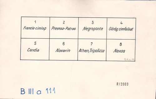
| Main title | 2 mt.: 1. Enumeration des Poteaux de la Frontiére continentale entre le Royaume Della Gréce et L’Empire Ottoman. (Görög–török szárazföldi határ térképe számozott határkőjelzés felsorolása.) 2. [Kréta.] |
| Subject | Görögország térképe 1838-ban. |
| Scale |
M. 1:400 000.
Normalized: 400000 |
| Contributor | Készítő: ALDENHOVEN, Ferdinand |
| Technical features |
Kiadó:
Metsz.: A. Forster. Athénes, 1838. Secrétaire ministriel aux Dép.-ts de la Maison du Roi et des Relations Extérieures. Litographie Royale. Ny.: A. Huber–J. Marco Dymos.
8 csatl. tl. egyenként: 45×56 cm. Szín. Hr. cs. Jelmagy. |
| Source | Institute and Museum of Military History • B III a • B III Balkán-félsziget • B I–XV. Európa |
[9 images]
Content provider
ⓒ Copyright Info: Any publication of the present digital material requires permission from the content provider. To reach content provider directly, click on „Contact”.