Carte de la Gréce. [B III a 112]
| Reference code | B III a 112 |
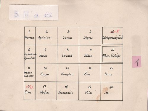
| Title | Carte de la Gréce. |
| Main title | 2 mt.: 1. Carte de la Gréce. |
| Subject | (Görögország) 2. Plan d’Athénes. (Athénai várostérkép.) |
| Scale |
M. 1:200 000.
Normalized: 200000 |
| Technical features |
Kiadó:
Metsz.: Erhard. Paris, 1852. Kaeppelin.
20 csatl. tl. egyenként: 30×40 cm és 59×40 cm. Hr. cs. Jelmagy. |
| Content | Görögország térképe 1852-ben. |
| Source | Institute and Museum of Military History • B III a • B III Balkán-félsziget • B I–XV. Európa |
[21 images]
Content provider
ⓒ Copyright Info: Any publication of the present digital material requires permission from the content provider. To reach content provider directly, click on „Contact”.