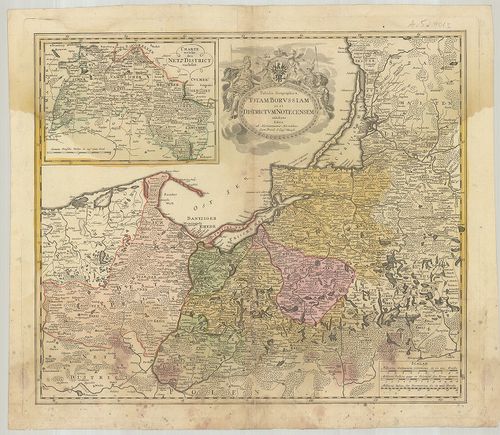
Tabula Geographica Totam Borussiam ut et Districtum Notecens... [B IV a 216/1]
| Reference code | B IV a 216/1 |
| Title | Tabula Geographica Totam Borussiam ut et Districtum Notecensem. |
| Main title | Mt.: Charte welche den Netz District vorstellet. (Kujawy terület térképe.)Poroszország térképe kerületi beosztással. |
| Scale |
[M. 1:790 000.]
Normalized: 790000 |
| Contributor | Készítő: HOMANN, Örökösök |
| Technical features |
Kiadó:
[Nürnberg, 17??] Homannianis Heredibus.
Szerzeményszám: 1208 54×46 cm. Szín. Rézm. Címerd. |
| Source | Institute and Museum of Military History • B IV a • B IV Német birodalom • B I–XV. Európa |
Content provider
ⓒ Copyright Info: Any publication of the present digital material requires permission from the content provider. To reach content provider directly, click on „Contact”.