Karte der Rhein-Provinz und. Prov.[inz] Westfalen. [B IV a 278]
| Reference code | B IV a 278 |
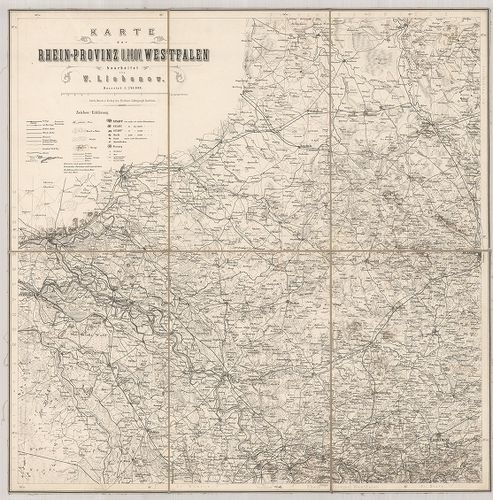
| Title | Karte der Rhein-Provinz und. Prov.[inz] Westfalen. |
| Main title | A Rajna-vidék és Vesztfália tartomány térképe. |
| Scale |
M. 1:240 000.
Normalized: 240000 |
| Contributor | Készítő: LIEBENOW, W. |
| Technical features |
Kiadó:
Berlin, [18??] Litograph. Institut.
6 tl. egyenként: 55×55 cm. Öh.: 27,5 cm. Hr. cs. Rézm. Vv. Jelmagy. |
| Source | Institute and Museum of Military History • B IV a • B IV Német birodalom • B I–XV. Európa |
[6 images]
Content provider
ⓒ Copyright Info: Any publication of the present digital material requires permission from the content provider. To reach content provider directly, click on „Contact”.