Topographisch-Orographische Spezial-Karte des Königreiches S... [B IV a 596]
| Reference code | B IV a 596 |
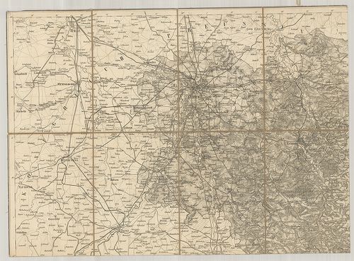
| Title | Topographisch-Orographische Spezial-Karte des Königreiches Sachsen. |
| Main title | Mt.: Üebersichtskarte der vorzüglichsten Höhen- und Thalpunkte des Königreiches Sachsen. (Szászország hegyeinek és völgyeinek áttekintő térképe.) |
| Subject | Szászország topográfiai-hegyrajzi részletes térképe. |
| Scale |
[M. 1:150 000.]
Normalized: 150000 |
| Contributor | Készítő: ANDRÉE, Otto |
| Technical features |
Kiadó:
Dresden, [18..] Gustav Dietze.
9 csatl. tl. egyenként: 49×36 cm. Öh.: 18 cm. Hr. cs. Rézm. Vv. Jelmagy. Háromszögelési hálózat. |
| Source | Institute and Museum of Military History • B IV a • B IV Német birodalom • B I–XV. Európa |
[9 images]
Content provider
ⓒ Copyright Info: Any publication of the present digital material requires permission from the content provider. To reach content provider directly, click on „Contact”.