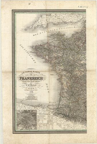
General Karte von Frankreich. [B V a 60]
| Reference code | B V a 60 |
| Title | General Karte von Frankreich. |
| Main title | Mt.: (Párizs és környéke.) |
| Subject | Franciaország általános térképe 1836-ban. |
| Scale |
[M. 1:1 790 000.]
Normalized: 1790000 |
| Contributor | Készítő: WEILAND, Carl Ferdinand |
| Technical features |
Kiadó:
Weimar, 1836. Geograph. Institut.
Szerzeményszám: 1649 2 csatl. tl. 78×63 cm. Szín. Hr. cs. Rézm. |
| Source | Institute and Museum of Military History • B V a • B V Franciaország • B I–XV. Európa |
[2 images]
Content provider
ⓒ Copyright Info: Any publication of the present digital material requires permission from the content provider. To reach content provider directly, click on „Contact”.