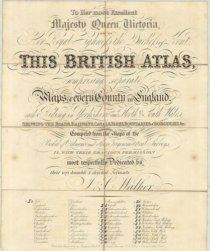
British Atlas, Comprising separate maps of every County in E... [B VI a 13/1]
| Reference code | B VI a 13/1 |
| Title | British Atlas, Comprising separate maps of every County in England… |
| Main title | 1. Northamptonshire. 2. Northumberland. 3. Nottinghamshire. 4. Oxfordshire. 5. Rutlandshire. 6. Shorpshire. 7. Somersetshire. 8. Staffordshire. 9. Suffolk. 10. Surrey. 11. Sussex. 12. Warwickshire. 13. Wiltshire. 14. Yorkshire, West Riding. 15. Yorkshire, North Riding. 16. Wales, North West. 17. Wales, North-East. 18. Wales, South-West. 19. Wales, South-East.Anglia grófságainak általános térképe 1837-ben. |
| Scale |
M. kül.
|
| Contributor | Készítő: WALKER, J. |
| Technical features |
Kiadó:
London, 1837. Longman, Rees and Co.
Szerzeményszám: 2157–2176 19 tl. + címlap, egyenként: 32×39 cm. Öh.: 17 cm. Szín. Hr. cs. Rézm. Jel- és számmagy. h. |
| Source | Institute and Museum of Military History • B VI a • B VI Anglia, Skócia és Írország • B I–XV. Európa |
[20 images]
Content provider
ⓒ Copyright Info: Any publication of the present digital material requires permission from the content provider. To reach content provider directly, click on „Contact”.