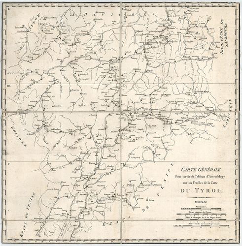
Carte du Tyrol. [B IX a 361]
| Reference code | B IX a 361 |
| Title | Carte du Tyrol. |
| Main title | Tirol térképe 1801 körül. |
| Scale |
[M. 1:140 500.]
Normalized: 140500 |
| Contributor | Készítő: ANICH, [Petro] |
| Technical features |
Kiadó:
Metsz. Blondenau és Chamoii. H. n. [1801?] Dépot Général de la Guerre.
6 csatl. tl. egyenként: 82×55 cm. Öh. 21 cm. Hr. vakondt és cs. Rézm. Jelm. á. 1. 41×41 cm. Vv. |
| Source | Institute and Museum of Military History • B IX a • B IX Ausztria–Magyarország • B I–XV. Európa |
[8 images]
Content provider
ⓒ Copyright Info: Any publication of the present digital material requires permission from the content provider. To reach content provider directly, click on „Contact”.