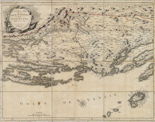
1. Nouvelle Carte de la Partie Occidentale de Dalmatie. – II... [B IX a 446]
| Reference code | B IX a 446 |
| Title | 1. Nouvelle Carte de la Partie Occidentale de Dalmatie. – II. Nouvelle Carte de la Orientale de Dalmatie. |
| Main title | Mt. Baye ou Bocche di Cattaro. (Kotori-ö.) |
| Subject | Dalmácia NY-i és K-i részének "új" térképe 1780-ban. |
| Scale |
[M. 1:350 000.]
Normalized: 350000 |
| Contributor | Készítő: SANTINI, P. |
| Technical features |
Kiadó:
Venezia. (Velence). 1780. M. Remondini.
2 csatl. tl. egyenként: 60×44 cm. Szín. Hr. vakondt. Rézm. Vv. |
| Source | Institute and Museum of Military History • B IX a • B IX Ausztria–Magyarország • B I–XV. Európa |
[2 images]
Content provider
ⓒ Copyright Info: Any publication of the present digital material requires permission from the content provider. To reach content provider directly, click on „Contact”.