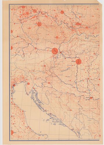
Középeurópa települési térképe. 1930 körüli adatok. [B XV c 1233]
| Reference code | B XV c 1233 |
| Title | Középeurópa települési térképe. 1930 körüli adatok. |
| Scale |
M. 1:1 000 000
Normalized: 1000000 |
| Contributor | Készítő: Rónai András |
| Technical features |
Kiadó:
Budapest, 1944. Gróf Teleki Pál Tudományos Intézet Államtudományi Intézete
Szerzeményszám: 78328 Két lapos, egyenként 118×84 cm. Szín. Jelm. |
| Source | Institute and Museum of Military History • B XV c • B XV Magyarország (1920 után) • B I–XV. Európa |
[2 images]
Content provider
ⓒ Copyright Info: Any publication of the present digital material requires permission from the content provider. To reach content provider directly, click on „Contact”.