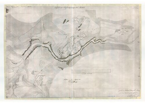
Project der Befestigung bei Aicha. [G I h 16]
| Reference code | G I h 16 |
| Title | Project der Befestigung bei Aicha. |
| Main title | Térképtervezet Aicha melletti erődítményről. (Innsbruck–Brixen közötti terület, az Eisack (Isar) folyó mentén). |
| Scale |
M. n.
|
| Contributor | Készítő: OTDERMATH, Friedrich |
| Technical features |
Kiadó:
Mühlbach, 1833. Kn.
65×45 cm. Fotóm. kézir. térképről. Hr. szv. Or. K. T. |
| Source | Institute and Museum of Military History • G I h vár alaprajzok, város és környéktérképek, utikönyvek • G I Európa • G I–V. Úti térképek |
Content provider
ⓒ Copyright Info: Any publication of the present digital material requires permission from the content provider. To reach content provider directly, click on „Contact”.