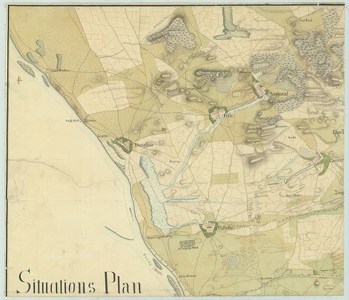
Situations Plan der Stadt Pest und der umliegenden Gegend… [G I h 70]
| Reference code | G I h 70 |
| Title | Situations Plan der Stadt Pest und der umliegenden Gegend… |
| Main title | Pest város és környékének térképe 1803-ban. |
| Scale |
[M. 1:28 800.]
Normalized: 28800 |
| Contributor | Készítő: CSEK, Jos[eph] |
| Technical features |
Kiadó:
[1803.]
Kézir. térk. 4 csatl. tl. egyenként: 70×59 cm. Szín. Hr. cs. Vv. T. |
| Source | Institute and Museum of Military History • G I h vár alaprajzok, város és környéktérképek, utikönyvek • G I Európa • G I–V. Úti térképek |
[4 images]
Content provider
ⓒ Copyright Info: Any publication of the present digital material requires permission from the content provider. To reach content provider directly, click on „Contact”.