Kleine Charte des Königreiches Hungarn. [B IX a 528/1a]
| Reference code | B IX a 528/1a |
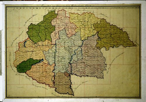
| Title | Kleine Charte des Königreiches Hungarn. |
| Main title | A Magyar Királyság részletes térképe 1785-ben, az I. katonai felmérés alapján. |
| Scale |
[M. 1:115 200.]
Normalized: 115200 |
| Contributor | Készítő: NEU, [Andreas] |
| Technical features |
Kiadó:
H. n. 1785. K. n.
Szerzeményszám: 382 színes, kéziratos térkép eredeti méretű fotóm. 44 szelv., egyenként 64x95 cm, á. 1. 91x62 cm. fekete-fehér, kicsinyített fotom. összemontírozva, 147×109 cm. Hr. cs. Az eredeti térkép a bécsi National Bibliothec gyűjteményében. Az áttekintőn a "Bezirk"-ek (kerület) kijelölése látható. |
| Source | Institute and Museum of Military History • B IX a • B IX Ausztria–Magyarország • B I–XV. Európa |
[48 images]
Content provider
ⓒ Copyright Info: Any publication of the present digital material requires permission from the content provider. To reach content provider directly, click on „Contact”.