Geographische Charte von Temeswarer Banat welche die Flüsse,... [B IX a 572]
| Reference code | B IX a 572 |
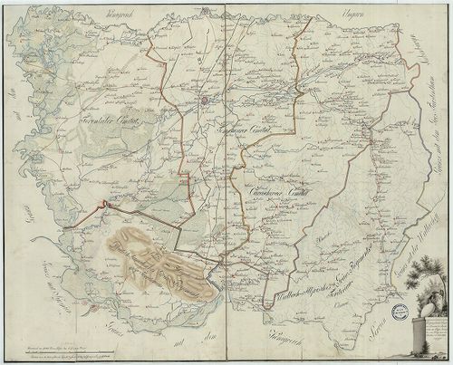
| Title | Geographische Charte von Temeswarer Banat welche die Flüsse, Ortschaften und Weege nach dem Bestand im Jahre 1805. |
| Main title | A Temesi Bánság földrajzi térképe 1805-ben, úthálózattal, megyebeosztással. |
| Scale |
[M. 1:288 000.]
Normalized: 288000 |
| Contributor | Készítő: [CZERMAK–FONDER] |
| Technical features |
Szerzeményszám:
79751
Kéziratos térkép színes másolata, 79×64 cm. Címdísz. növ. orn. Ep.89. |
| Source | Institute and Museum of Military History • B IX a • B IX Ausztria–Magyarország • B I–XV. Európa |
Content provider
ⓒ Copyright Info: Any publication of the present digital material requires permission from the content provider. To reach content provider directly, click on „Contact”.