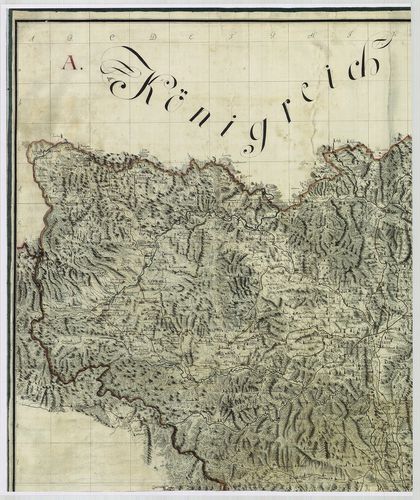
Geographische Charte des Caschauer Bezirks. [B IX a 627]
| Reference code | B IX a 627 |
| Title | Geographische Charte des Caschauer Bezirks. |
| Main title | A Kassai kerület térképe 1786-ban az I. katonai felmérés alapján. |
| Scale |
[M. 1:192 000].
Normalized: 192000 |
| Contributor | Készítő: NEU, Andreas |
| Technical features |
Kiadó:
H. n. [1786] K. n.
Szerzeményszám: 72540, 72527, 72532 Kéziratos térkép színes fénymásolata, 4 tl. kző. méret. + 4 o. javítóhálózat.+ leírás. Hr. vakondt. Jelm. Ep.: 139. |
| Source | Institute and Museum of Military History • B IX a • B IX Ausztria–Magyarország • B I–XV. Európa |
[8 images]
Content provider
ⓒ Copyright Info: Any publication of the present digital material requires permission from the content provider. To reach content provider directly, click on „Contact”.