Geographische Charte des Pester Bezirks im Königreich Hungar... [B IX a 650]
| Reference code | B IX a 650 |
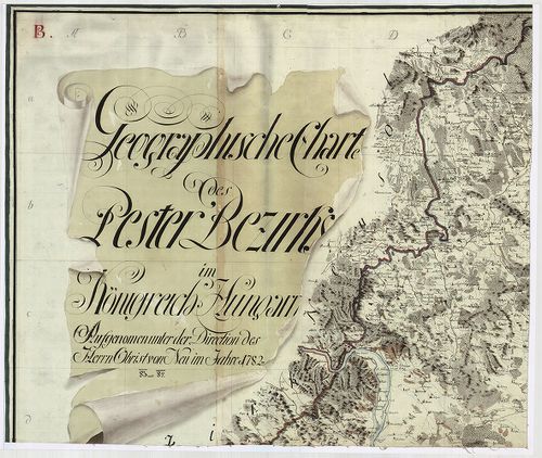
| Title | Geographische Charte des Pester Bezirks im Königreich Hungarn. Aufgenommen der Direction des Herrn Obrist Neu im Jahre 1782–83–84. |
| Main title | A Pesti Kerület általános térképe az I. katonai felmérés alapján. |
| Scale |
[M. 1:192 000].
Normalized: 192000 |
| Contributor | Készítő: NEU, [Andreas] |
| Technical features |
Kiadó:
H. n. [1786]. K. n.
Szerzeményszám: 72529 Kéziratos térkép színes fénymásolata, 6 csatl. tl. kző. nagyság. + 4 javítást nyílvántartó melléklet, + leírás. Hr. vakondt. Jelm. Ep.: 155. |
| Source | Institute and Museum of Military History • B IX a • B IX Ausztria–Magyarország • B I–XV. Európa |
[10 images]
Content provider
ⓒ Copyright Info: Any publication of the present digital material requires permission from the content provider. To reach content provider directly, click on „Contact”.