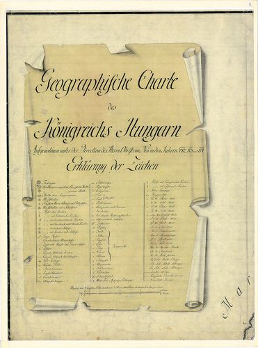
Geographische Charte des Königreichs Hungaria [B IX a 1120]
| Reference code | B IX a 1120 |
| Title | Geographische Charte des Königreichs Hungaria |
| Main title | Magyarország földrajzi (általános) térképe az I. katonai felmérés alapján. |
| Scale |
[M. 1:192 000].
Normalized: 192000 |
| Contributor | Készítő: NEU, Andreas: |
| Technical features |
Kiadó:
Hn.1786. Kn.
Szerzeményszám: 55694, 77794 Szín. Kézir. térk. fénymásolata. 43 szelvény + 1 áttekintő, egy szelvény 48x64 cm. Jelm. |
| Source | Institute and Museum of Military History • B IX a • B IX Ausztria–Magyarország • B I–XV. Európa |
[44 images]
Content provider
ⓒ Copyright Info: Any publication of the present digital material requires permission from the content provider. To reach content provider directly, click on „Contact”.