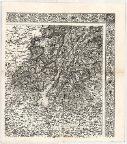
[Generalkarte des Oesterreichischen Kaiserstaates] [S 101 - No. 692/1-2.]
| Original reference code | D 247 1856:379/I |
| Type | földrajzi térkép |
| Size | 24 x 27,5 cm, 27 x 20 cm |
| Reference code | S_101_-_No._692/1-2. |
| Main title | [Generalkarte des Oesterreichischen Kaiserstaates] |
| Subject | No. 692/1-2. Osztrák Császárság |
| Scale |
[1:576 000]
|
| Date | Keletkezés éve: 1855 |
| Contributor |
Kiadás helye:
[Wien]
Kiadó: [Militär-Geogr. Inst.] Szerző: [Scheda, Josef] |
| Technical features |
Fizikai leírás:
nyomtatott
Eredetiség: másolat Tárolás: csak a XI. szelvény és az áttekintő lap Szelvényszám: 2 |
| Content |
Nyelv:
Német
Mellékábra, melléktérkép: Übersicht zur Zusammenstellung der Blaetter für die General Karte des oesterreichischen Kaiserstaates |
| Scope Link | 1350822 |
| Source | National Archives of Hungary • S 101 Abszolutizmuskori térképek (1849-1867) • S Kormányhatósági fondokból kiemelt térképek (17. sz.-20. sz.) • S – Térképtár |
[2 images]
Content provider
ⓒ Copyright Info: Any publication of the present digital material requires permission from the content provider. To reach content provider directly, click on „Contact”.