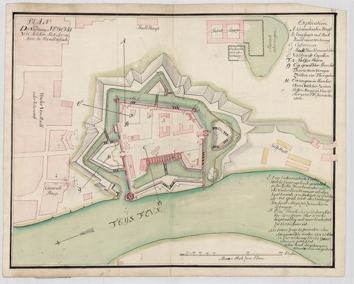
Plan von der Vösstung Segedin, wie solcher sich dermahlen in... [TK 904]
| Type | Hadtörténelmi térkép. |
| Size | 39,1 x 51,2 cm |
| Reference code | TK 904 |
| Title | Plan von der Vösstung Segedin, wie solcher sich dermahlen in Standt befinde |
| Scale |
[1:1800] 150 Kl. [=161 mm]
Normalized: 1800 |
| Date |
Normalizált:
1741
Keletkezés éve: [1741-1748] |
| Technical features | 1 térkl., ms., kézi szín. |
| Content | Szeged. A szegedi vár és környékének térképe. A várfalak keresztmetszeteivel, 1:360. Várfalak, épületek alaprajzban, betűvel. Betűmagyarázattal. Proven.: Széchényi F. |
| Source | National Széchényi Library • OSZK kéziratos térképek |
[2 images]
Content provider
ⓒ Copyright Info: Any publication of the present digital material requires permission from the content provider. To reach content provider directly, click on „Contact”.