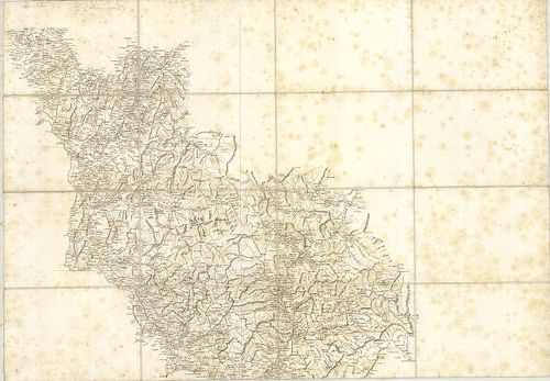
141. Piemont Korzika és Szárdinia. [B V a 211]
Institute and Museum of Military History •
B V a
•
B V Franciaország
•
B I–XV. Európa
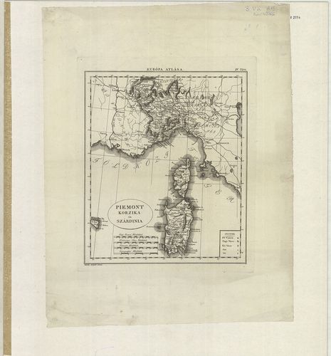
| Title | Piemont Korzika és Szárdinia. |
| Main title | Mell.: Régi Római Olasz, Francia mérföldek. |
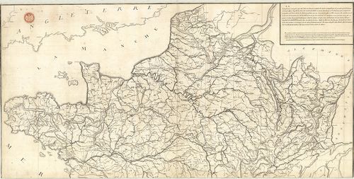
142. Franczia Ország. [B V a 212]
Institute and Museum of Military History •
B V a
•
B V Franciaország
•
B I–XV. Európa
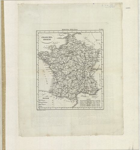
| Title | Franczia Ország. |
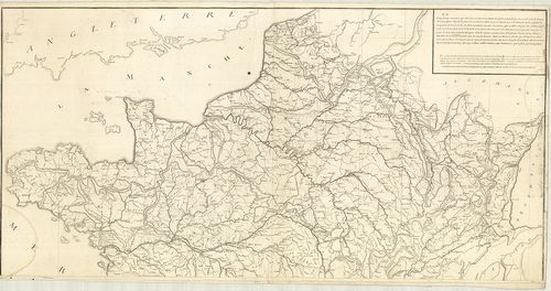
143. Franciaország. [B V a 213]
Institute and Museum of Military History •
B V a
•
B V Franciaország
•
B I–XV. Európa
| Title | Franciaország. |
| Main title | 4 mt.: 1. Fo. ipara 2. Fo. mezőgazd. 3. Párizs 4. Korzika. |
144. Champagne und Französisch-Lotharingien [B V a 214]
Institute and Museum of Military History •
B V a
•
B V Franciaország
•
B I–XV. Európa
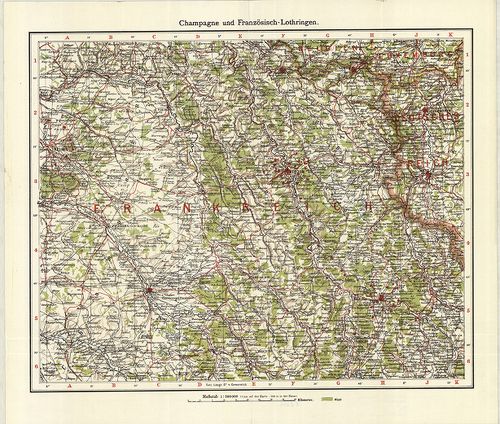
| Title | Champagne und Französisch-Lotharingien |
| Main title | ÉNy-Franciaország térképe az I. vh. idején. |
145. La Nouvelle France. [B V a 215]
Institute and Museum of Military History •
B V a
•
B V Franciaország
•
B I–XV. Európa
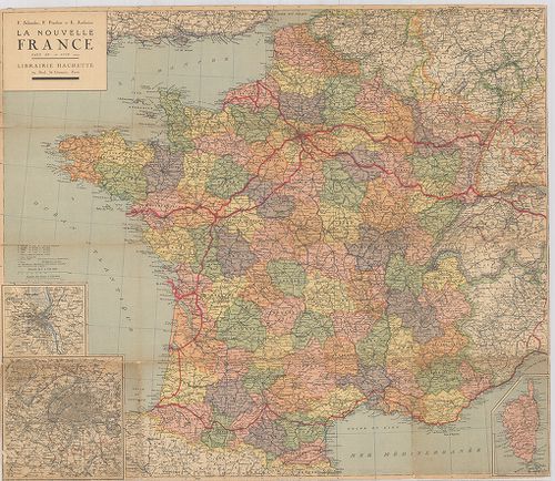
| Title | La Nouvelle France. |
| Main title | Franciaország térképe |
146. Frankreich und die Beneluxstaaten. [B V b 1]
Institute and Museum of Military History •
B V b
•
B V Franciaország
•
B I–XV. Európa
| Title | Frankreich und die Beneluxstaaten. |
147. Francija. Fizicseszkaja ucsebnaja karta. [B V b 2]
Institute and Museum of Military History •
B V b
•
B V Franciaország
•
B I–XV. Európa
| Title | Francija. Fizicseszkaja ucsebnaja karta. |
| Main title | Franciaország hegyvízrajzi térképe 1961-ben. |
148. Isola di Corsica. [B V b 3]
Institute and Museum of Military History •
B V b
•
B V Franciaország
•
B I–XV. Európa
| Title | Isola di Corsica. |
| Main title | Korzika szigetének térképe. |
149. Carte du Nivellement Général de la France. [B V b 8]
Institute and Museum of Military History •
B V b
•
B V Franciaország
•
B I–XV. Európa
| Title | Carte du Nivellement Général de la France. |
| Main title | Franciaország hegyvízrajzi, topográfiai térképe 1872-ben. |
150. Il Delfinato Diuiso in Baillaggi… [B V b 10]
Institute and Museum of Military History •
B V b
•
B V Franciaország
•
B I–XV. Európa
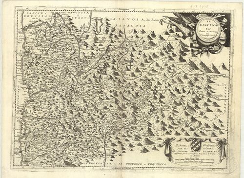
| Title | Il Delfinato Diuiso in Baillaggi… |
| Main title | Franciaország: Dauphiné általános térképe a 17. században. |
151. Contado de Venassino, e Prencipato D’Oranges… [B V b 11]
Institute and Museum of Military History •
B V b
•
B V Franciaország
•
B I–XV. Európa
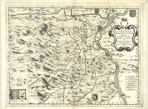
| Title | Contado de Venassino, e Prencipato D’Oranges… |
| Main title | Franciaország: Venaissin grófság és Oranges hercegség térképe 1690-ben. |
152. [Franciaország: Savoie–Provance tartományok határvidékének t... [B V b 13]
Institute and Museum of Military History •
B V b
•
B V Franciaország
•
B I–XV. Európa
| Title | [Franciaország: Savoie–Provance tartományok határvidékének térképe.] |
| Main title | A. I. lap. Carte Géométrique d’una partie du Cours Rhône… |
| Subject | Rhone folyóvidéke S. Génis (St. Genix) – Seissel (Seyssel) között. B. II. lap. [A Rhone folyóvidéke Genęve (Genf)–Genessia (Génissiat) között.] |
153. Carte des Alpes Francaises… [B V b 14]
Institute and Museum of Military History •
B V b
•
B V Franciaország
•
B I–XV. Európa
| Title | Carte des Alpes Francaises… |
| Main title | A Francia Alpok térképe a 18. században (Felső Dauphiné és Nizza grófság területe). |
154. Haute Savoie. – Hochsavoyen. [B V b 15]
Institute and Museum of Military History •
B V b
•
B V Franciaország
•
B I–XV. Európa
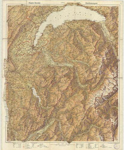
| Title | Haute Savoie. – Hochsavoyen. |
| Main title | Franciaország: Felső-Savoie általános térképe az 1900-as évek elején. |
155. Frankreich mit besonderer Rücksicht auf de Unebenheiten, … [B V b 17]
Institute and Museum of Military History •
B V b
•
B V Franciaország
•
B I–XV. Európa

| Title | Frankreich mit besonderer Rücksicht auf de Unebenheiten, … |
| Main title | Franciaország hegyvízrajzi térképe 1824-ben. |
156. [Az Alpok térképe.] [B V b 18]
Institute and Museum of Military History •
B V b
•
B V Franciaország
•
B I–XV. Európa
| Title | [Az Alpok térképe.] |
157. Tableau Géographique de la Navigation Intérieure du Royaume ... [B V b 21]
Institute and Museum of Military History •
B V b
•
B V Franciaország
•
B I–XV. Európa
| Title | Tableau Géographique de la Navigation Intérieure du Royaume de France. |
| Main title | A Francia Királyság hegyvízrajzi térképe 1791-ben, 83 megyével, úthálózattal. |
158. Tableau Géographique de la Navigation Intérieure du Territoi... [B V b 22]
Institute and Museum of Military History •
B V b
•
B V Franciaország
•
B I–XV. Európa
| Title | Tableau Géographique de la Navigation Intérieure du Territoire Républicain Francis. |
| Main title | A Francia Köztársaság hegyvízrajzi térképe 1795-ben, 86 megyével, úthálózattal. |
159. Carte du Canal Royal de la Province de Languedoc… [B V b 32]
Institute and Museum of Military History •
B V b
•
B V Franciaország
•
B I–XV. Európa
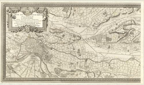
| Title | Carte du Canal Royal de la Province de Languedoc… |
| Main title | Franciaország: a Canal du Midi csatorna térképe Languedoc tartományban 1774-ben. |
160. Carte Albert Barbey: La chaine du Mont Blanc… [B V b 33]
Institute and Museum of Military History •
B V b
•
B V Franciaország
•
B I–XV. Európa
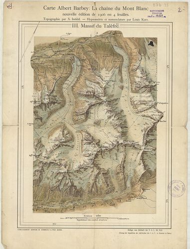
| Title | Carte Albert Barbey: La chaine du Mont Blanc… |
| Main title | A Mont Blanc hipszometrikus térképe 1906-ban. |