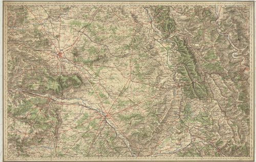
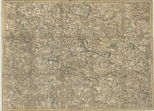
51. Carte de France. Saverne. [B V a 91]
Institute and Museum of Military History •
B V a
•
B V Franciaország
•
B I–XV. Európa
| Title | Carte de France. Saverne. |
| Main title | Franciaország térképe: Saverne és környéke úthálózattal. |
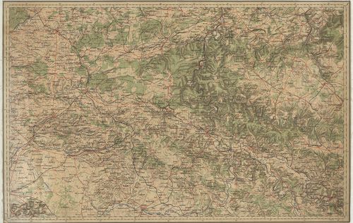
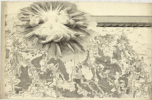
52. Carte de France. Châlons. [B V a 91/1]
Institute and Museum of Military History •
B V a
•
B V Franciaország
•
B I–XV. Európa
| Title | Carte de France. Châlons. |
| Main title | Franciaország: Châlons sur Marne környékének térképe úthálózattal. |
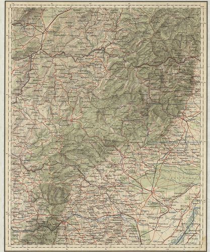
53. Carte De France. Méziéres. [B V a 91/2]
Institute and Museum of Military History •
B V a
•
B V Franciaország
•
B I–XV. Európa
| Title | Carte De France. Méziéres. |
| Main title | Franciaország: Méziéres és környékének térképe úthálózattal. |
54. Artesia Comitatus. Artois. [B V a 92]
Institute and Museum of Military History •
B V a
•
B V Franciaország
•
B I–XV. Európa
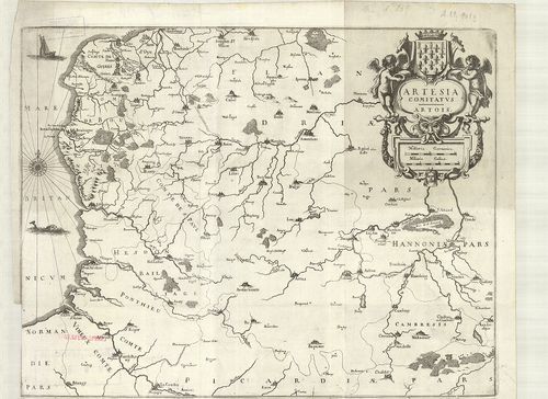
| Title | Artesia Comitatus. Artois. |
| Main title | Franciaország: Artois grófság térképe a 18. században. |
55. Carta del Ducato di Lorena. [B V a 92/2]
Institute and Museum of Military History •
B V a
•
B V Franciaország
•
B I–XV. Európa
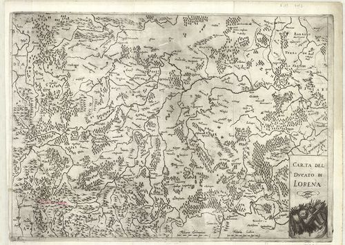
| Title | Carta del Ducato di Lorena. |
| Main title | Franciaország: Lotharingiai hercegség általános térképe a 18. században. |
56. Vermandois. [B V a 93]
Institute and Museum of Military History •
B V a
•
B V Franciaország
•
B I–XV. Európa
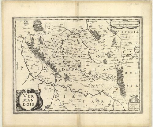
| Title | Vermandois. |
| Main title | Franciaország: Vermandois grófság általános térképe a 17. században. |
57. Touraine. Turonen sis ducatus. [B V a 93/1]
Institute and Museum of Military History •
B V a
•
B V Franciaország
•
B I–XV. Európa
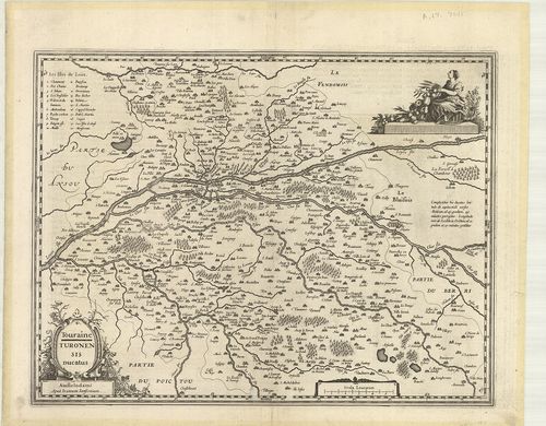
| Title | Touraine. Turonen sis ducatus. |
| Main title | Franciaország: Touraine hercegség általános térképe a 17. században. |
58. Normandia Ducatus. [B V a 93/2]
Institute and Museum of Military History •
B V a
•
B V Franciaország
•
B I–XV. Európa
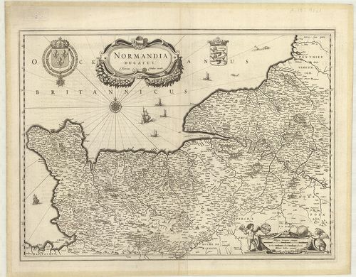
| Title | Normandia Ducatus. |
| Main title | Franciaország: Normandia hercegség általános térképe 1642-ben. |
59. Insvlae Divi Martini et Vliarvs Vulgo l’Isle de Re et Oleron... [B V a 93/3]
Institute and Museum of Military History •
B V a
•
B V Franciaország
•
B I–XV. Európa
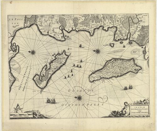
| Title | Insvlae Divi Martini et Vliarvs Vulgo l’Isle de Re et Oleron. |
| Main title | Franciaország: Ile de Ré és Oleron francia szigetek általános térképe a 17. században. |
60. Bourdelois, Pays de Medoc, et la Prevoste de Born. [B V a 93/5]
Institute and Museum of Military History •
B V a
•
B V Franciaország
•
B I–XV. Európa
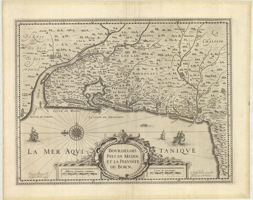
| Title | Bourdelois, Pays de Medoc, et la Prevoste de Born. |
| Main title | Franciaország: Bourdeaux-Medoc-Born vidék térképe 1642-ben. |
61. Kriegschauplatz in der Champagne im Jahr 1814. [B V a 94]
Institute and Museum of Military History •
B V a
•
B V Franciaország
•
B I–XV. Európa
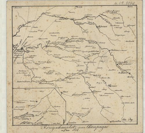
| Title | Kriegschauplatz in der Champagne im Jahr 1814. |
| Main title | Franciaország: Champagne tartomány általános térképe 1814-ben. |
62. Le Comte D’Artois. [B V a 95]
Institute and Museum of Military History •
B V a
•
B V Franciaország
•
B I–XV. Európa
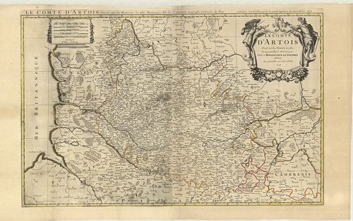
| Title | Le Comte D’Artois. |
| Main title | Franciaország: Artois francia grófság térképe 1696-ban. |
63. Le Gouvernement General du Dauphiné, divisé en Haut et Bas, ... [B V a 96]
Institute and Museum of Military History •
B V a
•
B V Franciaország
•
B I–XV. Európa
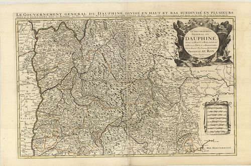
| Title | Le Gouvernement General du Dauphiné, divisé en Haut et Bas, Subdivisé en Plusieurs Pays, et en Bailliages. |
| Main title | Franciaország: Dauphine kormányzóság általános térképe 1692-ben. |
64. Gouvernement et Generalité de Paris, Divisée en Eslections. ... [B V a 97]
Institute and Museum of Military History •
B V a
•
B V Franciaország
•
B I–XV. Európa
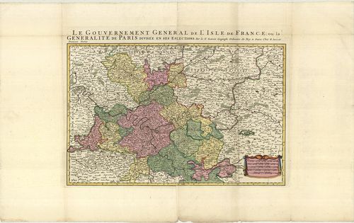
| Title | Gouvernement et Generalité de Paris, Divisée en Eslections. I. Premier Partie. II. Secondo Partie. Le Gouvernement General de L’Isle de France… |
| Main title | Franciaország: Páris környéke (Ile de France) általános térképe. |
65. Partie Meridionale de Champagne. [B V a 99]
Institute and Museum of Military History •
B V a
•
B V Franciaország
•
B I–XV. Európa

| Title | Partie Meridionale de Champagne. |
| Main title | Franciaország: Champagne tartomány általános térképe. |
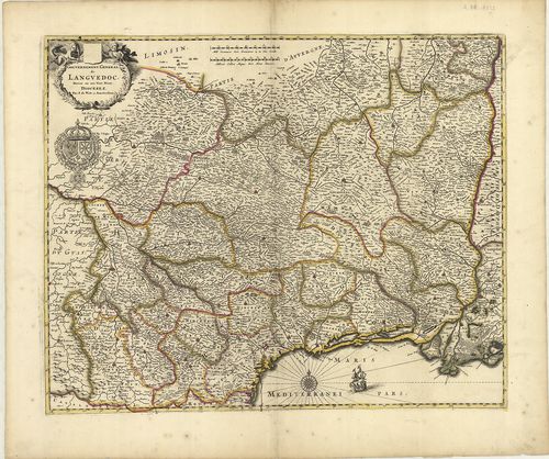
66. Partie Orientale du Gouvernement General de Languedoc. [B V a 100]
Institute and Museum of Military History •
B V a
•
B V Franciaország
•
B I–XV. Európa
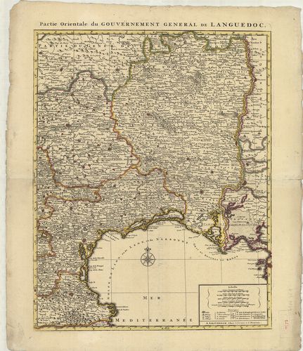
| Title | Partie Orientale du Gouvernement General de Languedoc. |
| Main title | Franciaország: Languedoc francia vidék K-i részének általános térképe. |
67. Circulus Bvrgvndicvs prout ille pro nunc continet Partes Dvc... [B V a 101]
Institute and Museum of Military History •
B V a
•
B V Franciaország
•
B I–XV. Európa
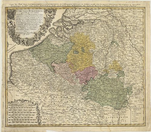
| Title | Circulus Bvrgvndicvs prout ille pro nunc continet Partes Dvcatvs Brabantiae, Lvxemburgensis, Limbvrgensis, et Geldriae, nec non Comitatus Flandriae, ac Hannoniae, itemque totum Comitatum Namvrcensem, Marchionatvm Sacri Romani Imperii…Carte des Pais Bas Catholiques ou des X. Privinces L’Allemagne Inferieure etc... |
| Main title | Franciaország: Burgundia tartomány, Brabant–Luxemburg–Limburg-hercegség, Geldern tartomány, Flandria, Namur térképe 1747-ben. |
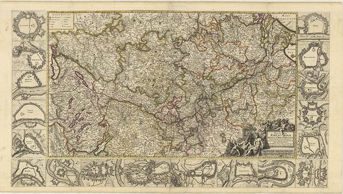
68. Carte Particuliere, Du Duche de Bourgogne… [B V a 102]
Institute and Museum of Military History •
B V a
•
B V Franciaország
•
B I–XV. Európa
| Title | Carte Particuliere, Du Duche de Bourgogne… |
| Main title | Mt.: Plan de Dijon (Dijon környéke). |
| Subject | Franciaország: Burgundia hercegség térképe úthálózattal 1751-ben. |
69. Carte des Départemens de la Haute Saône, du Doubs et Jura, q... [B V a 103]
Institute and Museum of Military History •
B V a
•
B V Franciaország
•
B I–XV. Európa
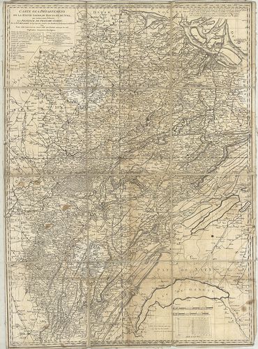
| Title | Carte des Départemens de la Haute Saône, du Doubs et Jura, qui composoient ci-devant La Province de Franche-Comte… |
| Main title | Franciaország: Saône-Jura és Doubs francia kerületek általános térképe 1791-ben. |
70. Gouvernement General de Bretagne, sive Ducatus Britanniae Mi... [B V a 104]
Institute and Museum of Military History •
B V a
•
B V Franciaország
•
B I–XV. Európa
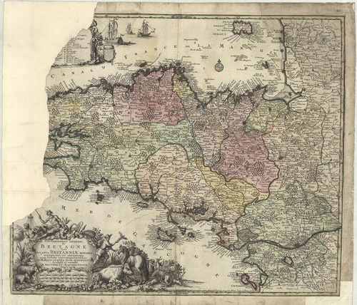
| Title | Gouvernement General de Bretagne, sive Ducatus Britanniae Minoris Superioris et Inferioris… |
| Main title | Franciaország: Bretagne, angol hercegség általános térképe úthálózattal a 18. század elején. |
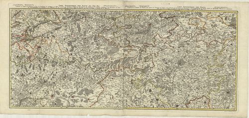
71. Fluviorum Rheni Mosae Mosellae Moeni Neccaris… [B V a 105]
Institute and Museum of Military History •
B V a
•
B V Franciaország
•
B I–XV. Európa
| Title | Fluviorum Rheni Mosae Mosellae Moeni Neccaris… |
| Main title | 1. Landaw (Landau). 2. Freiburg. 3. Mentz, Mayence (Mainz). 4. Namen, Namur. 5. Cöln, Cologne (Köln). 6. Basel. 7. Fort Louis. 8. Philisbourg (Philippsburg). 9. Brisach (Breisach) – Ville Neuve, Nieuwenstatt (Neufbrisach) 10. Strasbourg. 11. Coblentz (Koblenz). 12. Mont Royal. 13. Huningen (Huningue). 14. Trier, Treves. 15. Sar Louis (Saarlouis). 16. Luxemburg. 17. Maastricht. 18. Bonn. |
| Subject | A Rajna, Moselle, Maas, Main, Neckar vidékének térképe. |
72. Gouvernement General de Langvedoc. [B V a 106]
Institute and Museum of Military History •
B V a
•
B V Franciaország
•
B I–XV. Európa
| Title | Gouvernement General de Langvedoc. |
| Main title | Franciaország: Languedoc tartomány általános térképe egyházmegyei beosztással a 18. században. |
73. Tabula Delphinatus Vulgo le Gouvernement General Dauphiné… [B V a 107]
Institute and Museum of Military History •
B V a
•
B V Franciaország
•
B I–XV. Európa
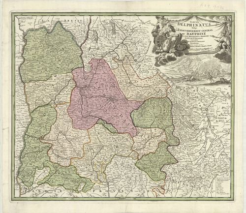
| Title | Tabula Delphinatus Vulgo le Gouvernement General Dauphiné… |
| Main title | Franciaország: Dauphine francia tartomány általános térképe kerületi beosztással a 18. században. |
74. Carte de Champagne et de Brie… [B V a 108]
Institute and Museum of Military History •
B V a
•
B V Franciaország
•
B I–XV. Európa
| Title | Carte de Champagne et de Brie… |
| Main title | Franciaország: Champagne és de Brie kerületek térképe 1790-ben. |
75. Tableau général et itinéraire De L’Empire Francais divisé en... [B V a 109]
Institute and Museum of Military History •
B V a
•
B V Franciaország
•
B I–XV. Európa
| Title | Tableau général et itinéraire De L’Empire Francais divisé en 130 Départements… |
| Main title | A Francia Császárság általános és közlekedési térképe 130 megye megjelölésével 1813-ban. |
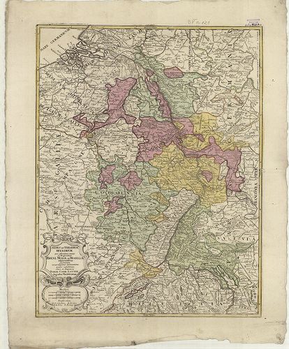
76. Lotharingiae Tabula Generalis in qua Ducatus Lotharingiae et... [B V a 110]
Institute and Museum of Military History •
B V a
•
B V Franciaország
•
B I–XV. Európa
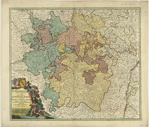
| Title | Lotharingiae Tabula Generalis in qua Ducatus Lotharingiae et Barri nec non Metensis, Tullensis et Verdunensis Episcopatus cum insertis et finitimis Ditionibus exhibentur… |
| Main title | Franciaország: Lotharingia hercegség, Barri, Metz, Verdun és Toul püspökségek általános térképe a 18. században. |
77. Carte Particuliere de la Chastellenie de Lille… [B V a 120]
Institute and Museum of Military History •
B V a
•
B V Franciaország
•
B I–XV. Európa
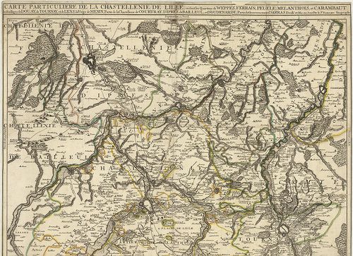
| Title | Carte Particuliere de la Chastellenie de Lille… |
| Main title | A franciaországi Lille-i várbirtok térképe a körülötte elhelyezkedő várakkal (Weppes, Ferrain, Peuelle, Melanthois, Carambaut, Douday, Tournay, Lens, Menin…) a 18. században. |
78. Sedes ac Theatrvm Bellorvm per plurimos annos in Regionibus ... [B V a 121]
Institute and Museum of Military History •
B V a
•
B V Franciaország
•
B I–XV. Európa
| Title | Sedes ac Theatrvm Bellorvm per plurimos annos in Regionibus Rheni, Mosae ac Mosellae… |
| Main title | A Rajna-torkolat térképe a 18. században. |
79. Carte du Departement de la Seine. [B V a 132/3]
Institute and Museum of Military History •
B V a
•
B V Franciaország
•
B I–XV. Európa
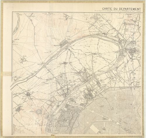
| Title | Carte du Departement de la Seine. |
| Main title | Franciaország: a Szajna-kerület topográfiai térképe 1871-ben. |
80. Carte Topographique et Militaire du Theatre de la Guerre dan... [B V a 135]
Institute and Museum of Military History •
B V a
•
B V Franciaország
•
B I–XV. Európa
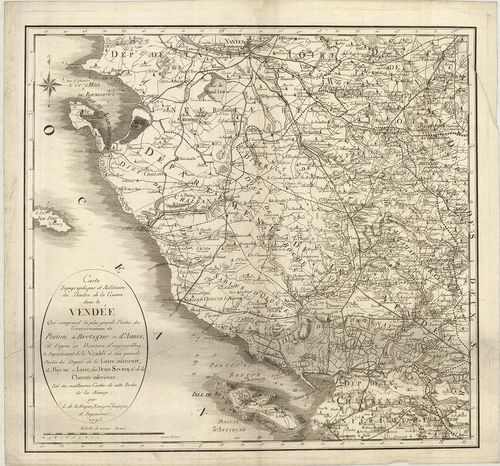
| Title | Carte Topographique et Militaire du Theatre de la Guerre dans la Vendée Qui comprend la plus grande Partie des Gouvernemens de Poitou, de Bretagne et d’Aunis… |
| Main title | Franciaország: a Vendé-kerület topográfiai térképe 1795-ben. |
81. Bell’Isle, avec partie des Côtes de Bretagne et les Isles vo... [B V a 136]
Institute and Museum of Military History •
B V a
•
B V Franciaország
•
B I–XV. Európa
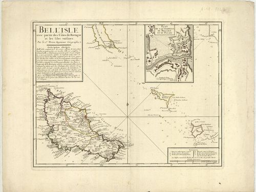
| Title | Bell’Isle, avec partie des Côtes de Bretagne et les Isles voisines. |
| Main title | Mt.: Plan de la Citadella de Bell’ Isle et du Palais. (A Bell’ Isle fellegvára és a palota alaprajza.) |
| Subject | Belle Isle (Fr.) sziget általános térképe 1761-ben. |
82. Le Gouvernement General de Provence divisé en ses Vigueries ... [B V a 138]
Institute and Museum of Military History •
B V a
•
B V Franciaország
•
B I–XV. Európa
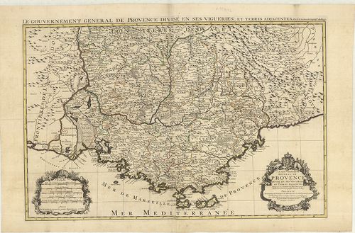
| Title | Le Gouvernement General de Provence divisé en ses Vigueries et Terres Adjacentes. |
| Main title | Franciaország: a Provence-i tartomány térképe az 1700-as évek elején. |
83. Carte Topographique tres Exata des Pais-Bas. [B V a 140]
Institute and Museum of Military History •
B V a
•
B V Franciaország
•
B I–XV. Európa
| Title | Carte Topographique tres Exata des Pais-Bas. |
| Main title | Németalföld: Franciaország és Belgium - Luxemburg határvidékének topográfiai térképe 1784-ben. |
84. [A Lotharingia-i Hercegség, Saarvidék, Bitche, Rockenhausen,... [B V a 141]
Institute and Museum of Military History •
B V a
•
B V Franciaország
•
B I–XV. Európa
| Title | [A Lotharingia-i Hercegség, Saarvidék, Bitche, Rockenhausen, Sierck, St. Avold közötti terület általános térképe a 18. században.] |
85. Alsatia tam Svperior, quam Inferior una cum Svndgovia… [B V a 143]
Institute and Museum of Military History •
B V a
•
B V Franciaország
•
B I–XV. Európa
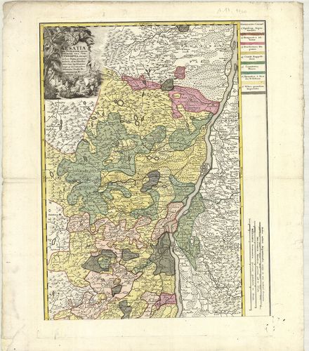
| Title | Alsatia tam Svperior, quam Inferior una cum Svndgovia… |
| Main title | Felső-Elzász és Südgau terület térképe a 18. században. |
86. Propriae Lugudunensis Generalitatis Mappa Chorographica… [B V a 148]
Institute and Museum of Military History •
B V a
•
B V Franciaország
•
B I–XV. Európa
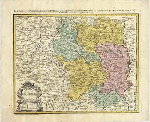
| Title | Propriae Lugudunensis Generalitatis Mappa Chorographica… |
| Main title | Franciaország: Lyon-kerület térképe 1762-ben. |
87. La Corsica. [B V a 149]
Institute and Museum of Military History •
B V a
•
B V Franciaország
•
B I–XV. Európa
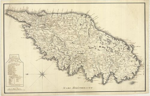
| Title | La Corsica. |
| Main title | Korzika térképe 1764-ben. |
88. Carte de Lisle de Corse divisée par Jurisdictions. [B V a 150]
Institute and Museum of Military History •
B V a
•
B V Franciaország
•
B I–XV. Európa
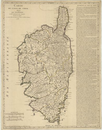
| Title | Carte de Lisle de Corse divisée par Jurisdictions. |
| Main title | Korzika közigazgatási térképe 1768-ban. |
89. Kriegstheater oder Graenzkarte zwischen Frankreich und Itali... [B V a 151]
Institute and Museum of Military History •
B V a
•
B V Franciaország
•
B I–XV. Európa
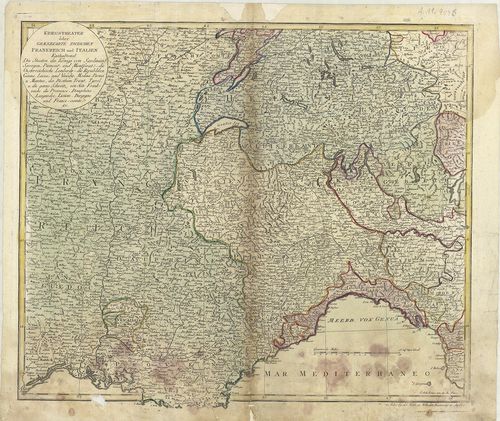
| Title | Kriegstheater oder Graenzkarte zwischen Frankreich und Italien. |
| Main title | Franciaország és Olaszország határtérképe a 18. században. |
90. Corsika. [B V a 155]
Institute and Museum of Military History •
B V a
•
B V Franciaország
•
B I–XV. Európa
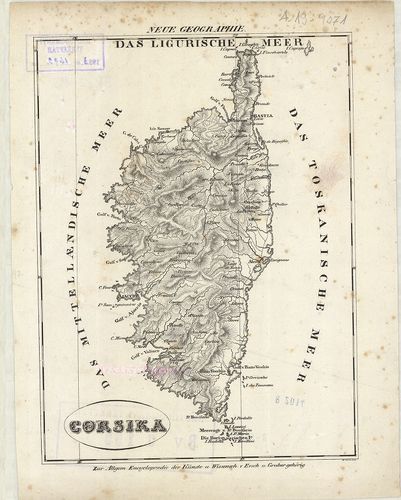
| Title | Corsika. |
| Main title | Korzika térképe az 1800-as években. |
91. [Korzika térképe.] [B V a 156]
Institute and Museum of Military History •
B V a
•
B V Franciaország
•
B I–XV. Európa
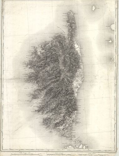
| Title | [Korzika térképe.] |
92. Evesché de Meaux… [B V a 158]
Institute and Museum of Military History •
B V a
•
B V Franciaország
•
B I–XV. Európa
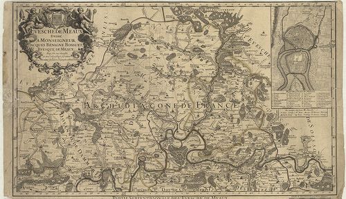
| Title | Evesché de Meaux… |
| Main title | Mt.: Plan de Ville de Meaux. (Meaux város térképe.) |
| Subject | Franciaország: Meaux érsekség terület É-i része a 18. században. |
93. I. Isola D’Oleron, Nelle Piaggie Occidentali Della Francia… [B V a 159]
Institute and Museum of Military History •
B V a
•
B V Franciaország
•
B I–XV. Európa
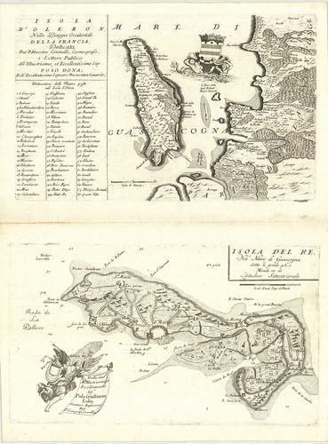
| Title | I. Isola D’Oleron, Nelle Piaggie Occidentali Della Francia… |
| Main title | Oleron sziget (Fr.) általános térképe a 18. században.II. Isola del Re… |
| Subject | Re sziget (Fr.) általános térképe a 18. században. |
94. Carte Géometrique du Comte de Nice et de la Vallée de Barcel... [B V a 161]
Institute and Museum of Military History •
B V a
•
B V Franciaország
•
B I–XV. Európa
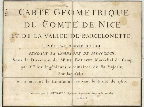
| Title | Carte Géometrique du Comte de Nice et de la Vallée de Barcelonette… |
| Main title | Franciaország: Nizza grófság és a Barcelonette-völgy térképe 1760-ban. |
95. Le Gouvernement General de Picardie, ou sont le Pays Reconqu... [B V a 161/1]
Institute and Museum of Military History •
B V a
•
B V Franciaország
•
B I–XV. Európa
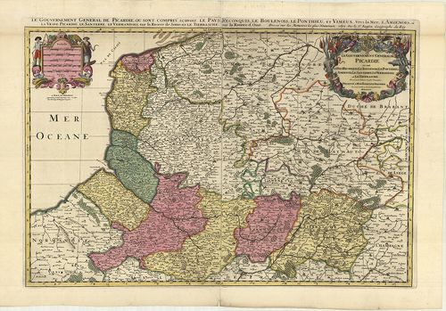
| Title | Le Gouvernement General de Picardie, ou sont le Pays Reconquis, Le Boulenois Le Ponthieu l’Amienois, Le Santerre, Le Vermandois, et Le Trierrasche. |
| Main title | Franciaország: Picardia francia tartomány általános térképe tartományi színezéssel 1692-ben. |
96. Le Comte de Haynaut, divisé en Chatellenies, Balliages, Prev... [B V a 162]
Institute and Museum of Military History •
B V a
•
B V Franciaország
•
B I–XV. Európa
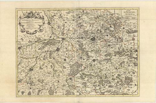
| Title | Le Comte de Haynaut, divisé en Chatellenies, Balliages, Prevostés etc. |
| Main title | Hainaut grófság térképe (Chatelleine, Baillages, Prevost kerületekkel) 1692-ben. |
97. Carta Generale de Stati di sua Altezza Reale. [B V a 164/1]
Institute and Museum of Military History •
B V a
•
B V Franciaország
•
B I–XV. Európa
| Title | Carta Generale de Stati di sua Altezza Reale. |
| Main title | Savoie hercegség és a környező tartományok általános térképe 1680-ban. |
98. Carte qui continent la Principauté, de Piemont, le Monferrat... [B V a 164/2]
Institute and Museum of Military History •
B V a
•
B V Franciaország
•
B I–XV. Európa
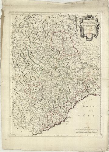
| Title | Carte qui continent la Principauté, de Piemont, le Monferrat, et la Comté de Nice avec la Riviére de Poment de Génes. Terv.: P. Santini. |
| Main title | Piemont hercegség, Monferrat, Nizza grófság, Genua térképe 1779-ben. |
99. Theatre de la Guerre en Savoye et en Piemont… [B V a 164/3]
Institute and Museum of Military History •
B V a
•
B V Franciaország
•
B I–XV. Európa
| Title | Theatre de la Guerre en Savoye et en Piemont… |
| Main title | Savoie és Piemont hercegség térképe 18. században. |
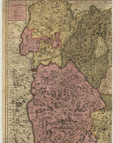
100. Carte du Duché de Bourgogne Comtés et Pays Adjacents… [B V a 165]
Institute and Museum of Military History •
B V a
•
B V Franciaország
•
B I–XV. Európa
| Title | Carte du Duché de Bourgogne Comtés et Pays Adjacents… |
| Main title | Franciaország: Bourgogne hercegség térképe 1782-ben. |