521. Reducierte Karte des Grossfürstenthums Siebenbürgen. [B IX a 718]
Institute and Museum of Military History •
B IX a
•
B IX Ausztria–Magyarország
•
B I–XV. Európa
| Title | Reducierte Karte des Grossfürstenthums Siebenbürgen. |
| Main title | Erdély általános térképe a 18. század végén az I. katonai felmérés alapján. |
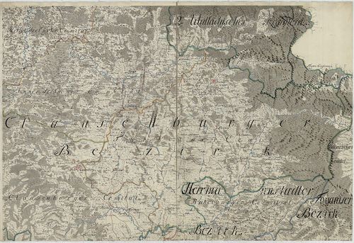
522. Administrativ Karte des Grossfürstenthums Siebenbürgen nach ... [B IX a 719]
Institute and Museum of Military History •
B IX a
•
B IX Ausztria–Magyarország
•
B I–XV. Európa
| Title | Administrativ Karte des Grossfürstenthums Siebenbürgen nach der neuesten Landeseintheilung 1859. |
| Main title | Erdély közigazgatási beosztásagának térképe térképe 1861-ben, részben a II. katonai felmérés alapján. |
523. …Karte von Siebenbürgen. [B IX a 720]
Institute and Museum of Military History •
B IX a
•
B IX Ausztria–Magyarország
•
B I–XV. Európa
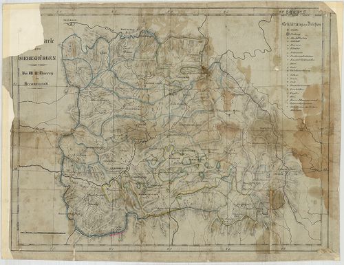
| Title | …Karte von Siebenbürgen. |
| Main title | Erdély térképe. |
524. Az Erdélyi részek kézi térképe. [B IX a 722]
Institute and Museum of Military History •
B IX a
•
B IX Ausztria–Magyarország
•
B I–XV. Európa
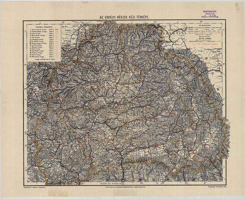
| Title | Az Erdélyi részek kézi térképe. |
525. Galizien, Nord Ungarn und ein Theil von Siebenbürgen. [B IX a 722/1]
Institute and Museum of Military History •
B IX a
•
B IX Ausztria–Magyarország
•
B I–XV. Európa
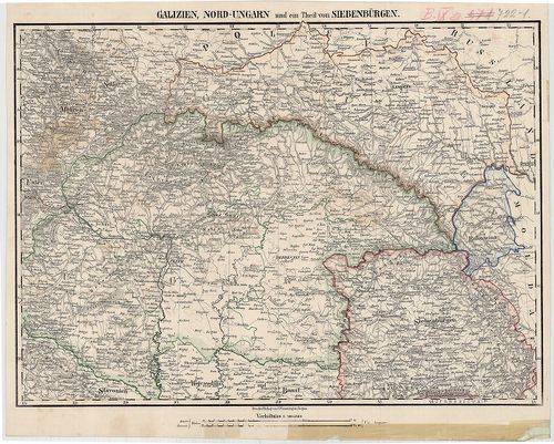
| Title | Galizien, Nord Ungarn und ein Theil von Siebenbürgen. |
| Main title | Észak-Magyarország, Galícia és Erdély egy részének térképe 1850 körül. |
526. Uebersichts-Karte des Grossfürstenthums Siebenbürgen nach de... [B IX a 722/2]
Institute and Museum of Military History •
B IX a
•
B IX Ausztria–Magyarország
•
B I–XV. Európa
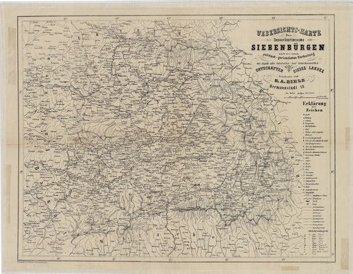
| Title | Uebersichts-Karte des Grossfürstenthums Siebenbürgen nach der neuen politisch-gerichtlichen Eintheilung… |
| Main title | Az Erdélyi Nagyfejedelemség áttekintő térképe a 19. század közepén. |
527. Geographische Mappe des Gross-Fürstenthums Siebenbürgen. [B IX a 722/3]
Institute and Museum of Military History •
B IX a
•
B IX Ausztria–Magyarország
•
B I–XV. Európa
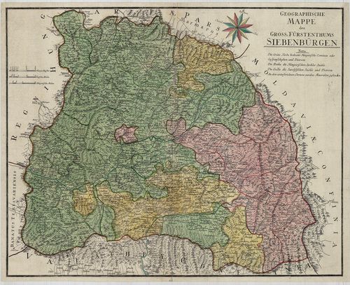
| Title | Geographische Mappe des Gross-Fürstenthums Siebenbürgen. |
| Main title | Az Erdélyi Nagyfejedelemség földrajzi térképe 1784-ben. |
528. Nova Principatus Transilvaniae Tabula … [B IX a 722/4]
Institute and Museum of Military History •
B IX a
•
B IX Ausztria–Magyarország
•
B I–XV. Európa
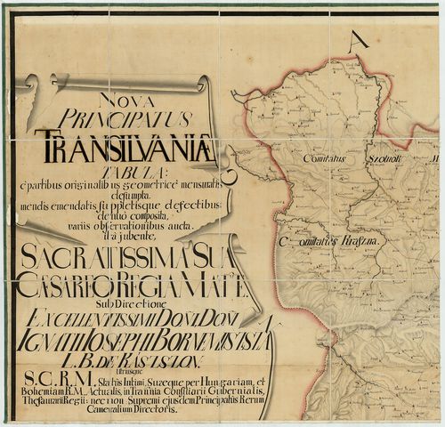
| Title | Nova Principatus Transilvaniae Tabula … |
| Main title | Erdély térképe. |
529. Ost-Ungarn Siebenbürgisch-Rumänische Grenze. – Bukovina bis ... [B IX a 723/1]
Institute and Museum of Military History •
B IX a
•
B IX Ausztria–Magyarország
•
B I–XV. Európa
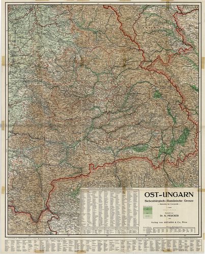
| Title | Ost-Ungarn Siebenbürgisch-Rumänische Grenze. – Bukovina bis Czernowitz. |
| Main title | Kelet-Magyarország, erdélyi-román határ. |
530. 2 térkép: 1.Erdély közigazgatási térképe 1847-ben. – Carte A... [B IX a 724]
Institute and Museum of Military History •
B IX a
•
B IX Ausztria–Magyarország
•
B I–XV. Európa
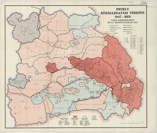
| Title | 2 térkép: 1.Erdély közigazgatási térképe 1847-ben. – Carte Administrative de la Transylvanie en 1847. |
| Main title | 2. térkép: Erdély közigazgatási térképe 1847-ben. – Carte de l’Administration de la Transilvanie en 1847. – Map of Transylvania According to her Administrative Structure in 1847. |
531. Regiones Danubianae Pannoniae Dacia, Moesiae. [B IX a 741]
Institute and Museum of Military History •
B IX a
•
B IX Ausztria–Magyarország
•
B I–XV. Európa
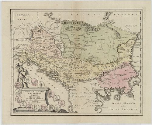
| Title | Regiones Danubianae Pannoniae Dacia, Moesiae. |
| Main title | Duna menti Magyarország, Erdély, Észak-Balkán területe. |
532. Erdély legújabb térképe. – Borítócím.: A Magyar Szent Korona... [B IX a 745]
Institute and Museum of Military History •
B IX a
•
B IX Ausztria–Magyarország
•
B I–XV. Európa
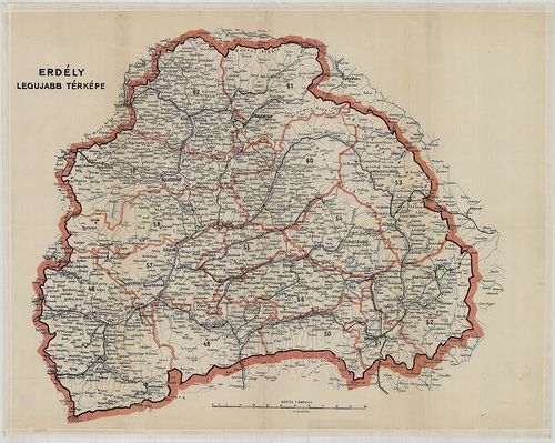
| Title | Erdély legújabb térképe. – Borítócím.: A Magyar Szent Korona Országai Erdély részének kézitérképe közigazgatási és közlekedési beosztással. |
533. Die Kaiserl. Königl. Militairgrenze… [B IX a 751]
Institute and Museum of Military History •
B IX a
•
B IX Ausztria–Magyarország
•
B I–XV. Európa
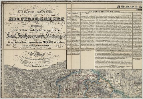
| Title | Die Kaiserl. Königl. Militairgrenze… |
| Main title | 2 mt. 1. Vergleichende Übersicht der dieser Karte vorkommenden Flüsse und Seen, erstere nach ihren Lauflängen geordnet. (A Duna Mehádia és Titel közötti szakasza mellékfolyói hosszúságának egybevetése.) 2. Trigonometrisch gemessene Höhen in und längs der Militairgrenze. (A határőrvidék hegyeinek madártávlati képe és trigonometriailag mért magassága.) |
| Subject | Horvát–Szlavónia, a Katonai Határőrvidék és Erdély térképe. |
534. Karte von Croatien und Slavonien nebst der K. u. K. Militär ... [B IX a 753]
Institute and Museum of Military History •
B IX a
•
B IX Ausztria–Magyarország
•
B I–XV. Európa
| Title | Karte von Croatien und Slavonien nebst der K. u. K. Militär Grenze… – Zemljovid Hérvarske i Szlavonije s Krajinom Vojnickom … |
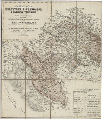
| Main title | Horvátország, Szlavónia és a Katonai Határőrvidék térképe 1856-ban. |
535. Charte von Kroatien, enthaltend die Agramer, Warasdiner und ... [B IX a 760]
Institute and Museum of Military History •
B IX a
•
B IX Ausztria–Magyarország
•
B I–XV. Európa
| Title | Charte von Kroatien, enthaltend die Agramer, Warasdiner und Kreutzer Gespannschaft, nebst dem Karlstädter und Warasdiner Generalat dem Bannal und dem Seebezirk. – Carta de la Croatie. |
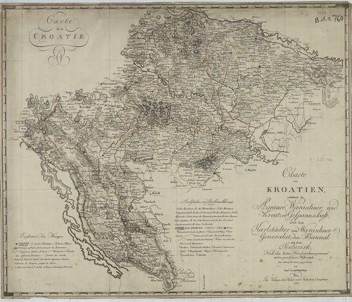
| Main title | Horvátország térképe 1803-ban. |
536. Charte von dem Königreiche Kroazien. [B IX a 761]
Institute and Museum of Military History •
B IX a
•
B IX Ausztria–Magyarország
•
B I–XV. Európa
| Title | Charte von dem Königreiche Kroazien. |
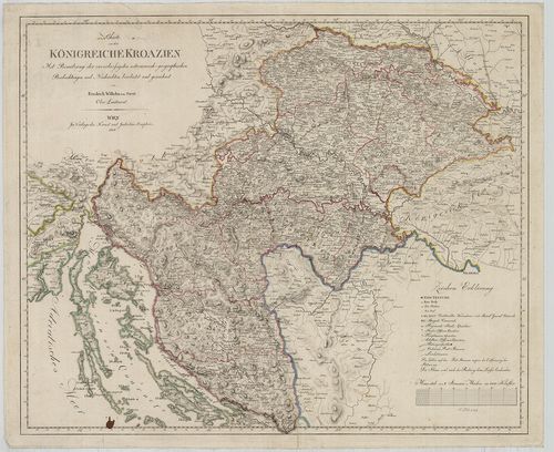
| Main title | A Horvát Királyság térképe 1808-ban. |
537. General-Karte von Krain. [B IX a 763]
Institute and Museum of Military History •
B IX a
•
B IX Ausztria–Magyarország
•
B I–XV. Európa
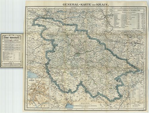
| Title | General-Karte von Krain. |
| Main title | Mt. Plan von Laibach. (Ljubljana várostérképe.) |
| Subject | Krajna általános térképe 1906 körül. |
538. Karte der Wojwodschaft Serbien und des Temescher Banates neb... [B IX a 772]
Institute and Museum of Military History •
B IX a
•
B IX Ausztria–Magyarország
•
B I–XV. Európa
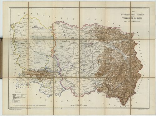
| Title | Karte der Wojwodschaft Serbien und des Temescher Banates nebst dem Serbisch-Banatischen Militärgränzlande. |
| Main title | A Szerb Vajdaság és a Temesi Bánság áttekintő térképe 1860 körül. |
539. Geripp-Karte des Territoriums der XXII. Truppen Division zu ... [B IX a 795]
Institute and Museum of Military History •
B IX a
•
B IX Ausztria–Magyarország
•
B I–XV. Európa
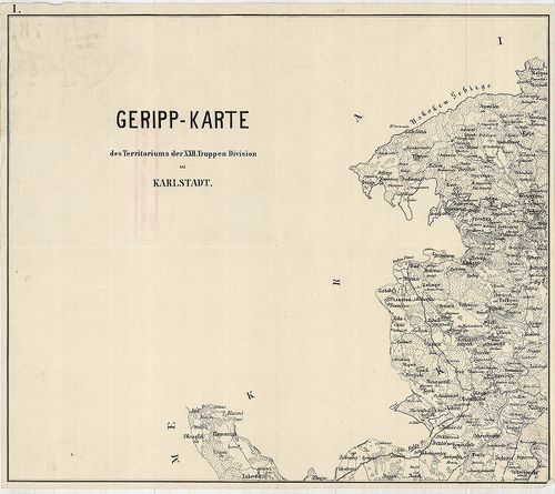
| Title | Geripp-Karte des Territoriums der XXII. Truppen Division zu Karlstadt. |
| Main title | Horvátország: a károlyvárosi hadosztály XXII. divizió területének térképe 1870 körül. |
540. Reise und Influenz-Karte der Eil-Post und Brancard-Wagen-Cou... [B IX a 795/a]
Institute and Museum of Military History •
B IX a
•
B IX Ausztria–Magyarország
•
B I–XV. Európa
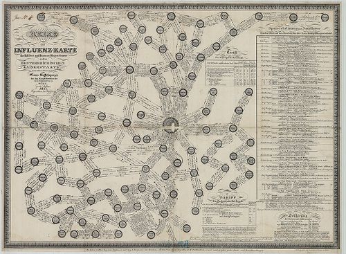
| Title | Reise und Influenz-Karte der Eil-Post und Brancard-Wagen-Course in den Oesterreischen Kaiserstaate. |
| Main title | Az Osztrák Császárság postakocsi forgalmi és szállítási térképe 1827-ben, fontos csatl. csomópontok jelölése. |