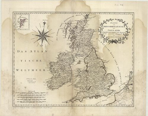
1861. Charte der vereinigten Königeriche Grossbritannien und Irlan... [B VI a 9]
Institute and Museum of Military History •
B VI a
•
B VI Anglia, Skócia és Írország
•
B I–XV. Európa
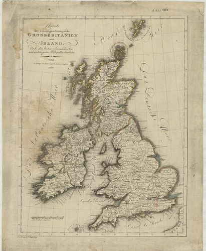
| Title | Charte der vereinigten Königeriche Grossbritannien und Irland. |
| Main title | Nagybritannia és Írország általános térképe 1806-ban. |
1862. Die Britischen Inseln und das umliegende Meer. [B VI a 10]
Institute and Museum of Military History •
B VI a
•
B VI Anglia, Skócia és Írország
•
B I–XV. Európa
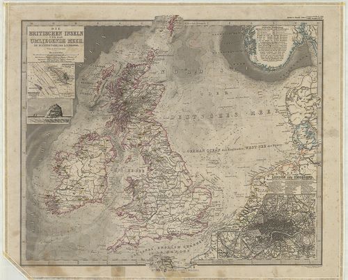
| Title | Die Britischen Inseln und das umliegende Meer. |
| Main title | 3 mt.: 1. Helgoland. |
| Subject | 2. Helgoland und die Düne. |
1863. Schlag nach über England. [B VI a 11]
Institute and Museum of Military History •
B VI a
•
B VI Anglia, Skócia és Írország
•
B I–XV. Európa
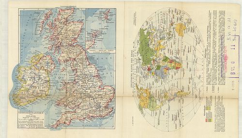
| Title | Schlag nach über England. |
| Main title | 2 térk.: 1. Grossbritannien und Irland. |
| Subject | (Nagybritannia és Írország.) 2. Politische Karte der Erde. (A világ politikai térképe.) |
1864. A General Map of Great Britain and Ireland… – Regnorum Magna... [B VI a 12]
Institute and Museum of Military History •
B VI a
•
B VI Anglia, Skócia és Írország
•
B I–XV. Európa
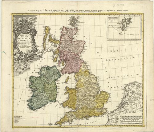
| Title | A General Map of Great Britain and Ireland… – Regnorum Magnae Britanniae et Hiberniae… |
| Main title | Mt.: Insulae Schetlandicae. (Shetland-szk.) |
| Subject | Nagy-Britannia és Írország általános térképe 1749-ben. |
1865. British Atlas, Comprising separate maps of every County in E... [B VI a 13/1]
Institute and Museum of Military History •
B VI a
•
B VI Anglia, Skócia és Írország
•
B I–XV. Európa
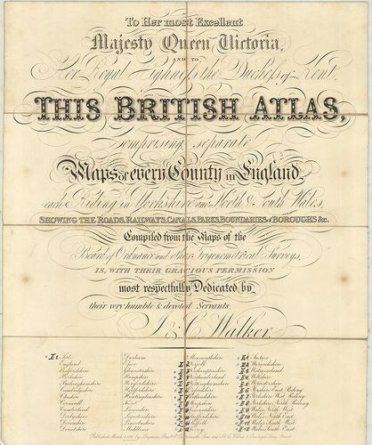
| Title | British Atlas, Comprising separate maps of every County in England… |
| Main title | 1. Northamptonshire. 2. Northumberland. 3. Nottinghamshire. 4. Oxfordshire. 5. Rutlandshire. 6. Shorpshire. 7. Somersetshire. 8. Staffordshire. 9. Suffolk. 10. Surrey. 11. Sussex. 12. Warwickshire. 13. Wiltshire. 14. Yorkshire, West Riding. 15. Yorkshire, North Riding. 16. Wales, North West. 17. Wales, North-East. 18. Wales, South-West. 19. Wales, South-East.Anglia grófságainak általános térképe 1837-ben. |
1866. Index shewing the progress of the ordnance survey of the Sou... [B VI a 14]
Institute and Museum of Military History •
B VI a
•
B VI Anglia, Skócia és Írország
•
B I–XV. Európa
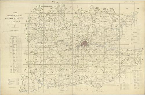
| Title | Index shewing the progress of the ordnance survey of the South Eastern Counties of England. |
| Main title | Anglia DK-i grófságainak katonai térképe. |
1867. Anglia Skotzia és Irlandia földképe. [B VI a 15]
Institute and Museum of Military History •
B VI a
•
B VI Anglia, Skócia és Írország
•
B I–XV. Európa
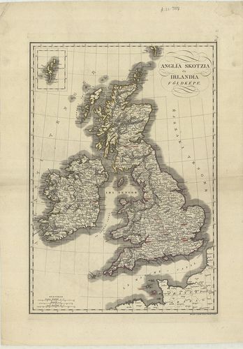
| Title | Anglia Skotzia és Irlandia földképe. |
| Main title | Anglia, Skócia és Írország térképe 1840 körül. |
1868. Karte von Grossbritannien und Ireland. X. [B VI a 16]
Institute and Museum of Military History •
B VI a
•
B VI Anglia, Skócia és Írország
•
B I–XV. Európa
| Title | Karte von Grossbritannien und Ireland. X. |
| Main title | Nagy-Britannia és Írország általános térképe 1795-ben. |
1869. Das Königreich England. XI. [B VI a 17]
Institute and Museum of Military History •
B VI a
•
B VI Anglia, Skócia és Írország
•
B I–XV. Európa
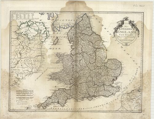
| Title | Das Königreich England. XI. |
| Main title | Az Angol Királyság térképe 1795-ben. |
1870. Karte von Scotland. XII. [B VI a 18]
Institute and Museum of Military History •
B VI a
•
B VI Anglia, Skócia és Írország
•
B I–XV. Európa
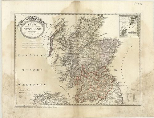
| Title | Karte von Scotland. XII. |
| Main title | Skócia térképe 1795-ben. |
1871. Karte von Ireland. XIII. [B VI a 19]
Institute and Museum of Military History •
B VI a
•
B VI Anglia, Skócia és Írország
•
B I–XV. Európa
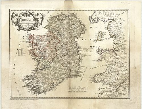
| Title | Karte von Ireland. XIII. |
| Main title | Írország térképe 1795-ben. |
1872. Insularum Britannicarum. [B VI a 20]
Institute and Museum of Military History •
B VI a
•
B VI Anglia, Skócia és Írország
•
B I–XV. Európa
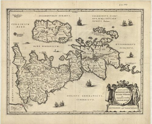
| Title | Insularum Britannicarum. |
| Main title | A Brit-szigetek térképe a XVI. században. |
1873. Parte meridionale del Regno D’Inghilterra. [B VI a 21]
Institute and Museum of Military History •
B VI a
•
B VI Anglia, Skócia és Írország
•
B I–XV. Európa
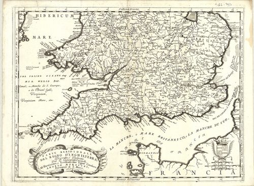
| Title | Parte meridionale del Regno D’Inghilterra. |
| Main title | Az Angol Királyság déli részének térképe 1690 körül. |
1874. General Survey of England and Wales. An entirely new and acc... [B VI a 22/3]
Institute and Museum of Military History •
B VI a
•
B VI Anglia, Skócia és Írország
•
B I–XV. Európa
| Title | General Survey of England and Wales. An entirely new and accurate Survey of the County of Kent… |
| Main title | Kent grófság térképe 1801-ben. |
1875. Neueste Karte von Grossbritannien und Ireland. [B VI a 25]
Institute and Museum of Military History •
B VI a
•
B VI Anglia, Skócia és Írország
•
B I–XV. Európa
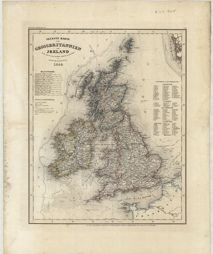
| Title | Neueste Karte von Grossbritannien und Ireland. |
| Main title | Nagy-Britannia és Írország térképe 1844-ben. |
1876. Neueste Karte von England. [B VI a 26]
Institute and Museum of Military History •
B VI a
•
B VI Anglia, Skócia és Írország
•
B I–XV. Európa
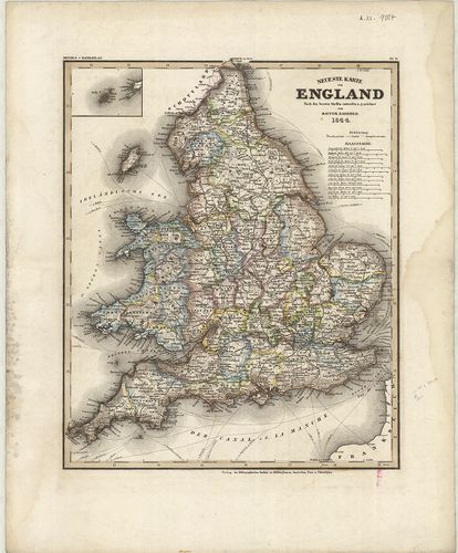
| Title | Neueste Karte von England. |
| Main title | Anglia térképe 1844-ben. |
1877. Neueste Karte von Schotland. [B VI a 27]
Institute and Museum of Military History •
B VI a
•
B VI Anglia, Skócia és Írország
•
B I–XV. Európa
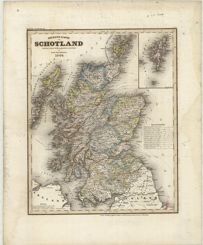
| Title | Neueste Karte von Schotland. |
| Main title | Skócia térképe 1844-ben. |
1878. Neuestes Karte von Ireland. [B VI a 28]
Institute and Museum of Military History •
B VI a
•
B VI Anglia, Skócia és Írország
•
B I–XV. Európa
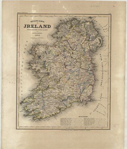
| Title | Neuestes Karte von Ireland. |
| Main title | Írország térképe 1844-ben. |
1879. Map of Scotland. [B VI a 30]
Institute and Museum of Military History •
B VI a
•
B VI Anglia, Skócia és Írország
•
B I–XV. Európa
| Title | Map of Scotland. |
| Main title | Skócia térképe 1810-ben. |
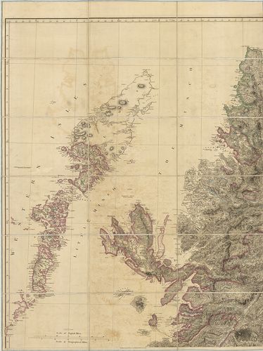
1880. Scotland with its Islands. [B VI a 31]
Institute and Museum of Military History •
B VI a
•
B VI Anglia, Skócia és Írország
•
B I–XV. Európa
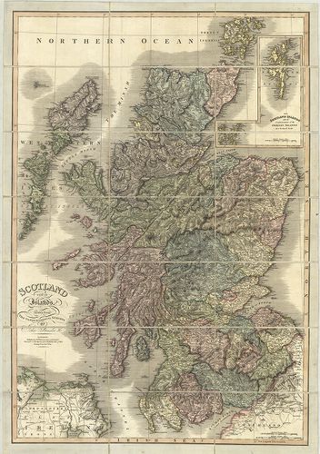
| Title | Scotland with its Islands. |
| Main title | Mt.: The Shetland Islands. (Shetland szk.) |
| Subject | Skócia és szigeteinek térképe 1824-ben. |