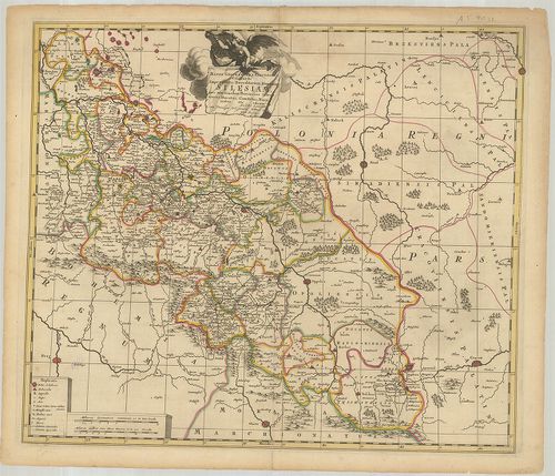
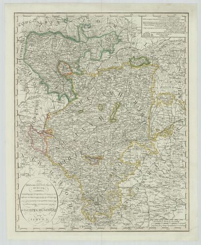
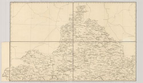
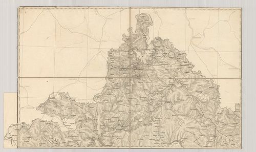
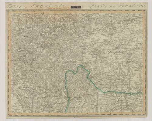
201. General-Karte von der Königlich Preussischen Provinz Schlesi... [B IV a 364]
Institute and Museum of Military History •
B IV a
•
B IV Német birodalom
•
B I–XV. Európa
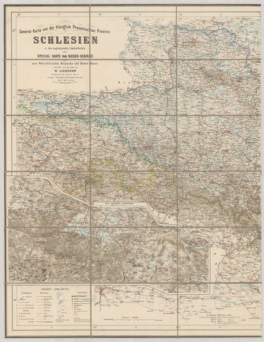
| Title | General-Karte von der Königlich Preussischen Provinz Schlesien und den angrenzenden Ländertheilen… |
| Main title | 4 mt.: 1. Breslau (Wrocław.) 2. Übersichts Karte Oberschlesien Bergwerks u. Hütten-Revier. (Áttekintőlap a Felsősziléziai bánya és kohóvidékhez.) 3. Das Riesen-Gebirge. (Karkonosze). (Az Óriás-hegység.) 4. Uebersicht d. Eisenbahn-Post u. Telegraphen Verbindungen. (Vasút-posta-távirdahálózat áttekintőlapja.) |
| Subject | Szilézia általános térképe 1865-ben a szomszédos államok egy részével. |
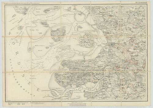
202. Karte der Umgegend von Danzig. [B IV a 366]
Institute and Museum of Military History •
B IV a
•
B IV Német birodalom
•
B I–XV. Európa
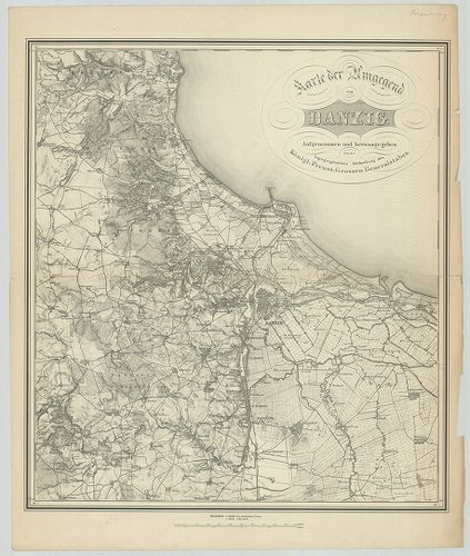
| Title | Karte der Umgegend von Danzig. |
| Main title | Gdansk és környékének térképe. |
203. Nova Famigerabilis Insulae ac Ducatus Rugiae… [B IV a 368]
Institute and Museum of Military History •
B IV a
•
B IV Német birodalom
•
B I–XV. Európa
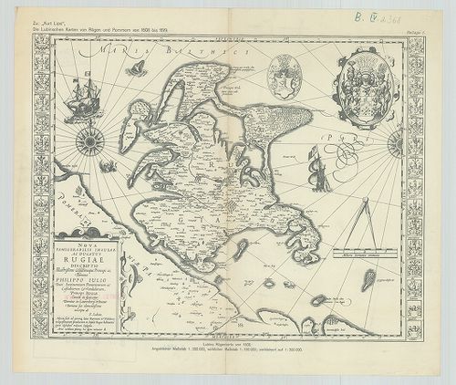
| Title | Nova Famigerabilis Insulae ac Ducatus Rugiae… |
| Main title | Rügen sziget térképe 1608–1619-ben. |
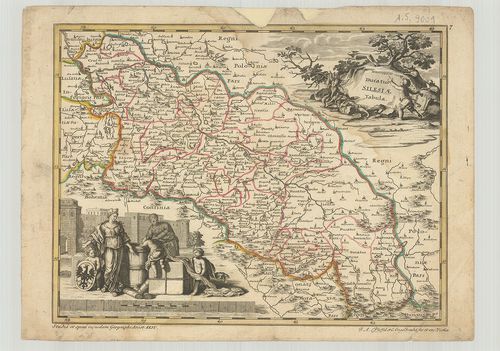
204. Silesia Ducatus. [B IV a 370]
Institute and Museum of Military History •
B IV a
•
B IV Német birodalom
•
B I–XV. Európa
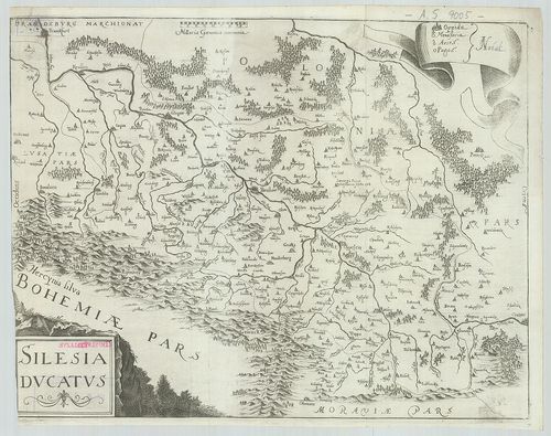
| Title | Silesia Ducatus. |
| Main title | A Szilézia hercegség térképe. (Frankfurt–Krakkó közötti terület.). |
205. Mappa Geographica Exactissima continens Imper Atoris Haeredi... [B IV a 371]
Institute and Museum of Military History •
B IV a
•
B IV Német birodalom
•
B I–XV. Európa
| Title | Mappa Geographica Exactissima continens Imper Atoris Haereditarium Dominium Silesiam… |
| Main title | Szilézia térképe. |
206. Ducatus Silesiae Tabula. [B IV a 372]
Institute and Museum of Military History •
B IV a
•
B IV Német birodalom
•
B I–XV. Európa
| Title | Ducatus Silesiae Tabula. |
| Main title | A Szilézia hercegség térképe. |
207. Ducatus Lauenburgicus… [B IV a 373]
Institute and Museum of Military History •
B IV a
•
B IV Német birodalom
•
B I–XV. Európa
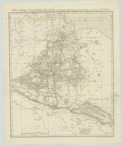
| Title | Ducatus Lauenburgicus… |
| Main title | A Lauenburg-i hercegség térképe 1771-ben. |
208. Karte vom Herzogthum Holstein den Gebiethen der Reichs-Staed... [B IV a 374]
Institute and Museum of Military History •
B IV a
•
B IV Német birodalom
•
B I–XV. Európa
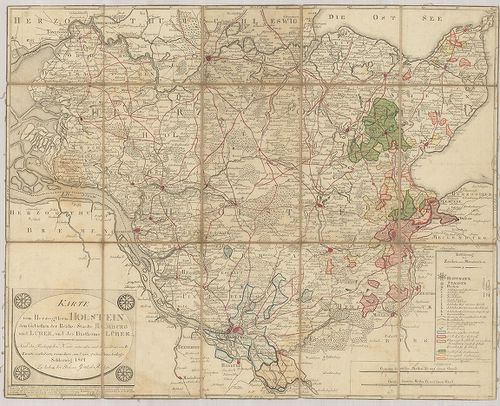
| Title | Karte vom Herzogthum Holstein den Gebiethen der Reichs-Staedte Hamburg und Lübek und des Bisthums Lübek. |
| Main title | A Holstein-i hercegség, Hamburg és Lübeck város és Lübeck püspökség térképe 1801-ben. |
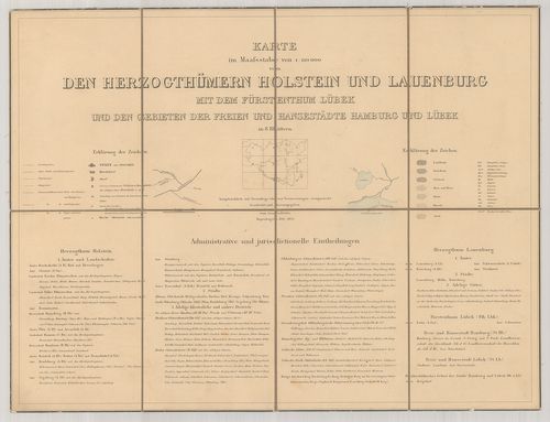
209. Herzogth.[um] Holstein und Lauenburg, Fürstenth.[um] Lübeck,... [B IV a 376]
Institute and Museum of Military History •
B IV a
•
B IV Német birodalom
•
B I–XV. Európa
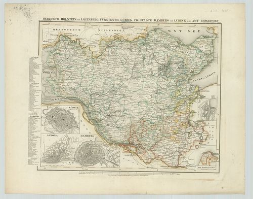
| Title | Herzogth.[um] Holstein und Lauenburg, Fürstenth.[um] Lübeck, Fr.[eien] Städte Hamburg und Lübeck nebst Amt Bergedorf. Metsz.: K. Fuchs |
| Main title | 4 mt.: 1. Lübeck, 2. Altona-Hamburg, 3. Kiel-várostérkép. 4. Zum Hamburger-Gebiet. |
| Subject | Holstein, Lauenburg, Lübeck hercegségek és a szabad Hamburg és Lübeck térképe. |
210. Sönderjylland eller Hertugdömmet Slesvig. [B IV a 377]
Institute and Museum of Military History •
B IV a
•
B IV Német birodalom
•
B I–XV. Európa
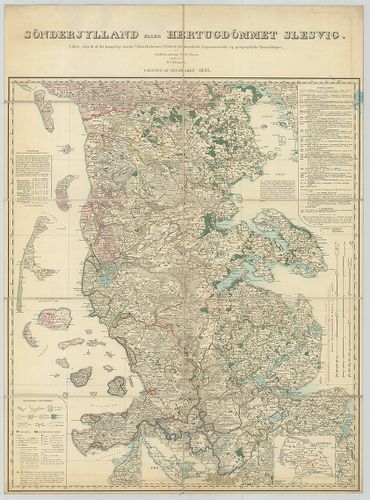
| Title | Sönderjylland eller Hertugdömmet Slesvig. |
| Main title | 2 mt.: 1. Aerř-sziget. 2. Fehmern-sz. Schleswig térképe 1836-ban. |
211. Herzogthum Schleswig. [B IV a 378]
Institute and Museum of Military History •
B IV a
•
B IV Német birodalom
•
B I–XV. Európa
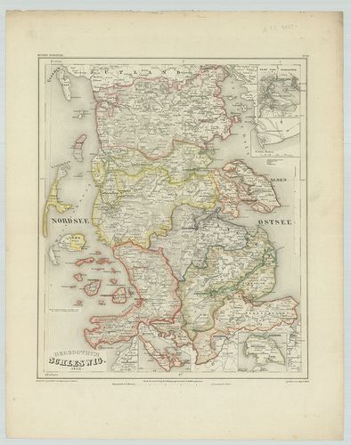
| Title | Herzogthum Schleswig. |
| Main title | 4 mt.: 1. Plan von Schleswig, (Schleswig várostérkép.) 2. Friederichsort. 3. Aerö (sziget) 4. Fehmern. (Fehmarn-sziget.) |
| Subject | A Schleswig-i hercegség általános térképe 1852-ben. |
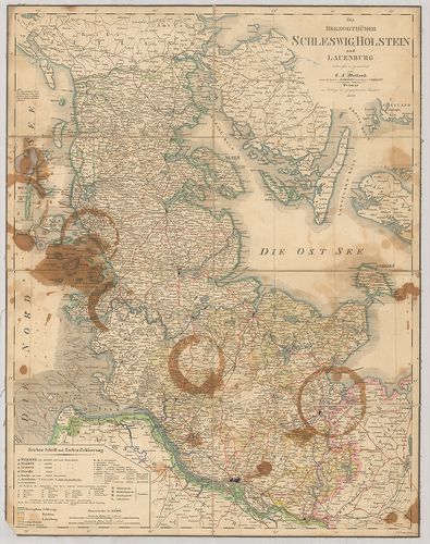
212. Die Königl.[ichen] Daenischen Herzogthümer Schleswig, Holste... [B IV a 379]
Institute and Museum of Military History •
B IV a
•
B IV Német birodalom
•
B I–XV. Európa
| Title | Die Königl.[ichen] Daenischen Herzogthümer Schleswig, Holstein und Lauenburg. |
| Main title | Schleswig, Holstein és Lauenburg hercegségek térképe 1843-ban. |
213. Kaart over Hertugdömmet Lauenborg. [B IV a 380]
Institute and Museum of Military History •
B IV a
•
B IV Német birodalom
•
B I–XV. Európa
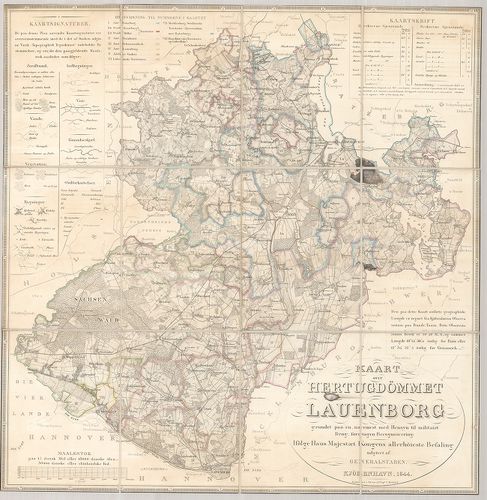
| Title | Kaart over Hertugdömmet Lauenborg. |
| Main title | A Lauenburg-i hercegség térképe 1844-ben. |
214. Die Herzogthümer Schleswig, Holstein und Lauenburg. [B IV a 381]
Institute and Museum of Military History •
B IV a
•
B IV Német birodalom
•
B I–XV. Európa
| Title | Die Herzogthümer Schleswig, Holstein und Lauenburg. |
| Main title | Schleswig, Holstein és a Lauenburg-i hercegség térképe 1849-ben. |
215. Karte vom Kriegsschauplatz in Schleswig. [B IV a 383]
Institute and Museum of Military History •
B IV a
•
B IV Német birodalom
•
B I–XV. Európa
| Title | Karte vom Kriegsschauplatz in Schleswig. |
| Main title | Schleswig hadszíntér térképe. |
216. Kaart i 1:120 000 sand Störrelse over Slesvigs Fastland og a... [B IV a 384]
Institute and Museum of Military History •
B IV a
•
B IV Német birodalom
•
B I–XV. Európa
| Title | Kaart i 1:120 000 sand Störrelse over Slesvigs Fastland og als… |
| Main title | Schleswig térképe 1854-ben, utak, vasutak és telefonállomások jelzésével. |
217. General-Karte von den Herzogthümern Schleswig, Holstein und ... [B IV a 385]
Institute and Museum of Military History •
B IV a
•
B IV Német birodalom
•
B I–XV. Európa
| Title | General-Karte von den Herzogthümern Schleswig, Holstein und Lauenburg, den Fürstenthümern Lübek und Ratzeburg, und den Freien und Hansestädten Hamburg und Lübek. |
| Main title | Mt.: Übersicht der Posten-Course mit Angabe der Wegesländen. (Posta és úthálózat.) |
| Subject | Schleswig, Holstein, Lauenburg, Lübeck és Ratzeburg hercegségek, a szabad Hansavárosok, Hamburg és Lübeck térképe 1858-ban. |
218. Die Herzogthümer Schleswig, Holstein und Lauenburg mit den F... [B IV a 386]
Institute and Museum of Military History •
B IV a
•
B IV Német birodalom
•
B I–XV. Európa
| Title | Die Herzogthümer Schleswig, Holstein und Lauenburg mit den Freien und Hansestädten Hamburg u. Lübeck. |
| Main title | Scheswig, Holstein, Lauenburg és a szabad Hansavárosok, Hamburg és Lübeck térképe. |
219. Nörrejylland Pl. 8. I. Däniemark mit Schleswig, Holstein u. ... [B IV a 387]
Institute and Museum of Military History •
B IV a
•
B IV Német birodalom
•
B I–XV. Európa
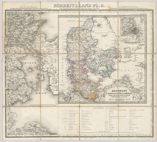
| Title | Nörrejylland Pl. 8. I. Däniemark mit Schleswig, Holstein u. Lauenburg, nebst den Dänischen Colonien. |
| Main title | II. Lille Belt. |
| Subject | Mt.: Kjöbenhavn. (Kopehnagen.) |
220. Karte von den Herzogthümern Holstein und Lauenburg mit den F... [B IV a 388]
Institute and Museum of Military History •
B IV a
•
B IV Német birodalom
•
B I–XV. Európa
| Title | Karte von den Herzogthümern Holstein und Lauenburg mit den Fürstenthum Lübek und den Gebieten der Freien und Hansestädte Hamburg und Lübek. |
| Main title | Holstein és Lauenburg hercegség, Hamburg és Lübeck általános térképe 1864-ben. |
221. General Karte der Herzogthümer Schleswig, Holstein und Lauen... [B IV a 391]
Institute and Museum of Military History •
B IV a
•
B IV Német birodalom
•
B I–XV. Európa
| Title | General Karte der Herzogthümer Schleswig, Holstein und Lauenburg der Fürstenthümer Lübek und Ratzeburg und der Gebiete der Freien u. Hansestädte Hamburg und Lübek… |
| Main title | Schleswig, Holstein, Lauenburg, Lübeck és Ratzenburg hercegségek és a szabad Hamburg és Lübeck általános térképe 1864-ben. |
222. Die Herzogthümer Holstein und Lauenburg mit dem Fürstenthum ... [B IV a 392]
Institute and Museum of Military History •
B IV a
•
B IV Német birodalom
•
B I–XV. Európa
| Title | Die Herzogthümer Holstein und Lauenburg mit dem Fürstenthum Lübeck und den Gebieten der Freien Städte Hamburg und Lübeck. |
| Main title | Holstein, Lauenburg és Lübeck hercegségek és a szabad Hamburg és Lübeck város általános térképe 1864-ben. |
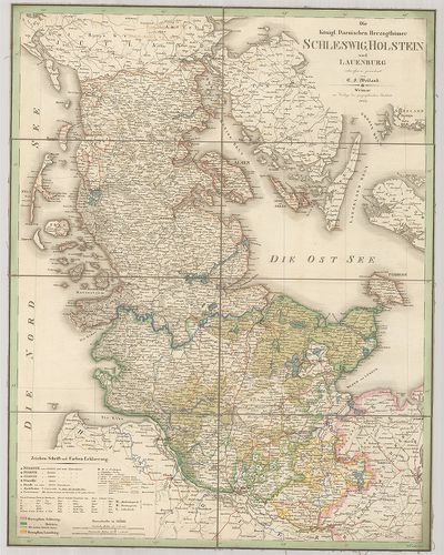
223. Karte von Holstein, Lauenburg, Schleswig u. den angrenzenden... [B IV a 393]
Institute and Museum of Military History •
B IV a
•
B IV Német birodalom
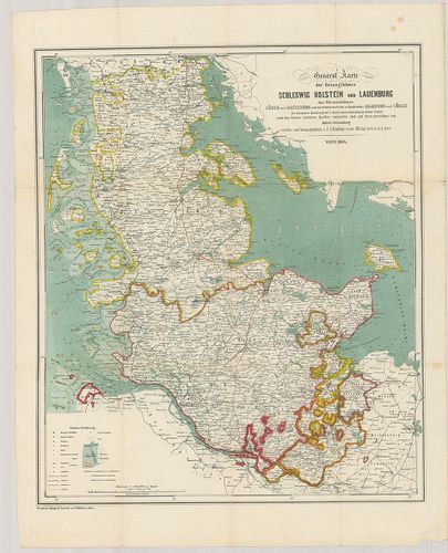
•
B I–XV. Európa
| Title | Karte von Holstein, Lauenburg, Schleswig u. den angrenzenden Landestheilen. |
| Main title | Holstein, Lauenburg, Schleswig térképe. |
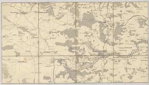
224. Topographische Karte vom südlichen Theile des Herzogthums Sc... [B IV a 394]
Institute and Museum of Military History •
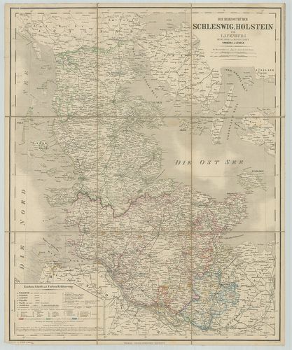
B IV a
•
B IV Német birodalom
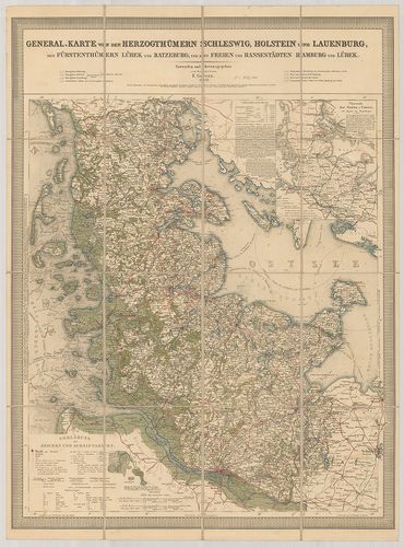
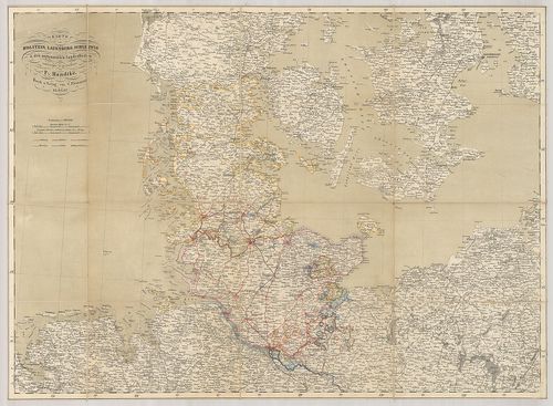
•
B I–XV. Európa
| Title | Topographische Karte vom südlichen Theile des Herzogthums Schleswig. |
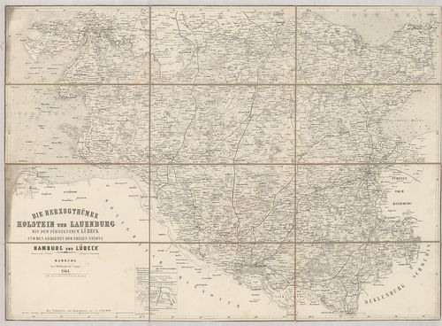
| Main title | Schleswig hercegség déli részének topográfiai térképe 1864-ben. |
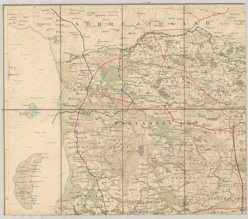
225. Topogr.[aphische] Karte vom südl.[iche] Theil des Herzogth.[... [B IV a 395]
Institute and Museum of Military History •
B IV a
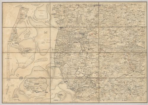
•
B IV Német birodalom
•
B I–XV. Európa
| Title | Topogr.[aphische] Karte vom südl.[iche] Theil des Herzogth.[um] Schleswig… |
| Main title | Schleswig hercegség déli részének topográfiai térképe 1863-ban. |
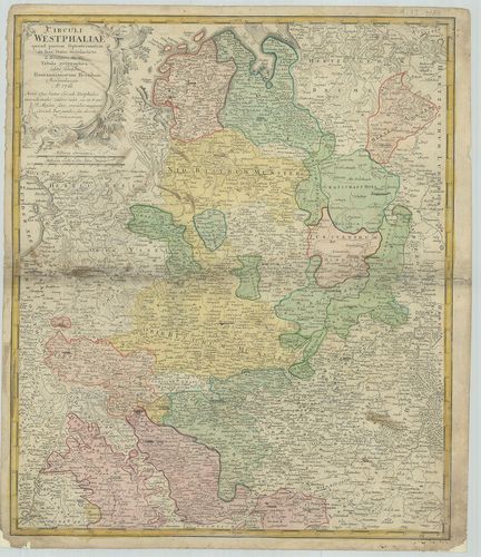
226. Nova et exacta Mappa Geographica exhibens Circulum Westphali... [B IV a 401]
Institute and Museum of Military History •
B IV a
•
B IV Német birodalom
•
B I–XV. Európa
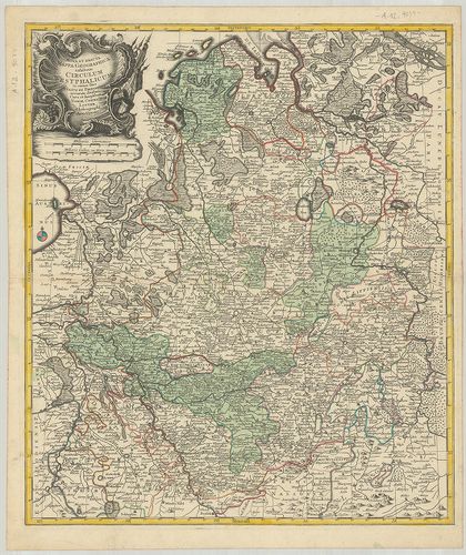
| Title | Nova et exacta Mappa Geographica exhibens Circulum Westphalicum… |
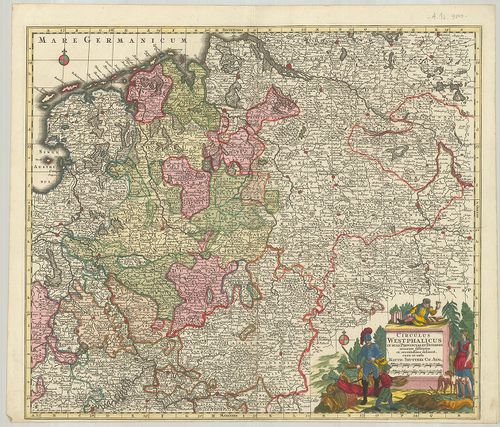
| Main title | Vesztfália porosz tartomány földrajz térképe. |
227. Carte du Cercle de Westphalie… [B IV a 402]
Institute and Museum of Military History •
B IV a
•
B IV Német birodalom
•
B I–XV. Európa
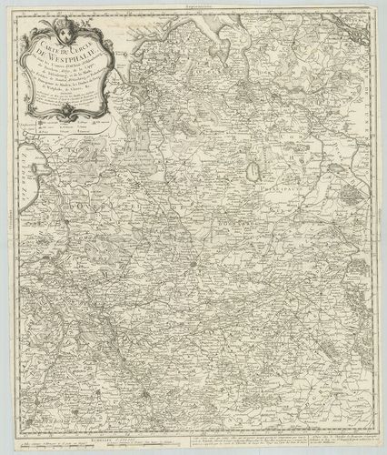
| Title | Carte du Cercle de Westphalie… |
| Main title | Vesztfália porosz tartomány térképe 1759-ben. |
228. Special Karte von den Westphälschen Provinzen… [B IV a 402/5]
Institute and Museum of Military History •
B IV a
•
B IV Német birodalom
•
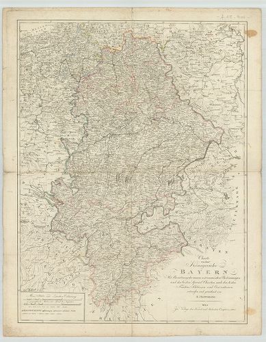
B I–XV. Európa
| Title | Special Karte von den Westphälschen Provinzen… |
| Main title | Vesztfália porosz tartomány részletes térképe 1790-ben. |
229. Charte von dem Königreiche Westphalen nach seinen dermaligen... [B IV a 402/6]
Institute and Museum of Military History •
B IV a
•
B IV Német birodalom
•
B I–XV. Európa
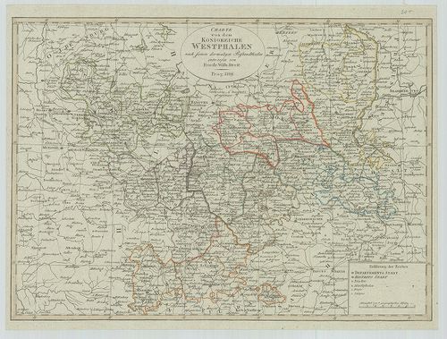
| Title | Charte von dem Königreiche Westphalen nach seinen dermaligen Bestandtheilen. |
| Main title | Vesztfália térképe 1809-ben. |
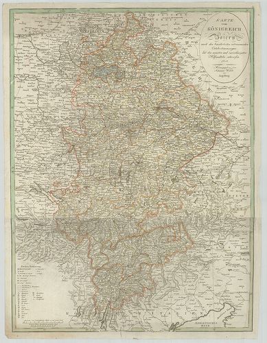
230. Circuli Westphaliae quoad partem septentrionalem in suos Sta... [B IV a 402/7]
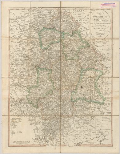
Institute and Museum of Military History •
B IV a
•
B IV Német birodalom
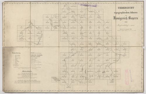
•
B I–XV. Európa
| Title | Circuli Westphaliae quoad partem septentrionalem in suos Status ecclesiasticos et seculares divisi Tabula geographica. |
| Main title | Vesztfália térképe 1760-ban. |
231. Topographischen Karte von Westphalen… [B IV a 402/11]
Institute and Museum of Military History •
B IV a
•
B IV Német birodalom
•
B I–XV. Európa
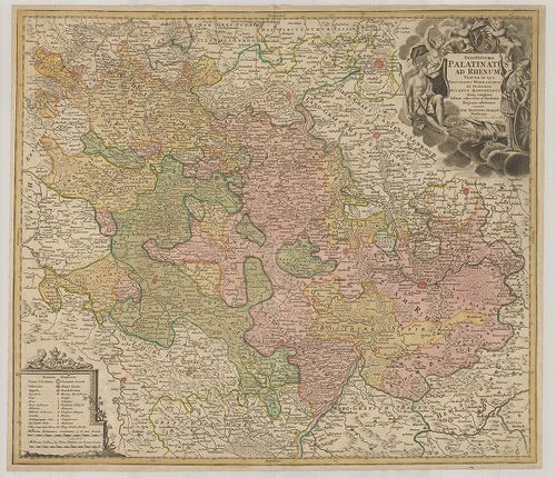
| Title | Topographischen Karte von Westphalen… |
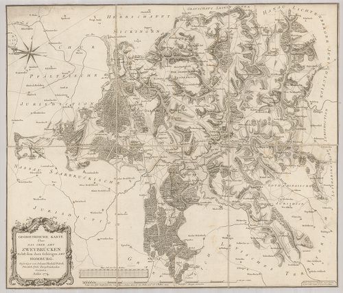
| Main title | Vesztfália topográfiai térképe 1812-ben. |
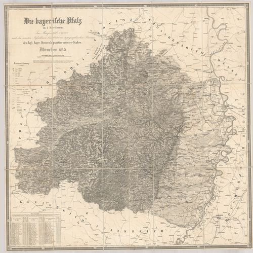
232. Der Westphaelische Kreis zum Gebrauche der Oesterreichischen... [B IV a 402/12]
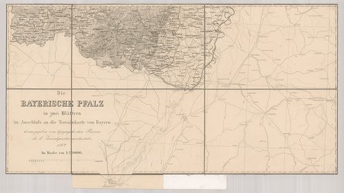
Institute and Museum of Military History •
B IV a
•
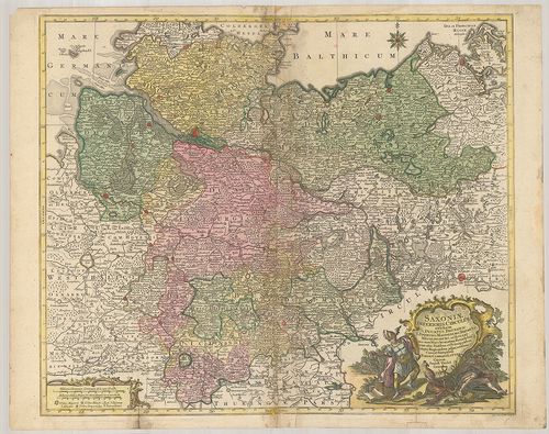
B IV Német birodalom
•
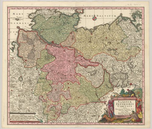
B I–XV. Európa
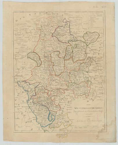
| Title | Der Westphaelische Kreis zum Gebrauche der Oesterreichischen Schulen. |
| Main title | Vesztfália térképe kerületi beosztással az osztrák iskolák részére. |
233. Topographisch-militairischer Atlas von dem Grossherzogthume ... [B IV a 402/14]
Institute and Museum of Military History •
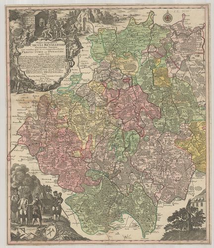
B IV a
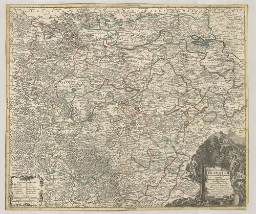
•
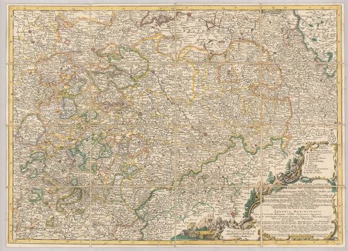
B IV Német birodalom
•
B I–XV. Európa
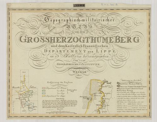
| Title | Topographisch-militairischer Atlas von dem Grossherzogthume Berg und dem Kaiserlich Französischen Departement der Lippe. |
| Main title | Berg Nagyhercegség és Lippe tartomány katonai-topográfiai térképe 1813-ban. |
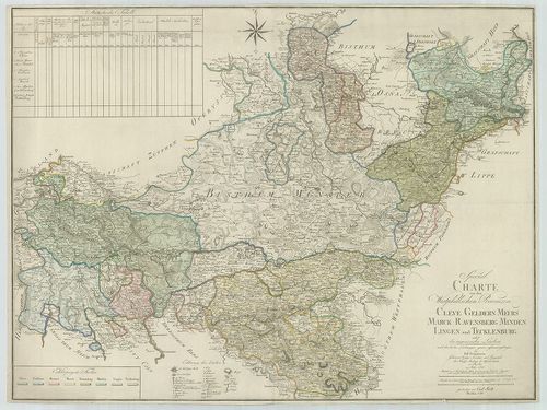
234. Die Königl.[ichen], Preussischen-Provinz Westphalen und Rhei... [B IV a 402/20]
Institute and Museum of Military History •
B IV a
•
B IV Német birodalom
•
B I–XV. Európa
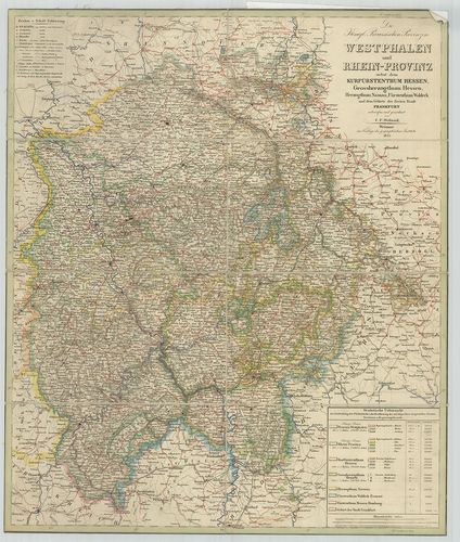
| Title | Die Königl.[ichen], Preussischen-Provinz Westphalen und Rhein-Provinz nebst dem Kurfürstenthum Hessen, Grossherzogthum Hessen, Herzogthum Nassau, Fürstenthum Waldeck und dem Gebiete der Freien Stadt Frankfurt. |
| Main title | Vesztfália porosz tartomány, a Rajna-tartományok és a szabad Frankfurt térképe 1844-ben. |
235. Topographische Karte des Regierungs-Bezirks Arnsberg nebst d... [B IV a 402/23]
Institute and Museum of Military History •
B IV a
•
B IV Német birodalom
•
B I–XV. Európa
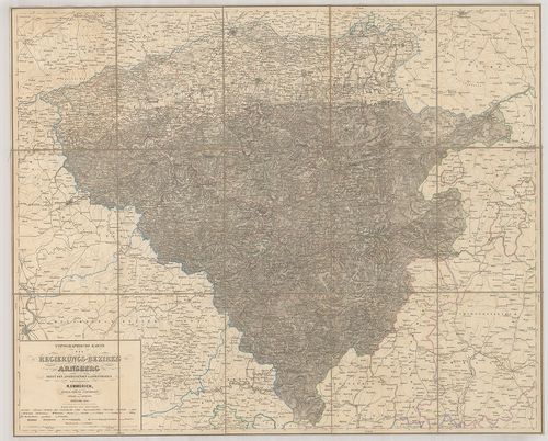
| Title | Topographische Karte des Regierungs-Bezirks Arnsberg nebst dem angrenzenden Landestheilen. |
| Main title | Arnsberg környékének topográfiai térképe 1860-ban. |
236. Karte der Rhein Gegenden von Käyserswerth bis Arnheim. [B IV a 402/29]
Institute and Museum of Military History •
B IV a
•
B IV Német birodalom
•
B I–XV. Európa
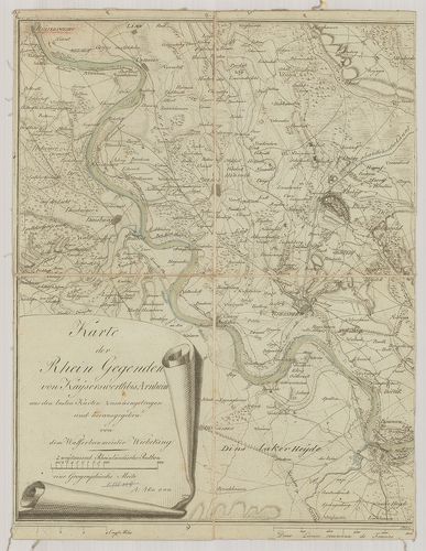
| Title | Karte der Rhein Gegenden von Käyserswerth bis Arnheim. |
| Main title | Mt.: [Pannerdeni csatorna.]A Rajna vidék térképe Käyserswerth-től Arnheim-ig. |
237. Ganz neue Vorstellung des Rhein-Stroms von Basel bis Coblenz... [B IV a 402/30]
Institute and Museum of Military History •
B IV a
•
B IV Német birodalom
•
B I–XV. Európa
| Title | Ganz neue Vorstellung des Rhein-Stroms von Basel bis Coblenz. Terv.: – 1792–1793. |
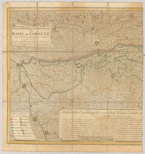
| Main title | A Rajna vidék térképe Baseltől-Koblenz-ig 1793-ban. |
238. Circulus Westphalicus in suas Provincias et Ditiones. [B IV a 403]
Institute and Museum of Military History •
B IV a
•
B IV Német birodalom
•
B I–XV. Európa
| Title | Circulus Westphalicus in suas Provincias et Ditiones. |
| Main title | Vesztfália tartomány térképe. |
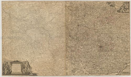
239. Circulus Bavariae in suas quasque Ditiones tam cum finitimis... [B IV a 404]
Institute and Museum of Military History •
B IV a
•
B IV Német birodalom
•
B I–XV. Európa
| Title | Circulus Bavariae in suas quasque Ditiones tam cum finitimis, quam Insertis Regionibus accuratissime divisus… |
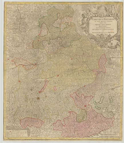
| Main title | Bajorország általános térképe. |
240. Circulus Bavaricus… [B IV a 405]
Institute and Museum of Military History •
B IV a
•
B IV Német birodalom
•
B I–XV. Európa
| Title | Circulus Bavaricus… |
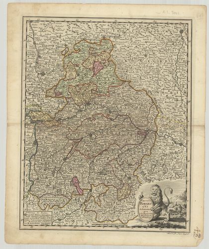
| Main title | Bajorország térképe. |
241. Charte des Bayrischen Kreises. [B IV a 406]
Institute and Museum of Military History •
B IV a
•
B IV Német birodalom
•
B I–XV. Európa
| Title | Charte des Bayrischen Kreises. |
| Main title | Bajorország térképe 1802-ben. |
242. Chur-Bayern. [B IV a 407]
Institute and Museum of Military History •
B IV a
•
B IV Német birodalom
•
B I–XV. Európa
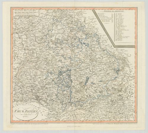
| Title | Chur-Bayern. |
| Main title | A Bajor választófejedelemség térképe 1802-ben. |
243. Königreich Baiern. [B IV a 408]
Institute and Museum of Military History •
B IV a
•
B IV Német birodalom
•
B I–XV. Európa
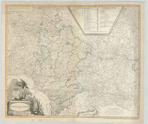
| Title | Königreich Baiern. |
| Main title | A Bajor Királyság térképe 1806-ban. |
244. Der Bayrische, Schwaebische und Fraenkische Kreis. [B IV a 409]
Institute and Museum of Military History •
B IV a
•
B IV Német birodalom
•
B I–XV. Európa
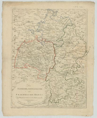
| Title | Der Bayrische, Schwaebische und Fraenkische Kreis. |
| Main title | Bajorország, Svábföld és Frankföld térképe 1807-ben. |
245. Charte von dem Königreiche Bayern. [B IV a 410]
Institute and Museum of Military History •
B IV a
•
B IV Német birodalom
•
B I–XV. Európa
| Title | Charte von dem Königreiche Bayern. |
| Main title | A Bajor Királyság térképe 1807-ben. |
246. Karte vom Königreich Baiern. [B IV a 411]
Institute and Museum of Military History •
B IV a
•
B IV Német birodalom
•
B I–XV. Európa
| Title | Karte vom Königreich Baiern. |
| Main title | A Bajor Királyság térképe 1808-ban. |
247. Karte vom Königreich Baiern… [B IV a 411/1]
Institute and Museum of Military History •
B IV a
•
B IV Német birodalom
•
B I–XV. Európa
| Title | Karte vom Königreich Baiern… |
| Main title | A Bajor Királyság térképe 1812-ben, kerületi beosztással. |
248. Militair Karte von Süd-Deutschland. [B IV a 411/2]
Institute and Museum of Military History •
B IV a
•
B IV Német birodalom
•
B I–XV. Európa
| Title | Militair Karte von Süd-Deutschland. |
| Main title | Dél-Németország katonai térképe. |
249. Die Baierische Monarchie. [B IV a 412]
Institute and Museum of Military History •
B IV a
•
B IV Német birodalom
•
B I–XV. Európa
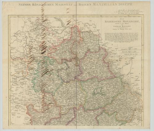
| Title | Die Baierische Monarchie. |
| Main title | A Bajor Királyság térképe kerületi beosztással 1808-ban. |
250. Bayern, Württemberg und Baden. [B IV a 413]
Institute and Museum of Military History •
B IV a
•
B IV Német birodalom
•
B I–XV. Európa
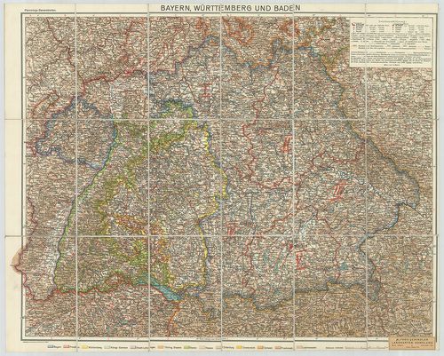
| Title | Bayern, Württemberg und Baden. |
| Main title | Bajorország, Württemberg és Baden tartományok térképe. |
251. [Bajorország.] Haidhausen-Isen környékének topográfiai térké... [B IV a 414]
Institute and Museum of Military History •
B IV a
•
B IV Német birodalom
•
B I–XV. Európa
| Title | [Bajorország.] Haidhausen-Isen környékének topográfiai térképe. |
252. Neueste Karte von Bayern, Württemberg, Baden und Hohenzoller... [B IV a 416]
Institute and Museum of Military History •
B IV a
•
B IV Német birodalom
•
B I–XV. Európa
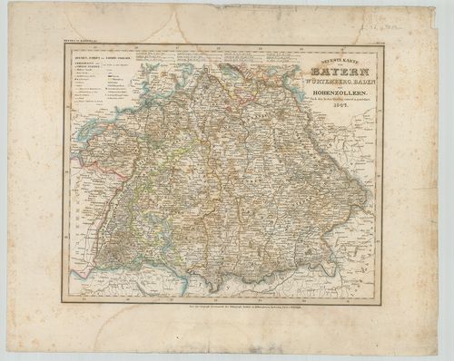
| Title | Neueste Karte von Bayern, Württemberg, Baden und Hohenzollern. |
| Main title | Bajorország, Württemberg, Baden és Hohenzollern tartományok térképe 1847-ben. |
253. Carte del Palatinato di Baviera. [B IV a 417]
Institute and Museum of Military History •
B IV a
•
B IV Német birodalom
•
B I–XV. Európa

| Title | Carte del Palatinato di Baviera. |
| Main title | Bajorország térképe. |
254. Das Königreich Bayern. [B IV a 420]
Institute and Museum of Military History •
B IV a
•
B IV Német birodalom
•
B I–XV. Európa
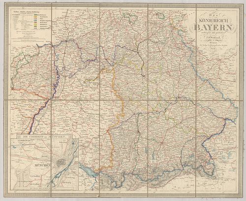
| Title | Das Königreich Bayern. |
| Main title | Mt.: Die Umgegend von München. (München és környéke.) |
| Subject | A Bajor Királyság térképe 1846-ban. |
255. S. Rom. Imperii Circvli et Electoratvs Bavariae Tabvla Chorc... [B IV a 421]
Institute and Museum of Military History •
B IV a
•
B IV Német birodalom
•
B I–XV. Európa
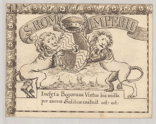
| Title | S. Rom. Imperii Circvli et Electoratvs Bavariae Tabvla Chorcographica. |
| Main title | A Bajor választófejedelemség térképe 1671-ben. |
256. Electoratvs Bavariae Compendiosa delineato. Typvs Circuli Ba... [B IV a 421/1]
Institute and Museum of Military History •
B IV a
•
B IV Német birodalom
•
B I–XV. Európa
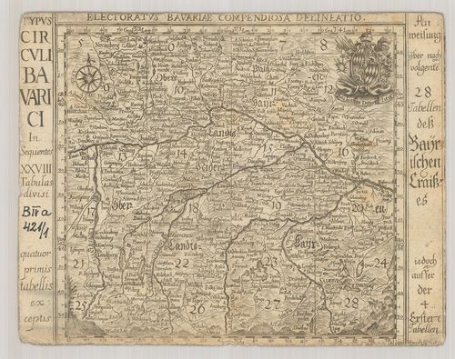
| Title | Electoratvs Bavariae Compendiosa delineato. Typvs Circuli Bavarici… |
| Main title | A Bajor választófejedelemség térképe 1684-ben. |
257. Mappa Electoratus et Ducatus Bavariae Superioris et Inferior... [B IV a 422]
Institute and Museum of Military History •
B IV a
•
B IV Német birodalom
•
B I–XV. Európa
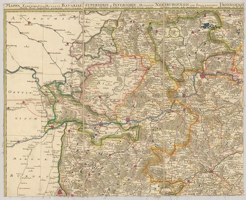
| Title | Mappa Electoratus et Ducatus Bavariae Superioris et Inferioris, Ducatus Neoburgensis cum Episcopatibus Frisingensi Ratisbonensi, Passaviensi et Praepositura Bergtolsgadensi… |
| Main title | A Bajor választófejedelemség, Neuburg hercegség, Passau püspökség, Berchtesgadeni prépostság térképe a 17. században. |
258. Le Palatinat et Electorat du Rhein… [B IV a 423]
Institute and Museum of Military History •
B IV a
•
B IV Német birodalom
•
B I–XV. Európa
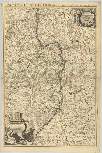
| Title | Le Palatinat et Electorat du Rhein… |
| Main title | A Rajna-Pfalz választófejedelemség térképe 1695-ben. |
259. Partie Occidentale du Rhein le Duché de Simmeren, les Comtés... [B IV a 424]
Institute and Museum of Military History •
B IV a
•
B IV Német birodalom
•
B I–XV. Európa
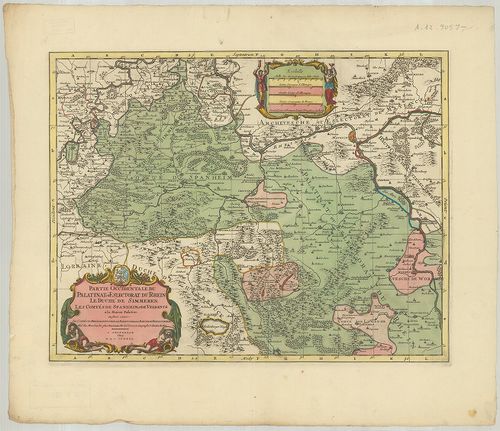
| Title | Partie Occidentale du Rhein le Duché de Simmeren, les Comtés de Spanheim et de Veldentz a la Maison Palatine. |
| Main title | A Rajna-Pfalz (Ny-i rész) választófejedelemség, Simmern hercegség. Sponheim és Veldenz grófság térképe. |
260. Hassiae Svperioris et Wetterav… [B IV a 425]
Institute and Museum of Military History •
B IV a
•
B IV Német birodalom
•
B I–XV. Európa
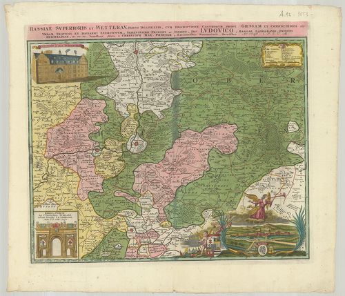
| Title | Hassiae Svperioris et Wetterav… |
| Main title | Felső-Hessen és Wetterau vidékének térképe 1746-ban. |
261. Territorium Seculare Episcopatus Spirensis una cum terris ad... [B IV a 426]
Institute and Museum of Military History •
B IV a
•
B IV Német birodalom
•
B I–XV. Európa
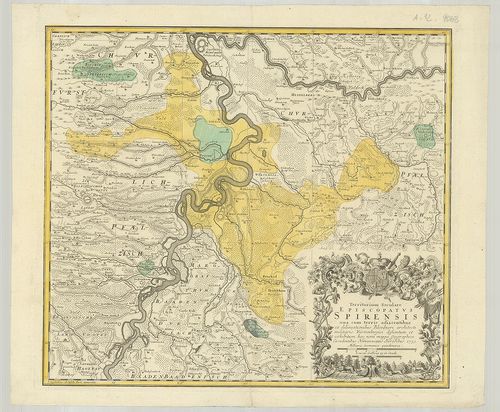
| Title | Territorium Seculare Episcopatus Spirensis una cum terris adiacentibus… |
| Main title | A Speyer-i püspökség térképe 1753-ban. |
262. Delineatio aureae Sterilitatis Herciniensis i. e. Herciniae ... [B IV a 427]
Institute and Museum of Military History •
B IV a
•
B IV Német birodalom
•
B I–XV. Európa
| Title | Delineatio aureae Sterilitatis Herciniensis i. e. Herciniae Metalliferae accurata Chorographia… |
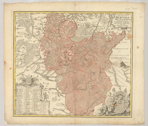
| Main title | A Hercinai erdős-hegység térképe. |
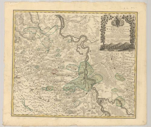
263. Territorium Seculare Episcopatvs Wormatiensis Tabula Geograp... [B IV a 428]
Institute and Museum of Military History •
B IV a
•
B IV Német birodalom
•
B I–XV. Európa
| Title | Territorium Seculare Episcopatvs Wormatiensis Tabula Geographica… |
| Main title | A Worms-i püspökség földrajzi térképe 1752-ben. |
264. Die Grafschaft Pyrmont mit den umliegenden Hannoverischen, B... [B IV a 429]
Institute and Museum of Military History •
B IV a
•
B IV Német birodalom
•
B I–XV. Európa
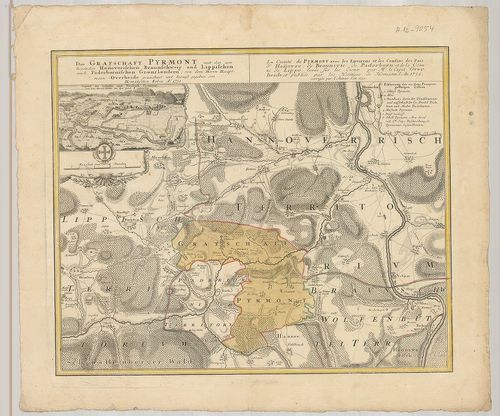
| Title | Die Grafschaft Pyrmont mit den umliegenden Hannoverischen, Braunschweig und Lippischen auch Paderbornischen Graenzlaendern. La Comté de Pyrmont avec les Environs et les Confins des Pais d’Hannovre, de Brounsvic, de Paderborn, et de la Comte de Lippe… |
| Main title | Mt.: Gegend des Schlosses und Neustadt Pyrmont. (Pyrmont térképe a grófi palotával) |
| Subject | Pyrmont grófság térképe a környező tartományokkal 1752-ben. |
265. Le Duché de Berg, le comté de Homberg, les Seigneuries de Ha... [B IV a 430]
Institute and Museum of Military History •
B IV a
•
B IV Német birodalom
•
B I–XV. Európa
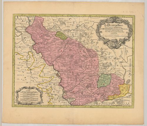
| Title | Le Duché de Berg, le comté de Homberg, les Seigneuries de Hardenberg, et de Wildenborg. |
| Main title | A Berg-i hercegség, Homberg grófság, Hardenberg és Wildenborg térképe. |
266. Uebersichtskarte des Königreiches Bayern… Ortskarte. [B IV a 432]
Institute and Museum of Military History •
B IV a
•
B IV Német birodalom
•
B I–XV. Európa
| Title | Uebersichtskarte des Königreiches Bayern… Ortskarte. |
| Main title | A Bajor Királyság topográfiai térképe (helységnevekkel) 1853-ban. |
267. Uebersichtskarte des Königreiches Bayern… Terrain Karte. [B IV a 433]
Institute and Museum of Military History •
B IV a
•
B IV Német birodalom
•
B I–XV. Európa
| Title | Uebersichtskarte des Königreiches Bayern… Terrain Karte. |
| Main title | A Bajor Királyság topográfiai térképe (síkrajz) 1853-ban. |
268. Chorographia Bavariae. [B IV a 447]
Institute and Museum of Military History •
B IV a
•
B IV Német birodalom
•
B I–XV. Európa
| Title | Chorographia Bavariae. |
| Main title | Bajorország térképe 1579-ben. |
269. Exactissima Statuum Totius Ducatus Bavariae…] [B IV a 448]
Institute and Museum of Military History •
B IV a
•
B IV Német birodalom
•
B I–XV. Európa
| Title | Exactissima Statuum Totius Ducatus Bavariae…] |
| Main title | Bajorország térképe. |
270. Topographisch-militairischer Atlas von dem Koenigreiche Baye... [B IV a 449]
Institute and Museum of Military History •
B IV a
•
B IV Német birodalom
•
B I–XV. Európa
| Title | Topographisch-militairischer Atlas von dem Koenigreiche Bayern und dem Fürstenthum Lichtenstein… |
| Main title | A Bajor Királyság és a Liechtenstein-i hercegség topográfiai térképe 1813-ban. |
271. Uebersicht des topographischen Atlasses vom Koenigreich Baye... [B IV a 450]
Institute and Museum of Military History •
B IV a
•
B IV Német birodalom
•
B I–XV. Európa
| Title | Uebersicht des topographischen Atlasses vom Koenigreich Bayern. |
| Main title | A Bajor Királyság topográfiai térképe 1848-ban. |
272. Bayern. [B IV a 453]
Institute and Museum of Military History •
B IV a
•
B IV Német birodalom
•
B I–XV. Európa
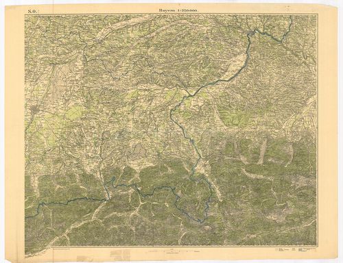
| Title | Bayern. |
| Main title | Bajorország térképe 1921-ben. |
273. I. Electoratus Moguntinus ut et Palatin Infer. Hassie et Flu... [B IV a 458]
Institute and Museum of Military History •
B IV a
•
B IV Német birodalom
•
B I–XV. Európa
| Title | I. Electoratus Moguntinus ut et Palatin Infer. Hassie et Fluminis Moeni alique pars exhibens simul… II. Circuli Franconiae Pars orientalis et Potior novissime… |
| Main title | Mainz érsekség és Hessen választófejedelemség és a Frankföld térképe. |
274. Franconia. [B IV a 459]
Institute and Museum of Military History •
B IV a
•
B IV Német birodalom
•
B I–XV. Európa
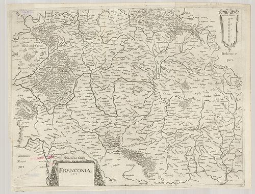
| Title | Franconia. |
| Main title | A Frankföld térképe. |
275. Circulus Franconicus ad Occidentem vergens cum regionibus co... [B IV a 460]
Institute and Museum of Military History •
B IV a
•
B IV Német birodalom
•
B I–XV. Európa
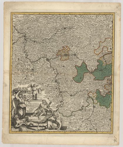
| Title | Circulus Franconicus ad Occidentem vergens cum regionibus contigius… |
| Main title | A Frankföld Ny-i részének térképe. |
276. Karte vom Fürstenthum Anspach oder Onolzbach oder Burggrafth... [B IV a 469]
Institute and Museum of Military History •
B IV a
•
B IV Német birodalom
•
B I–XV. Európa
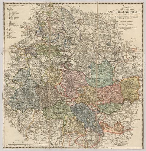
| Title | Karte vom Fürstenthum Anspach oder Onolzbach oder Burggrafthum Unterhalb des Gebürges. |
| Main title | Az Ansbach-i hercegség térképe 1792-ben. |
277. Special Charte der Laender in Franken enthaltend das Hochsti... [B IV a 472]
Institute and Museum of Military History •
B IV a
•
B IV Német birodalom
•
B I–XV. Európa
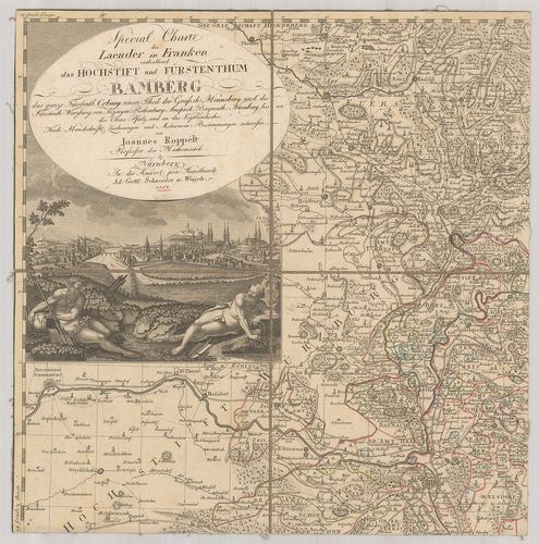
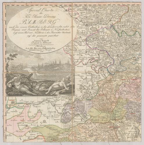
| Title | Special Charte der Laender in Franken enthaltend das Hochstift und Fürstenthum Bamberg… |
| Main title | Frankföld és a Bamberg-i hercegség részletes térképe 1801-ben. |
278. Special-Charte der Kön. Baier. Provinz Bamberg… [B IV a 472/1]
Institute and Museum of Military History •
B IV a
•
B IV Német birodalom
•
B I–XV. Európa
| Title | Special-Charte der Kön. Baier. Provinz Bamberg… |
| Main title | Bamberg bajor tartomány részletes térképe 1808-ban. |
279. Der Fraenkische Kreis nebst den angraenzenden Laendern… [B IV a 474/1]
Institute and Museum of Military History •
B IV a
•
B IV Német birodalom
•
B I–XV. Európa
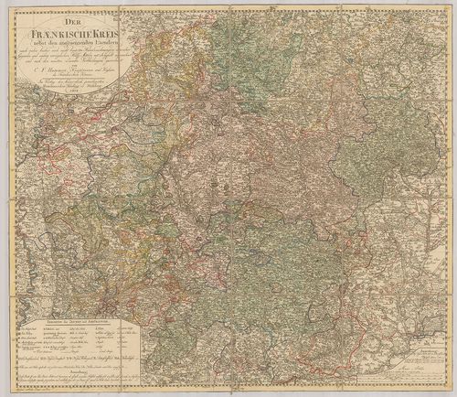
| Title | Der Fraenkische Kreis nebst den angraenzenden Laendern… |
| Main title | A Frankföld térképe 1804-ben a környező tartományokkal. |
280. Der Fraenkische Kreis nebst den angraenzenden Laendern… [B IV a 474/2]
Institute and Museum of Military History •
B IV a
•
B IV Német birodalom
•
B I–XV. Európa
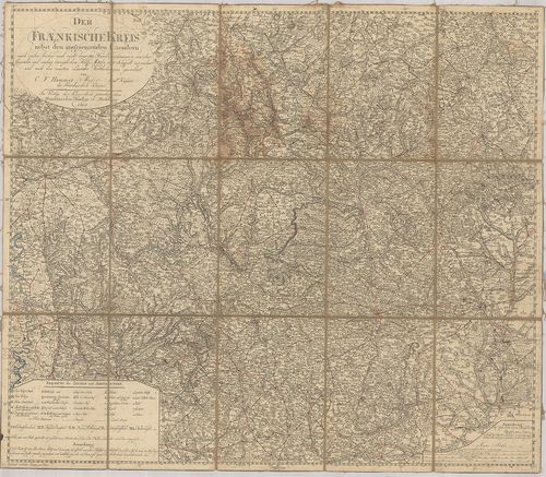
| Title | Der Fraenkische Kreis nebst den angraenzenden Laendern… |
| Main title | A Frankföld térképe 1805-ben a környező tartományokkal. |
281. Charte von Nürnberg. [B IV a 477]
Institute and Museum of Military History •
B IV a
•
B IV Német birodalom
•
B I–XV. Európa
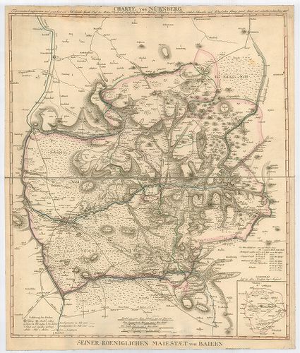
| Title | Charte von Nürnberg. |
| Main title | Mt.: Lichtenau liegt im alten Nordgau bey Anspach. (Lichtenau és környéke.) |
| Subject | Nürnberg és környékének térképe 1811-ben. |
282. Exactissima Palatinatus ad Rhenum Tabula in qua Episcopatus ... [B IV a 488]
Institute and Museum of Military History •
B IV a
•
B IV Német birodalom
•
B I–XV. Európa
| Title | Exactissima Palatinatus ad Rhenum Tabula in qua Episcopatus Wormaciensis et Spirensis Ducatus Bipontimus… |
| Main title | A Pfalz-i őrgrófság, a Worms-Speyer-i püspökség és a Zweibrücken-i hercegség térképe. |
283. Geometrische Karte über das ober Amt Zweybrücken nebst dem d... [B IV a 489]
Institute and Museum of Military History •
B IV a
•
B IV Német birodalom
•
B I–XV. Európa
| Title | Geometrische Karte über das ober Amt Zweybrücken nebst dem dazu gehörigen Amt Homburg. |
| Main title | Zweibrücken és Homburg környékének felmérési térképe 1774-ben. |
284. Die bayerische Pfalz. [B IV a 493]
Institute and Museum of Military History •
B IV a
•
B IV Német birodalom
•
B I–XV. Európa
| Title | Die bayerische Pfalz. |
| Main title | A bajor Pfalz tartomány térképe 1845-ben. |
285. Die Bayerische Pfalz. [B IV a 494]
Institute and Museum of Military History •
B IV a
•
B IV Német birodalom
•
B I–XV. Európa
| Title | Die Bayerische Pfalz. |
| Main title | A bajor Pfalz tartomány térképe 1862-ben. |
286. Tractus Nordligensis Germ. Ries dicti accurata Descritpio ad... [B IV a 497]
Institute and Museum of Military History •
B IV a
•
B IV Német birodalom
•
B I–XV. Európa
| Title | Tractus Nordligensis Germ. Ries dicti accurata Descritpio adjecto Indice, cui Dominium cujus vis loci aliaque Iura competant illustrata Curatib. |
| Main title | Mt.: Nordlingae Ichonographia. (Nördlingen város térképe.) A térkép alján Nördlingen város látképe.Nördlingen környékének térképe 1738-ban. |
287. Topographische Karte der Gegend zwischen der Donau, Abens, u... [B IV a 521/1]
Institute and Museum of Military History •
B IV a
•
B IV Német birodalom
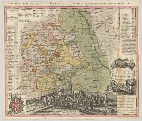
•
B I–XV. Európa
| Title | Topographische Karte der Gegend zwischen der Donau, Abens, und Iser. – Carte Topographique du Pays Entre le Danube, l’Abens, et l’Iser. |
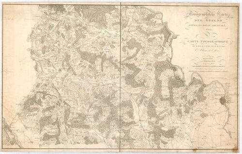
| Main title | A Duna–Abens–Isar közötti terület topográfiai térképe 1811-ben. |
288. Geographische Abbildvng des gantzen Umfangs der Marggrafscha... [B IV a 522]
Institute and Museum of Military History •
B IV a
•
B IV Német birodalom
•
B I–XV. Európa
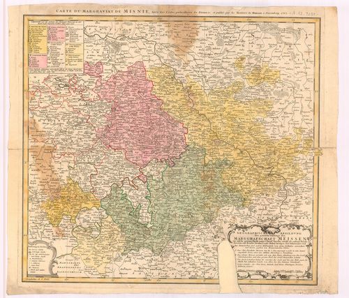
| Title | Geographische Abbildvng des gantzen Umfangs der Marggrafschaft Meissen… |
| Main title | A Meissen-i őrgrófság általános térképe 1762-ban. |
289. Circuli Supe Saxoniae… [B IV a 523]
Institute and Museum of Military History •
B IV a
•
B IV Német birodalom
•
B I–XV. Európa
| Title | Circuli Supe Saxoniae… |
| Main title | Szászország térképe 1757-ben. |
290. Saxoniae Inferioris Circulus, exhibens Ducatus Brunswic, Lün... [B IV a 524]
Institute and Museum of Military History •
B IV a
•
B IV Német birodalom
•
B I–XV. Európa
| Title | Saxoniae Inferioris Circulus, exhibens Ducatus Brunswic, Lüneburg, Magdeburg, Bremens, Mechlinoburg et Holsat… |
| Main title | Alsó-Szászország tartományainak: Braunschweig, Lüneburg, Magdeburg, Bréma, Mecklenburg és Holstein hercegség térképe 1761-ben. |
291. Saxonia Superiore. [B IV a 525]
Institute and Museum of Military History •
B IV a
•
B IV Német birodalom
•
B I–XV. Európa
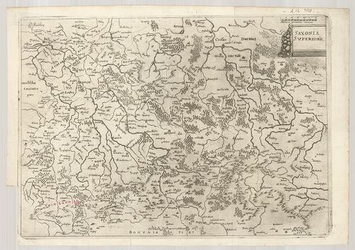
| Title | Saxonia Superiore. |
| Main title | Felső-Szászország térképe. |
292. Der Ober Saechsische Kreis zum Gebrauche der Oesterreichisch... [B IV a 526]
Institute and Museum of Military History •
B IV a
•
B IV Német birodalom
•
B I–XV. Európa
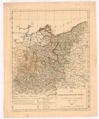
| Title | Der Ober Saechsische Kreis zum Gebrauche der Oesterreichischen Schulen entworfen. |
| Main title | Felső-Szászország térképe 1806-ban. |
293. Comitatus Schoenburgensis… [B IV a 528]
Institute and Museum of Military History •
B IV a
•
B IV Német birodalom
•
B I–XV. Európa
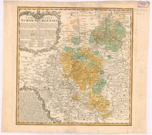
| Title | Comitatus Schoenburgensis… |
| Main title | Schönburg grófság térképe 1760-ban. |
294. Saxoniae Inferioris Circulus juxta Principatus et Status suo... [B IV a 529]
Institute and Museum of Military History •
B IV a
•
B IV Német birodalom
•
B I–XV. Európa
| Title | Saxoniae Inferioris Circulus juxta Principatus et Status suos Accurate delineatus cura et stilo… |
295. Mappa Geographica Circuli Metalliferi Electoratus Saxoniae c... [B IV a 574]
Institute and Museum of Military History •
B IV a
•
B IV Német birodalom
•
B I–XV. Európa
| Title | Mappa Geographica Circuli Metalliferi Electoratus Saxoniae cum imnibus quae in eo comprehenduntur Praefecturis et Dynastiis… |
| Main title | A Szász választófejedelemség bányavidékének földrajzi térképe. |
296. Landgraviatus Thuringiae juxta recentiss. designation: in su... [B IV a 576]
Institute and Museum of Military History •
B IV a
•
B IV Német birodalom
•
B I–XV. Európa
| Title | Landgraviatus Thuringiae juxta recentiss. designation: in suos Principatus Status, et Praefecturas accuratissime divisus… |
| Main title | A Thüringia-i őrgrófság térképe. |
297. Neue und accurate Landkarte des Mittätig-Ober-Sachsischen K.... [B IV a 578]
Institute and Museum of Military History •
B IV a
•
B IV Német birodalom
•
B I–XV. Európa
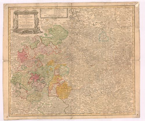
| Title | Neue und accurate Landkarte des Mittätig-Ober-Sachsischen K. Reichs Crenss. Begreiffend das Chur Herzogthum Sachsen, Marggrafthum Meissen, und die Landgrafschafft Thüringen. |
| Main title | Felső-Szászország - a Szász hercegség, Meissen és Thüringiai őrgrófság térképe. |
298. Karte von Königreiche Sachsen… [B IV a 580]
Institute and Museum of Military History •
B IV a
•
B IV Német birodalom
•
B I–XV. Európa

| Title | Karte von Königreiche Sachsen… |
| Main title | A Szász Királyság térképe 1833-ban. |
299. Das Königreich Sachsen und seine Umlande. [B IV a 581]
Institute and Museum of Military History •
B IV a
•
B IV Német birodalom
•
B I–XV. Európa
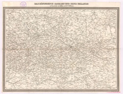
| Title | Das Königreich Sachsen und seine Umlande. |
| Main title | A Szász Királyság és környékének térképe úthálózattal. |
300. Marchionatus Misniae primaria Elector. Saxoniae Provincia, i... [B IV a 581/2]
Institute and Museum of Military History •
B IV a
•
B IV Német birodalom
•
B I–XV. Európa
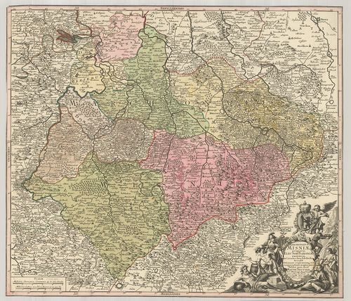
| Title | Marchionatus Misniae primaria Elector. Saxoniae Provincia, in Circulus suos subdivisus Accedit… |
| Main title | A Szász választófejedelemség Meissen őrgrófságának térképe. |