101. Carte de la Savoie. [B V a 169]
Institute and Museum of Military History •
B V a
•
B V Franciaország
•
B I–XV. Európa
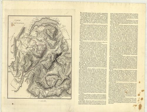
| Title | Carte de la Savoie. |
| Main title | A Savoie hercegség térképe 1814 körül. |
102. Plan der Gegend um Bar sur Aube. [B V a 174]
Institute and Museum of Military History •
B V a
•
B V Franciaország
•
B I–XV. Európa
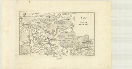
| Title | Plan der Gegend um Bar sur Aube. |
| Main title | Franciaország: A Bar sur Aube vidékének térképe az 1800-as években. |
103. Karte der Gegenden von Soissons, Craone, Laon und Rheims. [B V a 178]
Institute and Museum of Military History •
B V a
•
B V Franciaország
•
B I–XV. Európa
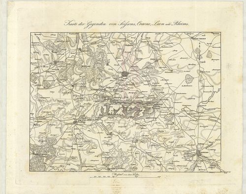
| Title | Karte der Gegenden von Soissons, Craone, Laon und Rheims. |
| Main title | Franciaország: Soissons, Craone, Laon és Reims vidék térképe az 1800-as években. |
104. Pont á Mousson, Nancy, Luneville. St. Dié. Ravensteins Krieg... [B V a 178/3]
Institute and Museum of Military History •
B V a
•
B V Franciaország
•
B I–XV. Európa
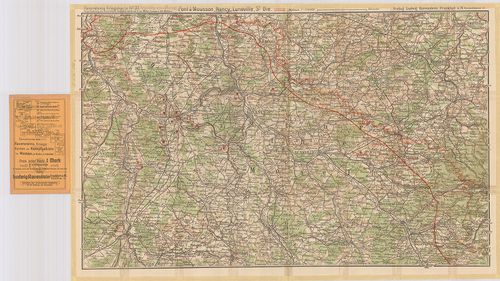
| Title | Pont á Mousson, Nancy, Luneville. St. Dié. Ravensteins Kriegskarte No. 37. |
| Main title | Franciaország: Pont á Mousson, Nancy, Luneville terület térképe az első világháború frontvonal megjelölésével. |
105. Frankreich. – France. – La France. – Francia. Flemmings Gene... [B V a 178/4]
Institute and Museum of Military History •
B V a
•
B V Franciaország
•
B I–XV. Európa
| Title | Frankreich. – France. – La France. – Francia. Flemmings Generalkarten Nr. 12. |
| Main title | 2 mt.: 1. Paris und Umgebung. (Párizs és környéke.) 2. Paris, |
| Subject | Franciaország térképe. |
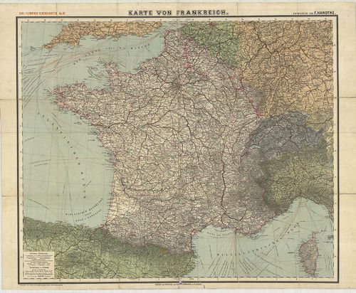
106. Frankreich. [B V a 181]
Institute and Museum of Military History •
B V a
•
B V Franciaország
•
B I–XV. Európa
| Title | Frankreich. |
| Main title | 2 mt.: 1. Frankreich nach seiner ehemaligen Eintheilung in Gouvernements mit den landschaftlichen Names u. den historisch wichtigen Orten. (Franciaország térképe közigazgatási kerületi beosztással és a történelmi helyek megnevezésével.) 2. Umgegend von Paris. (Párizs és környéke.) |
| Subject | Franciaország térképe úthálózattal 1858-ban. |
107. Nouvelle Carte Administrative de la France. [B V a 182]
Institute and Museum of Military History •
B V a
•
B V Franciaország
•
B I–XV. Európa
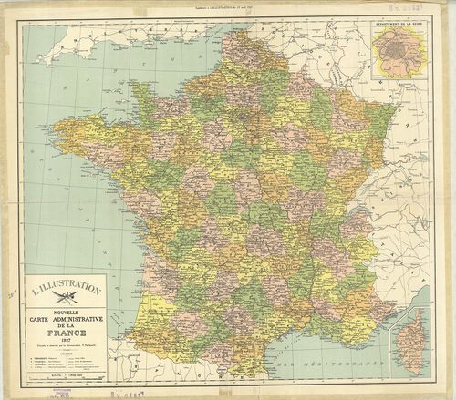
| Title | Nouvelle Carte Administrative de la France. |
| Main title | Mt.: Département de la Seine. (Szajna kerület térképe. Párizs és környéke.) |
| Subject | Franciaország (Belg.–Lux.–NSZK–Sv.–Ol.) közigazgatási térképe 1927-ben. |
108. France. [B V a 183]
Institute and Museum of Military History •
B V a
•
B V Franciaország
•
B I–XV. Európa
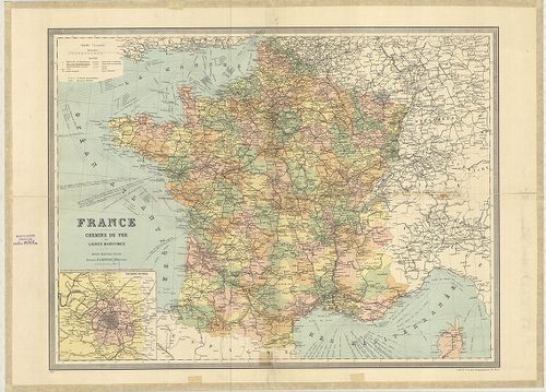
| Title | France. |
| Main title | Mt.: Environs de Paris. (Párizs és környéke.) |
| Subject | Franciaország (Belg.–Lux.–NSZK–Sv.–Ol.) általános térképe 1926-ban megyei felosztással, úthálózattal. |
109. A Francia háború térképe. [B V a 185]
Institute and Museum of Military History •
B V a
•
B V Franciaország
•
B I–XV. Európa

| Title | A Francia háború térképe. |
| Main title | Mt.: Páris környéke. |
110. Bródy-féle Francziaország és Belgium háborús térképe. [B V a 186]
Institute and Museum of Military History •
B V a
•
B V Franciaország
•
B I–XV. Európa
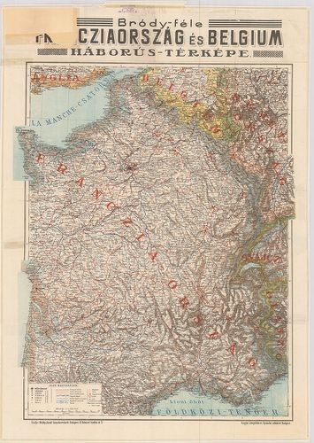
| Title | Bródy-féle Francziaország és Belgium háborús térképe. |
111. I. Karte von Frankreich und seine Grenzen gegen Deutschland.... [B V a 187]
Institute and Museum of Military History •
B V a
•
B V Franciaország
•
B I–XV. Európa
| Title | I. Karte von Frankreich und seine Grenzen gegen Deutschland. – Frankreich. 2 térk. lap. |
| Main title | 2 mt.: 1. Corsica. |
| Subject | 2. Paris und Umgebung. (Párizs és környéke.) |
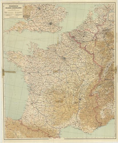
112. Frankreich Belgien Niederlande. [B V a 189]
Institute and Museum of Military History •
B V a
•
B V Franciaország
•
B I–XV. Európa
| Title | Frankreich Belgien Niederlande. |
| Main title | Franciaország, Belgium és Hollandia térképe 1944-ben úthálózattal. |
113. [Észak Franciaország és Belgium. Calais–Bruges–Páris–Chálons... [B V a 190]
Institute and Museum of Military History •
B V a
•
B V Franciaország
•
B I–XV. Európa
| Title | [Észak Franciaország és Belgium. Calais–Bruges–Páris–Chálons zur Marne közötti terület kivágata.] |
114. Karte von Frankreich. – Carl Flemmings Generalkarten. No. 28... [B V a 192]
Institute and Museum of Military History •
B V a
•
B V Franciaország
•
B I–XV. Európa
| Title | Karte von Frankreich. – Carl Flemmings Generalkarten. No. 28. |
| Main title | Franciaország térképe 1910 körül. |
115. Reymann’s Special Karte vom Deutsch-Französischen Kriegsscha... [B V a 195]
Institute and Museum of Military History •
B V a
•
B V Franciaország
•
B I–XV. Európa
| Title | Reymann’s Special Karte vom Deutsch-Französischen Kriegsschauplatze. |
| Main title | Franciaország topográfiai térképe 1870 körül. [Neuchateau–Luneville–Langres–Remiremont kivágat.] |
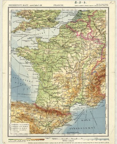
116. Franciaország. [B V a 197]
Institute and Museum of Military History •
B V a
•
B V Franciaország
•
B I–XV. Európa
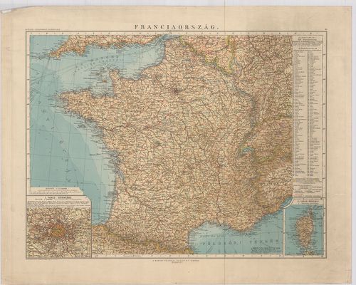
| Title | Franciaország. |
| Main title | 2 mt.: 1. Páris környéke. |
| Subject | 2. Corsica. |
117. Franciaország. [B V a 198]
Institute and Museum of Military History •
B V a
•
B V Franciaország
•
B I–XV. Európa
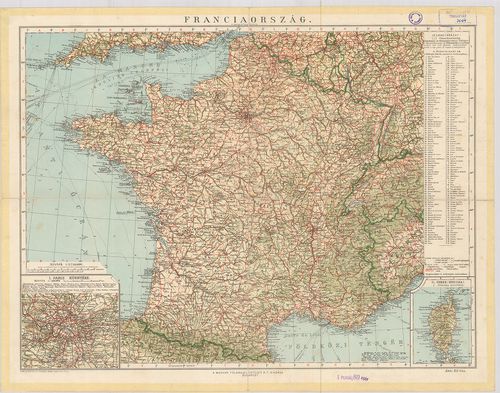
| Title | Franciaország. |
| Main title | 2 mt.: 1. Páris környéke. |
| Subject | 2. Corsica. |
118. Carte de la France. [B V a 202]
Institute and Museum of Military History •
B V a
•
B V Franciaország
•
B I–XV. Európa
| Title | Carte de la France. |
| Main title | Franciaország 1:100 000 ma. sorozatának néhány lapja. |
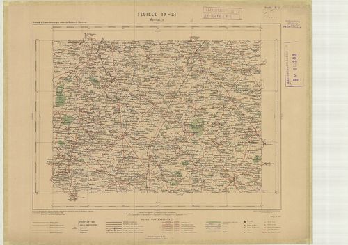
119. Carte de France et des Frontiéres. [B V a 203]
Institute and Museum of Military History •
B V a
•
B V Franciaország
•
B I–XV. Európa
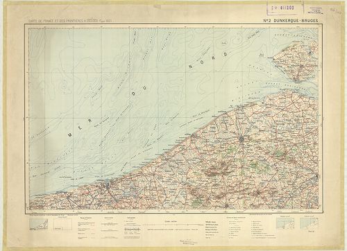
| Title | Carte de France et des Frontiéres. |
| Main title | Franciaország 1:200 000 ma. sorozatának néhány lapja. |
120. Carte de France … [B V a 204]
Institute and Museum of Military History •
B V a
•
B V Franciaország
•
B I–XV. Európa
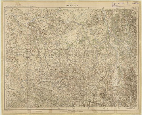
| Title | Carte de France … |
| Main title | Franciaország 1:500 000 ma. sorozatának néhány lapja. |
121. Feldmässig hergestellte Fliegkarte. [B V a 207]
Institute and Museum of Military History •
B V a
•
B V Franciaország
•
B I–XV. Európa
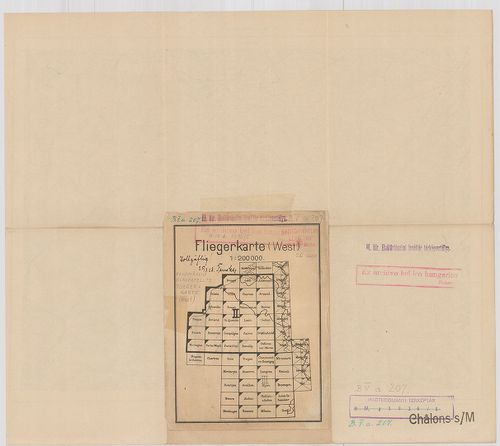
| Title | Feldmässig hergestellte Fliegkarte. |
| Main title | Repülőtérkép Brügge-Párizs-Genf területére. |
122. Charte von Frankreich. [B V a 208]
Institute and Museum of Military History •
B V a
•
B V Franciaország
•
B I–XV. Európa
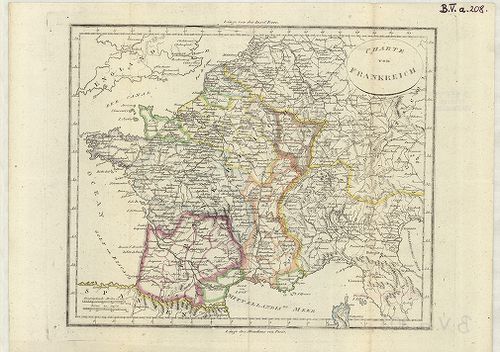
| Title | Charte von Frankreich. |
| Main title | Franciaország térképe a 18. században. |
123. Bovrdelois, Pays de Medoc, et la Prevoste de Born. [B V a 209]
Institute and Museum of Military History •
B V a
•
B V Franciaország
•
B I–XV. Európa
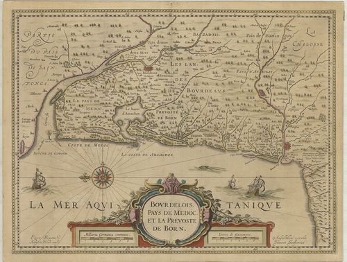
| Title | Bovrdelois, Pays de Medoc, et la Prevoste de Born. |
| Main title | Bordeaux, Pays de Medoc és Landes vidékek térképe. |
124. Normandia Ducatus. [B V a 210]
Institute and Museum of Military History •
B V a
•
B V Franciaország
•
B I–XV. Európa
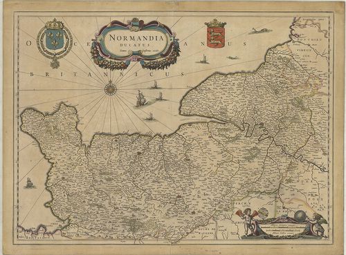
| Title | Normandia Ducatus. |
| Main title | Normandia hercegség térképe. |
125. Piemont Korzika és Szárdinia. [B V a 211]
Institute and Museum of Military History •
B V a
•
B V Franciaország
•
B I–XV. Európa
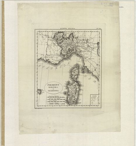
| Title | Piemont Korzika és Szárdinia. |
| Main title | Mell.: Régi Római Olasz, Francia mérföldek. |
126. Franczia Ország. [B V a 212]
Institute and Museum of Military History •
B V a
•
B V Franciaország
•
B I–XV. Európa
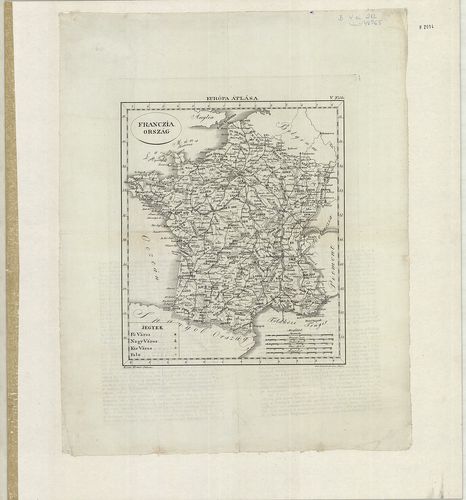
| Title | Franczia Ország. |
127. Champagne und Französisch-Lotharingien [B V a 214]
Institute and Museum of Military History •
B V a
•
B V Franciaország
•
B I–XV. Európa
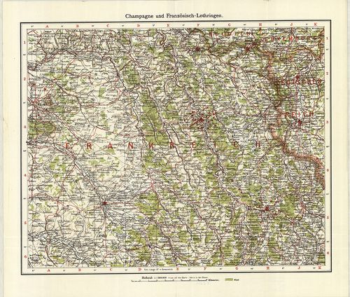
| Title | Champagne und Französisch-Lotharingien |
| Main title | ÉNy-Franciaország térképe az I. vh. idején. |
128. La Nouvelle France. [B V a 215]
Institute and Museum of Military History •
B V a
•
B V Franciaország
•
B I–XV. Európa
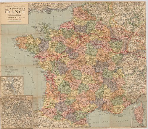
| Title | La Nouvelle France. |
| Main title | Franciaország térképe |
129. Carte du Nivellement Général de la France. [B V b 8]
Institute and Museum of Military History •
B V b
•
B V Franciaország
•
B I–XV. Európa
| Title | Carte du Nivellement Général de la France. |
| Main title | Franciaország hegyvízrajzi, topográfiai térképe 1872-ben. |
130. Il Delfinato Diuiso in Baillaggi… [B V b 10]
Institute and Museum of Military History •
B V b
•
B V Franciaország
•
B I–XV. Európa
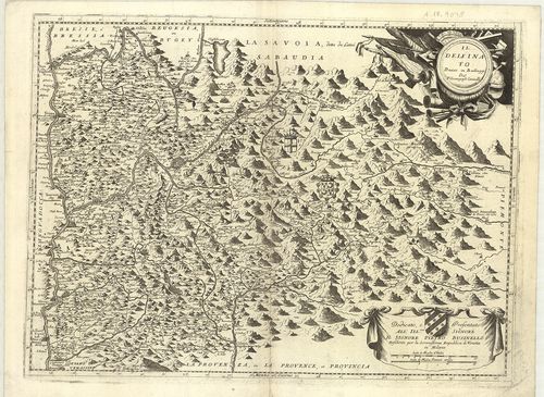
| Title | Il Delfinato Diuiso in Baillaggi… |
| Main title | Franciaország: Dauphiné általános térképe a 17. században. |
131. Contado de Venassino, e Prencipato D’Oranges… [B V b 11]
Institute and Museum of Military History •
B V b
•
B V Franciaország
•
B I–XV. Európa
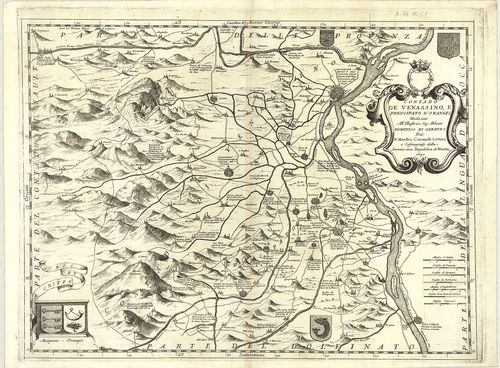
| Title | Contado de Venassino, e Prencipato D’Oranges… |
| Main title | Franciaország: Venaissin grófság és Oranges hercegség térképe 1690-ben. |
132. [Franciaország: Savoie–Provance tartományok határvidékének t... [B V b 13]
Institute and Museum of Military History •
B V b
•
B V Franciaország
•
B I–XV. Európa
| Title | [Franciaország: Savoie–Provance tartományok határvidékének térképe.] |
| Main title | A. I. lap. Carte Géométrique d’una partie du Cours Rhône… |
| Subject | Rhone folyóvidéke S. Génis (St. Genix) – Seissel (Seyssel) között. B. II. lap. [A Rhone folyóvidéke Genęve (Genf)–Genessia (Génissiat) között.] |
133. Carte des Alpes Francaises… [B V b 14]
Institute and Museum of Military History •
B V b
•
B V Franciaország
•
B I–XV. Európa
| Title | Carte des Alpes Francaises… |
| Main title | A Francia Alpok térképe a 18. században (Felső Dauphiné és Nizza grófság területe). |
134. Haute Savoie. – Hochsavoyen. [B V b 15]
Institute and Museum of Military History •
B V b
•
B V Franciaország
•
B I–XV. Európa
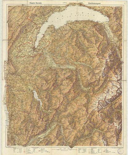
| Title | Haute Savoie. – Hochsavoyen. |
| Main title | Franciaország: Felső-Savoie általános térképe az 1900-as évek elején. |
135. Frankreich mit besonderer Rücksicht auf de Unebenheiten, … [B V b 17]
Institute and Museum of Military History •
B V b
•
B V Franciaország
•
B I–XV. Európa

| Title | Frankreich mit besonderer Rücksicht auf de Unebenheiten, … |
| Main title | Franciaország hegyvízrajzi térképe 1824-ben. |
136. Tableau Géographique de la Navigation Intérieure du Royaume ... [B V b 21]
Institute and Museum of Military History •
B V b
•
B V Franciaország
•
B I–XV. Európa
| Title | Tableau Géographique de la Navigation Intérieure du Royaume de France. |
| Main title | A Francia Királyság hegyvízrajzi térképe 1791-ben, 83 megyével, úthálózattal. |
137. Tableau Géographique de la Navigation Intérieure du Territoi... [B V b 22]
Institute and Museum of Military History •
B V b
•
B V Franciaország
•
B I–XV. Európa
| Title | Tableau Géographique de la Navigation Intérieure du Territoire Républicain Francis. |
| Main title | A Francia Köztársaság hegyvízrajzi térképe 1795-ben, 86 megyével, úthálózattal. |
138. Carte du Canal Royal de la Province de Languedoc… [B V b 32]
Institute and Museum of Military History •
B V b
•
B V Franciaország
•
B I–XV. Európa
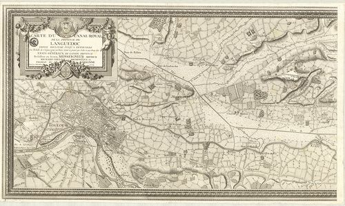
| Title | Carte du Canal Royal de la Province de Languedoc… |
| Main title | Franciaország: a Canal du Midi csatorna térképe Languedoc tartományban 1774-ben. |
139. Carte Albert Barbey: La chaine du Mont Blanc… [B V b 33]
Institute and Museum of Military History •
B V b
•
B V Franciaország
•
B I–XV. Európa
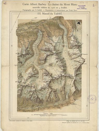
| Title | Carte Albert Barbey: La chaine du Mont Blanc… |
| Main title | A Mont Blanc hipszometrikus térképe 1906-ban. |
140. Piano Thipografico del Corso del Fiume Rodano tendente dal M... [B V b 36/3]
Institute and Museum of Military History •
B V b
•
B V Franciaország
•
B I–XV. Európa
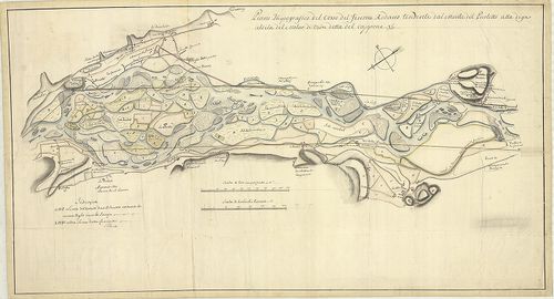
| Title | Piano Thipografico del Corso del Fiume Rodano tendente dal Monte del Picoletto alla diga aldila del Molar divion detta del capone. |
| Main title | Franciaország: a Rhone folyó egy szakaszának térképe 1760 körül. |
141. Piano del Corso attuale der Fiume Rodano tendente dallo Citt... [B V b 36/4]
Institute and Museum of Military History •
B V b
•
B V Franciaország
•
B I–XV. Európa
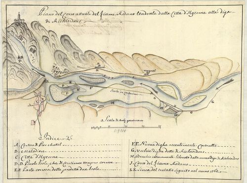
| Title | Piano del Corso attuale der Fiume Rodano tendente dallo Citta d’Hyeme alla digadi Richierdons. |
| Main title | Franciaország: a Rhone folyó St. Didier környéki szakaszának térképe 1760-ban. |
142. Battlefields in French Flanders and Artois 1915. Map. 1. [B V b 47]
Institute and Museum of Military History •
B V b
•
B V Franciaország
•
B I–XV. Európa
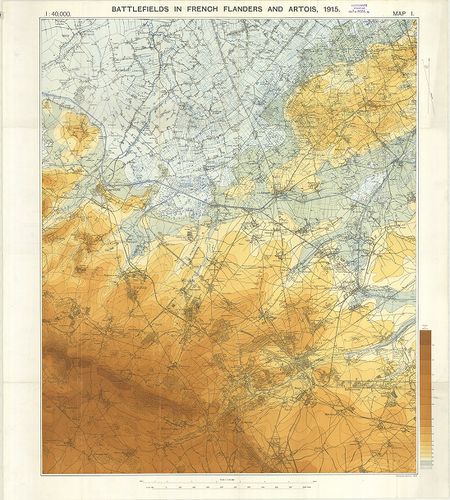
| Title | Battlefields in French Flanders and Artois 1915. Map. 1. |
| Main title | Franciaország: Flandria és Artois hipszometrikus térképe. |
143. Francie. [B V b 59]
Institute and Museum of Military History •
B V b
•
B V Franciaország
•
B I–XV. Európa
| Title | Francie. |
| Main title | Franciaország térképe 1948-ban. |
144. Carte oro-hydrographique de la Gaule [B V b 60]
Institute and Museum of Military History •
B V b
•
B V Franciaország
•
B I–XV. Európa
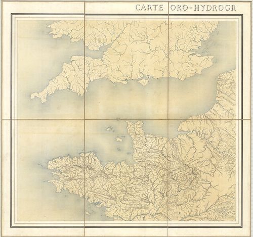
| Title | Carte oro-hydrographique de la Gaule |
| Main title | Gallia hegy- és vízrajzi térképe. |
145. Eisenbahnkarte von Frankreich und Belgien. [B V c 10]
Institute and Museum of Military History •
B V c
•
B V Franciaország
•
B I–XV. Európa
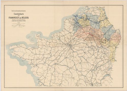
| Title | Eisenbahnkarte von Frankreich und Belgien. |
| Main title | Franciaország északi része és Belgium vasúthálózati térképe 1916-ban. |
146. Carte Générale des Chemins de Fer et des Voies Navigables de... [B V c 13/1]
Institute and Museum of Military History •
B V c
•
B V Franciaország
•
B I–XV. Európa
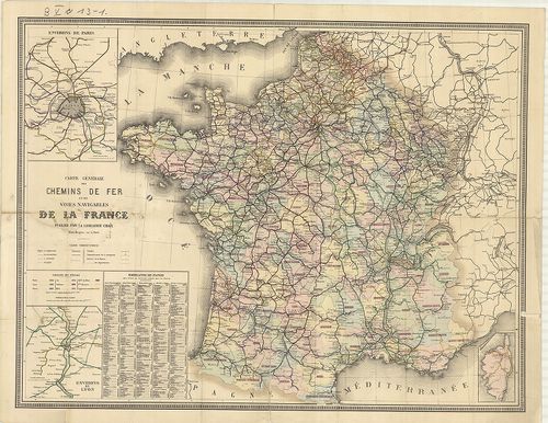
| Title | Carte Générale des Chemins de Fer et des Voies Navigables de la France… – Guide Chaix Carte des Chemins de Fer de La France. |
| Main title | 2 mt.: 1. Environs de Paris. (Páris környéke.) 2. Environs de Lyon. (Lyon környéke.) |
| Subject | Franciaország vasúti és hajózási térképe 1879-ben. |
147. Carte des Routes d’Étapes de l’Émpire Frances… [B V c 30]
Institute and Museum of Military History •
B V c
•
B V Franciaország
•
B I–XV. Európa
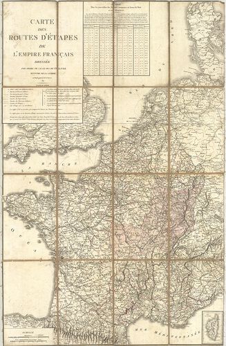
| Title | Carte des Routes d’Étapes de l’Émpire Frances… |
| Main title | A Francia Császárság katonai utánpótlási úthálózati térképe 1811-ben. (London–Varsó–Pergignan–Sarajevo kivágat.) |
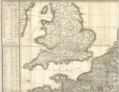
148. Carte des Routes d’Étapes de la France. [B V c 30/1]
Institute and Museum of Military History •
B V c
•
B V Franciaország
•
B I–XV. Európa
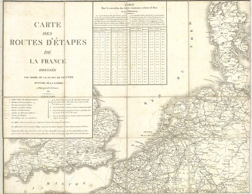
| Title | Carte des Routes d’Étapes de la France. |
| Main title | Franciaország katonai utánpótlási, úthálózati térképe 1814-ben. |
149. Carte Itinéraire de l’Empire Français… [B V c 33]
Institute and Museum of Military History •
B V c
•
B V Franciaország
•
B I–XV. Európa
| Title | Carte Itinéraire de l’Empire Français… |
| Main title | A Francia Császárság közlekedési térképe 1814-ben, a 130 megye megjelölésével. |
150. Itinéraire de la France du Atlas Général… [B V c 33/1]
Institute and Museum of Military History •
B V c
•
B V Franciaország
•
B I–XV. Európa
| Title | Itinéraire de la France du Atlas Général… |
| Main title | Franciaország úttérképe a 19. században. |