2201. Stuttgart–Herrenberg–Reutlingen. Blatt 7. [B IV a 1017]
Institute and Museum of Military History •
B IV a
•
B IV Német birodalom
•
B I–XV. Európa
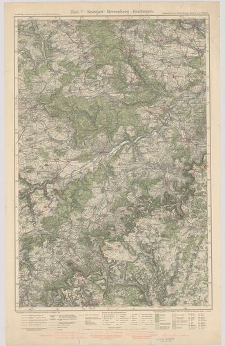
| Title | Stuttgart–Herrenberg–Reutlingen. Blatt 7. |
| Main title | Stuttgart–Herrenberg–Reutlingen közötti terület (Németo.) topográfiai térképe 1930-ban. |
2202. Göppingen–Urach–Blaubeuren. Blatt 8. [B IV a 1018]
Institute and Museum of Military History •
B IV a
•
B IV Német birodalom
•
B I–XV. Európa
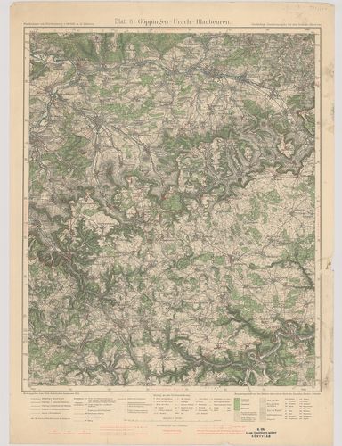
| Title | Göppingen–Urach–Blaubeuren. Blatt 8. |
| Main title | Göppingen–Urach–Blaubeuren közötti terület (Németo.) topográfiai térképe 1934-ben. |
2203. Neresheim–Geislingen–Ulm. Blatt 9. [B IV a 1019]
Institute and Museum of Military History •
B IV a
•
B IV Német birodalom
•
B I–XV. Európa
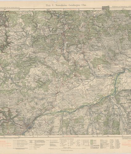
| Title | Neresheim–Geislingen–Ulm. Blatt 9. |
| Main title | Neresheim–Geislingen–Ulm közötti terület (Németo.) topográfiai térképe 1929-ben. |
2204. Sulz–Schramberg–Tuttlingen. Blatt 10. [B IV a 1020]
Institute and Museum of Military History •
B IV a
•
B IV Német birodalom
•
B I–XV. Európa
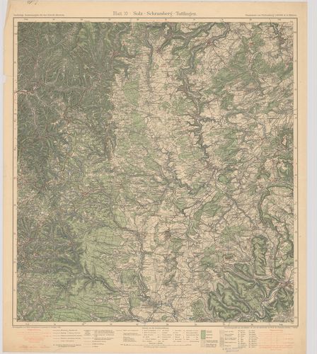
| Title | Sulz–Schramberg–Tuttlingen. Blatt 10. |
| Main title | Sulz–Schramberg–Tuttlingen közötti terület (Németo.) topográfiai térképe 1931-ben. |
2205. Hechingen–Tuttlingen–Sigmaringen. Blatt 11. [B IV a 1021]
Institute and Museum of Military History •
B IV a
•
B IV Német birodalom
•
B I–XV. Európa
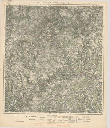
| Title | Hechingen–Tuttlingen–Sigmaringen. Blatt 11. |
| Main title | Hechingen–Tuttlingen–Sigmaringen közötti terület (Németo.) topográfiai térképe 1929-ben. |
2206. Ehingen–Riedlingen–Biberach. Blatt 12. [B IV a 1022]
Institute and Museum of Military History •
B IV a
•
B IV Német birodalom
•
B I–XV. Európa
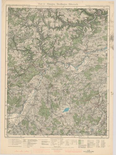
| Title | Ehingen–Riedlingen–Biberach. Blatt 12. |
| Main title | Ehingen–Riedlingen–Biberach közötti terület (Németo.) topográfiai térképe 1934-ben. |
2207. Ulm–Laupheim–Memmingen. Blatt 13. [B IV a 1023]
Institute and Museum of Military History •
B IV a
•
B IV Német birodalom
•
B I–XV. Európa
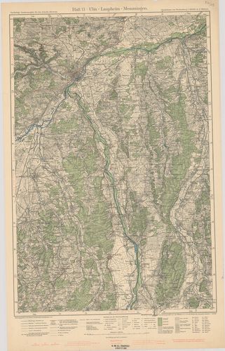
| Title | Ulm–Laupheim–Memmingen. Blatt 13. |
| Main title | Ulm–Laupheim–Memmingen közötti terület (Németo.) topográfiai térképe 1933-ban. |
2208. Waldsee–Friedrichshafen–Bregenz. Blatt 14. [B IV a 1024]
Institute and Museum of Military History •
B IV a
•
B IV Német birodalom
•
B I–XV. Európa
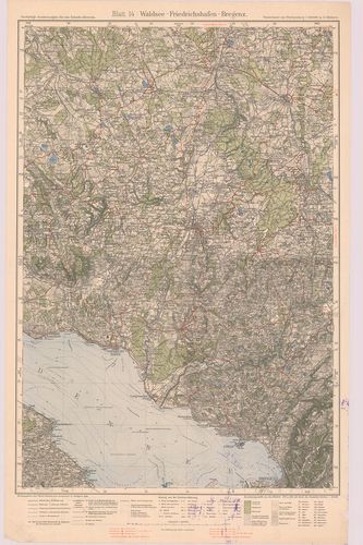
| Title | Waldsee–Friedrichshafen–Bregenz. Blatt 14. |
| Main title | Waldsee–Friedrichshafen–Bregenz közötti terület (Németo.) topográfiai térképe 1928-ban. |
2209. Memmingen–Wangen–Kempten. Blatt 15. [B IV a 1025]
Institute and Museum of Military History •
B IV a
•
B IV Német birodalom
•
B I–XV. Európa
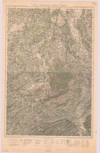
| Title | Memmingen–Wangen–Kempten. Blatt 15. |
| Main title | Memmingen–Wangen–Kempten közötti terület (Németo.) topográfiai térképe 1932-ben. |
2210. Unterland I. Heilbronn–Heidelberg. Unterland II. Ellwagen–Ha... [B IV a 1026]
Institute and Museum of Military History •
B IV a
•
B IV Német birodalom
•
B I–XV. Európa
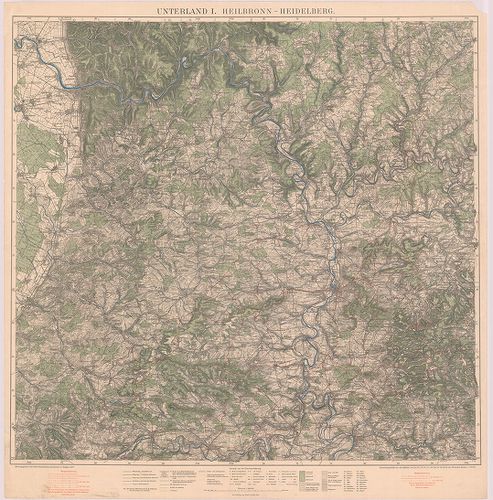
| Title | Unterland I. Heilbronn–Heidelberg. Unterland II. Ellwagen–Hall–Rothenburg o. d. t. |
| Main title | Heilbronn–Heidelberg és Ellwagen–Hall–Rothenburg o.d.t. közötti terület (Németo.) topográfiai térképe 1927-ben. |
2211. Gemeinde und Kreiskarte von Baden–Württemberg. Stand 1.7.197... [B IV a 1027]
Institute and Museum of Military History •
B IV a
•
B IV Német birodalom
•
B I–XV. Európa
| Title | Gemeinde und Kreiskarte von Baden–Württemberg. Stand 1.7.1971. Kreise, Regierungsbezirke und Regionen nach dem Kreisreformgesetz und dem Regionalverbandsgesetz. |
| Main title | Baden–Württemberg (Németo.) község és körzet (kerület) térképe. |
2212. Geographische Landesaufnahme Naturräumliche Gliederung, Deut... [B IV a 1028]
Institute and Museum of Military History •
B IV a
•
B IV Német birodalom
•
B I–XV. Európa
| Title | Geographische Landesaufnahme Naturräumliche Gliederung, Deutschlands. – Bremerhaven, 39. |
2213. Geographische Landesaufnahme Naturräumliche Gliederung, Deut... [B IV a 1028/1]
Institute and Museum of Military History •
B IV a
•
B IV Német birodalom
•
B I–XV. Európa
| Title | Geographische Landesaufnahme Naturräumliche Gliederung, Deutschlands. – Braunschweig, 87. |
2214. Geographische Landesaufnahme Naturräumliche Gliederung, Deut... [B IV a 1028/2]
Institute and Museum of Military History •
B IV a
•
B IV Német birodalom
•
B I–XV. Európa
| Title | Geographische Landesaufnahme Naturräumliche Gliederung, Deutschlands. – Husum. 22. |
2215. Karte des Deutschen Reiches. [B IV a 1041]
Institute and Museum of Military History •
B IV a
•
B IV Német birodalom
•
B I–XV. Európa
| Title | Karte des Deutschen Reiches. |
2216. [Németország.] [B IV a 1045]
Institute and Museum of Military History •
B IV a
•
B IV Német birodalom
•
B I–XV. Európa
| Title | [Németország.] |
2217. Topographischer Atlas von Bayern. [B IV a 1046]
Institute and Museum of Military History •
B IV a
•
B IV Német birodalom
•
B I–XV. Európa
| Title | Topographischer Atlas von Bayern. |
2218. Deutsche Karte. [B IV a 1046/1]
Institute and Museum of Military History •
B IV a
•
B IV Német birodalom
•
B I–XV. Európa
| Title | Deutsche Karte. |
2219. Vergrösserung der Karte des Deutschen Reichs M. 1:100 000. i... [B IV a 1046/2]
Institute and Museum of Military History •
B IV a
•
B IV Német birodalom
•
B I–XV. Európa
| Title | Vergrösserung der Karte des Deutschen Reichs M. 1:100 000. in M. 1:50 000. |
2220. Topogr.[aphische] Übersichtskarte des Deutschen Reiches. Bam... [B IV a 1050]
Institute and Museum of Military History •
B IV a
•
B IV Német birodalom
•
B I–XV. Európa
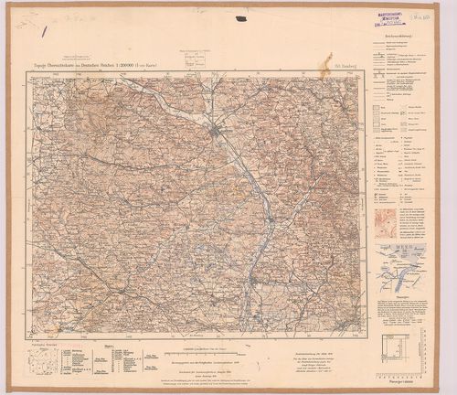
| Title | Topogr.[aphische] Übersichtskarte des Deutschen Reiches. Bamberg 153. |
| Main title | Németország: Bamberg környékének topográfiai áttekintő térképe 1940-ben. |