3381. G. Freytags Karte des Italienischen Kriegsschauplatzes. [B VII c 202/1]
Institute and Museum of Military History •
B VII c
•
B VII Olaszország
•
B I–XV. Európa
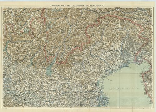
| Title | G. Freytags Karte des Italienischen Kriegsschauplatzes. |
| Main title | Az olasz hadszíntér térképe. |
3382. G. Freytags Karte der Tiroler Front. [B VII c 202/2]
Institute and Museum of Military History •
B VII c
•
B VII Olaszország
•
B I–XV. Európa
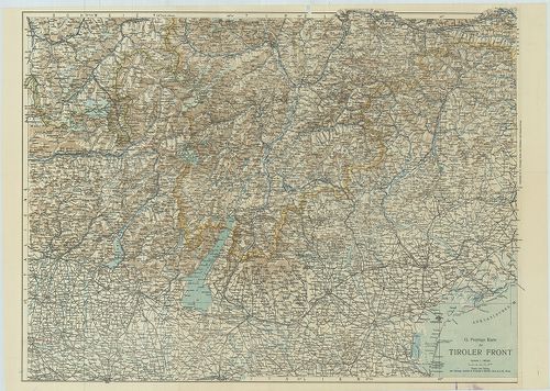
| Title | G. Freytags Karte der Tiroler Front. |
| Main title | Olaszország: a tiroli hadszíntér térképe 1916 körül. |
3383. Neue Generalkarte des südwestlichen Kriegsschauplatzes. West... [B VII c 203]
Institute and Museum of Military History •
B VII c
•
B VII Olaszország
•
B I–XV. Európa
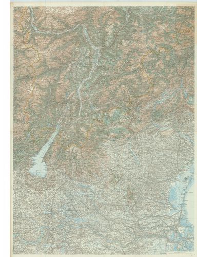
| Title | Neue Generalkarte des südwestlichen Kriegsschauplatzes. Westliches Blatt. (Tiroler-Front). Lechners Kriegskarten XVIII. |
| Main title | A délnyugati hadszíntér - tiroli hadszíntér - térképe 1916–17-ben. |
3384. Neu Generalkarte des südwestlichen Kriegsschauplatzes. Östli... [B VII c 203/1]
Institute and Museum of Military History •
B VII c
•
B VII Olaszország
•
B I–XV. Európa
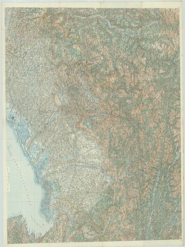
| Title | Neu Generalkarte des südwestlichen Kriegsschauplatzes. Östliches Blatt. (Isonzo-Front.) Lechners Kriegskarten XIX. |
| Main title | A Délnyugati hadszíntér - Isonzo-front térképe 1916–17-ben. |
3385. Az olasz háború térképe. [B VII c 203/2]
Institute and Museum of Military History •
B VII c
•
B VII Olaszország
•
B I–XV. Európa
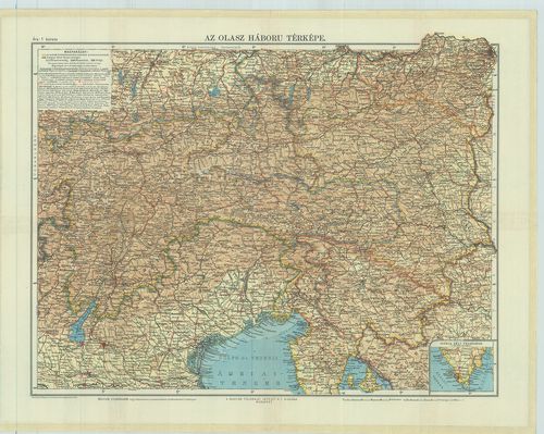
| Title | Az olasz háború térképe. |
3386. Special-Karte des Kriegsschauplatzes in Sardinien. – Special... [B VII c 204]
Institute and Museum of Military History •
B VII c
•
B VII Olaszország
•
B I–XV. Európa
| Title | Special-Karte des Kriegsschauplatzes in Sardinien. – Special Map of the seat of war in Sardinia. |
| Main title | 2 mt.: 1. Plänen der Umgebungen Alessandria. (Alessandria környéke.) 2. Plänen der Umgebungen Casale. (Casale Monferrato környéke.)A Szardiniai Királyság (Piemonte) hadszíntér térképe 1850 körül. |
3387. Italienischer Kriegsschauplatz. [B VII c 205]
Institute and Museum of Military History •
B VII c
•
B VII Olaszország
•
B I–XV. Európa
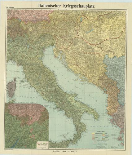
| Title | Italienischer Kriegsschauplatz. |
| Main title | Mt.: Sprachenkarte von Südtirol (Dél-Tirol nyelvjárásai). |
| Subject | Az olasz hadszíntér térképe 1917 körül. |
3388. Olaszország háborús térképe. Rózsavölgyi térképek. 9. [B VII c 206]
Institute and Museum of Military History •
B VII c
•
B VII Olaszország
•
B I–XV. Európa
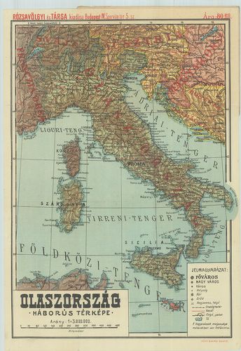
| Title | Olaszország háborús térképe. Rózsavölgyi térképek. 9. |
3389. Lechner’s Übersichtskarte des südwestlichen Kriegsschauplatz... [B VII c 207]
Institute and Museum of Military History •
B VII c
•
B VII Olaszország
•
B I–XV. Európa
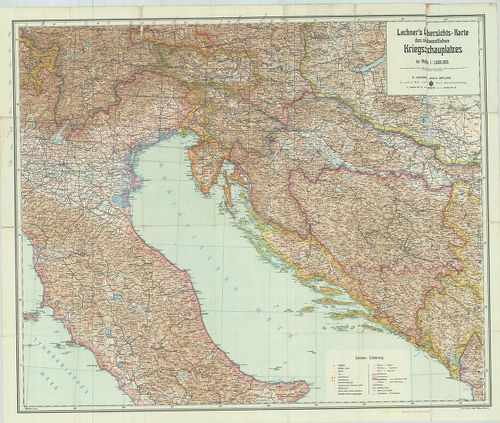
| Title | Lechner’s Übersichtskarte des südwestlichen Kriegsschauplatzes. – Lechners Kriegskarte XI. |
| Main title | A délnyugati hadszíntér áttekintő térképe 1915-ben. |
3390. G. Freytag Karte der Kärntner und Isonzo-Front. – Karte der ... [B VII c 208]
Institute and Museum of Military History •
B VII c
•
B VII Olaszország
•
B I–XV. Európa
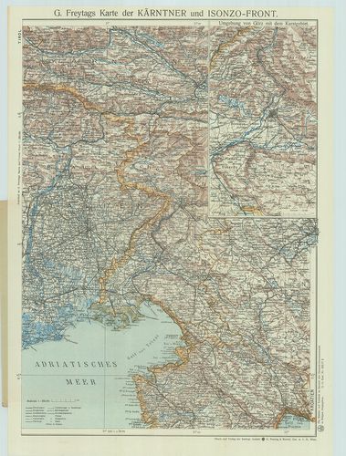
| Title | G. Freytag Karte der Kärntner und Isonzo-Front. – Karte der Isonzo-Front. |
| Main title | Mt.: Umgebung von Görz mit dem Karstgebiet. (Gorizia és a Karszt-vidék térképe.)Az Isonzo-front és Karintia térképe úthálózattal 1917 körül. |
3391. Übersichtskarte des südwestlichen Kriegsschauplatzes. – Über... [B VII c 209]
Institute and Museum of Military History •
B VII c
•
B VII Olaszország
•
B I–XV. Európa
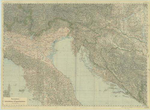
| Title | Übersichtskarte des südwestlichen Kriegsschauplatzes. – Übersichtskarte der österreich–italienischen Grenzgebiete. Lechners Kriegskarten X. |
| Main title | A délnyugati hadszíntér – osztrák–olasz határvidék - térképe 1915-ben. |
3392. G. Freytags Karte des Österreichisch–Italienischen Grenzgebi... [B VII c 209/1]
Institute and Museum of Military History •
B VII c
•
B VII Olaszország
•
B I–XV. Európa
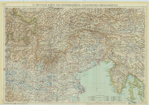
| Title | G. Freytags Karte des Österreichisch–Italienischen Grenzgebietes. |
| Main title | Az osztrák–olasz határvidék térképe 1917 körül. |
3393. Carta itineraria delle stazioni militari del regno di Napoli... [B VII c 210]
Institute and Museum of Military History •
B VII c
•
B VII Olaszország
•
B I–XV. Európa
| Title | Carta itineraria delle stazioni militari del regno di Napoli. Metsz.: G. Azzerboni |
| Main title | A Nápolyi Királyság katonai és úttérképe 1810-ben. |
3394. Plan des Schlachtfeldes von Custoza am 24. Juni. 1866. [B VII c 222]
Institute and Museum of Military History •
B VII c
•
B VII Olaszország
•
B I–XV. Európa
| Title | Plan des Schlachtfeldes von Custoza am 24. Juni. 1866. |
| Main title | A Custozai csatatér térképe 1866. június 24-én. |
3395. Gegend Diess- und jenseits des Mincio Flusses. Zwischen Pesc... [B VII c 222/1]
Institute and Museum of Military History •
B VII c
•
B VII Olaszország
•
B I–XV. Európa
| Title | Gegend Diess- und jenseits des Mincio Flusses. Zwischen Peschiera, Castiglione, Guidizzolo, Valeggio und Castelnovo. |
| Main title | A Mincio folyó környéke Peschiera d. G., Castiglione, Guidizzolo, Valeggio és Castelnuovo között 1850 körül. |
3396. [A Mincio folyó környéke Valeggio, Volta és Castellaro közöt... [B VII c 222/2]
Institute and Museum of Military History •
B VII c
•
B VII Olaszország
•
B I–XV. Európa
| Title | [A Mincio folyó környéke Valeggio, Volta és Castellaro között.] |
3397. Carta itineraria del regno d’Italia. [B VII c 223]
Institute and Museum of Military History •
B VII c
•
B VII Olaszország
•
B I–XV. Európa
| Title | Carta itineraria del regno d’Italia. |
| Main title | Az Olasz Királyság úttérképe 1868-ban. |
3398. Az Olasz Királyság úttérképe 1896–99-ben. [B VII c 225]
Institute and Museum of Military History •
B VII c
•
B VII Olaszország
•
B I–XV. Európa
| Title | Az Olasz Királyság úttérképe 1896–99-ben. |
3399. Ravensteins Kriegskarte. 1. No. 16. – Süd-Tirol („Trentin”) ... [B VII c 226]
Institute and Museum of Military History •
B VII c
•
B VII Olaszország
•
B I–XV. Európa
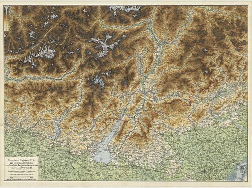
| Title | Ravensteins Kriegskarte. 1. No. 16. – Süd-Tirol („Trentin”) Dolomiten, Lombardische Berge, Gardasee-Gebiet und Angrenzendes Ober-Italien. 2. No. 17. Oestl. Dolomiten, Karnische- u. Julische Alpen, Gönz, Küstenland, Friaul und oberitalienische Venezianische Ebene. |
| Main title | Dél-Tirol, Dolomitok, Garda-tó, Felső-Olaszországi határvidék, K.-Dolomitok, Karni-Juliai Alpok, Görz, Tengermellék Frianli és Felső-Olaszország-i Velencei-síkság térképe 1880 körül. |
3400. La Sicilia. – Sicilia preistorica. [B VII c 233]
Institute and Museum of Military History •
B VII c
•
B VII Olaszország
•
B I–XV. Európa
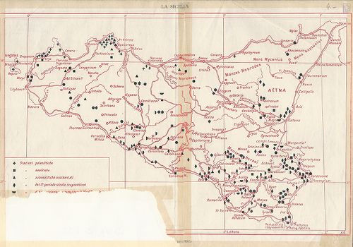
| Title | La Sicilia. – Sicilia preistorica. |
| Main title | Szicília őskori térképe. |