561. Strassen-Karte des Herzogthums Steyermark. [B IX c 359]
Institute and Museum of Military History •
B IX c
•
B IX Ausztria–Magyarország
•
B I–XV. Európa
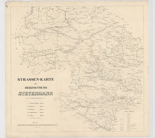
| Title | Strassen-Karte des Herzogthums Steyermark. |
| Main title | Stájerország úttérképe. |
562. Marschrouten-Karte des Herzogthums Steyermark. [B IX c 369]
Institute and Museum of Military History •
B IX c
•
B IX Ausztria–Magyarország
•
B I–XV. Európa
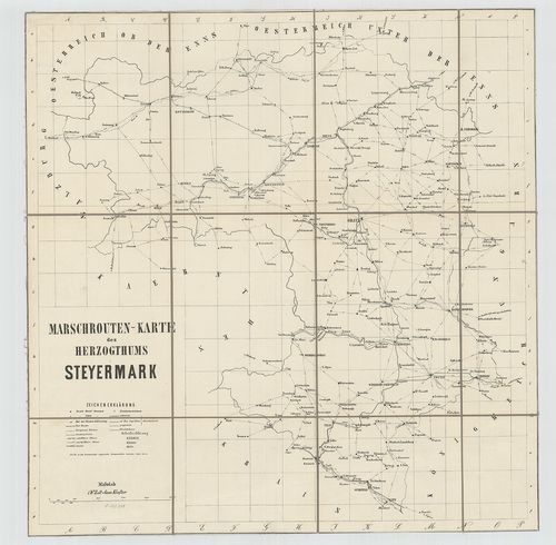
| Title | Marschrouten-Karte des Herzogthums Steyermark. |
| Main title | Stájerország menettérképel. |
563. General Post und Strassen Karte des Herzogthums Steyermark. [B IX c 3/3]
Institute and Museum of Military History •
B IX c
•
B IX Ausztria–Magyarország
•
B I–XV. Európa
| Title | General Post und Strassen Karte des Herzogthums Steyermark. |
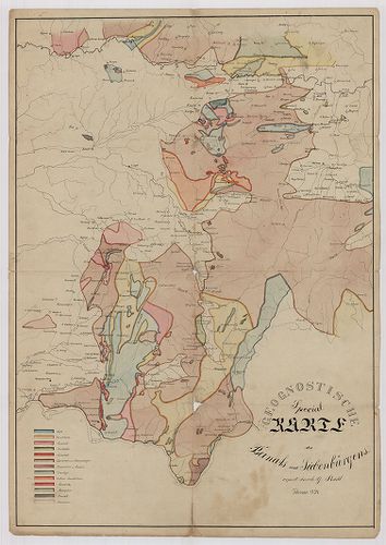
564. A Székelyföld földtani térképe. – Geologische-Karte des Szék... [B IX b 363]
Institute and Museum of Military History •
B IX b
•
B IX Ausztria–Magyarország
•
B I–XV. Európa
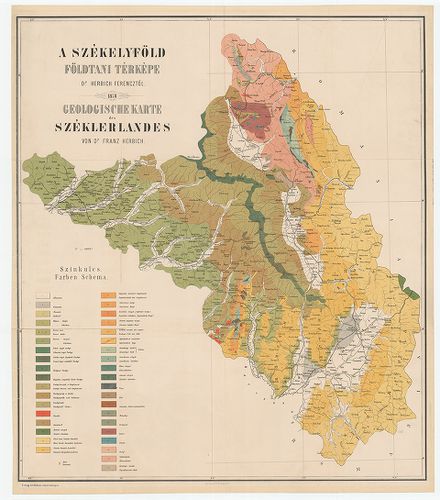
| Title | A Székelyföld földtani térképe. – Geologische-Karte des Székerlandes. |
565. Strassen Karte des Königreiches Dalmatien. [B IX c 573]
Institute and Museum of Military History •
B IX c
•
B IX Ausztria–Magyarország
•
B I–XV. Európa
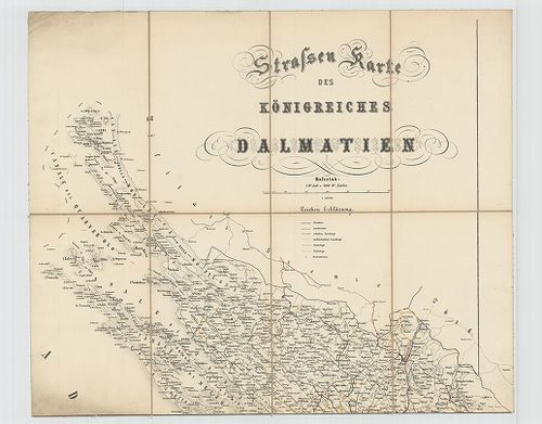
| Title | Strassen Karte des Königreiches Dalmatien. |
| Main title | Dalmácia úttérképe. |
566. Karte: des kőnigl. Lippaer Cameral Verwalter Amts Bezirks [TK 2161]
National Széchényi Library •
OSZK kéziratos térképek
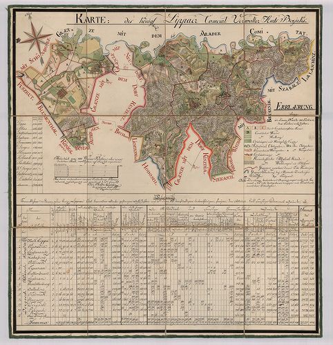
| Title | Karte: des kőnigl. Lippaer Cameral Verwalter Amts Bezirks |
567. Marschrouten-Karte des Königreiches Dalmatien. [B IX c 604]
Institute and Museum of Military History •
B IX c
•
B IX Ausztria–Magyarország
•
B I–XV. Európa
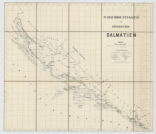
| Title | Marschrouten-Karte des Königreiches Dalmatien. |
| Main title | Dalmácia menettérképe. |
568. Karte des Groszvardeiner Steuer Distriktes im Kronlande Unga... [TK 2086]
National Széchényi Library •
OSZK kéziratos térképek
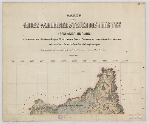
| Title | Karte des Groszvardeiner Steuer Distriktes im Kronlande Ungarn |
569. Plan des Militarischen Varasdiner Generalats samt dessen Gra... [TK 1921]
National Széchényi Library •
OSZK kéziratos térképek

| Title | Plan des Militarischen Varasdiner Generalats samt dessen Graenzen |
570. Culturen Croquis des Ofen Pester Districtes in Ungarn [TK 1904]
National Széchényi Library •
OSZK kéziratos térképek

| Title | Culturen Croquis des Ofen Pester Districtes in Ungarn |
571. Plan des Warasdiner Generalats Militaris mit seinen Graentze... [TK 1372]
National Széchényi Library •
OSZK kéziratos térképek

| Title | Plan des Warasdiner Generalats Militaris mit seinen Graentzen |
572. Plan des Drau-Flusses längst der Csurgoer Herrschaft [TK 1347]
National Széchényi Library •
OSZK kéziratos térképek

| Title | Plan des Drau-Flusses längst der Csurgoer Herrschaft |
573. Strassen-Karte des Koenigreiches Boehmen. [B IX c 185]
Institute and Museum of Military History •
B IX c
•
B IX Ausztria–Magyarország
•
B I–XV. Európa
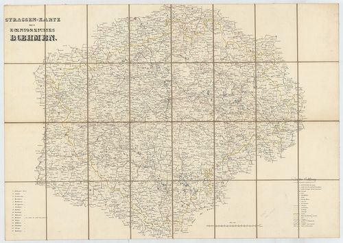
| Title | Strassen-Karte des Koenigreiches Boehmen. |
| Main title | Csehország úttérképe. |
574. Geognostische Special-Karte des Banats und Sieben-bürgens [TK 1163]
National Széchényi Library •
OSZK kéziratos térképek
| Title | Geognostische Special-Karte des Banats und Sieben-bürgens |
575. Profil des Carlburger Arms, wo der Damm kommet [TK 739]
National Széchényi Library •
OSZK kéziratos térképek
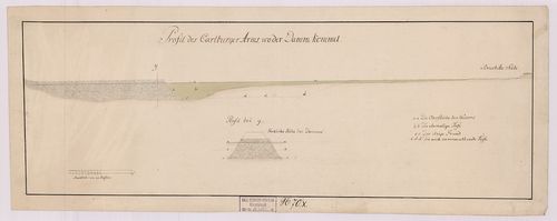
| Title | Profil des Carlburger Arms, wo der Damm kommet |
576. Anlage des neu zu errichtenden Marktes Neu Légrád . [TK 648]
National Széchényi Library •
OSZK kéziratos térképek

| Title | Anlage des neu zu errichtenden Marktes Neu Légrád . |
577. Vorstellung des bey Eszek vorbey fliessenden Drau Strohm [TK 385]
National Széchényi Library •
OSZK kéziratos térképek
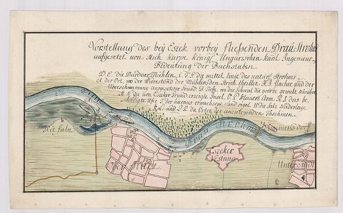
| Title | Vorstellung des bey Eszek vorbey fliessenden Drau Strohm |
578. General-Karte des Königreiches Griechenland. [B III a 100]
Institute and Museum of Military History •
B III a
•
B III Balkán-félsziget
•
B I–XV. Európa
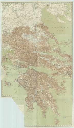
| Title | General-Karte des Königreiches Griechenland. |
| Main title | Görögország térképe. |
579. Belgii universi seu Inferioris Germaniae quam XVII Provincia... [S 40 - No. 7/5.]
National Archives of Hungary •
S 40 Görgey család (1755-1838)
•
S Családi fondokból kiemelt térképek (17. sz.-20. sz.)
•
S – Térképtár
| Main title | Belgii universi seu Inferioris Germaniae quam XVII Provinciae, Austriaco, Gallico et Batavo sceptro parentes constituunt, nova tabula geographica Carte des XVII. provinces ou de l'Allemagne Inferieure; Carte des XVII. provinces ou de l'Allemagne Inferieure |
| Subject | No. 7/5. Hollandia |
580. Quer Profil des Waagfliszes unter der Brücke zu Rosenberg Qu... [S 101 - No. 125/1-3.]
National Archives of Hungary •
S 101 Abszolutizmuskori térképek (1849-1867)
•
S Kormányhatósági fondokból kiemelt térképek (17. sz.-20. sz.)
•
S – Térképtár
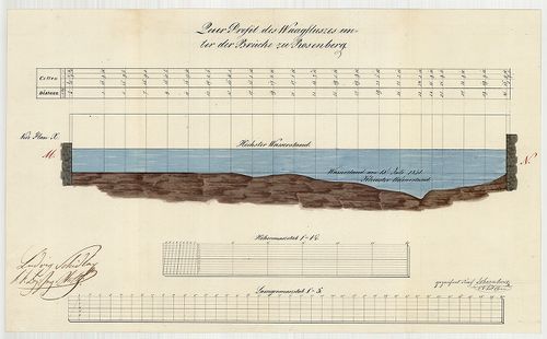
| Main title | Quer Profil des Waagfliszes unter der Brücke zu Rosenberg Quer Profil des Waagfluszes unter der Brücke zu Nagy Olaszi Situations Plan von der Umgebung der Brücke zu Nagy Olaszi |
| Subject | No. 125/1-3. A Vág Rózsehegynél és Nagyolaszinál (Liptó m.) |