641. Generalkarte des italienischen Kriegsschauplatzes. [H IV d 603/1/b]
Institute and Museum of Military History •
Olasz hadszíntér
•
H IV d (1914-1918)
•
H IV Újabbkori háborúk
•
H Háborúk
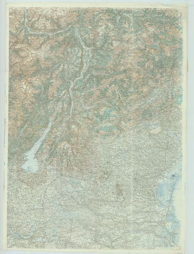
| Title | Generalkarte des italienischen Kriegsschauplatzes. |
| Main title | Az olasz hadszíntér általános térképe. |
642. Marschrouten-Karte des Grossfürstenthums Siebenbürgen. [B IX c 775]
Institute and Museum of Military History •
B IX c
•
B IX Ausztria–Magyarország
•
B I–XV. Európa
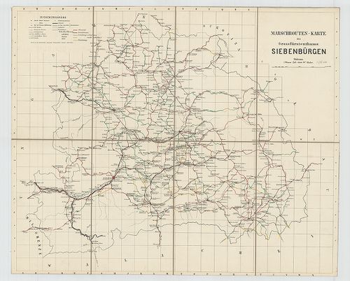
| Title | Marschrouten-Karte des Grossfürstenthums Siebenbürgen. |
| Main title | Erdély menettérképe 1868-ban. |
643. Charte des löb. Gradiscaner Regiments. [B IX a 1324]
Institute and Museum of Military History •
B IX a
•
B IX Ausztria–Magyarország
•
B I–XV. Európa
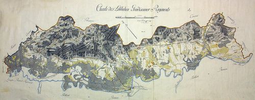
| Title | Charte des löb. Gradiscaner Regiments. |
| Main title | A Gradiscai ezred térképe. |
644. Plan des Graniz-Cordons von Pancsova. [B IX c 1479]
Institute and Museum of Military History •
B IX c
•
B IX Ausztria–Magyarország
•
B I–XV. Európa
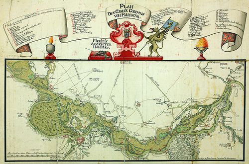
| Title | Plan des Graniz-Cordons von Pancsova. |
| Main title | Határvonalak Pancsova környékén. |
645. Plan des Rothen Thurner Passes. [B IX a 1254]
Institute and Museum of Military History •
B IX a
•
B IX Ausztria–Magyarország
•
B I–XV. Európa
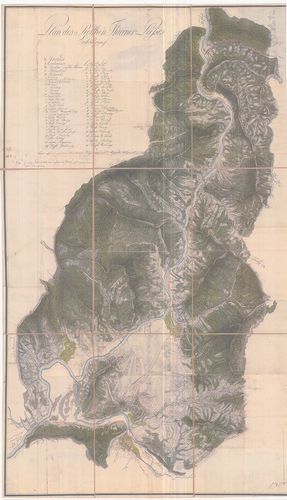
| Title | Plan des Rothen Thurner Passes. |
| Main title | A Vöröstorony-hágó térképe. |
646. Übersichtskarte des Balkan-Kriegsschauplatzes. [B III c 30]
Institute and Museum of Military History •
B III c
•
B III Balkán-félsziget
•
B I–XV. Európa
| Title | Übersichtskarte des Balkan-Kriegsschauplatzes. |
| Main title | A Balkán-félsziget hadszíntereinek áttekintőtérképe. |
647. Plan des Waldtheiles Wolfsgurgel Dömörkapu [TMOL XV 3 T. 15]
Tolna County Archives •
Tolna megye kéziratos térképei
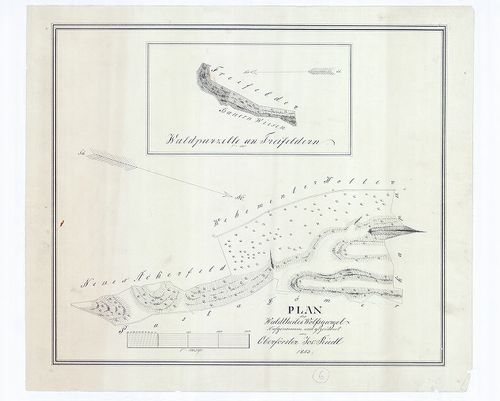
| Main title | Plan des Waldtheiles Wolfsgurgel Dömörkapu |
| Subject | Bátaapáti, Tolna megye |
648. Strassen Karte des Grossfürstenthums Siebenbürgen [S 75 - No. 163.]
National Archives of Hungary •
S 75 Nyomtatott térképek (19. sz.-20. sz.)
•
S – Térképtár
| Main title | Strassen Karte des Grossfürstenthums Siebenbürgen |
| Subject | No. 163. Erdély |
649. G. Freytags Karte des nördlichen Serbien. [B III a 218/5]
Institute and Museum of Military History •
B III a
•
B III Balkán-félsziget
•
B I–XV. Európa
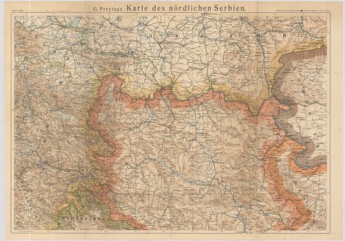
| Title | G. Freytags Karte des nördlichen Serbien. |
| Main title | É-Szerbia térképe. |
650. General-Karte des Fürstenthums Walachei. [B III a 198]
Institute and Museum of Military History •
B III a
•
B III Balkán-félsziget
•
B I–XV. Európa
| Title | General-Karte des Fürstenthums Walachei. |
| Main title | Havasalföld térképe 1867-ben. |
651. Militair Carte des Varasdiner Generalats... [B IX a 1229]
Institute and Museum of Military History •
B IX a
•
B IX Ausztria–Magyarország
•
B I–XV. Európa
| Title | Militair Carte des Varasdiner Generalats... |
| Main title | A Varasdi Határőrvidék térképe. |
652. Strassen-Karte des Königreiches Illyrien [S 75 - No. 18.]
National Archives of Hungary •
S 75 Nyomtatott térképek (19. sz.-20. sz.)
•
S – Térképtár
| Main title | Strassen-Karte des Königreiches Illyrien |
| Subject | No. 18. Illíria |
653. Strassen-Karte des Königreichs Dalmatien [S 75 - No. 17.]
National Archives of Hungary •
S 75 Nyomtatott térképek (19. sz.-20. sz.)
•
S – Térképtár
| Main title | Strassen-Karte des Königreichs Dalmatien |
| Subject | No. 17. Dalmácia |
654. Trencsén megye uthálózatja [TK 746]
National Széchényi Library •
OSZK kéziratos térképek

| Title | Trencsén megye uthálózatja |
| Subject | Strassen Netz des Trenchiner Comitates |
655. Strassen-Karte des Herzogthums Steyermark [S 75 - No. 15.]
National Archives of Hungary •
S 75 Nyomtatott térképek (19. sz.-20. sz.)
•
S – Térképtár
| Main title | Strassen-Karte des Herzogthums Steyermark |
| Subject | No. 15. Steiermark |
656. Niveau Plan des Ausflusses vom Tihanyer Teiche [VeML XV 11 a T 384]
Veszprém County Archives •
Veszprém megye kéziratos térképei
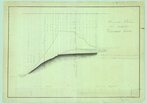
| Main title | Niveau Plan des Ausflusses vom Tihanyer Teiche |
| Subject | Tihany |
657. Übersichtskarte des russischen Kriegsschauplatzes. [B XI c 80]
Institute and Museum of Military History •
B XI c
•
B XI Oroszország
•
B I–XV. Európa

| Title | Übersichtskarte des russischen Kriegsschauplatzes. |
| Main title | Az orosz hadszíntér áttekintő térképe. |
658. Correction der Donau und des Leches zwischen Lechsend und Ma... [TK 2071]
National Széchényi Library •
OSZK kéziratos térképek
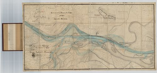
| Title | Correction der Donau und des Leches zwischen Lechsend und Marxheim |
659. General-Karte des Grossfürstenthums Siebenbürgen [S 74 - U. - 27.]
National Archives of Hungary •
S 74 Kereskedelmi minisztériumi térképek (1765-1913)
•
S Kormányhatósági fondokból kiemelt térképek (17. sz.-20. sz.)
•
S – Térképtár
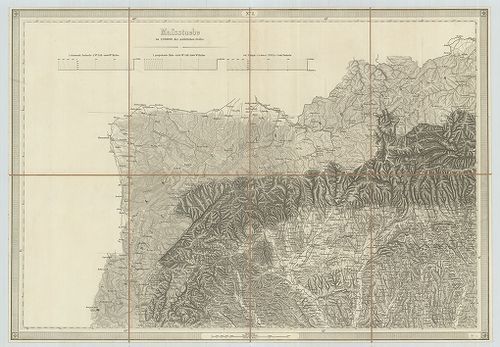
| Main title | General-Karte des Grossfürstenthums Siebenbürgen |
| Subject | U. - 27. Erdély |
660. A Cserhát-hegység földtani térképe. – Geologische Karte des ... [B XV b 271]
Institute and Museum of Military History •
B XV b
•
B XV Magyarország (1920 után)
•
B I–XV. Európa
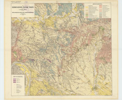
| Title | A Cserhát-hegység földtani térképe. – Geologische Karte des Cserhát-Gebirges. |