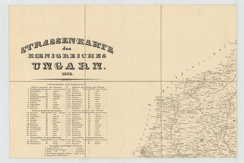
661. Strassen-Karte des Koenigreiches Ungarn. [B IX c 619]
Institute and Museum of Military History •
B IX c
•
B IX Ausztria–Magyarország
•
B I–XV. Európa
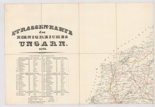
| Title | Strassen-Karte des Koenigreiches Ungarn. |
| Main title | Magyarország úttérképe 1832-ben. |
662. Profils des Tracaux de Bude. [H III c 187]
Institute and Museum of Military History •
H III c (1651–1700)
•
H III Újkori háborúk (1492–1789)
•
H Háborúk
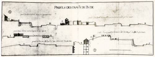
| Title | Profils des Tracaux de Bude. |
| Main title | Buda várának erődítési terve. |
663. Luftverkehrkarte des Deutschen Reiches. [B IV c 406]
Institute and Museum of Military History •
B IV c
•
B IV Német birodalom
•
B I–XV. Európa
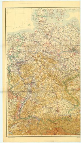
| Title | Luftverkehrkarte des Deutschen Reiches. |
| Main title | A Német Birodalom légiforgalmi térképe. |
664. Charte, und Tabelle, der Strassen, und Brücken, des Eisenbur... [TK 25]
National Széchényi Library •
OSZK kéziratos térképek
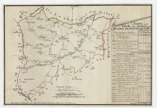
| Title | Charte, und Tabelle, der Strassen, und Brücken, des Eisenburger Comitats |
665. A Mecsek hegység földtani térképe. – Geologische Karte des M... [B XV b 288]
Institute and Museum of Military History •
B XV b
•
B XV Magyarország (1920 után)
•
B I–XV. Európa
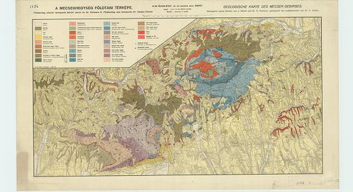
| Title | A Mecsek hegység földtani térképe. – Geologische Karte des Mecsek-Gebirges. |
666. Forstcarte des Zirczer Revirs [VeML XV 11 a T 125]
Veszprém County Archives •
Veszprém megye kéziratos térképei
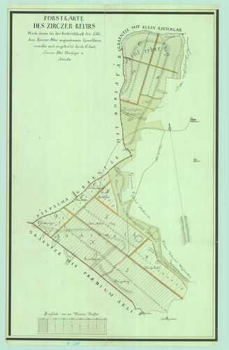
| Main title | Forstcarte des Zirczer Revirs |
| Subject | Zirc NY-i szélén |
667. Carte Générale des Gaules. [B V a 46]
Institute and Museum of Military History •
B V a
•
B V Franciaország
•
B I–XV. Európa
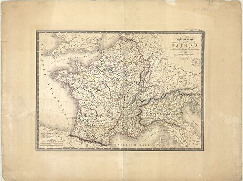
| Title | Carte Générale des Gaules. |
| Main title | Franciaország általános térképe 1821-ben. |
668. Strassenkarte des Szolnoker Comitates [S 101 - No. 415.]
National Archives of Hungary •
S 101 Abszolutizmuskori térképek (1849-1867)
•
S Kormányhatósági fondokból kiemelt térképek (17. sz.-20. sz.)
•
S – Térképtár

| Main title | Strassenkarte des Szolnoker Comitates |
| Subject | No. 415. Szolnok megye |
669. Umgebungskarte des Übungslagers bei Esztergom. [G I h 164]
Institute and Museum of Military History •
G I h vár alaprajzok, város és környéktérképek, utikönyvek
•
G I Európa
•
G I–V. Úti térképek
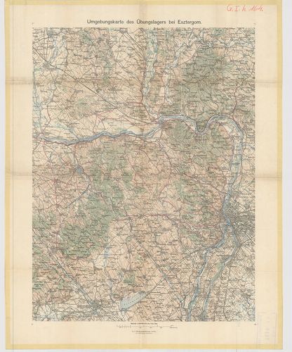
| Title | Umgebungskarte des Übungslagers bei Esztergom. |
| Main title | Esztergom és környékének térképe. |
670. Kleine Umgebungskarte des Kurortes Meran. [G I h 1581]
Institute and Museum of Military History •
G I h vár alaprajzok, város és környéktérképek, utikönyvek
•
G I Európa
•
G I–V. Úti térképek
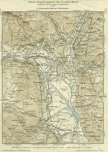
| Title | Kleine Umgebungskarte des Kurortes Meran. |
| Main title | Merano és környékének térképe. |
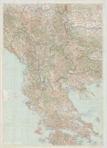
671. Übersichtskarte des Kriegsschauptplatzes [S 68 - XV. - No. 5.]
National Archives of Hungary •
S 68 Festetics család (1645-1943)
•
S Családi fondokból kiemelt térképek (17. sz.-20. sz.)
•
S – Térképtár
| Main title | Übersichtskarte des Kriegsschauptplatzes |
| Subject | XV. - No. 5. Észak-Balkán |
672. General-Karte des Grossfürstenthums Siebenbürgen [S 67 - No. 48.]
National Archives of Hungary •
S 67 Falitérképek (1782-1940)
•
S – Térképtár
| Main title | General-Karte des Grossfürstenthums Siebenbürgen |
| Subject | No. 48. Erdély |
673. Carte des Temeschwarer Banat [S 167 - No. 66.]
National Archives of Hungary •
S 167 Vegyes térképanyag (18. sz.-19. sz.)
•
S Családi fondokból kiemelt térképek (17. sz.-20. sz.)
•
S – Térképtár
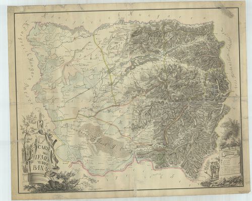
| Main title | Carte des Temeschwarer Banat |
| Subject | No. 66. Temesi Bánság |
674. Strassen-Karte des Königreiches Ungarn. [B IX c 690]
Institute and Museum of Military History •
B IX c
•
B IX Ausztria–Magyarország
•
B I–XV. Európa
| Title | Strassen-Karte des Königreiches Ungarn. |
| Main title | Magyarország úttérképe 1832-ben. |
675. Strassen Karte des Grossfürstenthums Siebenbürgen. [B IX c 736/1]
Institute and Museum of Military History •
B IX c
•
B IX Ausztria–Magyarország
•
B I–XV. Európa

| Title | Strassen Karte des Grossfürstenthums Siebenbürgen. |
| Main title | Erdély úttérképe 1828 körül. |
676. Uibersichts-Karte der Serbischen Wojwodschaft und des Temese... [TK 1901]
National Széchényi Library •
OSZK kéziratos térképek
| Title | Uibersichts-Karte der Serbischen Wojwodschaft und des Temeser Banat's |
677. Übersichtskarte des südöstlichen Kriegsschauplatzes. [B III c 262]
Institute and Museum of Military History •
B III c
•
B III Balkán-félsziget
•
B I–XV. Európa
| Title | Übersichtskarte des südöstlichen Kriegsschauplatzes. |
| Main title | Átnézeti térkép a dékeleti hadszíntérről. |
678. Situations Plan der Stadt Szamos Ujvár in Betref der allda z... [S 105 - No. 92/1.]
National Archives of Hungary •
S 105 Erdélyi kormányhatósági levéltárból kiemelt térképek (1798-1868)
•
S Kormányhatósági fondokból kiemelt térképek (17. sz.-20. sz.)
•
S – Térképtár
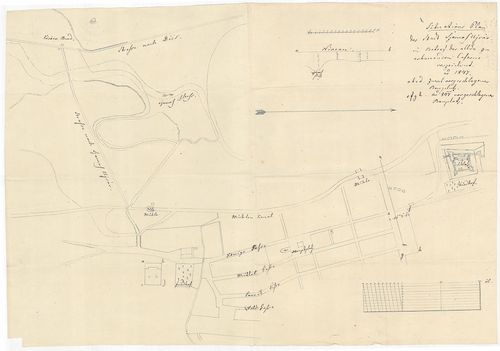
| Main title | Situations Plan der Stadt Szamos Ujvár in Betref der allda zu erbauenden Caserne verzeichnet anno 1847 |
| Subject | No. 92/1. A szamosújvári (Szolnok-Doboka m., ma Gherla, RO) kaszárnyaépítéssel kapcsolatban a város egy részének ábrázolása |
Content: [...] kaszárnyaépület alaprajza vízimalmok templomalaprajz váralaprajz Désre vivő út fürdő Kérőer Baad [...] Content: [...] kaszárnyaépület alaprajza vízimalmok templomalaprajz váralaprajz Désre vivő út fürdő Kérőer Baad [...]
679. General Post- und Strassenkarte des Kronlandes Galizien und ... [B IX c 502]
Institute and Museum of Military History •
B IX c
•
B IX Ausztria–Magyarország
•
B I–XV. Európa
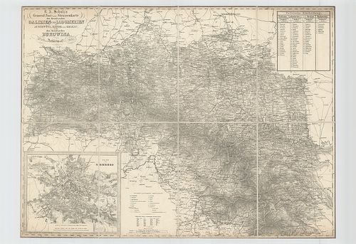
| Title | General Post- und Strassenkarte des Kronlandes Galizien und Lodomerien mit Auschwitz (Oswiecim), Zator und Krakau (Krakow) sie wie des Kronlandes Bukowina. |
| Main title | Mt. Plan von Lemberg. (Lvov térképe. Lak.: 65 978, ház: 2524 az 1843. évben.) |
| Subject | Galícia, Lodoméria és Bukowina posta- és úttérképe 1851-ben. |
680. Atlas des plus mémorables batailles, combats et siéges des t... [S 68 - Vegyes nyomtatott térképek. - No. 75.]
National Archives of Hungary •
S 68 Festetics család (1645-1943)
•
S Családi fondokból kiemelt térképek (17. sz.-20. sz.)
•
S – Térképtár

| Main title | Atlas des plus mémorables batailles, combats et siéges des temps anciens, du moyen age et de l'age moderne en 200 feuilles Atlas der wichtigsten Schlachten, Treffen und Belagerungen der alten, mittleren und neuern Zeit in 200 Blättern |
| Subject | Vegyes nyomtatott térképek. - No. 75. Föld |