781. Plan des Cameral Dorfs Grentzest ... [S 11 - No. 136.]
National Archives of Hungary •
S 11 Kamarai térképek (1747-1882)
•
S Kormányhatósági fondokból kiemelt térképek (17. sz.-20. sz.)
•
S – Térképtár
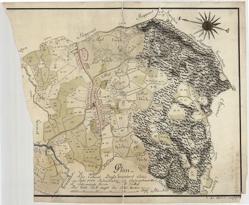
| Main title | Plan des Cameral Dorfs Grentzest ... |
| Subject | No. 136. Grentzest úrbéri térképe |
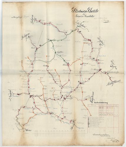
782. Straszen Karte des Borsoder Comitats [S 101 - No. 412/2.]
National Archives of Hungary •
S 101 Abszolutizmuskori térképek (1849-1867)
•
S Kormányhatósági fondokból kiemelt térképek (17. sz.-20. sz.)
•
S – Térképtár

| Main title | Straszen Karte des Borsoder Comitats |
| Subject | No. 412/2. Borsod megye |
783. Kommunikationskarte des Österreichisch Italienischen Grenzge... [B IX c 33]
Institute and Museum of Military History •
B IX c
•
B IX Ausztria–Magyarország
•
B I–XV. Európa
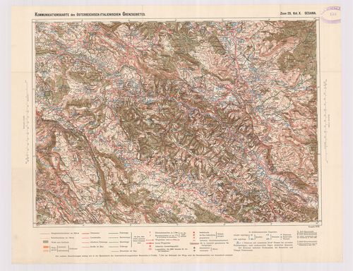
| Title | Kommunikationskarte des Österreichisch Italienischen Grenzgebietes. |
| Main title | Az osztrák–olasz határvidék közlekedési térképe. |
784. Mappe des - in dem Derzsimorecer Hotter liegenden - herrscha... [TK 267]
National Széchényi Library •
OSZK kéziratos térképek
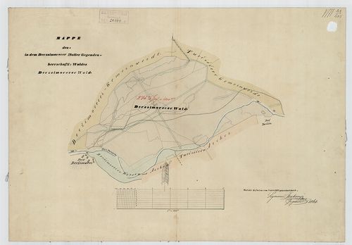
| Title | Mappe des - in dem Derzsimorecer Hotter liegenden - herrschaftl[ichen] Waldes Derzsimorecer Wald. |
785. Strassen Charte des Gömörer Comitates [S 101 - No. 651.]
National Archives of Hungary •
S 101 Abszolutizmuskori térképek (1849-1867)
•
S Kormányhatósági fondokból kiemelt térképek (17. sz.-20. sz.)
•
S – Térképtár
| Main title | Strassen Charte des Gömörer Comitates |
| Subject | No. 651. Gömör-Kishont megye |
786. Situations Plan des gräfl[ichen] Harrachischen Gartens zu Br... [TK 1214]
National Széchényi Library •
OSZK kéziratos térképek

| Title | Situations Plan des gräfl[ichen] Harrachischen Gartens zu Bruck an der Leytha |
787. Reducirte Charte des Száárer Hotters [S 69 - No. 203.]
National Archives of Hungary •
S 69 Eszterházy család tatai ága (18. sz.-19. sz.)
•
S Családi fondokból kiemelt térképek (17. sz.-20. sz.)
•
S – Térképtár
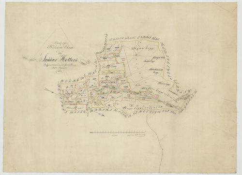
| Main title | Reducirte Charte des Száárer Hotters |
| Subject | No. 203. Szár (Fejér m.) |
788. Waldkarte des untern Waldes der /kőniglichen Frey-/stadt Gün... [VAML T 119]
Vas County Archives •
Törzsanyag
•
Vas megye kéziratos térképei
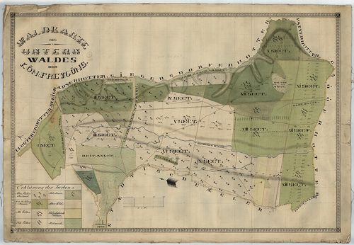
| Main title | Waldkarte des untern Waldes der /kőniglichen Frey-/stadt Güns |
| Subject | Kőszeg |
789. Special-Karte des Karwendel Gebirges. [B IX b 60]
Institute and Museum of Military History •
B IX b
•
B IX Ausztria–Magyarország
•
B I–XV. Európa
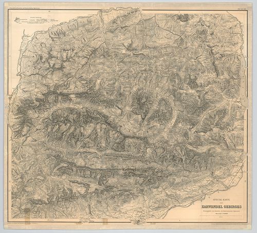
| Title | Special-Karte des Karwendel Gebirges. |
| Main title | A Karwendel-hegység térképe 1888-ban. |
790. Generalkarte des griechisch–türkischen Grenzgebietes. [B III c 50]
Institute and Museum of Military History •
B III c
•
B III Balkán-félsziget
•
B I–XV. Európa
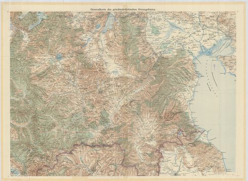
| Title | Generalkarte des griechisch–türkischen Grenzgebietes. |
| Main title | A görög–török határvidék általános térképe. |
791. Charte des Szőllőser Terrains [S 69 - No. 218.]
National Archives of Hungary •
S 69 Eszterházy család tatai ága (18. sz.-19. sz.)
•
S Családi fondokból kiemelt térképek (17. sz.-20. sz.)
•
S – Térképtár
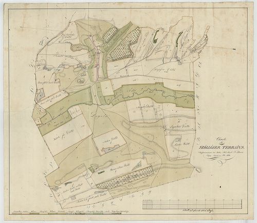
| Main title | Charte des Szőllőser Terrains |
| Subject | No. 218. Vértesszőlős (Komárom m.) területe |
792. Generalkarte des Russischen Reichs [S 73 - No. 70.]
National Archives of Hungary •
S 73 Új szerzeményű térképek (1701-1940)
•
S – Térképtár
| Main title | Generalkarte des Russischen Reichs |
| Subject | No. 70. Az Orosz Birodalom térképe |
793. Karte des Kaisergebirges im Tirol [S 73 - No. 81.]
National Archives of Hungary •
S 73 Új szerzeményű térképek (1701-1940)
•
S – Térképtár
| Main title | Karte des Kaisergebirges im Tirol |
| Subject | No. 81. Tiroli hegyvidék (A) |
794. Karte des Kriegsschauplatzes der Ostsee [S 41 - No. 8/18.]
National Archives of Hungary •
S 41 Kapuváry család (18. sz.-19. sz.)
•
S Családi fondokból kiemelt térképek (17. sz.-20. sz.)
•
S – Térképtár
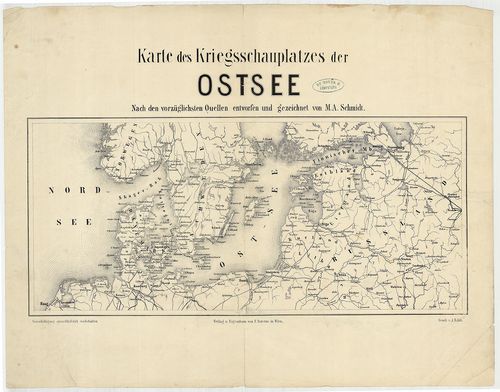
| Main title | Karte des Kriegsschauplatzes der Ostsee |
| Subject | No. 8/18. Balti-tenger |
795. Plan des Cameral Dorfs Gerpest ... [S 11 - No. 131.]
National Archives of Hungary •
S 11 Kamarai térképek (1747-1882)
•
S Kormányhatósági fondokból kiemelt térképek (17. sz.-20. sz.)
•
S – Térképtár
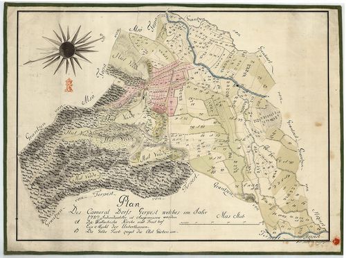
| Main title | Plan des Cameral Dorfs Gerpest ... |
| Subject | No. 131. Gerpest úrbéri térképe |
796. A Gerecse hegység északnyugati részének földtani térképe. – ... [B XV b 283]
Institute and Museum of Military History •
B XV b
•
B XV Magyarország (1920 után)
•
B I–XV. Európa
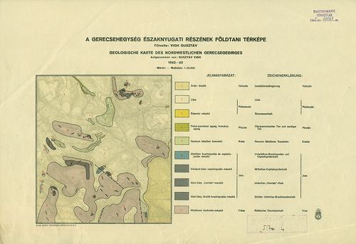
| Title | A Gerecse hegység északnyugati részének földtani térképe. – Geologische Karte des Nordwestlichen Gerecsegebirges. |
797. Wanderkarte des Odenwaldklubs. Blatt 3. Weinheim. [B IV c 253]
Institute and Museum of Military History •
B IV c
•
B IV Német birodalom
•
B I–XV. Európa
| Title | Wanderkarte des Odenwaldklubs. Blatt 3. Weinheim. |
| Main title | Weinheim és környékének turistatérképe úthálózattal. |
798. Plan des k. k. Czaikisten Grenz-Bataillons. [B IX a 1336]
Institute and Museum of Military History •
B IX a
•
B IX Ausztria–Magyarország
•
B I–XV. Európa
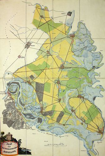
| Title | Plan des k. k. Czaikisten Grenz-Bataillons. |
| Main title | A Csajkás határezred térképe. |
799. Situation Umlegung des Teufelgrabens [S 101 - No. 725.]
National Archives of Hungary •
S 101 Abszolutizmuskori térképek (1849-1867)
•
S Kormányhatósági fondokból kiemelt térképek (17. sz.-20. sz.)
•
S – Térképtár

| Main title | Situation Umlegung des Teufelgrabens |
| Subject | No. 725. Az Ördögárok-patak (Budapest) |
800. Plan des Slavonischen Peterwardeiner Gränz Regiments. [B IX a 1331]
Institute and Museum of Military History •
B IX a
•
B IX Ausztria–Magyarország
•
B I–XV. Európa
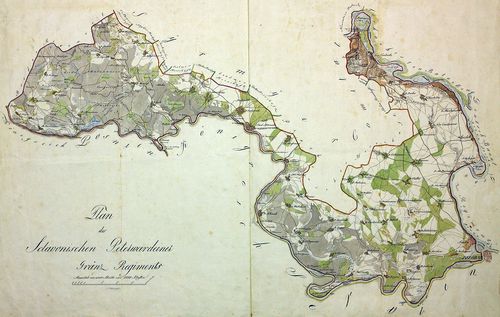
| Title | Plan des Slavonischen Peterwardeiner Gränz Regiments. |
| Main title | A szlavóniai Péterváradi határezred térképe. |