941. Strassenkarte des Brooser Kreises [S 105 - No. 264/4.]
National Archives of Hungary •
S 105 Erdélyi kormányhatósági levéltárból kiemelt térképek (1798-1868)
•
S Kormányhatósági fondokból kiemelt térképek (17. sz.-20. sz.)
•
S – Térképtár
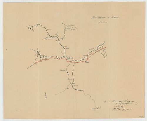
| Main title | Strassenkarte des Brooser Kreises |
| Subject | No. 264/4. A szászvárosi építési körzet |
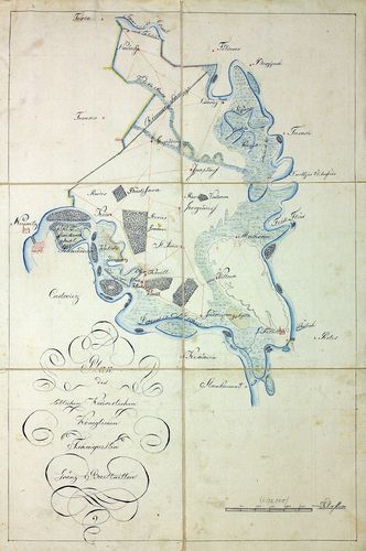
942. Ausmass nach Jochen, von 12. Hundert Quadrat Klaftern jedes,... [TK 196]
National Széchényi Library •
OSZK kéziratos térképek
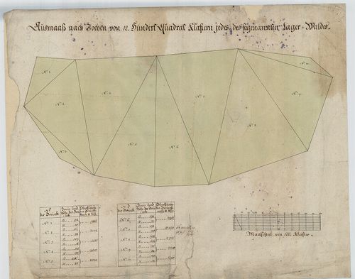
| Title | Ausmass nach Jochen, von 12. Hundert Quadrat Klaftern jedes, des sogenannten Lager-Waldes |
943. Marsch und Reise Karte des Oesterreichishcen Kaiserstaates. [B IX c 700]
Institute and Museum of Military History •
B IX c
•
B IX Ausztria–Magyarország
•
B I–XV. Európa
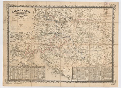
| Title | Marsch und Reise Karte des Oesterreichishcen Kaiserstaates. |
| Main title | Az Osztrák Császárság közlekedési térképe. |
944. Kreis-Atlas des Königreichs Böhmen. [B IX a 85]
Institute and Museum of Military History •
B IX a
•
B IX Ausztria–Magyarország
•
B I–XV. Európa
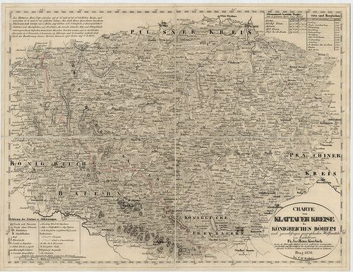
| Title | Kreis-Atlas des Königreichs Böhmen. |
| Main title | Csehország 16 kerületének térképe 1826–1834-ben. |
945. Plan des löblichen kaiserlichen königlichen Tschaikisten Gre... [B IX a 1335]
Institute and Museum of Military History •
B IX a
•
B IX Ausztria–Magyarország
•
B I–XV. Európa
| Title | Plan des löblichen kaiserlichen königlichen Tschaikisten Grenz-Bataillons. |
| Main title | A Csajkás határezred térképe. |
946. A moldvai csángók néprajzi térképe. – Carte Ethnographique d... [B IX c 606/1]
Institute and Museum of Military History •
B IX c
•
B IX Ausztria–Magyarország
•
B I–XV. Európa
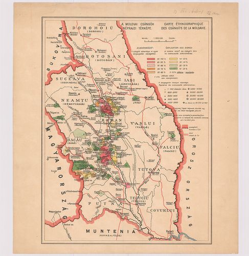
| Title | A moldvai csángók néprajzi térképe. – Carte Ethnographique des Csángó’s de la Moldavie. |
947. Plan des k. k. Czaikisten Grenz-Bataill. Bezirks. [B IX a 1338]
Institute and Museum of Military History •
B IX a
•
B IX Ausztria–Magyarország
•
B I–XV. Európa
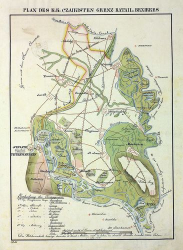
| Title | Plan des k. k. Czaikisten Grenz-Bataill. Bezirks. |
| Main title | A Csajkás határezred térképe. |
948. Geognostische Karte des Beckens von Wien… [B IX b 5]
Institute and Museum of Military History •
B IX b
•
B IX Ausztria–Magyarország
•
B I–XV. Európa
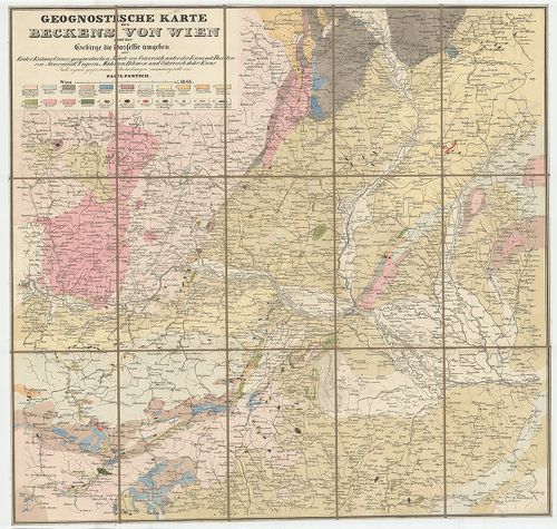
| Title | Geognostische Karte des Beckens von Wien… |
| Main title | Bécs környékének geológiai térképe 1843-ban. |
949. Schauplatz des russisch, türkischen Krieges. [B III a 42/1]
Institute and Museum of Military History •
B III a
•
B III Balkán-félsziget
•
B I–XV. Európa
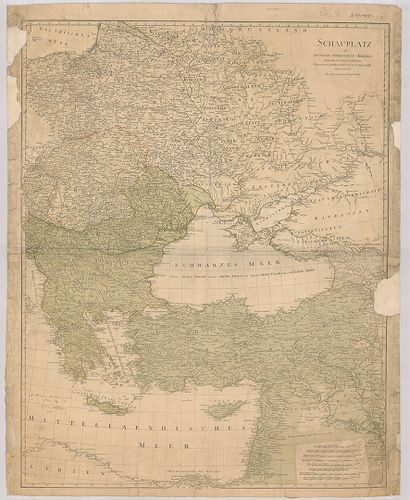
| Title | Schauplatz des russisch, türkischen Krieges. |
| Main title | Az orosz–török háború színtere 1787-ben. |
950. Reliefkarte des Salzkammergutes. Oberösterreich Salzkammerg... [B IX c 481/2]
Institute and Museum of Military History •
B IX c
•
B IX Ausztria–Magyarország
•
B I–XV. Európa
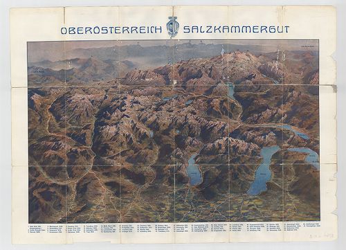
| Title | Reliefkarte des Salzkammergutes. Oberösterreich Salzkammergut. |
| Main title | Felső-Ausztria: Salzkammergut madártávlatos térképe 1900 körül. |
951. General Karte des Osmanischen Reichs. [B III a 42/4]
Institute and Museum of Military History •
B III a
•
B III Balkán-félsziget
•
B I–XV. Európa
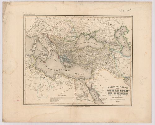
| Title | General Karte des Osmanischen Reichs. |
| Main title | A Török Birodalom általános térképe 1845-ben. |
952. Hypsometrische Übersichts Karte des Königreiches Böhmen. [B IX b 27]
Institute and Museum of Military History •
B IX b
•
B IX Ausztria–Magyarország
•
B I–XV. Európa
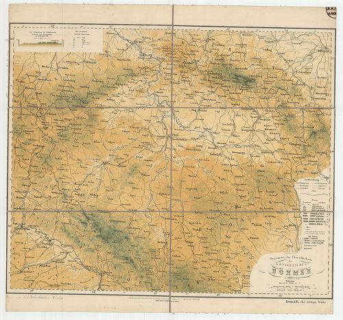
| Title | Hypsometrische Übersichts Karte des Königreiches Böhmen. |
| Main title | A Cseh Királyság hipszometrikus áttekintő térképe. |
953. Karte des Brooser-Baukreises [S 105 - No. 406/2.]
National Archives of Hungary •
S 105 Erdélyi kormányhatósági levéltárból kiemelt térképek (1798-1868)
•
S Kormányhatósági fondokból kiemelt térképek (17. sz.-20. sz.)
•
S – Térképtár
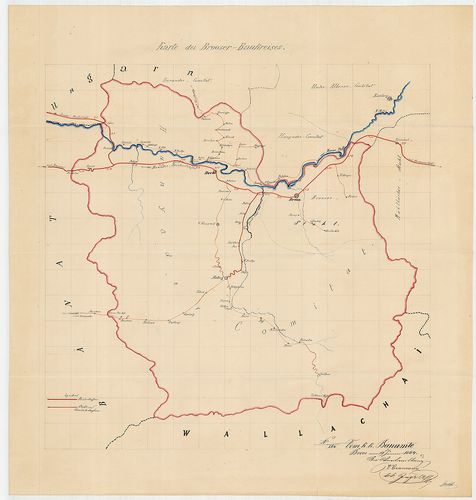
| Main title | Karte des Brooser-Baukreises |
| Subject | No. 406/2. A szászvárosi építési kerület |
954. Schub Plan des 6-ten Gendarmerie Regiments [S 114 - No. 17.]
National Archives of Hungary •
S 114 Múzeumi törzsanyag térképei (18. sz.-20. sz.)
•
S – Térképtár
| Main title | Schub Plan des 6-ten Gendarmerie Regiments |
| Subject | No. 17. 6. zsandárezred |
955. Marsch und Reise Karte des Oesterreichischen Kaiserstaates. [B IX c 78]
Institute and Museum of Military History •
B IX c
•
B IX Ausztria–Magyarország
•
B I–XV. Európa
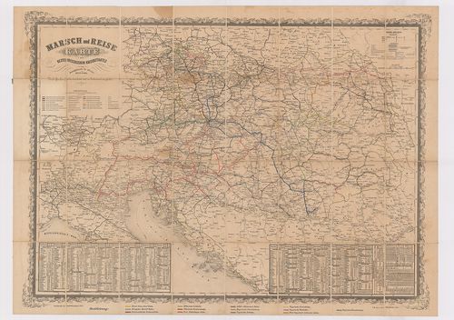
| Title | Marsch und Reise Karte des Oesterreichischen Kaiserstaates. |
| Main title | Az Osztrák Monarchia közlekedési térképe. |
956. Plan des Cameral Dorfs Terpes ... [S 11 - No. 135:1.]
National Archives of Hungary •
S 11 Kamarai térképek (1747-1882)
•
S Kormányhatósági fondokból kiemelt térképek (17. sz.-20. sz.)
•
S – Térképtár
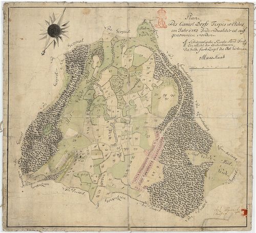
| Main title | Plan des Cameral Dorfs Terpes ... |
| Subject | No. 135:1. Terpes úrbéri térképe |
957. Karte des Ortlergebietes. [B IX b 56]
Institute and Museum of Military History •
B IX b
•
B IX Ausztria–Magyarország
•
B I–XV. Európa
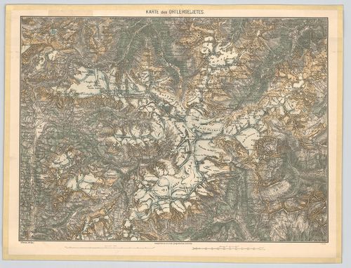
| Title | Karte des Ortlergebietes. |
| Main title | Az Ortler- hegység (Ortles, Ol.) részletes térképe 1876-ban. |
958. Karte des Riesen-Gebirgs. [B IX b 77]
Institute and Museum of Military History •
B IX b
•
B IX Ausztria–Magyarország
•
B I–XV. Európa
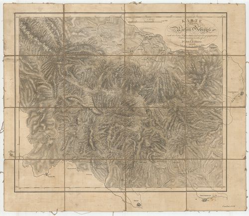
| Title | Karte des Riesen-Gebirgs. |
| Main title | A Karkonosze (Riesen-Gebirgs) hegység térképe 1806-ban. |
959. Rajzképe a Pest-Buda-Magyar Sz. k. Városokat az éjszaki Ferd... [S 75 - No. 79/1.]
National Archives of Hungary •
S 75 Nyomtatott térképek (19. sz.-20. sz.)
•
S – Térképtár
| Main title | Rajzképe a Pest-Buda-Magyar Sz. k. Városokat az éjszaki Ferdinánd Császár vasútnak összekaptsolása ... Szitányi-Ulmann Móritz Ur több T. N. Vármegyék Tábla Bírájától alapított Magyar Középponti Vaspályának |
| Subject | No. 79/1. Tervezett magyarországi vasútvonalak térképe |
Contributor: [...] C F unter der Leitung des amerik Eisenbahn Ober Ingenieur und des Königl Preuss Confalonieri Anton Oberlieut [...]
960. Nur für den Dienstgebrauch-Feldmässig hergestellte Fliegerka... [B XI a 54/4]
Institute and Museum of Military History •
B XI a
•
B XI Oroszország
•
B I–XV. Európa
| Title | Nur für den Dienstgebrauch-Feldmässig hergestellte Fliegerkarte. |
Technical features: H n 1916 17 Abteilung des Stellvertretenden Generalstabes der Armee