521. Übersichtskarte von Ostpreussen, Kurland und den angrenzende... [B IV c 130]
Institute and Museum of Military History •
B IV c
•
B IV Német birodalom
•
B I–XV. Európa
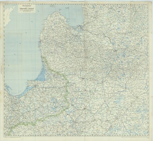
| Title | Übersichtskarte von Ostpreussen, Kurland und den angrenzenden Gebieten. |
| Main title | Kelet-Poroszország, Lettország és Litvánia áttekintő térképe a vasútvonalak feltüntetésével. |
522. Wegkarte von Württemberg. Nördliche Hälfte. [B IV c 154]
Institute and Museum of Military History •
B IV c
•
B IV Német birodalom
•
B I–XV. Európa
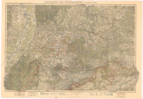
| Title | Wegkarte von Württemberg. Nördliche Hälfte. |
| Main title | Württemberg úttérképe 1929-ben. |
523. Völker und Sprachen-Karte von Deutschland und den Nachbarlän... [B IV c 157]
Institute and Museum of Military History •
B IV c
•
B IV Német birodalom
•
B I–XV. Európa
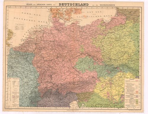
| Title | Völker und Sprachen-Karte von Deutschland und den Nachbarländern. |
| Main title | Németország nemzetiségi és anyanyelv szerinti népesség-térképe. |
524. Sprachenkarte der Deutschen Ostmarken. [B IV c 160]
Institute and Museum of Military History •
B IV c
•
B IV Német birodalom
•
B I–XV. Európa
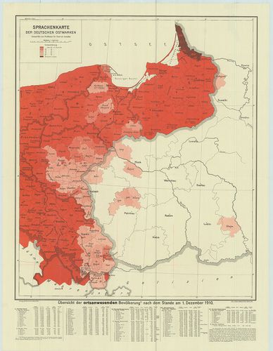
| Title | Sprachenkarte der Deutschen Ostmarken. |
| Main title | Németország keleti részének nemzetiségi térképe anyanyelv szerint 1910. dec. 1-jén. |
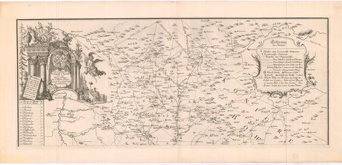
525. Geographische Mauth-Charte von Bae˙ern … [B IV c 167]
Institute and Museum of Military History •
B IV c
•
B IV Német birodalom
•
B I–XV. Európa

| Title | Geographische Mauth-Charte von Bae˙ern … |
| Main title | Bajorország vámtérképe 1764-ben. |
526. Geographische Mauth-Carthe von dem Herzogthum der Ober Pfalz... [B IV c 168]
Institute and Museum of Military History •
B IV c
•
B IV Német birodalom
•
B I–XV. Európa
| Title | Geographische Mauth-Carthe von dem Herzogthum der Ober Pfalz und der Landgrafschaft Leuchtenburg. |
| Main title | Felső-Pfalz hercegség Leuchtenberg grófság vámhálózati térképe 1769-ben. |
527. Karte Der im Jahre 1802 gemessenen Basis in der Richtung vom... [B IV c 177]
Institute and Museum of Military History •
B IV c
•
B IV Német birodalom
•
B I–XV. Európa
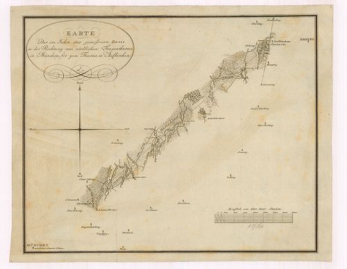
| Title | Karte Der im Jahre 1802 gemessenen Basis in der Richtung vom nördlichen Frauenthurme in München bis zum Thurme in Aufkirchen. |
| Main title | Iránymérés München északi Frauen-toronyból az Aufkirchen-i templomtoronyra 1801-ben. |
528. Reise-Karte von Schwaben mit angezeigten Chausseen und Stras... [B IV c 181]
Institute and Museum of Military History •
B IV c
•
B IV Német birodalom
•
B I–XV. Európa
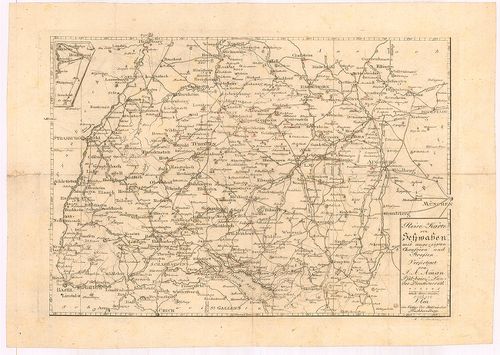
| Title | Reise-Karte von Schwaben mit angezeigten Chausseen und Strassen. |
| Main title | A Svábföld úthálózati térképe 1824-ben. |
529. Übersichtsblatt für die Einfügung einer Gruppe von Nivelleme... [B IV c 188]
Institute and Museum of Military History •
B IV c
•
B IV Német birodalom
•
B I–XV. Európa
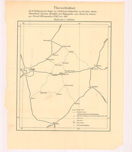
| Title | Übersichtsblatt für die Einfügung einer Gruppe von Nivellements-Festpunkten an der Linie Berlin-Manschnow zwischen Herzfelde und Hoppegarten zum Ersatz bis bisherigen Normál-Höhenpunktes. (N. H.) von 1879. |
| Main title | Áttekintőtérkép a Berlin–Manschnow közötti szintezési menetről 1879-ben. |
530. Karte der Urlaubergebiete Deutschland für Urlauber des Westh... [B IV c 189]
Institute and Museum of Military History •
B IV c
•
B IV Német birodalom
•
B I–XV. Európa
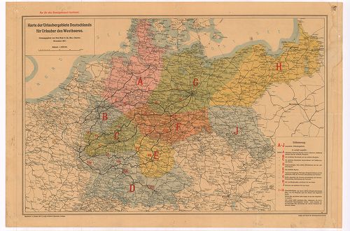
| Title | Karte der Urlaubergebiete Deutschland für Urlauber des Westheeres. |
| Main title | Németország szabadságolási térképe a nyugati véderő tagjai számára 1917-ben. |
531. Charte vom Taunus und seinen Heilquellen. – Carte du Taunus ... [B IV c 189/1]
Institute and Museum of Military History •
B IV c
•
B IV Német birodalom
•
B I–XV. Európa
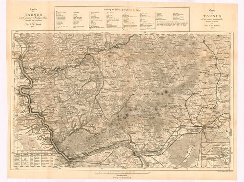
| Title | Charte vom Taunus und seinen Heilquellen. – Carte du Taunus et ses eaux minerales. |
| Main title | A Taunus-hegység gyógyforrásainak térképe. |
532. Allemagne Du Sud et Autriche Grands Itinéraires pour Automob... [B IV c 190]
Institute and Museum of Military History •
B IV c
•
B IV Német birodalom
•
B I–XV. Európa
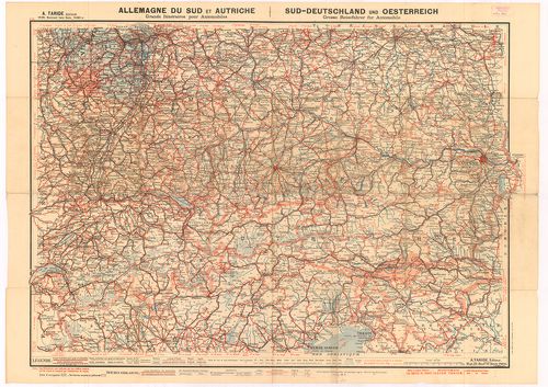
| Title | Allemagne Du Sud et Autriche Grands Itinéraires pour Automobiles. Sud-Deutschland und Oesterreich Grosse Reisefurhrer fur Automobile. |
| Main title | Dél-Németország és Ausztria út-vasúthálózati térképe. |
533. Allemagne Du Nord Grands Itinéraires pour Automobiles. – Nor... [B IV c 191/2]
Institute and Museum of Military History •
B IV c
•
B IV Német birodalom
•
B I–XV. Európa
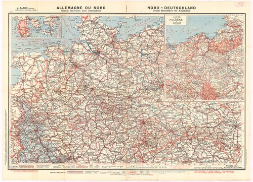
| Title | Allemagne Du Nord Grands Itinéraires pour Automobiles. – Nord-Deutschland Grosse Reiseführer für Automobile. Nr. 36. |
| Main title | Mt.: Carte de la Pologne á Berlin. (Úthálózati térkép Berlinből Lengyelország felé.) |
| Subject | Észak-Németország út-vasúthálózati térképe. |
534. Historische Karte von Elsass und Lothringen zur Uebersicht d... [B IV c 203]
Institute and Museum of Military History •
B IV c
•
B IV Német birodalom
•
B I–XV. Európa
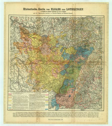
| Title | Historische Karte von Elsass und Lothringen zur Uebersicht der territorialen Veränderungen im 17. und 18. Jahrhundert. |
| Main title | Elszász-Lotharingia történelmi térképe. |
535. Post und Reise-Karte von Deutschland und den Nachbar Staaten... [B IV c 205]
Institute and Museum of Military History •
B IV c
•
B IV Német birodalom
•
B I–XV. Európa
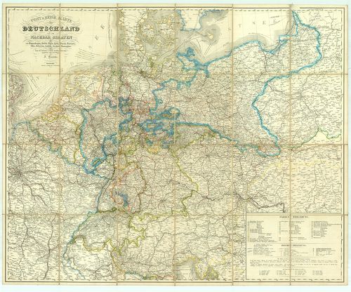
| Title | Post und Reise-Karte von Deutschland und den Nachbar Staaten bis Kopenhagen, Dover, Paris, Lyon, Turin, Ferrara, Ofen, Debrecin, Lublin, Grodno, Tauroggen. |
| Main title | Németország posta és úthálózati térképe. |
536. General-Karte von Westlichen Russland nebst Preussen, Posen ... [B IV c 206]
Institute and Museum of Military History •
B IV c
•
B IV Német birodalom
•
B I–XV. Európa
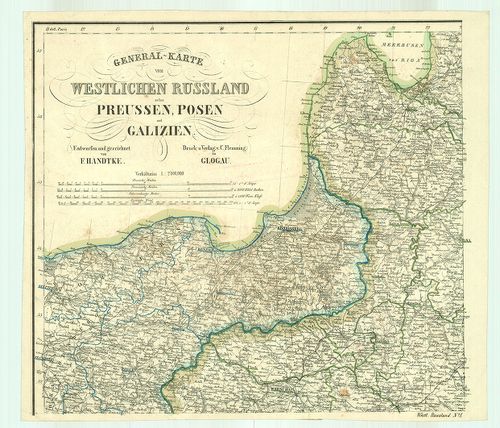
| Title | General-Karte von Westlichen Russland nebst Preussen, Posen und Galizien. |
| Main title | Mt.: (Warszawa és környéke.) |
| Subject | Nyugat-Oroszország–Poroszország–Poznan és Galicia általános térképe úthálózattal. |
537. Pharus-Reisekarte von Deutschland. [B IV c 208]
Institute and Museum of Military History •
B IV c
•
B IV Német birodalom
•
B I–XV. Európa
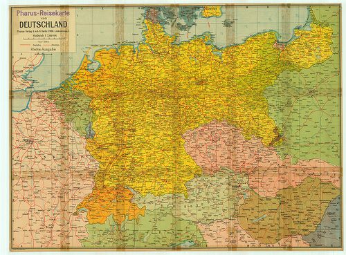
| Title | Pharus-Reisekarte von Deutschland. |
| Main title | Németország úttérképe. |
538. Eduard Gaebler’s Verkehrskarte des Deutschen Reichs. Zur Übe... [B IV c 209]
Institute and Museum of Military History •
B IV c
•
B IV Német birodalom
•
B I–XV. Európa
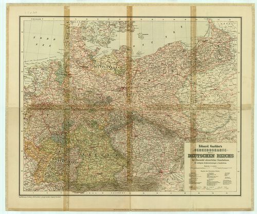
| Title | Eduard Gaebler’s Verkehrskarte des Deutschen Reichs. Zur Übersichts sämmtlicher Eisenbahnen… |
| Main title | A Német Birodalom közlekedési térképe 1934-ben. |
539. Allgemeine Ubersicht des nordwestlichen Kriegsschauplatzes. [B IV c 211]
Institute and Museum of Military History •
B IV c
•
B IV Német birodalom
•
B I–XV. Európa
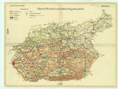
| Title | Allgemeine Ubersicht des nordwestlichen Kriegsschauplatzes. |
| Main title | Az európai ÉNY-i hadszíntér áttekintőtérképe 1899/1890-ben. |
540. Németország [B IV c 212]
Institute and Museum of Military History •
B IV c
•
B IV Német birodalom
•
B I–XV. Európa
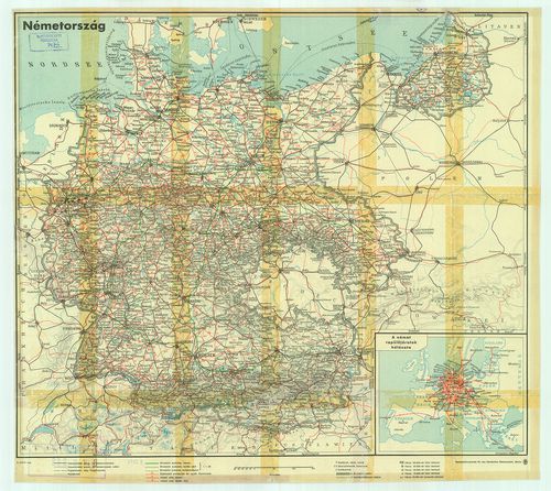
| Title | Németország |
| Main title | Mt.: A német repülőjáratok hálózata. |
| Subject | Németország út-vasúthálózati térképe. |