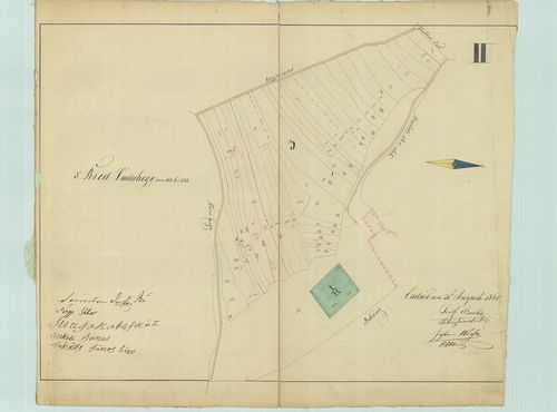
61. II Ortsried von L. Z. bis 1 [SML XV 2 balatonendred 02]
Somogy County Archives •
Somogy megye kéziratos térképei
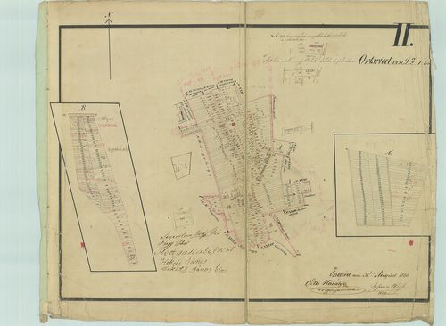
| Main title | II Ortsried von L. Z. bis 1 |
| Subject | Balatonendréd belterületének térképe |
62. III Ried N II Varihegy L. Z. 509. bis 557 [SML XV 2 balatonendred 03]
Somogy County Archives •
Somogy megye kéziratos térképei
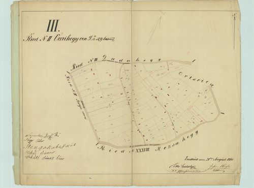
| Main title | III Ried N II Varihegy L. Z. 509. bis 557 |
| Subject | Balatonendréd Várihegy egy részének térképe |
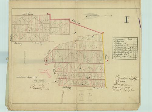
63. Ried Dudahegy von 558. bis 588 [SML XV 2 balatonendred 04]
Somogy County Archives •
Somogy megye kéziratos térképei
| Main title | Ried Dudahegy von 558. bis 588 |
| Subject | Balatonendréd, Dudahegy térképe |
64. V [SML XV 2 balatonendred 05]
Somogy County Archives •
Somogy megye kéziratos térképei
| Main title | V |
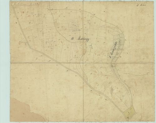
| Subject | Balatonendréd, 4–11. dűlők térképe |
65. VI [SML XV 2 balatonendred 06]
Somogy County Archives •
Somogy megye kéziratos térképei
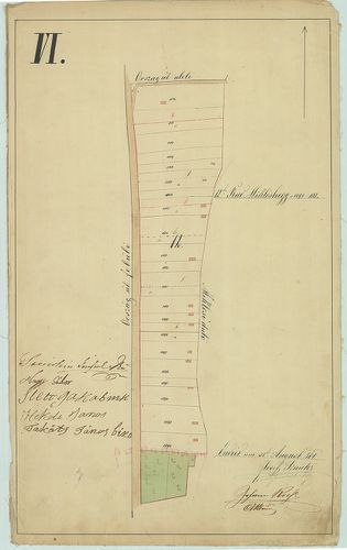
| Main title | VI |
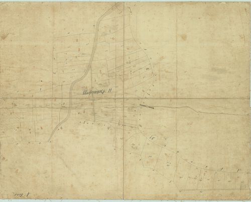
| Subject | Balatonendréd. 12. Miklóshegy dűlő térképe |
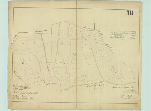
66. VII [SML XV 2 balatonendred 07]
Somogy County Archives •
Somogy megye kéziratos térképei
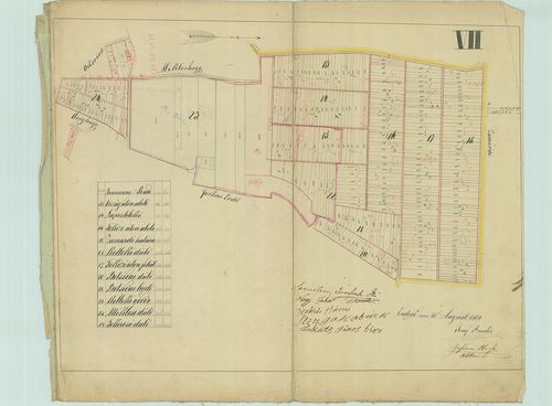
| Main title | VII |
| Subject | Balatonendréd, 13–24. dűlők térképe |
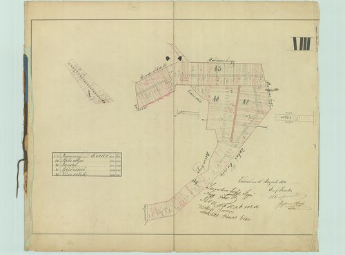
67. VIII [SML XV 2 balatonendred 08]
Somogy County Archives •
Somogy megye kéziratos térképei
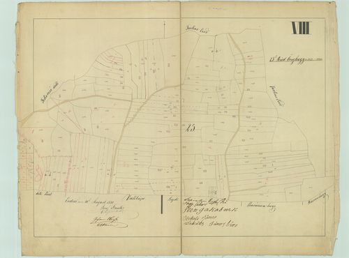
| Main title | VIII |
| Subject | Balatonendréd, 25. Öreghegy dűlő térképe |
68. IX [SML XV 2 balatonendred 09]
Somogy County Archives •
Somogy megye kéziratos térképei
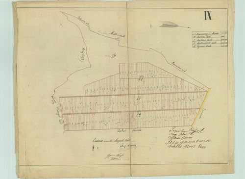
| Main title | IX |
| Subject | Balatonendréd, 26–29. dűlők térképe |
69. X [SML XV 2 balatonendred 10]
Somogy County Archives •
Somogy megye kéziratos térképei
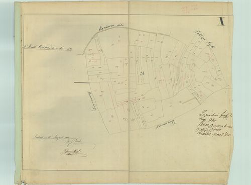
| Main title | X |
| Subject | Balatonendréd, 32. Karáncza dűlő térképe |
70. XI [SML XV 2 balatonendred 11]
Somogy County Archives •
Somogy megye kéziratos térképei

| Main title | XI |
| Subject | Balatonendréd, 33–36. dűlők térképe |
71. XII [SML XV 2 balatonendred 12]
Somogy County Archives •
Somogy megye kéziratos térképei
| Main title | XII |
| Subject | Balatonendréd, 37. Cziczevár és 38. Rózsahegy dűlők térképe |
72. XIII [SML XV 2 balatonendred 13]
Somogy County Archives •
Somogy megye kéziratos térképei
| Main title | XIII |
| Subject | Balatonendréd, 39–43. dűlők térképe |
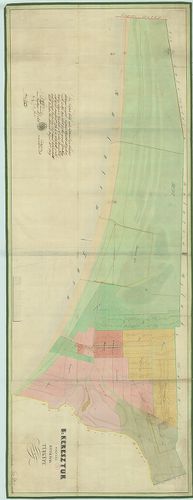
73. Mappa Possessionis Balaton Keresztúr urbarialiter regulate a... [SML XV 2 b U 019]
Somogy County Archives •
Somogy megye kéziratos térképei
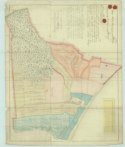
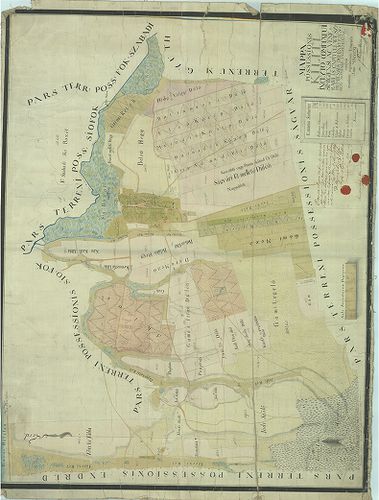
| Main title | Mappa Possessionis Balaton Keresztúr urbarialiter regulate anno 1805 |
| Subject | Balatonkeresztúr térképe |
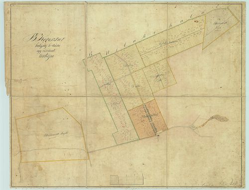
74. B: Keresztur helység határának térképe [SML XV 2 b U 015]
Somogy County Archives •
Somogy megye kéziratos térképei
| Main title | B: Keresztur helység határának térképe |
| Subject | Balatonkeresztúr kiosztási térképe |
75. B: Keresztur helység határa egy részének térképe [SML XV 2 balatonkeresztur 01]
Somogy County Archives •
Somogy megye kéziratos térképei
| Main title | B: Keresztur helység határa egy részének térképe |
| Subject | Balatonkeresztúr egy részének térképe |
76. Belterület [SML XV 2 balatonkeresztur 02]
Somogy County Archives •
Somogy megye kéziratos térképei
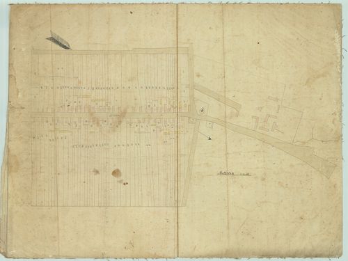
| Main title | Belterület |
| Subject | Balatonkeresztúr belterületének térképe |
77. 2. vázlat [SML XV 2 balatonkeresztur 03]
Somogy County Archives •
Somogy megye kéziratos térképei
| Main title | 2. vázlat |
| Subject | Balatonkeresztúr, Somogy megyei helység 1., 4–8. dűlőinek térképe |
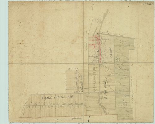
78. 3. vázlat [SML XV 2 balatonkeresztur 04]
Somogy County Archives •
Somogy megye kéziratos térképei
| Main title | 3. vázlat |
| Subject | Balatonkeresztúr, Somogy megyei helység 10. Alsóhegy és 11. Kenderföld dűlőinek térképe |
79. 4. vázlat [SML XV 2 balatonkeresztur 05]
Somogy County Archives •
Somogy megye kéziratos térképei
| Main title | 4. vázlat |
| Subject | Balatonkeresztúr, 12. Bokroshegy dűlő térképe |
80. Mappa Possessionis Kiliti [SML XV 2 b U 226]
Somogy County Archives •
Somogy megye kéziratos térképei
| Main title | Mappa Possessionis Kiliti |
| Subject | Kiliti térképe |