1501. Oberamtskarte Münsingen. [B IV a 1007]
Institute and Museum of Military History •
B IV a
•
B IV Német birodalom
•
B I–XV. Európa
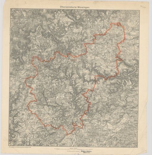
| Title | Oberamtskarte Münsingen. |
| Main title | Münsingen-kerület (Németo.) topográfiai térképe 1934-ben. |
1502. Oberamtskarte Ulm. [B IV a 1008]
Institute and Museum of Military History •
B IV a
•
B IV Német birodalom
•
B I–XV. Európa
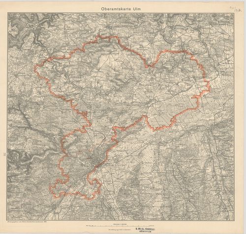
| Title | Oberamtskarte Ulm. |
| Main title | Ulm-kerület (Németo.) topográfiai térképe 1934-ben. |
1503. Oberamtskarte Urach. [B IV a 1009]
Institute and Museum of Military History •
B IV a
•
B IV Német birodalom
•
B I–XV. Európa
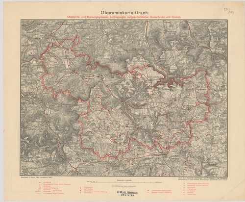
| Title | Oberamtskarte Urach. |
| Main title | Oberamts und Markungsgrenzen Eintragungen vorgeschtlicher Bodenfunde und Strassen. |
| Subject | Urach-kerület (Németo.) térképe a régészeti lelőhelyek és utak berajzolásával 1932-ben. |
1504. Heilbronn – Hall – Mergentheim. Blatt I. [B IV a 1011]
Institute and Museum of Military History •
B IV a
•
B IV Német birodalom
•
B I–XV. Európa
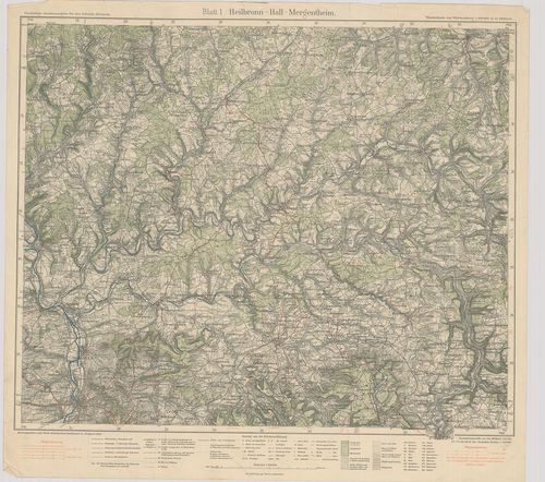
| Title | Heilbronn – Hall – Mergentheim. Blatt I. |
| Main title | Heilbronn–Hall–Mergentheim közötti terület (Németo.) térképe 1928-ban. |
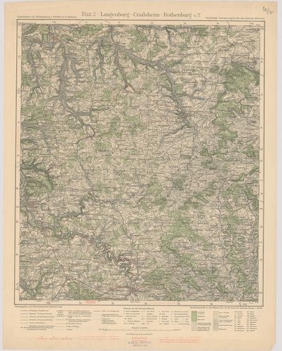
1505. Langenburg–Crailsheim–Rothenburg. Blatt 2. [B IV a 1012]
Institute and Museum of Military History •
B IV a
•
B IV Német birodalom
•
B I–XV. Európa
| Title | Langenburg–Crailsheim–Rothenburg. Blatt 2. |
| Main title | Langenburg–Crailsheim–Rothenburg közötti terület (Németo.) topográfiai térképe 1932-ben. |
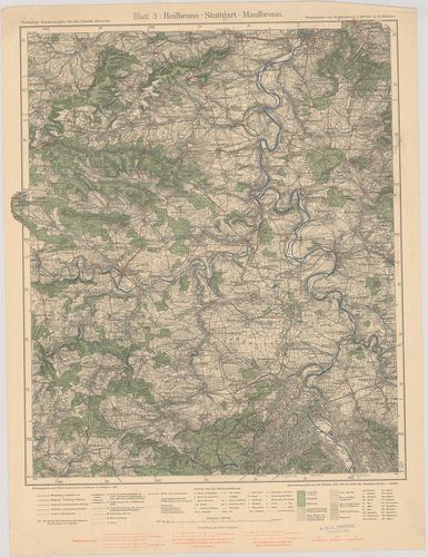
1506. Heilbronn–Stuttgart–Maulbronn. Blatt 3. [B IV a 1013]
Institute and Museum of Military History •
B IV a
•
B IV Német birodalom
•
B I–XV. Európa
| Title | Heilbronn–Stuttgart–Maulbronn. Blatt 3. |
| Main title | Heiilbronn–Stuttgart–Maulbronn közötti terület (Németo.) topográfiai térképe 1931-ben. |
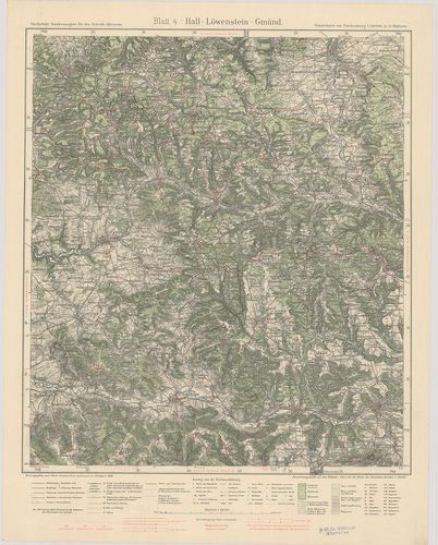
1507. Hall–Löwenstein–Gmünd. Blatt 4. [B IV a 1014]
Institute and Museum of Military History •
B IV a
•
B IV Német birodalom
•
B I–XV. Európa
| Title | Hall–Löwenstein–Gmünd. Blatt 4. |
| Main title | Hall–Löwenstein–Gmünd közötti terület (Németo.) topográfiai térképe 1930-ban. |
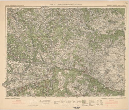
1508. Crailsheim–Gmünd–Nördlingen. Blatt 5. [B IV a 1015]
Institute and Museum of Military History •
B IV a
•
B IV Német birodalom
•
B I–XV. Európa
| Title | Crailsheim–Gmünd–Nördlingen. Blatt 5. |
| Main title | Crailsheim–Gmünd–Nördlingen közötti terület (Németo.) topográfiai térképe 1933-ban. |
1509. Stuttgart–Herrenberg–Reutlingen. Blatt 7. [B IV a 1017]
Institute and Museum of Military History •
B IV a
•
B IV Német birodalom
•
B I–XV. Európa
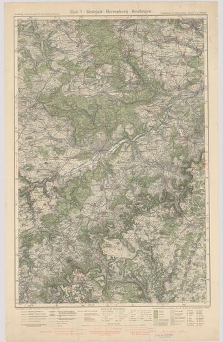
| Title | Stuttgart–Herrenberg–Reutlingen. Blatt 7. |
| Main title | Stuttgart–Herrenberg–Reutlingen közötti terület (Németo.) topográfiai térképe 1930-ban. |
1510. Göppingen–Urach–Blaubeuren. Blatt 8. [B IV a 1018]
Institute and Museum of Military History •
B IV a
•
B IV Német birodalom
•
B I–XV. Európa
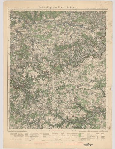
| Title | Göppingen–Urach–Blaubeuren. Blatt 8. |
| Main title | Göppingen–Urach–Blaubeuren közötti terület (Németo.) topográfiai térképe 1934-ben. |
1511. Neresheim–Geislingen–Ulm. Blatt 9. [B IV a 1019]
Institute and Museum of Military History •
B IV a
•
B IV Német birodalom
•
B I–XV. Európa
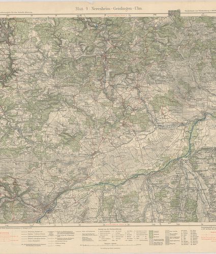
| Title | Neresheim–Geislingen–Ulm. Blatt 9. |
| Main title | Neresheim–Geislingen–Ulm közötti terület (Németo.) topográfiai térképe 1929-ben. |
1512. Sulz–Schramberg–Tuttlingen. Blatt 10. [B IV a 1020]
Institute and Museum of Military History •
B IV a
•
B IV Német birodalom
•
B I–XV. Európa
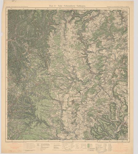
| Title | Sulz–Schramberg–Tuttlingen. Blatt 10. |
| Main title | Sulz–Schramberg–Tuttlingen közötti terület (Németo.) topográfiai térképe 1931-ben. |
1513. Hechingen–Tuttlingen–Sigmaringen. Blatt 11. [B IV a 1021]
Institute and Museum of Military History •
B IV a
•
B IV Német birodalom
•
B I–XV. Európa
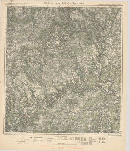
| Title | Hechingen–Tuttlingen–Sigmaringen. Blatt 11. |
| Main title | Hechingen–Tuttlingen–Sigmaringen közötti terület (Németo.) topográfiai térképe 1929-ben. |
1514. Ehingen–Riedlingen–Biberach. Blatt 12. [B IV a 1022]
Institute and Museum of Military History •
B IV a
•
B IV Német birodalom
•
B I–XV. Európa
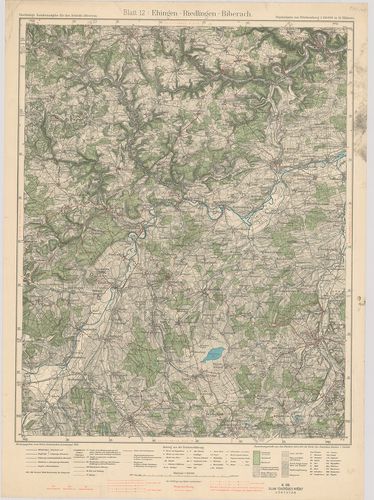
| Title | Ehingen–Riedlingen–Biberach. Blatt 12. |
| Main title | Ehingen–Riedlingen–Biberach közötti terület (Németo.) topográfiai térképe 1934-ben. |
1515. Ulm–Laupheim–Memmingen. Blatt 13. [B IV a 1023]
Institute and Museum of Military History •
B IV a
•
B IV Német birodalom
•
B I–XV. Európa
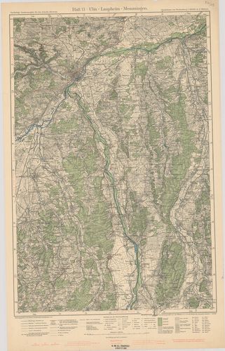
| Title | Ulm–Laupheim–Memmingen. Blatt 13. |
| Main title | Ulm–Laupheim–Memmingen közötti terület (Németo.) topográfiai térképe 1933-ban. |
1516. Waldsee–Friedrichshafen–Bregenz. Blatt 14. [B IV a 1024]
Institute and Museum of Military History •
B IV a
•
B IV Német birodalom
•
B I–XV. Európa
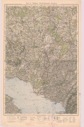
| Title | Waldsee–Friedrichshafen–Bregenz. Blatt 14. |
| Main title | Waldsee–Friedrichshafen–Bregenz közötti terület (Németo.) topográfiai térképe 1928-ban. |
1517. Memmingen–Wangen–Kempten. Blatt 15. [B IV a 1025]
Institute and Museum of Military History •
B IV a
•
B IV Német birodalom
•
B I–XV. Európa
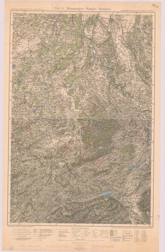
| Title | Memmingen–Wangen–Kempten. Blatt 15. |
| Main title | Memmingen–Wangen–Kempten közötti terület (Németo.) topográfiai térképe 1932-ben. |
1518. Unterland I. Heilbronn–Heidelberg. Unterland II. Ellwagen–Ha... [B IV a 1026]
Institute and Museum of Military History •
B IV a
•
B IV Német birodalom
•
B I–XV. Európa
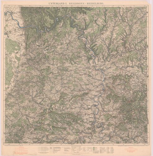
| Title | Unterland I. Heilbronn–Heidelberg. Unterland II. Ellwagen–Hall–Rothenburg o. d. t. |
| Main title | Heilbronn–Heidelberg és Ellwagen–Hall–Rothenburg o.d.t. közötti terület (Németo.) topográfiai térképe 1927-ben. |
1519. Topogr.[aphische] Übersichtskarte des Deutschen Reiches. Bam... [B IV a 1050]
Institute and Museum of Military History •
B IV a
•
B IV Német birodalom
•
B I–XV. Európa
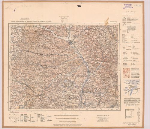
| Title | Topogr.[aphische] Übersichtskarte des Deutschen Reiches. Bamberg 153. |
| Main title | Németország: Bamberg környékének topográfiai áttekintő térképe 1940-ben. |
1520. Germany. Salzburg Sheet N. 48. – Köln Sheet K. 51. [B IV a 1051]
Institute and Museum of Military History •
B IV a
•
B IV Német birodalom
•
B I–XV. Európa
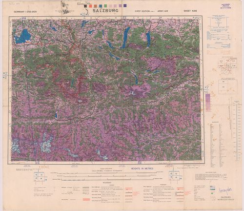
| Title | Germany. Salzburg Sheet N. 48. – Köln Sheet K. 51. |
| Main title | Németország: Salzburg (48.) és Köln (51) 1:250 000 ma. lapok. |