2081. Hypsometrische Karte von Mittel-Italien. [B VII b 4]
Institute and Museum of Military History •
B VII b
•
B VII Olaszország
•
B I–XV. Európa
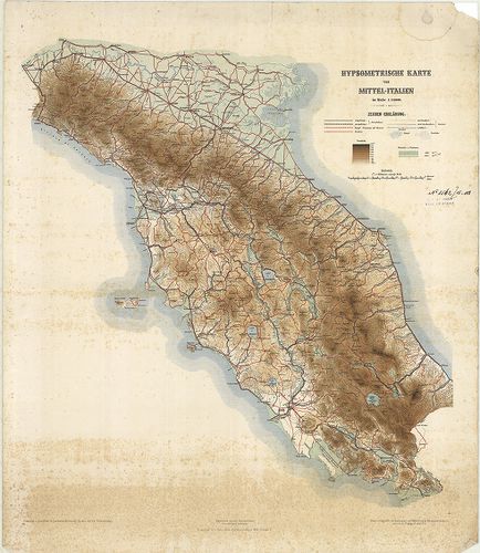
| Title | Hypsometrische Karte von Mittel-Italien. |
| Main title | Közép-Olaszország hipszometrikus térképe 1882 körül. |
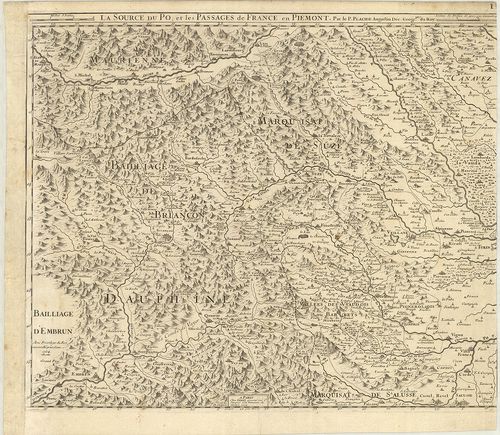
2082. Carte des Alpes relative á la guerre de 1792. [B VII b 6/1]
Institute and Museum of Military History •
B VII b
•
B VII Olaszország
•
B I–XV. Európa
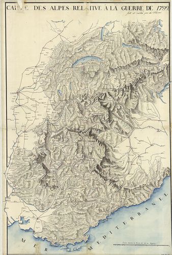
| Title | Carte des Alpes relative á la guerre de 1792. |
| Main title | Az Alpok térképe 1792-ben. |
2083. Rundschau von Luschari-Berge. I.–II. Blatt. [B VII b 14]
Institute and Museum of Military History •
B VII b
•
B VII Olaszország
•
B I–XV. Európa

| Title | Rundschau von Luschari-Berge. I.–II. Blatt. |
| Main title | A Luschari-hegy madártávlatos képe 1889-ben. |
2084. Karte der Marmolatagruppe. [B VII b 16]
Institute and Museum of Military History •
B VII b
•
B VII Olaszország
•
B I–XV. Európa
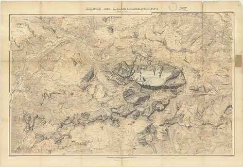
| Title | Karte der Marmolatagruppe. |
| Main title | A Marmolada-hegycsoport térképe 1905-ben. |
2085. Riviera da Nervi a Voltri. [B VII b 19]
Institute and Museum of Military History •
B VII b
•
B VII Olaszország
•
B I–XV. Európa
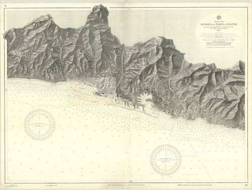
| Title | Riviera da Nervi a Voltri. |
| Main title | Nervi és Voltri közötti partszakasz hajózási térképe. |
2086. Gruppo di Brenta. Carte delle zone Turistiche d’Italia. [B VII b 20]
Institute and Museum of Military History •
B VII b
•
B VII Olaszország
•
B I–XV. Európa
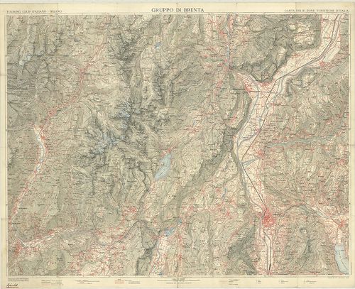
| Title | Gruppo di Brenta. Carte delle zone Turistiche d’Italia. |
| Main title | A Brenta hegycsoport és tágabb környékének térképe az 1920-as években. |
2087. Il Vesuvio. [B VII b 27]
Institute and Museum of Military History •
B VII b
•
B VII Olaszország
•
B I–XV. Európa
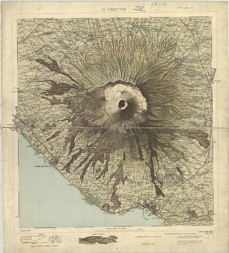
| Title | Il Vesuvio. |
| Main title | A Vezúv és környékének térképe 1908-ban. |
2088. Carta Idrografica Stradale Amministrativa Consorziale della ... [B VII b 29]
Institute and Museum of Military History •
B VII b
•
B VII Olaszország
•
B I–XV. Európa
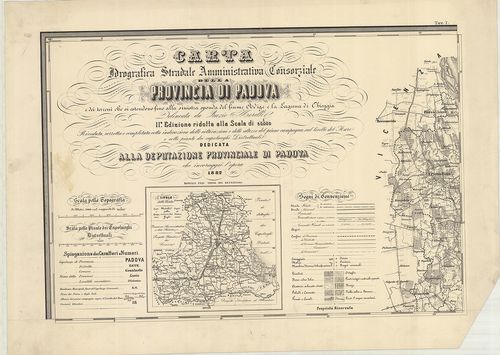
| Title | Carta Idrografica Stradale Amministrativa Consorziale della Provincia di Padova… |
| Main title | 8 mt.: 1. Cittadella. 2. Camposampiero. 3. Monselice. 4. Montagnana. 5. Este. 6. Padova. 7. Conselve. 8. Piove. |
| Subject | Padova tartományvízrajzi, út- és közigazgatási térképe 1882-ben. |
2089. Icon sinus Baiarum uti nunc videtur… [B VII b 35/10]
Institute and Museum of Military History •
B VII b
•
B VII Olaszország
•
B I–XV. Európa
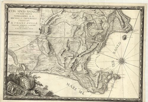
| Title | Icon sinus Baiarum uti nunc videtur… |
| Main title | A Pozzuoli-öböl (Nápolytól Ny-ra) térképe az 1720-as évek körül. |
2090. Plan du Golfe de la Spezia Côtes d’ Italia. (Duché de Génes)... [B VII b 35/13]
Institute and Museum of Military History •
B VII b
•
B VII Olaszország
•
B I–XV. Európa
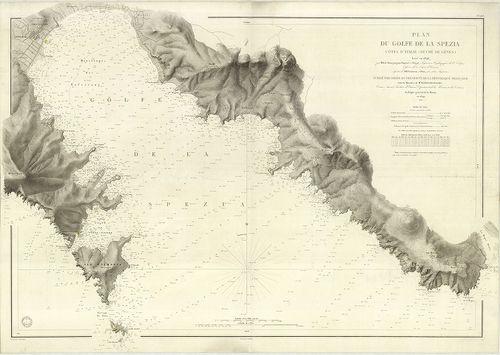
| Title | Plan du Golfe de la Spezia Côtes d’ Italia. (Duché de Génes). |
| Main title | A Speziai-öböl térképe 1846–67-ben. |
2091. Laguna Veneta. Mappa topografica. [B VII b 36/2]
Institute and Museum of Military History •
B VII b
•
B VII Olaszország
•
B I–XV. Európa
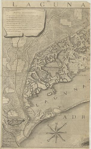
| Title | Laguna Veneta. Mappa topografica. |
| Main title | Mt.: [Venezia.] |
| Subject | A Velence-i laguna topográfiai térképe 1780-ban. |
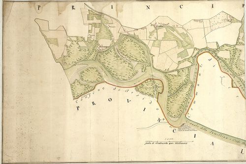
2092. Plan des Adda-Flus[s], von Trezzo bis zu dem Einflus[s] in P... [B VII b 37]
Institute and Museum of Military History •
B VII b
•
B VII Olaszország
•
B I–XV. Európa
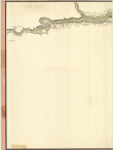
| Title | Plan des Adda-Flus[s], von Trezzo bis zu dem Einflus[s] in Poo dessen Lauff sich durch das Mailendische und Lodisanische erstrecket. |
| Main title | Az Adda folyó és közvetlen környéke (Trezzo-tól a Pó-ig.) 1750 körül. |
2093. Mittelmeer Westküste von Italien Capo Circeo bis Capo Palinu... [B VII b 38]
Institute and Museum of Military History •
B VII b
•
B VII Olaszország
•
B I–XV. Európa
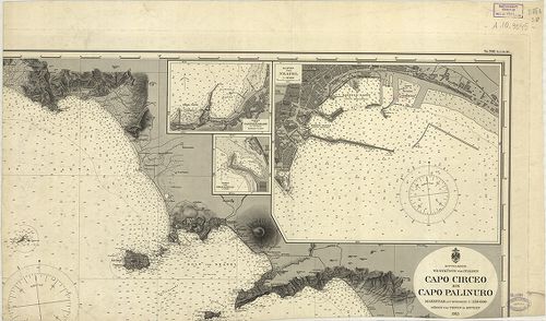
| Title | Mittelmeer Westküste von Italien Capo Circeo bis Capo Palinuro. Nr. 506. (Tit. V. Nr. 94.) |
| Main title | 3 mt.: 1. Hafen von Neapel (a Nápoly-i kikötő). |
| Subject | 2. Hafen von Castellamare di Stabia. |
2094. Dissegno fatto per le Regolation della Piaue et altri Fiumi ... [B VII b 68]
Institute and Museum of Military History •
B VII b
•
B VII Olaszország
•
B I–XV. Európa
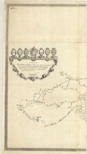
| Title | Dissegno fatto per le Regolation della Piaue et altri Fiumi … |
| Main title | A Piave és a betorkolló folyók szabályozásának térképe 1633–39-ben. |
2095. Corso del Po per la Lombardia dalle sve fonti sino al Mare… [B VII b 72]
Institute and Museum of Military History •
B VII b
•
B VII Olaszország
•
B I–XV. Európa
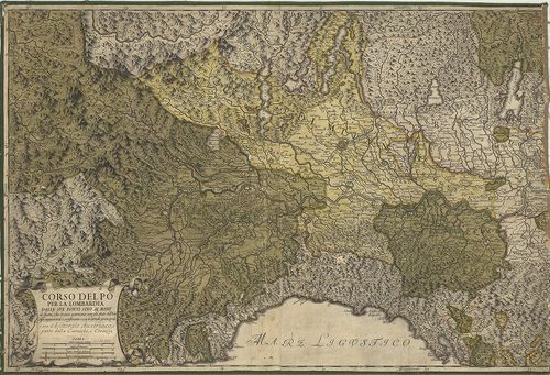
| Title | Corso del Po per la Lombardia dalle sve fonti sino al Mare… |
| Main title | A Pó-síkság és a környező részek térképe 1733-ban. |
2096. Mappa del Corso e stato presentaneo del fiume Po in Vicinanz... [B VII b 74]
Institute and Museum of Military History •
B VII b
•
B VII Olaszország
•
B I–XV. Európa
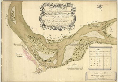
| Title | Mappa del Corso e stato presentaneo del fiume Po in Vicinanza della Citta di Cremona … Közreműködött: Bernardino Mazzoni–Adamo du Ponte … |
| Main title | A Pó és környéke Cremona közelében 1726–28-ban. |
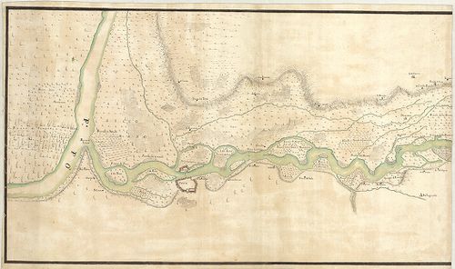
2097. Le Cours du Po. [B VII b 80]
Institute and Museum of Military History •
B VII b
•
B VII Olaszország
•
B I–XV. Európa
| Title | Le Cours du Po. |
| Main title | A Pó és környékének térképe 1703–1734-ben. |
2098. Dissegno delle valli et Isole del fiume Ticino delli 15 otto... [B VII b 103]
Institute and Museum of Military History •
B VII b
•
B VII Olaszország
•
B I–XV. Európa
| Title | Dissegno delle valli et Isole del fiume Ticino delli 15 ottobre 1681. |
| Main title | A Ticino folyó térképe 1681–1714-ben. |
2099. Corso del Fiume Ticino dal Porto di Parasacco sino alla sboc... [B VII b 104]
Institute and Museum of Military History •
B VII b
•
B VII Olaszország
•
B I–XV. Európa
| Title | Corso del Fiume Ticino dal Porto di Parasacco sino alla sbocatura del Gravallone in Ticino al disotto di Pauia. |
| Main title | A Ticino folyó térképe 1721 körül. |
2100. Nuova carta topografica del Lago di Como. [B VII b 106]
Institute and Museum of Military History •
B VII b
•
B VII Olaszország
•
B I–XV. Európa
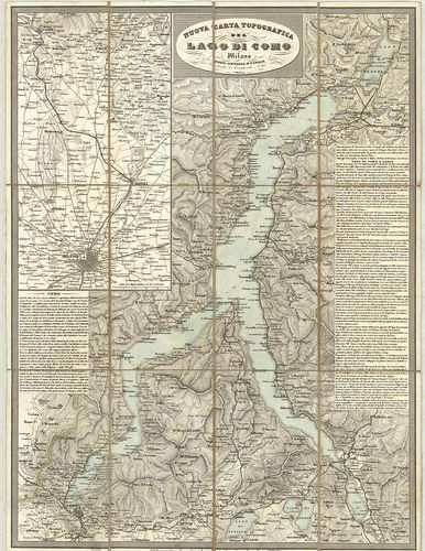
| Title | Nuova carta topografica del Lago di Como. |
| Main title | Mt.: [Milano-Como közti terület.] |
| Subject | A Comoi-tó és környékének topográfiai térképe 1850 körül. |