2261. Königreich Böhmen. Markgrafschaft Mähren. Herzogthum Schlesi... [B IX a 76]
Institute and Museum of Military History •
B IX a
•
B IX Ausztria–Magyarország
•
B I–XV. Európa
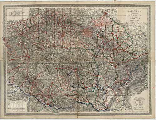
| Title | Königreich Böhmen. Markgrafschaft Mähren. Herzogthum Schlesien. |
| Main title | „Scheda und Steinhauser Atlas. Böhmen, Mähren u. Schlesien.” lapja. |
| Subject | Cseh–, Morvaország és Szilézia térképe 1877-ben. |
2262. Mappa Geographica Regnum Bohemiae cum adiunctis Ducatu[s] Si... [B IX a 77]
Institute and Museum of Military History •
B IX a
•
B IX Ausztria–Magyarország
•
B I–XV. Európa
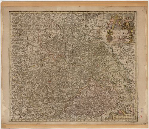
| Title | Mappa Geographica Regnum Bohemiae cum adiunctis Ducatu[s] Silesiae, et Marchionatib. Moraviae, et Lusatiae… |
| Main title | Csehország, Szilézia, Morvaország és Lausitz őrgrófság térképe a 18. században. |
2263. Nova et accurata Descriptio Geographica Totius Regni Bohemia... [B IX a 78]
Institute and Museum of Military History •
B IX a
•
B IX Ausztria–Magyarország
•
B I–XV. Európa
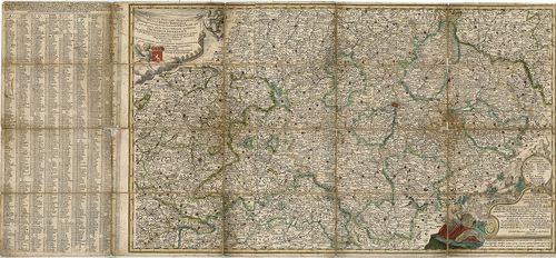
| Title | Nova et accurata Descriptio Geographica Totius Regni Bohemiae, Eidemque incorporati Comitatus Glacensis… |
| Main title | Csehország térképe a 18. században. |
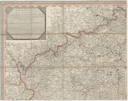
2264. Mappa Geographica totius Regni Bohemiae in XII. Circulus div... [B IX a 79]
Institute and Museum of Military History •
B IX a
•
B IX Ausztria–Magyarország
•
B I–XV. Európa
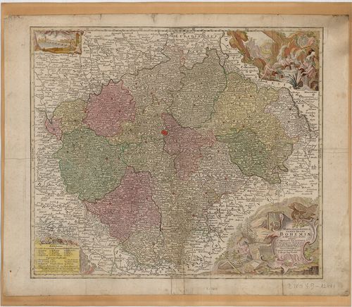
| Title | Mappa Geographica totius Regni Bohemiae in XII. Circulus divisae, annexis Comitatu Glacensi et Districtu Egerano… |
| Main title | Csehország térképe 1758-ban a XII. ker. megnevezésével és jelölésével. |
2265. Mappa Chorographica novissima et completissima Totius Regni ... [B IX a 80]
Institute and Museum of Military History •
B IX a
•
B IX Ausztria–Magyarország
•
B I–XV. Európa
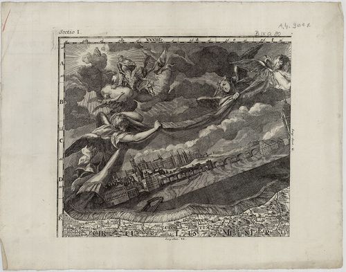
| Title | Mappa Chorographica novissima et completissima Totius Regni Bohemiae in duodecim Circulos Divisae cum Comitatu Glacensi et Districtu Egrano… |
| Main title | Csehország térképe 1726-ban. |
2266. Totius Regni Bohemiae Mappa Chorographico-mineralogico-hydra... [B IX a 83]
Institute and Museum of Military History •
B IX a
•
B IX Ausztria–Magyarország
•
B I–XV. Európa
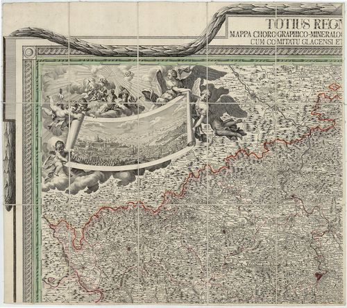
| Title | Totius Regni Bohemiae Mappa Chorographico-mineralogico-hydraulico-commercialis cum Comitatu Glacensi et Districtu Egrano. |
| Main title | Csehország térképe 1808-ban. |
2267. Das Koenigreich Boehmen… [B IX a 84]
Institute and Museum of Military History •
B IX a
•
B IX Ausztria–Magyarország
•
B I–XV. Európa
| Title | Das Koenigreich Boehmen… |
| Main title | Csehország térképe 1809-ben. |
2268. Kreis-Atlas des Königreichs Böhmen. [B IX a 85]
Institute and Museum of Military History •
B IX a
•
B IX Ausztria–Magyarország
•
B I–XV. Európa
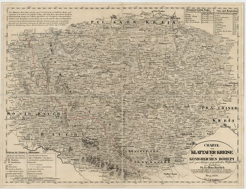
| Title | Kreis-Atlas des Königreichs Böhmen. |
| Main title | Csehország 16 kerületének térképe 1826–1834-ben. |
2269. Das Königreich Boehmen. [B IX a 85/a]
Institute and Museum of Military History •
B IX a
•
B IX Ausztria–Magyarország
•
B I–XV. Európa
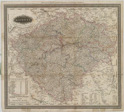
| Title | Das Königreich Boehmen. |
| Main title | Csehország térképe 1842-ben. |
2270. Karte des Königreiches Boehmen. [B IX a 85/b]
Institute and Museum of Military History •
B IX a
•
B IX Ausztria–Magyarország
•
B I–XV. Európa
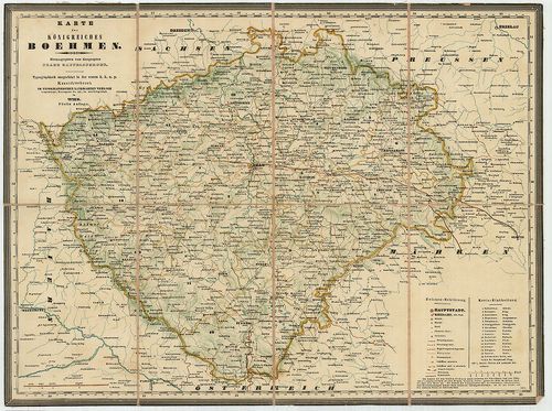
| Title | Karte des Königreiches Boehmen. |
| Main title | Csehország térképe 1845-ben. |
2271. Kreis, -Gericht, -Völker, -Telegrafen, -Eisenbahn und Post-K... [B IX a 85/c]
Institute and Museum of Military History •
B IX a
•
B IX Ausztria–Magyarország
•
B I–XV. Európa
| Title | Kreis, -Gericht, -Völker, -Telegrafen, -Eisenbahn und Post-Karte des Königreiches Boehmen. |
| Main title | Csehország közigazgatási, törvénykezési, népességi, távirda, posta, vasúthálózati térképe 1850-ben. |
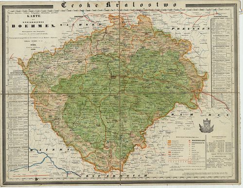
2272. Karte des Königreiches Boehmen. [B IX a 85/d]
Institute and Museum of Military History •
B IX a
•
B IX Ausztria–Magyarország
•
B I–XV. Európa
| Title | Karte des Königreiches Boehmen. |
| Main title | Csehország térképe 1841-ben. |
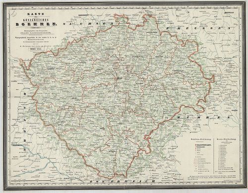
2273. Koenigreich Boehmen. [B IX a 86]
Institute and Museum of Military History •
B IX a
•
B IX Ausztria–Magyarország
•
B I–XV. Európa
| Title | Koenigreich Boehmen. |
| Main title | Csehország térképe 1844-ben. |
2274. General-Karte des Königreiches Böhmen. [B IX a 87]
Institute and Museum of Military History •
B IX a
•
B IX Ausztria–Magyarország
•
B I–XV. Európa
| Title | General-Karte des Königreiches Böhmen. |
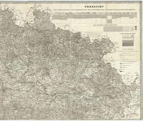
| Main title | Csehország térképe 1862-ben vasúthálózattal. |
2275. General Karte des Königreichs Böhmen. [B IX a 88]
Institute and Museum of Military History •
B IX a
•
B IX Ausztria–Magyarország
•
B I–XV. Európa
| Title | General Karte des Königreichs Böhmen. |
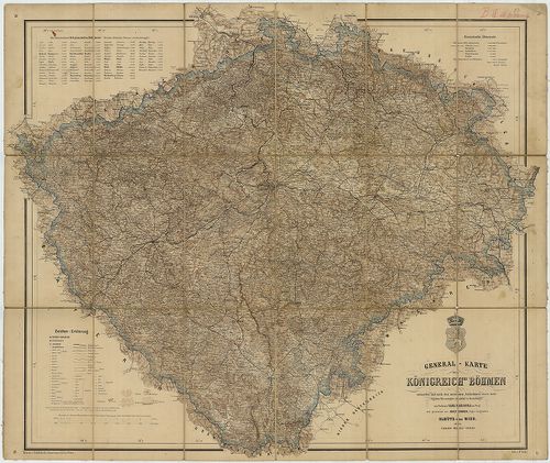
| Main title | Csehország általános térképe 1865-ben, a II. katonai felmérés alapján. |
2276. General-Karte Königreiches Böhmen. [B IX a 89]
Institute and Museum of Military History •
B IX a
•
B IX Ausztria–Magyarország
•
B I–XV. Európa
| Title | General-Karte Königreiches Böhmen. |
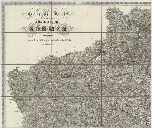
| Main title | Csehország térképe 1895-ben. |
2277. General-Karte des Fürst zu Fürstenbergschen Fideikommissbesi... [B IX a 90]
Institute and Museum of Military History •
B IX a
•
B IX Ausztria–Magyarország
•
B I–XV. Európa
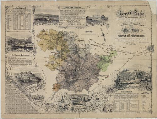
| Title | General-Karte des Fürst zu Fürstenbergschen Fideikommissbesitzstandes auf den Domainen Pürgltz, (Křivoklat), Kruschowitz, (Krušovice,) Nischburg, (Nižbor,) Wschettat, (Všetaty), Panošuv Ujezd, Skřiwan, (Skřivany,) Woleschna, (Volešna), und Pawelschin, (Pavlčin), Prager Kreises in Böhmen. |
| Main title | Fürstenberg fejedelemség (Csehország, Prágától NY-ra.) térképe a 19. században. |
2278. Karte jener Theile des Erzherzogthums Oesterreich, Königreic... [B IX a 91]
Institute and Museum of Military History •
B IX a
•
B IX Ausztria–Magyarország
•
B I–XV. Európa

| Title | Karte jener Theile des Erzherzogthums Oesterreich, Königreiches Ungarn und Markgraftthums Mähren, welche von der zur K. K. Familie Herrschaft Holitsch gehörigen Hutweide Provist… |
| Main title | Holitsch őrgrófi család birtoka, Ausztria, Magyarország és a Morva őrgrófság területén 1839-ben. (Pozsonytól É-ra.) |
2279. Carte Generale du Royaume de Boheme du Dusché de Silesie et ... [B IX a 92]
Institute and Museum of Military History •
B IX a
•
B IX Ausztria–Magyarország
•
B I–XV. Európa
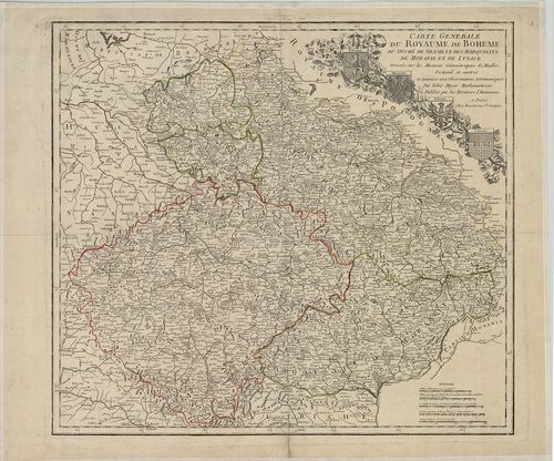
| Title | Carte Generale du Royaume de Boheme du Dusché de Silesie et des Marquisats de Moravie et de Lusace. |
| Main title | Csehország, Sziléziai hercegség, Morva – és Lausitz őrgrófságok általános térképe a 18. század közepén. |
2280. Special-Karte des Koenigreiches Boehmen. [B IX a 95]
Institute and Museum of Military History •
B IX a
•
B IX Ausztria–Magyarország
•
B I–XV. Európa
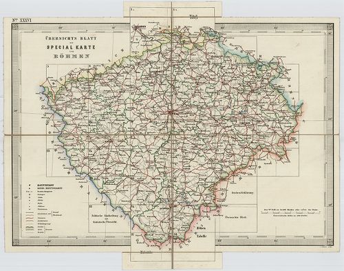
| Title | Special-Karte des Koenigreiches Boehmen. |
| Main title | Csehország részletes topográfiai térképe 1847-1860 között, a II. katonai felmérés alapján. |