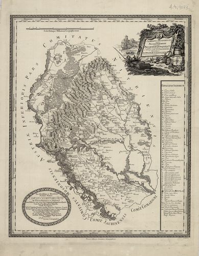
2661. Comitatus Posoniensis Ungarice Posony-Vármegye et Germanice ... [B IX a 654]
Institute and Museum of Military History •
B IX a
•
B IX Ausztria–Magyarország
•
B I–XV. Európa
| Title | Comitatus Posoniensis Ungarice Posony-Vármegye et Germanice Pressburger Gespanschaft… |
| Main title | Pozsony vármegye térképe 1794-ben. |
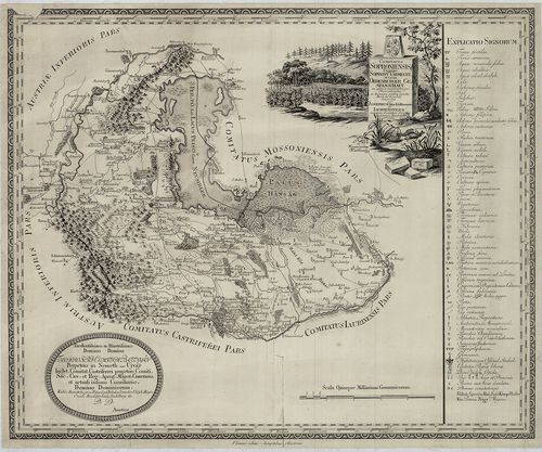
2662. Comitatus Soproniensis Ungarice Soprony Vármegye et Grm. Oed... [B IX a 656]
Institute and Museum of Military History •
B IX a
•
B IX Ausztria–Magyarország
•
B I–XV. Európa
| Title | Comitatus Soproniensis Ungarice Soprony Vármegye et Grm. Oedenburger Gespanschaft… |
| Main title | Sopron vármegye térképe 1793-ban. |
2663. Sopron vármegye… [B IX a 657]
Institute and Museum of Military History •
B IX a
•
B IX Ausztria–Magyarország
•
B I–XV. Európa
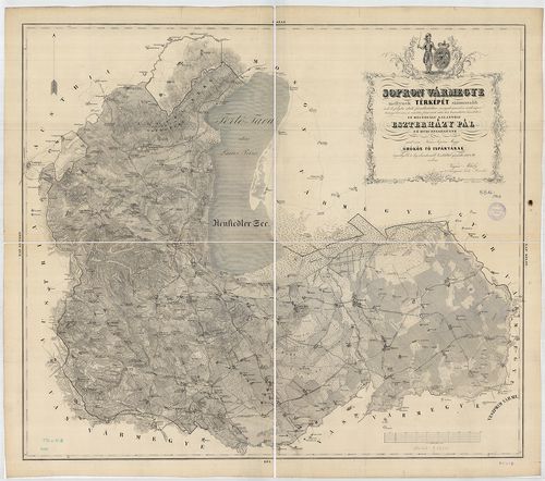
| Title | Sopron vármegye… |
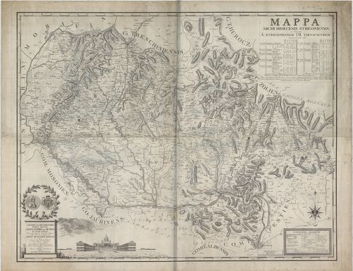
2664. Mappa Archi Dioecesis Strigoniensis. [B IX a 658]
Institute and Museum of Military History •
B IX a
•
B IX Ausztria–Magyarország
•
B I–XV. Európa
| Title | Mappa Archi Dioecesis Strigoniensis. |
| Main title | Az Esztergomi egyházmegye térképe 1822-ben. |
2665. Mappa von dem Temesvaer District. [B IX a 659]
Institute and Museum of Military History •
B IX a
•
B IX Ausztria–Magyarország
•
B I–XV. Európa
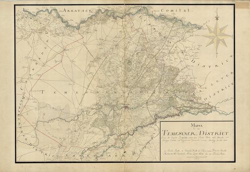
| Title | Mappa von dem Temesvaer District. |
| Main title | A Temesi Kerület térképe 1720-ban. |
2666. Temes megye közigazgatási és kulturtérképe és statisztikája. [B IX a 660]
Institute and Museum of Military History •
B IX a
•
B IX Ausztria–Magyarország
•
B I–XV. Európa
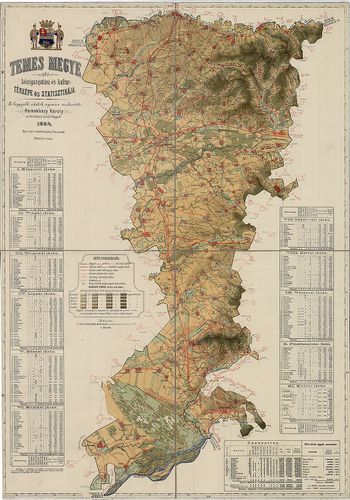
| Title | Temes megye közigazgatási és kulturtérképe és statisztikája. |
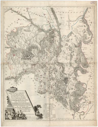
2667. Comitatus Tolnensis Ungarice Tolná-Vármegye et Germanice Tol... [B IX a 661]
Institute and Museum of Military History •
B IX a
•
B IX Ausztria–Magyarország
•
B I–XV. Európa
| Title | Comitatus Tolnensis Ungarice Tolná-Vármegye et Germanice Tolner Gespanschaft. |
| Main title | Tolna vármegye térképe 1795-ben. |
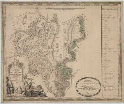
2668. Mappa Inclyti Comitatus Tolnensis… [B IX a 662]
Institute and Museum of Military History •
B IX a
•
B IX Ausztria–Magyarország
•
B I–XV. Európa
| Title | Mappa Inclyti Comitatus Tolnensis… |
| Main title | Tolna vármegye térképe 1818-ban. |
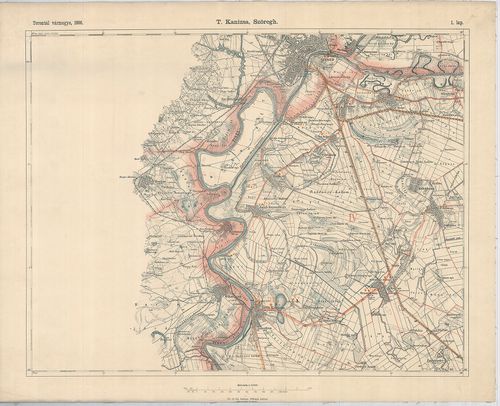
2669. Torontál vármegye térképe. 1896. [B IX a 663]
Institute and Museum of Military History •
B IX a
•
B IX Ausztria–Magyarország
•
B I–XV. Európa
| Title | Torontál vármegye térképe. 1896. |
| Main title | 3 mt. 1. Magybecskerek (Zrenjanin) r. t. város térképe. 2. Nagykikinda (Kikinda) r. t. város térképe. 3. Pancsova (Pancevo) tvh. j. város térképe. Járási beosztás. |
2670. Mappa Comitatus Thurotziensis. [B IX a 664]
Institute and Museum of Military History •
B IX a
•
B IX Ausztria–Magyarország
•
B I–XV. Európa
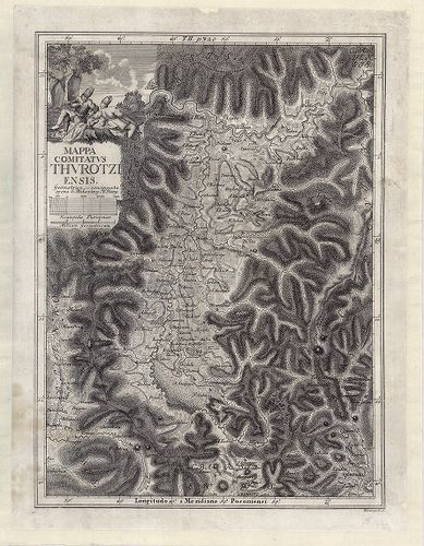
| Title | Mappa Comitatus Thurotziensis. |
| Main title | Turóc vármegye térképe 1736 körül. |
2671. Turócz megye közigazgatási térképe. [B IX a 664/1]
Institute and Museum of Military History •
B IX a
•
B IX Ausztria–Magyarország
•
B I–XV. Európa
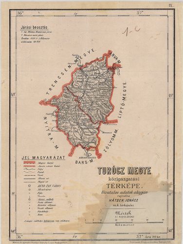
| Title | Turócz megye közigazgatási térképe. |
2672. Comitatus Castri Ferrei Iussu Ordinum ichnographice delineat... [B IX a 665]
Institute and Museum of Military History •
B IX a
•
B IX Ausztria–Magyarország
•
B I–XV. Európa
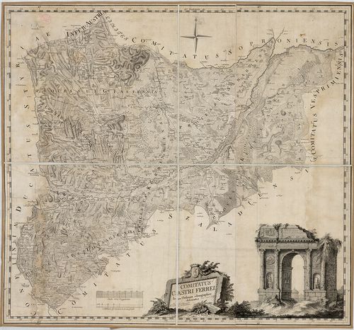
| Title | Comitatus Castri Ferrei Iussu Ordinum ichnographice delineatus… |
| Main title | Vas vármegye térképe 1785-ben. |
2673. Comitatus Weszprimiensis jussu Inclytorum Statuum et Ordinum... [B IX a 667]
Institute and Museum of Military History •
B IX a
•
B IX Ausztria–Magyarország
•
B I–XV. Európa
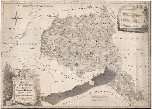
| Title | Comitatus Weszprimiensis jussu Inclytorum Statuum et Ordinum.…1797. |
| Main title | Veszprém vármegye térképe 1799-ben. |
2674. Mappa von dem Werschezer District. [B IX a 668]
Institute and Museum of Military History •
B IX a
•
B IX Ausztria–Magyarország
•
B I–XV. Európa
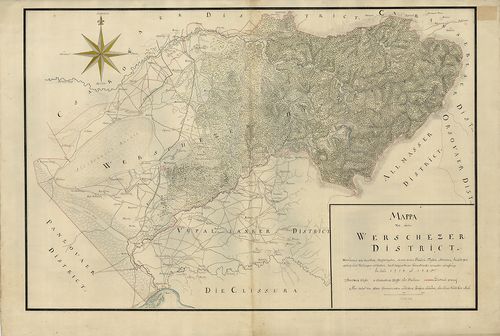
| Title | Mappa von dem Werschezer District. |
| Main title | A Verseci körzet térképe 1725 körül. |
2675. Comitatus Zaladiensis jussu inclytorum statuum et ordinum ic... [B IX a 669]
Institute and Museum of Military History •
B IX a
•
B IX Ausztria–Magyarország
•
B I–XV. Európa
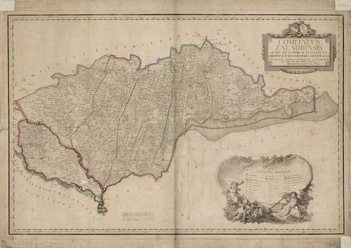
| Title | Comitatus Zaladiensis jussu inclytorum statuum et ordinum ichnographice delineatus … |
| Main title | Zala vármegye térképe 1792-ben. |
2676. Mappa Comitatus Zoliensis… [B IX a 670]
Institute and Museum of Military History •
B IX a
•
B IX Ausztria–Magyarország
•
B I–XV. Európa
| Title | Mappa Comitatus Zoliensis… |
| Main title | Zólyom vármegye térképe 1730 körül. Térkép mell. Bél Mátyás Notitia Hungariae Novae…-jából. (Tom. II. pag. 408.) |
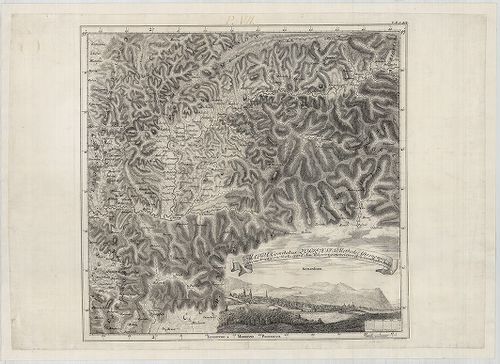
2677. Detail-Karte des Tátra Gebietes in 2 Blättern. [B IX a 671]
Institute and Museum of Military History •
B IX a
•
B IX Ausztria–Magyarország
•
B I–XV. Európa
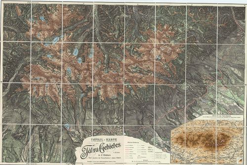
| Title | Detail-Karte des Tátra Gebietes in 2 Blättern. |
| Main title | Mt. Übersicht des Tátra-Gebietes… (A Magas-Tátra áttekintő térképe.) |
| Subject | A Magas-Tátra topográfiai térképe 1896–97-ben, a IV. katonai felmérés alapján. |
2678. Plan der zwischen der Gemeinde Becskereck (Zrenjanin) und Mo... [B IX a 672]
Institute and Museum of Military History •
B IX a
•
B IX Ausztria–Magyarország
•
B I–XV. Európa
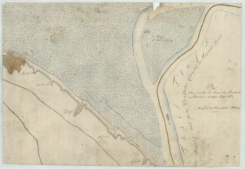
| Title | Plan der zwischen der Gemeinde Becskereck (Zrenjanin) und Moschorin (Mošorin) strittigen Insel Adda. |
| Main title | Adda sziget környékének térképe 1780 körül. |
2679. Plan von der Königl.(iche) Hungar-Cameral Herrschaft Arad, w... [B IX a 673]
Institute and Museum of Military History •
B IX a
•
B IX Ausztria–Magyarország
•
B I–XV. Európa
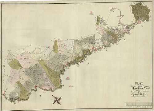
| Title | Plan von der Königl.(iche) Hungar-Cameral Herrschaft Arad, welche in denen 1764 und 65 Jahren durch Sigmund v. Hubert aufgenommen worden. |
| Main title | Az aradi kincstári birtok térképe 1764–65-ben. (Makótól–Lippáig) |
2680. Plan Worauf vorgestellet wird, die Gegend zwischen der Donau... [B IX a 674]
Institute and Museum of Military History •
B IX a
•
B IX Ausztria–Magyarország
•
B I–XV. Európa
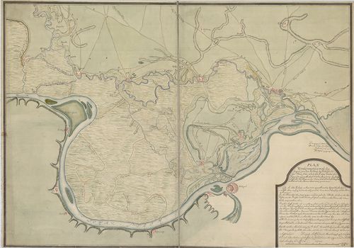
| Title | Plan Worauf vorgestellet wird, die Gegend zwischen der Donau bey Bellgrad, und des Temes flus, mittels durch eines Graben die Donavitza genant, durch Welchen Anno 1717. die Griegsschiff aus der Donau in die Temes, und Unterhalb Banczova (Pancsova) widerumb in die Donau ihren weeg genommen. |
| Main title | Az Al-Duna térképe 1717-ben. (Zenta–Beograd–Pancsova között). |