2821. Karte von Oberhungarn … [B IX a 1108]
Institute and Museum of Military History •
B IX a
•
B IX Ausztria–Magyarország
•
B I–XV. Európa
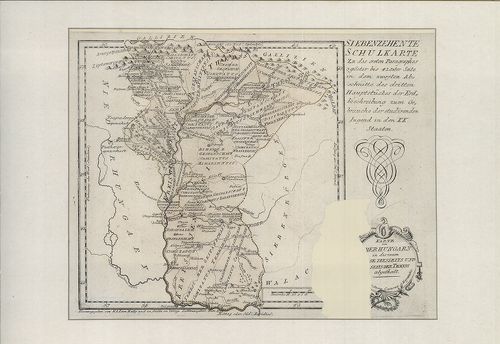
| Title | Karte von Oberhungarn … |
| Main title | Felső-Magyarország térképe. Reilly által készített iskolai térképek 17. lapja. |
2822. Karte von Croatien … [B IX a 1109]
Institute and Museum of Military History •
B IX a
•
B IX Ausztria–Magyarország
•
B I–XV. Európa
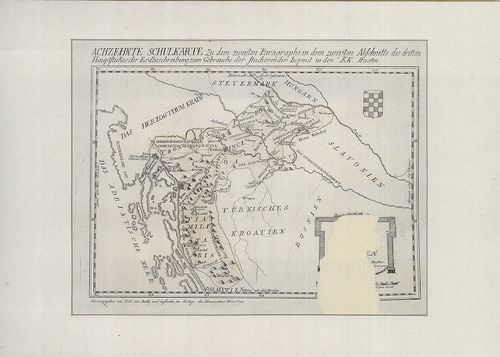
| Title | Karte von Croatien … |
| Main title | Horvátország térképe. Reilly által készített iskolai térképek 18. lapja. |
2823. Karte vn dem Königreiche Slavonie. [B IX a 1110]
Institute and Museum of Military History •
B IX a
•
B IX Ausztria–Magyarország
•
B I–XV. Európa
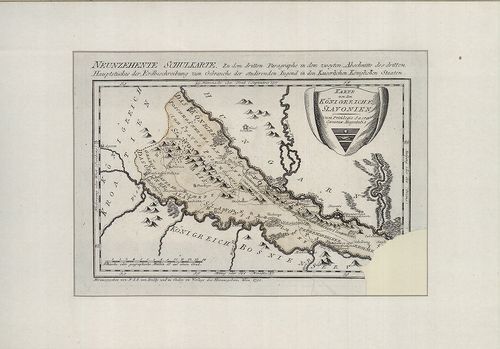
| Title | Karte vn dem Königreiche Slavonie. |
| Main title | A Szlavón Királyság térképe Reilly által készített iskolai térképek 19. lapja. |
2824. Uibersichts-Karte der Erzherzoglichen Herrschaft Ungarisch A... [B IX a 1111]
Institute and Museum of Military History •
B IX a
•
B IX Ausztria–Magyarország
•
B I–XV. Európa
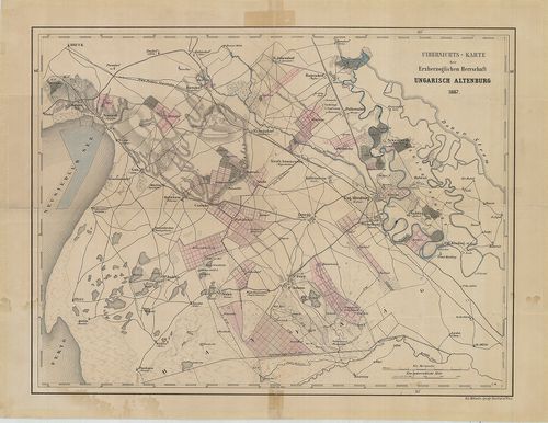
| Title | Uibersichts-Karte der Erzherzoglichen Herrschaft Ungarisch Altenburg. |
| Main title | Magyaróvár (Mosonmagyaróvár) és környékének térképe. |
2825. [A Magyar királyság nyugati felének térképe.] [B IX a 1112]
Institute and Museum of Military History •
B IX a
•
B IX Ausztria–Magyarország
•
B I–XV. Európa
| Title | [A Magyar királyság nyugati felének térképe.] |
| Main title | Magyarország nyugati felének térképe, többnyelvű névírás, ostromok és csaták évszámai. |
2826. Carte de la Hungrie, de la Transilvanie… [B IX a 1113]
Institute and Museum of Military History •
B IX a
•
B IX Ausztria–Magyarország
•
B I–XV. Európa
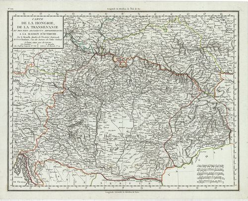
| Title | Carte de la Hungrie, de la Transilvanie… |
| Main title | Magyarország és Erdély térképe. |
2827. Plan von einem Theil der Gegend beiden Papagej zwischen dem ... [B IX a 1114]
Institute and Museum of Military History •
B IX a
•
B IX Ausztria–Magyarország
•
B I–XV. Európa
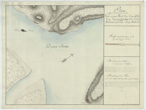
| Title | Plan von einem Theil der Gegend beiden Papagej zwischen dem Dorf Moldowa und dem Berg Alibeck. |
| Main title | A Papagáj-sziget (tört. Mo. déli határa) és környékének térképe. |
2828. Plan vortheilhaften Truppen-Aufstellungen zwischen der Dunau... [B IX a 1117]
Institute and Museum of Military History •
B IX a
•
B IX Ausztria–Magyarország
•
B I–XV. Európa

| Title | Plan vortheilhaften Truppen-Aufstellungen zwischen der Dunau, der Raab und dem Blatten See. |
| Main title | A csapatok mozgása a Duna, Rába és a Balaton között. |
2829. Übersichts-Karte von der südlichen u. grösseren Hälfte des T... [B IX a 1118]
Institute and Museum of Military History •
B IX a
•
B IX Ausztria–Magyarország
•
B I–XV. Európa
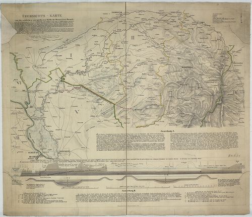
| Title | Übersichts-Karte von der südlichen u. grösseren Hälfte des Temesvarer Banat’s. |
| Main title | A Temesi Bánság déli részének térképe. |
2830. General Karte des Grossfürstenthurms Siebenbürgen. [B IX a 1119]
Institute and Museum of Military History •
B IX a
•
B IX Ausztria–Magyarország
•
B I–XV. Európa
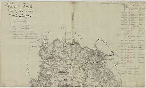
| Title | General Karte des Grossfürstenthurms Siebenbürgen. |
| Main title | Az Erdélyi Nagyhercegség általános térképe népességi adatokkal. |
2831. Geographische Charte des Königreichs Hungaria [B IX a 1120]
Institute and Museum of Military History •
B IX a
•
B IX Ausztria–Magyarország
•
B I–XV. Európa
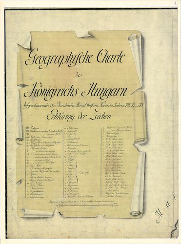
| Title | Geographische Charte des Königreichs Hungaria |
| Main title | Magyarország földrajzi (általános) térképe az I. katonai felmérés alapján. |
2832. Theatre de la Guerre ouvert en Hongrie dans la tartarie crim... [B IX a 1122]
Institute and Museum of Military History •
B IX a
•
B IX Ausztria–Magyarország
•
B I–XV. Európa
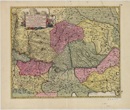
| Title | Theatre de la Guerre ouvert en Hongrie dans la tartarie crimée... |
| Main title | A Duna medencéje Pesttől a Fekete-tengerig. |
2833. Magyar Ország és Erdély földabrosza. [B IX a 1125]
Institute and Museum of Military History •
B IX a
•
B IX Ausztria–Magyarország
•
B I–XV. Európa
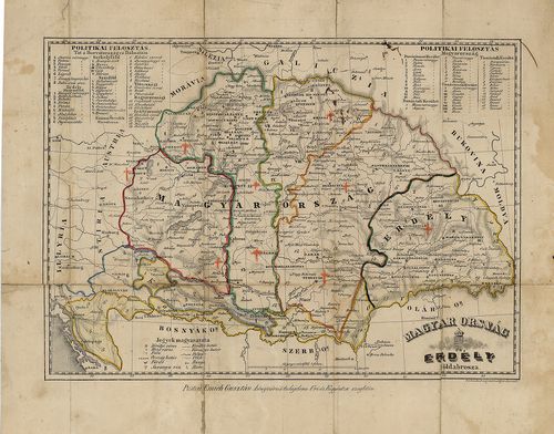
| Title | Magyar Ország és Erdély földabrosza. |
| Main title | Tartományi és megyehatárok. |
2834. Carte des Broder Gräntz Regiments. [B IX a 1126]
Institute and Museum of Military History •
B IX a
•
B IX Ausztria–Magyarország
•
B I–XV. Európa
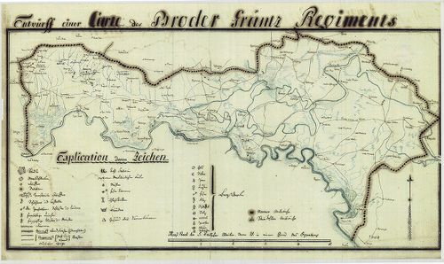
| Title | Carte des Broder Gräntz Regiments. |
| Main title | A Brodi határőrezred területének térképe a XIX. sz. elejéről. |
2835. Carte des Gradiscaner Gräntz Regiments. [B IX a 1127]
Institute and Museum of Military History •
B IX a
•
B IX Ausztria–Magyarország
•
B I–XV. Európa
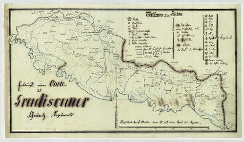
| Title | Carte des Gradiscaner Gräntz Regiments. |
| Main title | A Gradiscai határőrezred területének térképe a XIX. sz. elejéről. |
2836. Carte des Warasdiner Gräntz Regiments. [B IX a 1128]
Institute and Museum of Military History •
B IX a
•
B IX Ausztria–Magyarország
•
B I–XV. Európa
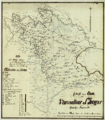
| Title | Carte des Warasdiner Gräntz Regiments. |
| Main title | A Varasdi határőrezred területének térképe a XIX. sz. elejéről. |
2837. Carte des Peterwardeiner Gränz Regiments. [B IX a 1129]
Institute and Museum of Military History •
B IX a
•
B IX Ausztria–Magyarország
•
B I–XV. Európa
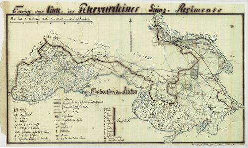
| Title | Carte des Peterwardeiner Gränz Regiments. |
| Main title | A Péterváradi határőrezred területének térképe a XIX. sz. elejéről. |
2838. Carte des ersten Banal Regiments. [B IX a 1130]
Institute and Museum of Military History •
B IX a
•
B IX Ausztria–Magyarország
•
B I–XV. Európa
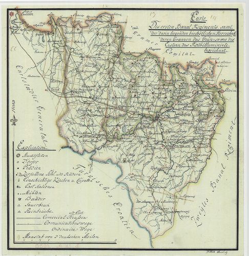
| Title | Carte des ersten Banal Regiments. |
| Main title | Az Első Bánáti Regiment (Báni határőrezred) területének térképe a XIX. sz. elején. |
2839. Eigentlicher Entwurff des zwischen Ungarn und Schlesien gele... [B IX a 1131]
Institute and Museum of Military History •
B IX a
•
B IX Ausztria–Magyarország
•
B I–XV. Európa
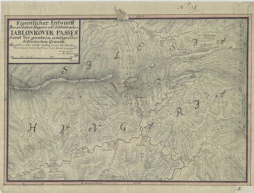
| Title | Eigentlicher Entwurff des zwischen Ungarn und Schlesien gelegene Iablonkover Passes... |
| Main title | A Jablunkai-hágó térképe a magyar-sziléziai határon. |
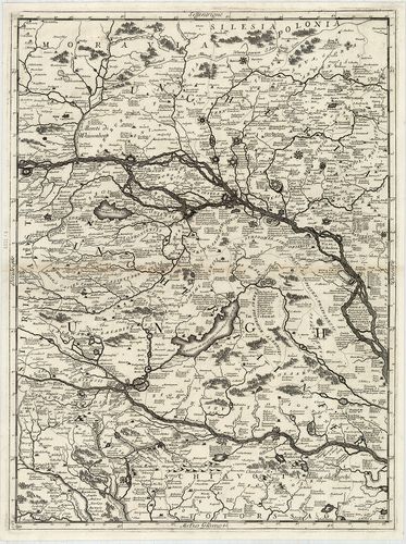
2840. Royaume de Hongrie; Avec la Partie la plus Septentrionale de... [B IX a 1133]
Institute and Museum of Military History •
B IX a
•
B IX Ausztria–Magyarország
•
B I–XV. Európa
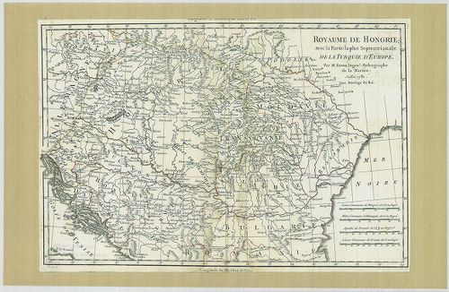
| Title | Royaume de Hongrie; Avec la Partie la plus Septentrionale de la Turquie D'Europe. |
| Main title | A Magyar Királyság; a Török Birodalom északi része Európában. |