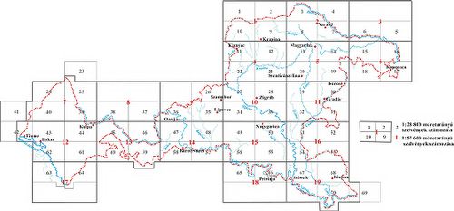
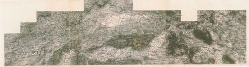
2861. Österreich–Ungarn, Übersicht. [B IX a 1167]
Institute and Museum of Military History •
B IX a
•
B IX Ausztria–Magyarország
•
B I–XV. Európa
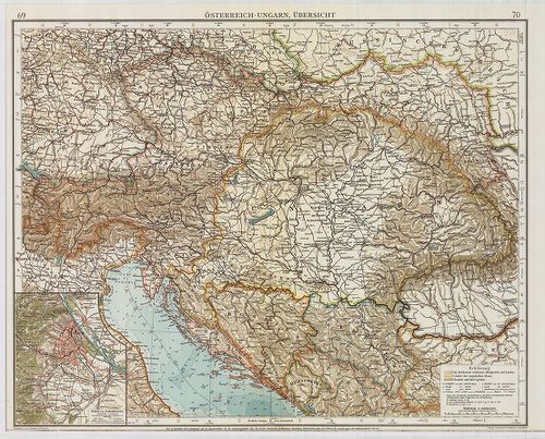
| Title | Österreich–Ungarn, Übersicht. |
| Main title | Az Osztrák–Magyar Monarchia áttekintő térképe. Az „Andrees Allgemeines Handatlas” 69–70. o. nagyítva. |
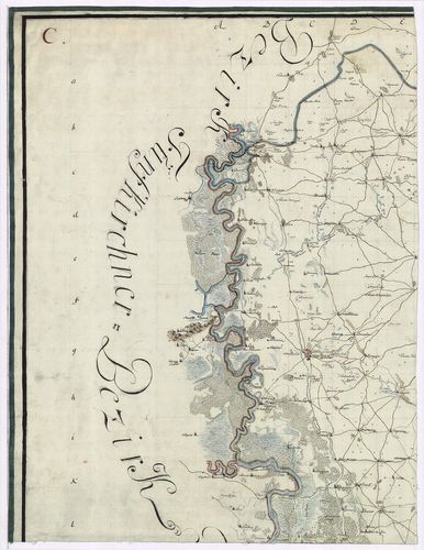
2862. Geographische Charte des Neutraer Bezirkes. [B IX a 1168]
Institute and Museum of Military History •
B IX a
•
B IX Ausztria–Magyarország
•
B I–XV. Európa
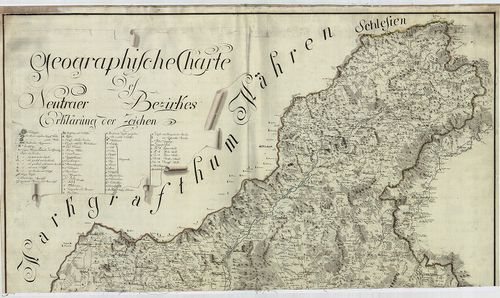
| Title | Geographische Charte des Neutraer Bezirkes. |
| Main title | A Nyitrai kerület földrajzi térképe az I. katonai felmérés alapján. |
2863. Charten des Warasdiner Generalats. [B IX a 1169]
Institute and Museum of Military History •
B IX a
•
B IX Ausztria–Magyarország
•
B I–XV. Európa
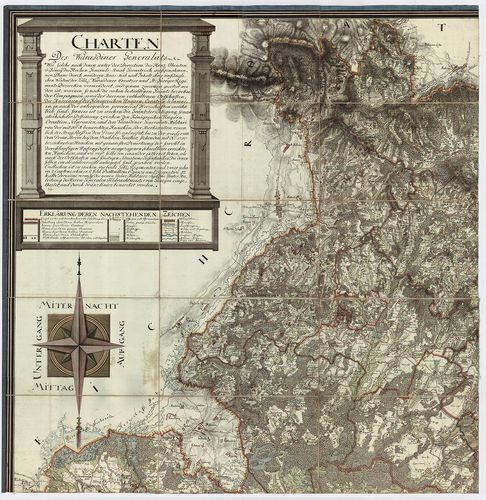
| Title | Charten des Warasdiner Generalats. |
| Main title | A Varasdi Határőrvidék levezetett térképe az I. katonai felmérés alapján. |
2864. Geographische Charte des Neusoller Bezirks. [B IX a 1170]
Institute and Museum of Military History •
B IX a
•
B IX Ausztria–Magyarország
•
B I–XV. Európa
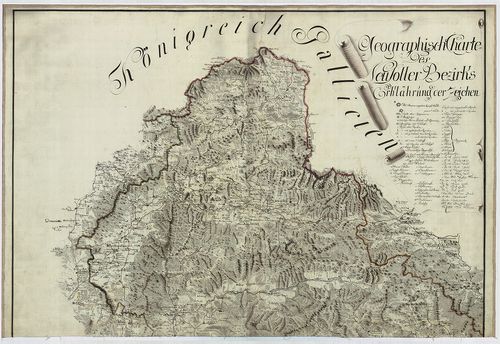
| Title | Geographische Charte des Neusoller Bezirks. |
| Main title | A Besztercebányai kerület földrajzi térképe az I. katonai felmérés alapján. |
2865. Militair Charte der Banal Grenze… [B IX a 1171]
Institute and Museum of Military History •
B IX a
•
B IX Ausztria–Magyarország
•
B I–XV. Európa

| Title | Militair Charte der Banal Grenze… |
| Main title | A Báni Határőrvidék katonai térképe az I. kat. felm. alapján. |
2866. Charte des Carlstaedter Generalats … [B IX a 1172]
Institute and Museum of Military History •
B IX a
•
B IX Ausztria–Magyarország
•
B I–XV. Európa

| Title | Charte des Carlstaedter Generalats … |
| Main title | A Károlyvárosi katonai térképe az I. kat. felm. alapján. |
2867. Mappa von Provincial Croatien. [B IX a 1173]
Institute and Museum of Military History •
B IX a
•
B IX Ausztria–Magyarország
•
B I–XV. Európa
| Title | Mappa von Provincial Croatien. |
| Main title | Horvátország térképe az I. kat. felm. alapján. |
2868. Geographische Charte des Temeswarer Bezirks … [B IX a 1174]
Institute and Museum of Military History •
B IX a
•
B IX Ausztria–Magyarország
•
B I–XV. Európa
| Title | Geographische Charte des Temeswarer Bezirks … |
| Main title | A Temesvári kerület földrajzi térképe az I. kat. felm. alapján. |
2869. A Tabula Hubgariae és változatai. [B IX a 1176]
Institute and Museum of Military History •
B IX a
•
B IX Ausztria–Magyarország
•
B I–XV. Európa
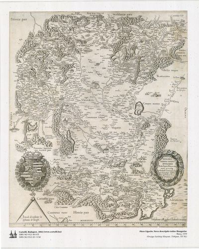
| Title | A Tabula Hubgariae és változatai. |
| Main title | A Lázár és Zsámboky térképek (XVI. sz.) faximile kiadása. |
2870. Illyricum. [B IX a 1178]
Institute and Museum of Military History •
B IX a
•
B IX Ausztria–Magyarország
•
B I–XV. Európa
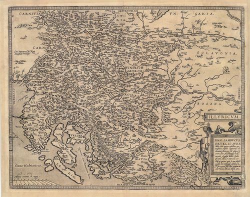
| Title | Illyricum. |
| Main title | Illíria térképe. |
2871. A Szent Korona országai (1886). [B IX a 1182]
Institute and Museum of Military History •
B IX a
•
B IX Ausztria–Magyarország
•
B I–XV. Európa
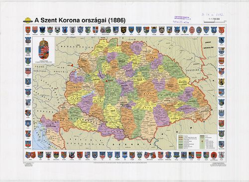
| Title | A Szent Korona országai (1886). |
2872. The mape of Hungari....1626. [B IX a 1183]
Institute and Museum of Military History •
B IX a
•
B IX Ausztria–Magyarország
•
B I–XV. Európa
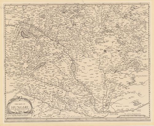
| Title | The mape of Hungari....1626. |
| Main title | Magyarország térképe, 1626. |
2873. Das Khynigreich Hungern... [B IX a 1199]
Institute and Museum of Military History •
B IX a
•
B IX Ausztria–Magyarország
•
B I–XV. Európa
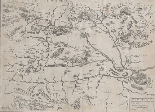
| Title | Das Khynigreich Hungern... |
| Main title | A Magyar Királyság. Az 1566-os török hadjárat főbb várostromainak bemutatása. |
2874. Regni Hungariae cum adiuncta Transylvania... [B IX a 1200]
Institute and Museum of Military History •
B IX a
•
B IX Ausztria–Magyarország
•
B I–XV. Európa
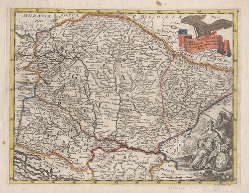
| Title | Regni Hungariae cum adiuncta Transylvania... |
| Main title | A Magyar Királyság és Erdély térképe. |
2875. Carte von Ungarn und Siebenbürgen. [B IX a 1201]
Institute and Museum of Military History •
B IX a
•
B IX Ausztria–Magyarország
•
B I–XV. Európa
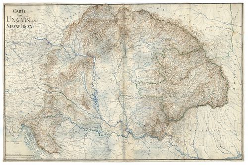
| Title | Carte von Ungarn und Siebenbürgen. |
| Main title | A Magyar Királyság és Erdély térképe. |
2876. Carte von Ungarn und Siebenbürgen. [B IX a 1202]
Institute and Museum of Military History •
B IX a
•
B IX Ausztria–Magyarország
•
B I–XV. Európa
| Title | Carte von Ungarn und Siebenbürgen. |
| Main title | A Magyar Királyság és Erdély térképe. |
2877. Charte von den Königreichen Ungarn, Kroatien, und Slavonien ... [B IX a 1203]
Institute and Museum of Military History •
B IX a
•
B IX Ausztria–Magyarország
•
B I–XV. Európa
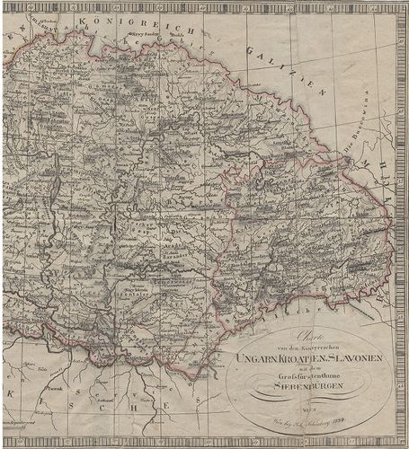
| Title | Charte von den Königreichen Ungarn, Kroatien, und Slavonien mit dem Grossfürstenthume Siebenbürgen. |
| Main title | A Magyar Királyság, Horvátország, Szlavónia és Erdély térképe. (nyugati rész h.) |
2878. Magyar Ország közönséges földképe. [B IX a 1204]
Institute and Museum of Military History •
B IX a
•
B IX Ausztria–Magyarország
•
B I–XV. Európa

| Title | Magyar Ország közönséges földképe. |
2879. Tabula generalis Regni Hungariae, Croatiae et Slavoniae nec ... [B IX a 1205]
Institute and Museum of Military History •
B IX a
•
B IX Ausztria–Magyarország
•
B I–XV. Európa
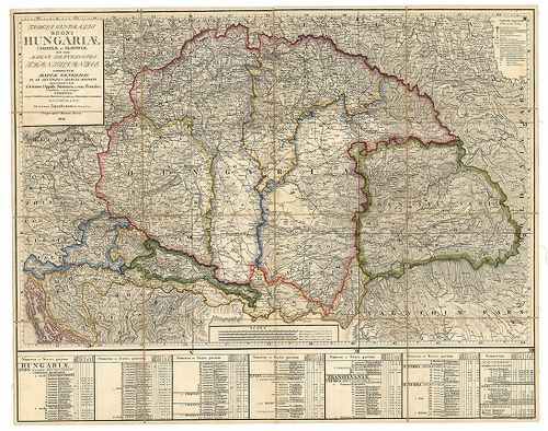
| Title | Tabula generalis Regni Hungariae, Croatiae et Slavoniae nec non Magni Principatus Transylvaniae… |
| Main title | A Magyar Királyság, Horvát-Szlavónia és Erdély általános térképe 1848-ban. Tartományi színezés. |
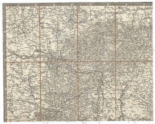
2880. [Trencsén-, Túróc-, Árva-, Liptó-, Szepes- és Sáros megyék t... [B IX a 1206]
Institute and Museum of Military History •
B IX a
•
B IX Ausztria–Magyarország
•
B I–XV. Európa
| Title | [Trencsén-, Túróc-, Árva-, Liptó-, Szepes- és Sáros megyék területét ábrázoló általános térkép 1831-ből, készült Aulich százados irányításával, az I. katonai felmérés alapján.] |