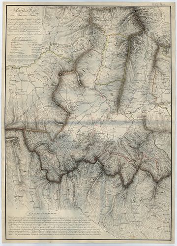
2881. Karte vom Banat und der Wallachey... [B IX a 1207]
Institute and Museum of Military History •
B IX a
•
B IX Ausztria–Magyarország
•
B I–XV. Európa
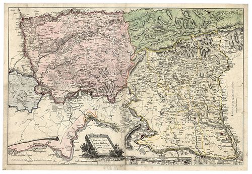
| Title | Karte vom Banat und der Wallachey... |
| Main title | A Temesi Bánság és Havasalföld térképe. |
2882. Der Temesvarer Bannat. [B IX a 1208]
Institute and Museum of Military History •
B IX a
•
B IX Ausztria–Magyarország
•
B I–XV. Európa
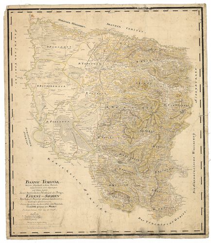
| Title | Der Temesvarer Bannat. |
| Main title | A Temesi Bánság "Mercy" féle térképének a kicsinyitésével készült térkép. (Lásd: B IX a 1166) |
2883. [A Temesi Bánság topográfiai térképe.] [B IX a 1209]
Institute and Museum of Military History •
B IX a
•
B IX Ausztria–Magyarország
•
B I–XV. Európa
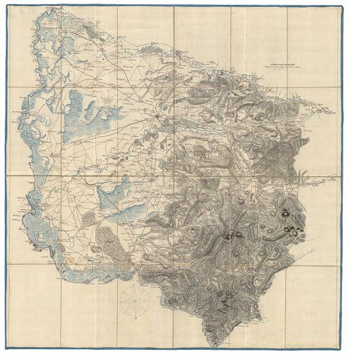
| Title | [A Temesi Bánság topográfiai térképe.] |
2884. Carte von dem Temesvarer Banat und dem König. Servien, nebst... [B IX a 1210]
Institute and Museum of Military History •
B IX a
•
B IX Ausztria–Magyarország
•
B I–XV. Európa
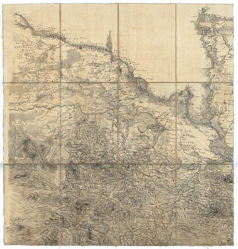
| Title | Carte von dem Temesvarer Banat und dem König. Servien, nebst einen Theil von Ungarn, Slavonien und Bosnien. |
| Main title | A Temesi Bánság és a Szerb Királyság, valamint a Magyar Királyság, Szlavónia és Bosznia egy részének totográfiai térképe. |
2885. Generalkarte vom Temesvárer Banat, mit Inbegriff des Tschaik... [B IX a 1211]
Institute and Museum of Military History •
B IX a
•
B IX Ausztria–Magyarország
•
B I–XV. Európa
| Title | Generalkarte vom Temesvárer Banat, mit Inbegriff des Tschaikisten Bezirks. |
| Main title | A Temesi Bánság (a Csajkások területével együtt) topográfiai térképe az I. kat. felm. alapján. |
2886. Karte des Wallach-Illirischen und des deutchen Ansiedlungs-R... [B IX a 1212]
Institute and Museum of Military History •
B IX a
•
B IX Ausztria–Magyarország
•
B I–XV. Európa
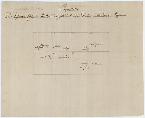
| Title | Karte des Wallach-Illirischen und des deutchen Ansiedlungs-Regiments. |
| Main title | Az Oláh-Illír és a és a Német Bánsági Határezredek topográfiai térképe az I. kat. felm. alapján. |
2887. Uibersichts Karte der Banatischen Militair Granze. [B IX a 1213]
Institute and Museum of Military History •
B IX a
•
B IX Ausztria–Magyarország
•
B I–XV. Európa
| Title | Uibersichts Karte der Banatischen Militair Granze. |
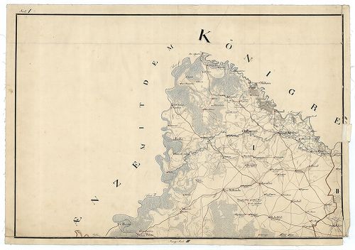
| Main title | A Bánsági Határőrvidék topográfiai térképe az I. kat. felm. alapján. |
2888. Plan des Roszdyil Berges bei F. Hrabonicza an der Strasse vo... [B IX a 1214]
Institute and Museum of Military History •
B IX a
•
B IX Ausztria–Magyarország
•
B I–XV. Európa
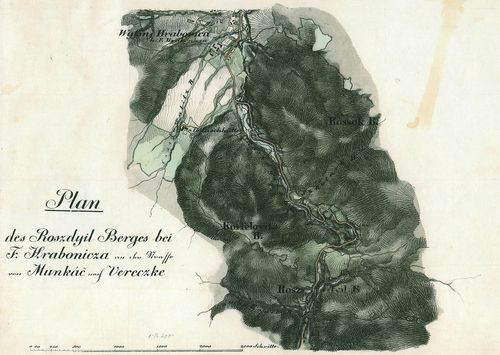
| Title | Plan des Roszdyil Berges bei F. Hrabonicza an der Strasse von Munkác nach Vereczke. |
| Main title | A Roszdyil-hegység F. Hraboniczánál, a Munkács-Verecke közötti út mentén. |
2889. Plan des Roszdyil Berges bei F. Hrabonicza an der Strasse vo... [B IX a 1214]
Institute and Museum of Military History •
B IX a
•
B IX Ausztria–Magyarország
•
B I–XV. Európa
| Title | Plan des Roszdyil Berges bei F. Hrabonicza an der Strasse von Munkác nach Vereczke. |
| Main title | A Roszdyil-hegység F. Hraboniczánál, a Munkács-Verecke közötti út mentén. |
2890. Plan des Passes bei Sola (Sóslak) im Comitat Unghvar an der ... [B IX a 1215]
Institute and Museum of Military History •
B IX a
•
B IX Ausztria–Magyarország
•
B I–XV. Európa
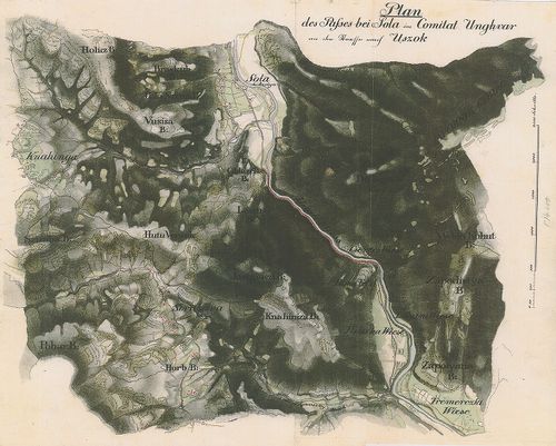
| Title | Plan des Passes bei Sola (Sóslak) im Comitat Unghvar an der Strasse nach Uszok. |
| Main title | A Sóslaki-szoros Ung megyében, az Uzsoki-hágó felé vezető úton. |
2891. Plan des Passes...im Vitsa (Vecsa). Thale am Wege von Munkác... [B IX a 1217]
Institute and Museum of Military History •
B IX a
•
B IX Ausztria–Magyarország
•
B I–XV. Európa

| Title | Plan des Passes...im Vitsa (Vecsa). Thale am Wege von Munkács über Szolyva und Volocz nach Verecke. |
| Main title | A Munkács-Verecke közötti völgy térképe. |
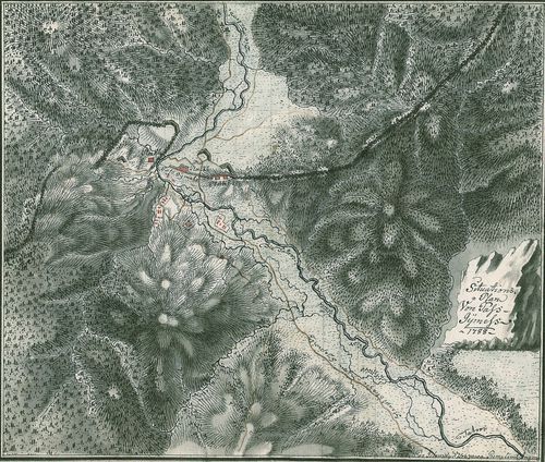
2892. Situation der Wederanischen Hölle. [B IX a 1218]
Institute and Museum of Military History •
B IX a
•
B IX Ausztria–Magyarország
•
B I–XV. Európa
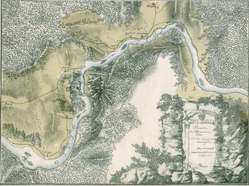
| Title | Situation der Wederanischen Hölle. |
| Main title | A Veteráni-barlang kkörnyéke. |
2893. Magni Principatus Transylvaniae... [B IX a 1219]
Institute and Museum of Military History •
B IX a
•
B IX Ausztria–Magyarország
•
B I–XV. Európa
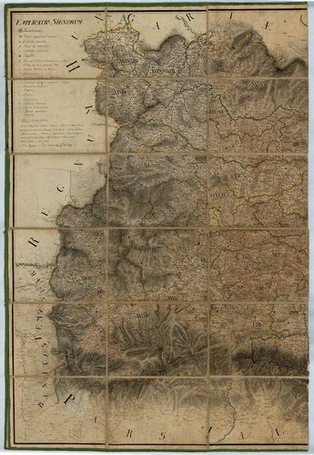
| Title | Magni Principatus Transylvaniae... |
| Main title | Az Erdélyi Nagyfejedelemség térképe az I. kat. felm. nyomán, a Jeney-féle térkép alapján - B IX a 715/1 - harmadára kicsinyítve. |
2894. Nova Magni Principatus Transilvaniae... [B IX a 1220]
Institute and Museum of Military History •
B IX a
•
B IX Ausztria–Magyarország
•
B I–XV. Európa
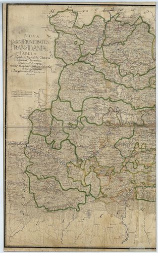
| Title | Nova Magni Principatus Transilvaniae... |
| Main title | Az Erdélyi Nagyfejedelemség "új" térképe, Bukovina és Moldva területével, Jeney-féle térkép alapján - B IX a 715/1 - negyedére kicsinyítve. |
2895. Generalkarte von Siebenbürgen… [B IX a 1221]
Institute and Museum of Military History •
B IX a
•
B IX Ausztria–Magyarország
•
B I–XV. Európa
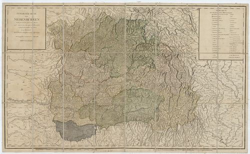
| Title | Generalkarte von Siebenbürgen… |
| Main title | Erdély általános térképe 1789-ben. |
2896. Charte des Grossfürstenthum Siebenbürgen. [B IX a 1222]
Institute and Museum of Military History •
B IX a
•
B IX Ausztria–Magyarország
•
B I–XV. Európa
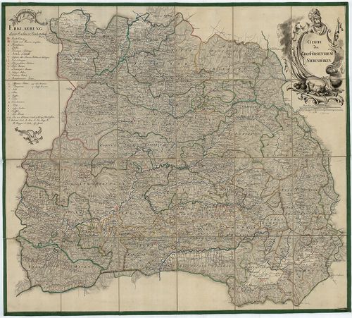
| Title | Charte des Grossfürstenthum Siebenbürgen. |
| Main title | Az Erdélyi Nagyfejedelemség térképe |
2897. Karte des Grossfürstenthums Siebenbürgen. [B IX a 1223]
Institute and Museum of Military History •
B IX a
•
B IX Ausztria–Magyarország
•
B I–XV. Európa
| Title | Karte des Grossfürstenthums Siebenbürgen. |
| Main title | Az Erdélyi Nagyfejedelemség térképe |
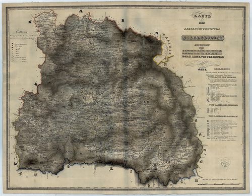
2898. Special-Karte von Burzen Lande, oder dem Kronstadter Distric... [B IX a 1224]
Institute and Museum of Military History •
B IX a
•
B IX Ausztria–Magyarország
•
B I–XV. Európa
| Title | Special-Karte von Burzen Lande, oder dem Kronstadter District, in Siebenbürgen... |
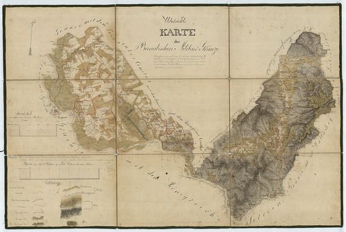
| Main title | Az erdélyi Brassói Körzet topográfiai térképe az I. kat. felm. alapján (hatodára kics. ) |
2899. Situatons Plan von Pass Gymess. [B IX a 1225]
Institute and Museum of Military History •
B IX a
•
B IX Ausztria–Magyarország
•
B I–XV. Európa
| Title | Situatons Plan von Pass Gymess. |
| Main title | A Gyimesi-szoros térképe. |
2900. Geographische Mappe des Grossfürstenthums Siebenbürgen. [B IX a 1226]
Institute and Museum of Military History •
B IX a
•
B IX Ausztria–Magyarország
•
B I–XV. Európa

| Title | Geographische Mappe des Grossfürstenthums Siebenbürgen. |
| Main title | Az Erdélyi Nagyfejedelemség földrajzi térképe |