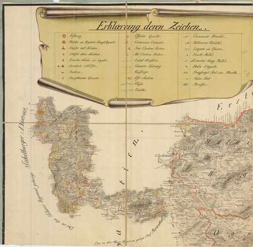
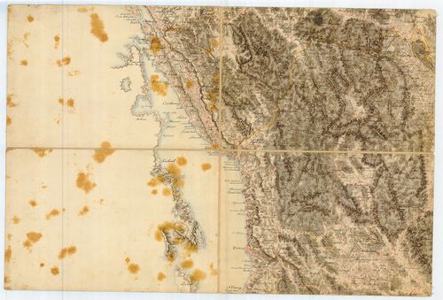
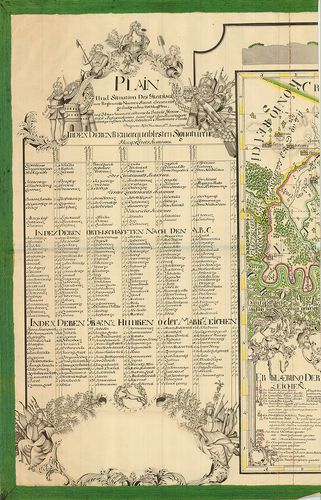
2901. Ideal Plan. Von der zwischen Agram, Carlstadt, Zeng, Ottocha... [B IX a 1227]
Institute and Museum of Military History •
B IX a
•
B IX Ausztria–Magyarország
•
B I–XV. Európa
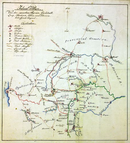
| Title | Ideal Plan. Von der zwischen Agram, Carlstadt, Zeng, Ottochacz, Glina und Petrinja betreffende Gegend. |
| Main title | A Zágráb, Károlyváros, Zeng, Glina és Petrinja által határolt. terület térképe. |
2902. Charte des Carlstadter Generalats... [B IX a 1228]
Institute and Museum of Military History •
B IX a
•
B IX Ausztria–Magyarország
•
B I–XV. Európa
| Title | Charte des Carlstadter Generalats... |
| Main title | A Károlyvárosi Határőrvidék térképe az I. katonai felmérés 1791-es kiegészítése után. |
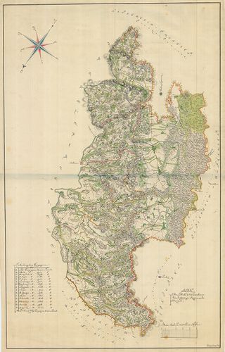
2903. Militair Carte des Varasdiner Generalats... [B IX a 1229]
Institute and Museum of Military History •
B IX a
•
B IX Ausztria–Magyarország
•
B I–XV. Európa
| Title | Militair Carte des Varasdiner Generalats... |
| Main title | A Varasdi Határőrvidék térképe. |
2904. Warasdiner Miliairgrenze... [B IX a 1230]
Institute and Museum of Military History •
B IX a
•
B IX Ausztria–Magyarország
•
B I–XV. Európa
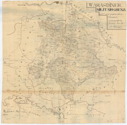
| Title | Warasdiner Miliairgrenze... |
| Main title | A Varasdi Határőrvidék térképe. |
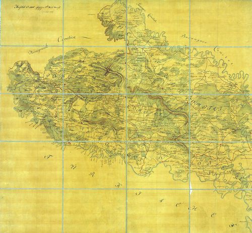
2905. Carte der Carlstadter Banal und Warasdiner Granz Regimenter ... [B IX a 1231]
Institute and Museum of Military History •
B IX a
•
B IX Ausztria–Magyarország
•
B I–XV. Európa
| Title | Carte der Carlstadter Banal und Warasdiner Granz Regimenter als auch des angranzenden Illyrien und Provinzial Croatien. |
| Main title | A Báni és Varasdi Határőrvidék térképe a határos illír és horvát területekkel. |
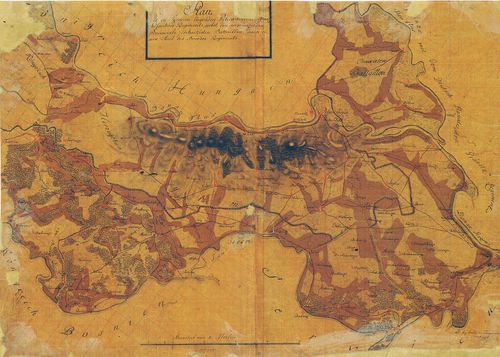
2906. Plan des löblichen Warasdiner-Sanct Geoger Regiments Bezirk. [B IX a 1232]
Institute and Museum of Military History •
B IX a
•
B IX Ausztria–Magyarország
•
B I–XV. Európa
| Title | Plan des löblichen Warasdiner-Sanct Geoger Regiments Bezirk. |
| Main title | A Szent György ezred területének térképe. |
2907. [A Szlavón Királyság és a Szlavón Határőrvidék térképe] [B IX a 1233]
Institute and Museum of Military History •
B IX a
•
B IX Ausztria–Magyarország
•
B I–XV. Európa
| Title | [A Szlavón Királyság és a Szlavón Határőrvidék térképe] |
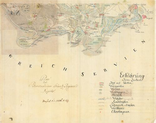
2908. Plan des in Syrmien liegenden Peterwardeiner granz Infanteri... [B IX a 1234]
Institute and Museum of Military History •
B IX a
•
B IX Ausztria–Magyarország
•
B I–XV. Európa
| Title | Plan des in Syrmien liegenden Peterwardeiner granz Infanterie Regiments ... |
| Main title | A Péterváradi Határőrezred területén fekvő Szerémség térképe. |
2909. Carta des Peterwardeiner Grenz Regiments nebst dem Tschaiqui... [B IX a 1235]
Institute and Museum of Military History •
B IX a
•
B IX Ausztria–Magyarország
•
B I–XV. Európa
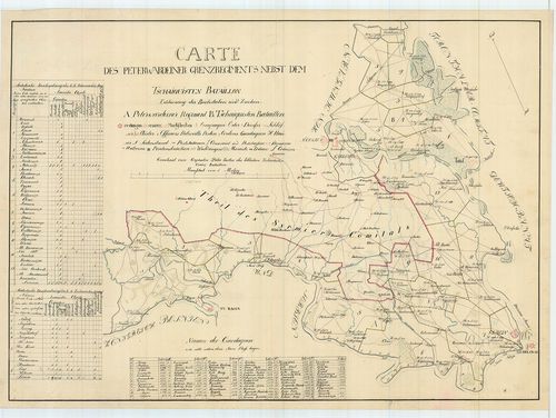
| Title | Carta des Peterwardeiner Grenz Regiments nebst dem Tschaiquisten Bataillon. |
| Main title | A Péterváradi Határőrezred és a Csajkás ezred területe. |
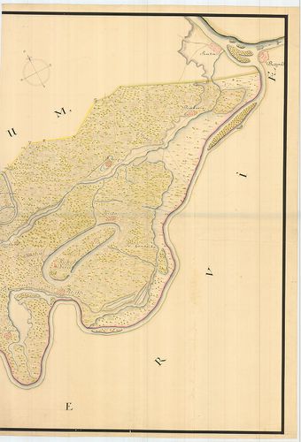
2910. Mappa der ad Militaire anno 1767 in Syrmien übernommene Herr... [B IX a 1236]
Institute and Museum of Military History •
B IX a
•
B IX Ausztria–Magyarország
•
B I–XV. Európa
| Title | Mappa der ad Militaire anno 1767 in Syrmien übernommene Herrschaft Woika (Vojka). |
| Main title | A Vojka-i uradalmi birtok térképe a Szerémségben. |
2911. Carte Originale et particuliere de la Bosnie... [B IX a 1237]
Institute and Museum of Military History •
B IX a
•
B IX Ausztria–Magyarország
•
B I–XV. Európa
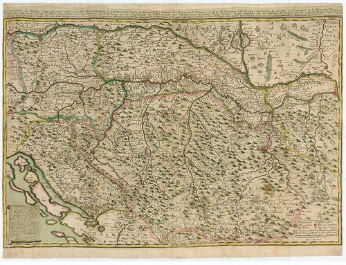
| Title | Carte Originale et particuliere de la Bosnie... |
| Main title | Bosznia, Szlavónia, Horvátország és a határőrvidékek térképe, a Magyar Királyság és Szerbia egy részével. |
2912. Plan des Peterwardeiner Granz-Regiments Bezirks. [B IX a 1238]
Institute and Museum of Military History •
B IX a
•
B IX Ausztria–Magyarország
•
B I–XV. Európa
| Title | Plan des Peterwardeiner Granz-Regiments Bezirks. |
| Main title | A Péterváradi Határőrvidék térképe. (Szlavón Határőrvidék része) |
2913. Plan und Situation des Gradiscaner Regiments... [B IX a 1239]
Institute and Museum of Military History •
B IX a
•
B IX Ausztria–Magyarország
•
B I–XV. Európa
| Title | Plan und Situation des Gradiscaner Regiments... |
| Main title | A Gradisca-i Katonai Hatáűrőrezred térképe. (Szlavón Határőrvidék része) |
2914. Broeder Grenz-Regiment. [B IX a 1240]
Institute and Museum of Military History •
B IX a
•
B IX Ausztria–Magyarország
•
B I–XV. Európa
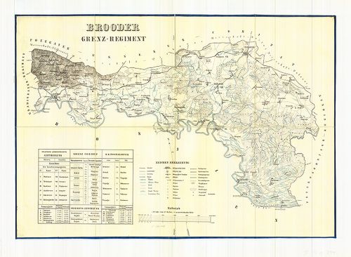
| Title | Broeder Grenz-Regiment. |
| Main title | A Brodi Katonai Határőrezred térképe. (Szlavón Határőrvidék része) |
2915. Karte des Gradiscaner Grenz Regiment. [B IX a 1241]
Institute and Museum of Military History •
B IX a
•
B IX Ausztria–Magyarország
•
B I–XV. Európa

| Title | Karte des Gradiscaner Grenz Regiment. |
| Main title | A Gradisca-i Katonai Hatáűrőrezred térképe. (Szlavón Határőrvidék része) |
2916. Peterwardeiner Regiment. [B IX a 1242]
Institute and Museum of Military History •
B IX a
•
B IX Ausztria–Magyarország
•
B I–XV. Európa
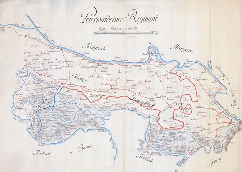
| Title | Peterwardeiner Regiment. |
| Main title | A Péterváradi Katonai Hatáűrőrezred térképe. (Szlavón Határőrvidék része) |
2917. A Szlavón Határőrvidék - Gradiscaner Dist., Broder District,... [B IX a 1243]
Institute and Museum of Military History •
B IX a
•
B IX Ausztria–Magyarország
•
B I–XV. Európa
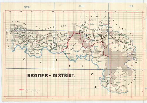
| Title | A Szlavón Határőrvidék - Gradiscaner Dist., Broder District, Peterwardeiner-Distrikt. |
| Main title | A Szlavón Határőrvidék - a Gradiscai, Brodi, Péterváradi körzet térképei. |
2918. Mappa inclyti Comitatus Syrmiensis... [B IX a 1244]
Institute and Museum of Military History •
B IX a
•
B IX Ausztria–Magyarország
•
B I–XV. Európa
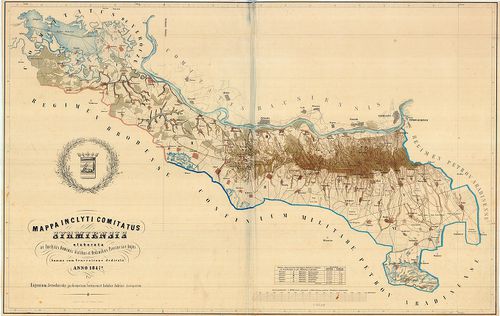
| Title | Mappa inclyti Comitatus Syrmiensis... |
| Main title | A Szerémség térképe. |
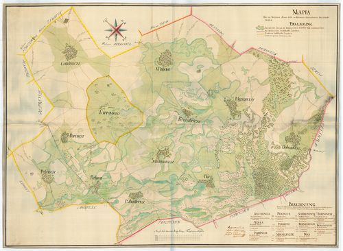
2919. Carta des Peterwardeiner Militar-Districts zwischen Ratscha ... [B IX a 1245]
Institute and Museum of Military History •
B IX a
•
B IX Ausztria–Magyarország
•
B I–XV. Európa
| Title | Carta des Peterwardeiner Militar-Districts zwischen Ratscha und Zemlin. |
| Main title | A Péterváradi Katonai Körzet térképe Racsa és Zemlin között. |
2920. Karte des Grossfürtenthums Siebenbürgen... [B IX a 1247]
Institute and Museum of Military History •
B IX a
•
B IX Ausztria–Magyarország
•
B I–XV. Európa
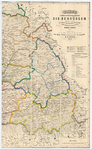
| Title | Karte des Grossfürtenthums Siebenbürgen... |
| Main title | Az Erdélyi Nagyfejedelemség térképe. |