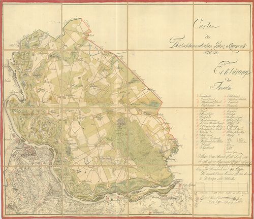
2941. Carte des Löbl. Wallach-Illyrischen Granz Regiment No. 13. [B IX a 1269]
Institute and Museum of Military History •
B IX a
•
B IX Ausztria–Magyarország
•
B I–XV. Európa
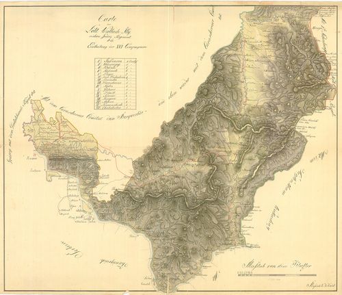
| Title | Carte des Löbl. Wallach-Illyrischen Granz Regiment No. 13. |
| Main title | A Oláh-Illír 13. határezred térképe. |
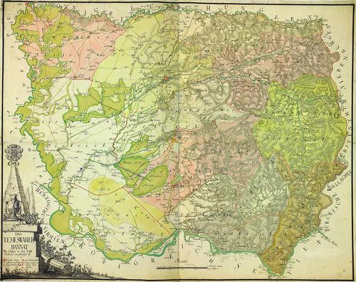
2942. Übersichts Carte des Illyrisch Banater Grenz Bataillons. [B IX a 1270]
Institute and Museum of Military History •
B IX a
•
B IX Ausztria–Magyarország
•
B I–XV. Európa
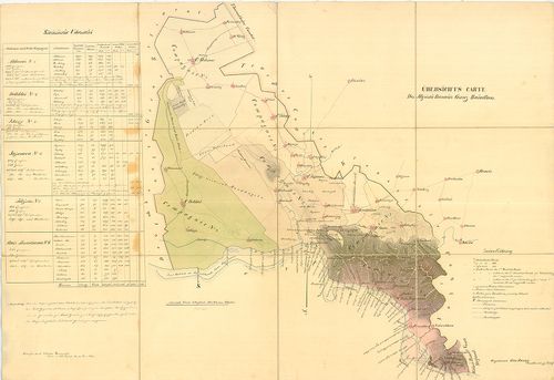
| Title | Übersichts Carte des Illyrisch Banater Grenz Bataillons. |
| Main title | Az Illír-Bánsági 14. határezred áttekintő térképe. |
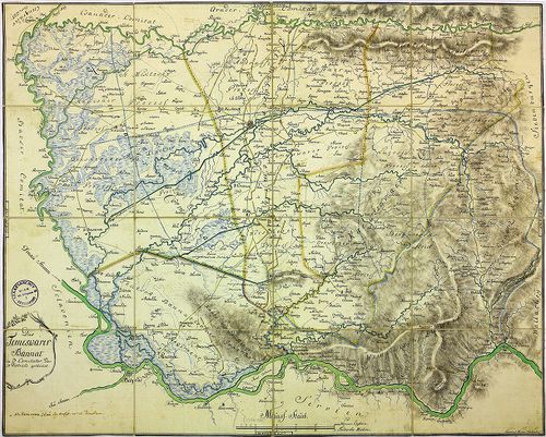
2943. Illirischbanater Grenz-Regiment No. 14. [B IX a 1272]
Institute and Museum of Military History •
B IX a
•
B IX Ausztria–Magyarország
•
B I–XV. Európa

| Title | Illirischbanater Grenz-Regiment No. 14. |
| Main title | Az Illír-Bánsági 14. határezred térképe. |
2944. Carte des K. k. Deutsbanatischen Granz Regimenst No. 12. [B IX a 1273]
Institute and Museum of Military History •
B IX a
•
B IX Ausztria–Magyarország
•
B I–XV. Európa
| Title | Carte des K. k. Deutsbanatischen Granz Regimenst No. 12. |
| Main title | A Német-Bánsági 12. határezred térképe. |
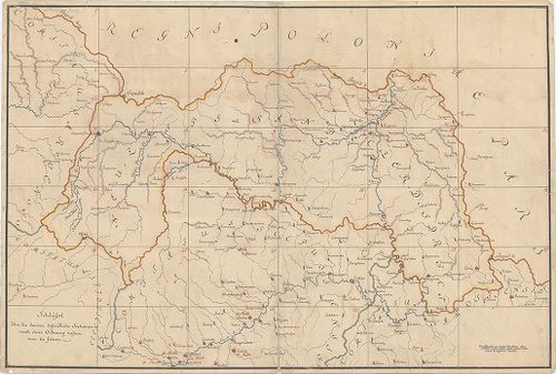
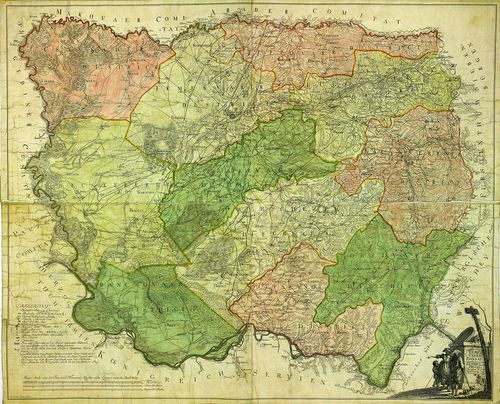
2945. Karte der Banater Militaergraenze. [B IX a 1274]
Institute and Museum of Military History •
B IX a
•
B IX Ausztria–Magyarország
•
B I–XV. Európa

| Title | Karte der Banater Militaergraenze. |
| Main title | Az Bánsági Katonai Határőrvidék térképe. |
2946. Plan der Gegent zwischen Caransebes und Fenisch im Temesware... [B IX a 1275]
Institute and Museum of Military History •
B IX a
•
B IX Ausztria–Magyarország
•
B I–XV. Európa
| Title | Plan der Gegent zwischen Caransebes und Fenisch im Temeswarer-Banat. |
| Main title | A Temesvári Bánságban található Karánsebes és Fényes környékének térképe. |
2947. Carte des Deutsbanatischen Granz-Regimenst No. 12. [B IX a 1276]
Institute and Museum of Military History •
B IX a
•
B IX Ausztria–Magyarország
•
B I–XV. Európa
| Title | Carte des Deutsbanatischen Granz-Regimenst No. 12. |
| Main title | A Német-Bánsági 12. határezred térképe. |
2948. Situations Plan der gegend im Ried, wo das neue Ort in alt B... [B IX a 1277]
Institute and Museum of Military History •
B IX a
•
B IX Ausztria–Magyarország
•
B I–XV. Európa

| Title | Situations Plan der gegend im Ried, wo das neue Ort in alt Bortsa... |
| Main title | Borcsa környékének térképe. |
2949. [Az Oláh-Illír határezred térképe.] [B IX a 1278]
Institute and Museum of Military History •
B IX a
•
B IX Ausztria–Magyarország
•
B I–XV. Európa
| Title | [Az Oláh-Illír határezred térképe.] |
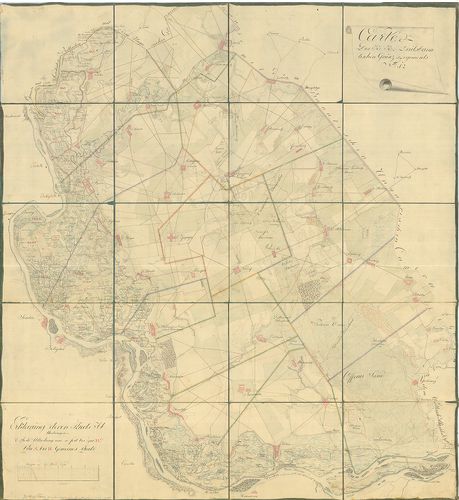
2950. [A sandec-i körzet-Árva, Liptó,, Szepes, Sáros vármegyék erg... [B IX a 1279]
Institute and Museum of Military History •
B IX a
•
B IX Ausztria–Magyarország
•
B I–XV. Európa
| Title | [A sandec-i körzet-Árva, Liptó,, Szepes, Sáros vármegyék ergyes részei-felmérési szelvényeinek áttekintője (28 szelvény). Az I. katonai felmérés előzménye, részfelmérés.] |
2951. Plan von dem Temesvarer Bannat wie solches im 11 Districten ... [B IX a 1280]
Institute and Museum of Military History •
B IX a
•
B IX Ausztria–Magyarország
•
B I–XV. Európa
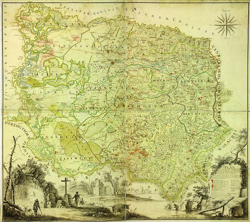
| Title | Plan von dem Temesvarer Bannat wie solches im 11 Districten eingetheilt. |
| Main title | A Temesi Bánság térképe a 11 kerületi beosztással. |
2952. Temesvarer Bannat abgetheilet in Seine District und Process. [B IX a 1281]
Institute and Museum of Military History •
B IX a
•
B IX Ausztria–Magyarország
•
B I–XV. Európa
| Title | Temesvarer Bannat abgetheilet in Seine District und Process. |
| Main title | A Temesi Bánság térképe kerületi beosztással. |
2953. Das Temesvarer Bannat wie solches in ihre 11 Districte einge... [B IX a 1282]
Institute and Museum of Military History •
B IX a
•
B IX Ausztria–Magyarország
•
B I–XV. Európa
| Title | Das Temesvarer Bannat wie solches in ihre 11 Districte eingetheilet ist. |
| Main title | A Temesi Bánság térképe a 11 kerületi beosztással. |
2954. Das Temeswarer Bannat in 3 Komitater, oder 13 Districte geth... [B IX a 1283]
Institute and Museum of Military History •
B IX a
•
B IX Ausztria–Magyarország
•
B I–XV. Európa
| Title | Das Temeswarer Bannat in 3 Komitater, oder 13 Districte getheilet. |
| Main title | A Temesi Bánság térképe kerületi beosztással. |
2955. Plan der 43 Ortschaften des Deutsch-Bannatischen Grenz-Regim... [B IX a 1284]
Institute and Museum of Military History •
B IX a
•
B IX Ausztria–Magyarország
•
B I–XV. Európa
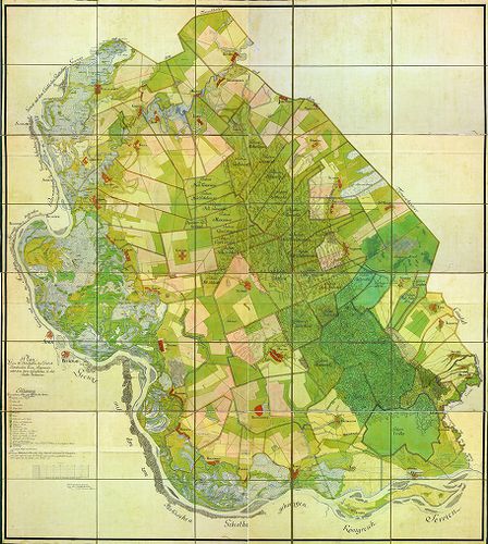
| Title | Plan der 43 Ortschaften des Deutsch-Bannatischen Grenz-Regiments, nebst dem darin befindlichen Gr. Rit. Kloster Voilovicza. |
| Main title | A Német-Bánsági Határőrvidék 43 településének térképe. |
2956. Plan des Deutsch-Bannatischen Gränz-Infanterie-Regiments. [B IX a 1285]
Institute and Museum of Military History •
B IX a
•
B IX Ausztria–Magyarország
•
B I–XV. Európa
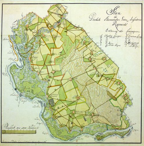
| Title | Plan des Deutsch-Bannatischen Gränz-Infanterie-Regiments. |
| Main title | A Német-Bánsági Határőrvidék térképe. |
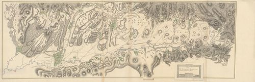
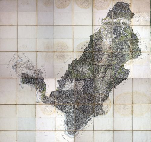
2957. Carta geografica ejusdem Transilvaniae partis et quidem Czik... [B IX a 1286]
Institute and Museum of Military History •
B IX a
•
B IX Ausztria–Magyarország
•
B I–XV. Európa
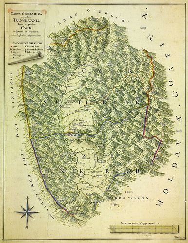
| Title | Carta geografica ejusdem Transilvaniae partis et quidem Czik inferioris et superioris, cum confinibus adjacentibus. |
| Main title | Az erdélyi Csík területe és környéke. |
2958. Plan des Passes Ojtoss. [B IX a 1287]
Institute and Museum of Military History •
B IX a
•
B IX Ausztria–Magyarország
•
B I–XV. Európa
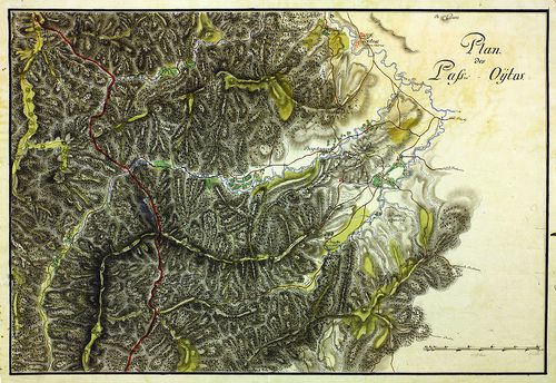
| Title | Plan des Passes Ojtoss. |
| Main title | Az Ojtozi-szoros térképe. |
2959. Situations-Plan des Törtzburger Passes in Siebenbürgen nebst... [B IX a 1288]
Institute and Museum of Military History •
B IX a
•
B IX Ausztria–Magyarország
•
B I–XV. Európa
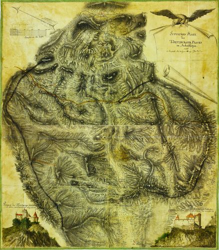
| Title | Situations-Plan des Törtzburger Passes in Siebenbürgen nebst 2 Prospect des dasigen Bergschlosses. |
| Main title | Az erdélyi Törcsvári-hágó térképe, alul jobb és bal oldalt a vár oldalnézeti képével. |
2960. Situations-Plan des Ter(t)zburger Passes. [B IX a 1289]
Institute and Museum of Military History •
B IX a
•
B IX Ausztria–Magyarország
•
B I–XV. Európa
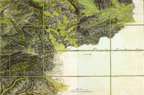
| Title | Situations-Plan des Ter(t)zburger Passes. |
| Main title | A Törcsvári-hágó térképe. |