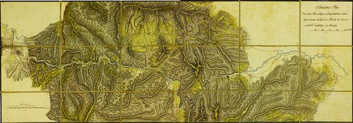
2961. Situations-Plan des Ter(t)zburger Passes... [B IX a 1290]
Institute and Museum of Military History •
B IX a
•
B IX Ausztria–Magyarország
•
B I–XV. Európa

| Title | Situations-Plan des Ter(t)zburger Passes... |
| Main title | A Törcsvári-hágó térképe. |
2962. Situations-Plan des Rothen Thurm Passes im Grossiürsteuthum ... [B IX a 1291]
Institute and Museum of Military History •
B IX a
•
B IX Ausztria–Magyarország
•
B I–XV. Európa
| Title | Situations-Plan des Rothen Thurm Passes im Grossiürsteuthum Siebenbürgen. |
| Main title | Az erdélyi Vöröstorony-hágó térképe. |
2963. Situations-Plan des Rothen Thurm Passes, von der Strasse und... [B IX a 1292]
Institute and Museum of Military History •
B IX a
•
B IX Ausztria–Magyarország
•
B I–XV. Európa
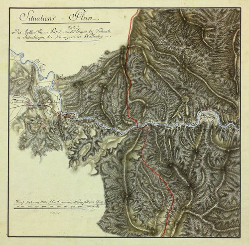
| Title | Situations-Plan des Rothen Thurm Passes, von der Strasse und Gegend bei Talmats (Nagy-Talmács) in Siebenbürgen, bis Kineny' (Cáneni) in der Walachey. |
| Main title | Az erdélyi Vöröstorony-hágó térképe az erdélyi Nagy-Talmács és a havasalföldi Cáneni között. |
2964. Plan des Vulcaner Passes, oder Weg von Hatzeg (Hátszeg) über... [B IX a 1293]
Institute and Museum of Military History •
B IX a
•
B IX Ausztria–Magyarország
•
B I–XV. Európa
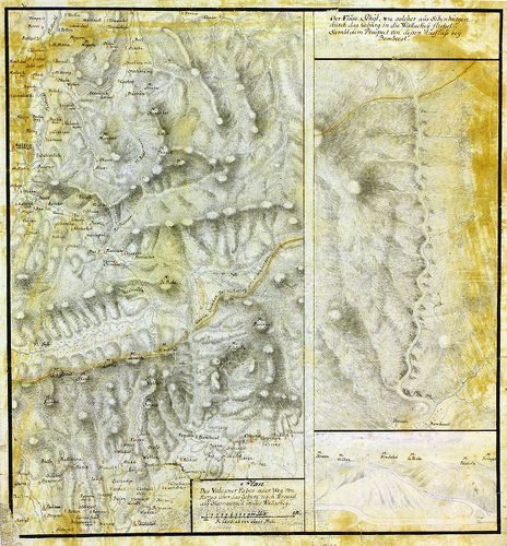
| Title | Plan des Vulcaner Passes, oder Weg von Hatzeg (Hátszeg) über das Gebürg nach Tergusyl (Tergu Jiu) aus Siebenbürgen in die Wallachey. |
| Main title | Az erdélyi Vulkán-szoros térképe Hátszeg és Tergu Jiu között. |
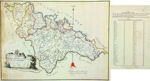
2965. Mappa Chorographica otendens....Tractum Territoriorum…Pacis,... [B IX a 1294]
Institute and Museum of Military History •
B IX a
•
B IX Ausztria–Magyarország
•
B I–XV. Európa
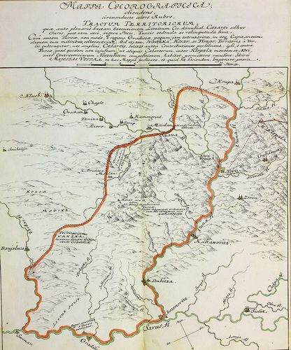
| Title | Mappa Chorographica otendens....Tractum Territoriorum…Pacis, Turcis... |
| Main title | Földrajzi térkép, amely piros színnel keretezve azokat a területeket mutatja, amelyet a békeszerződés értelmében a törököknek kell átadni (Banja Luka, Gradisca, Novi közti terület). |
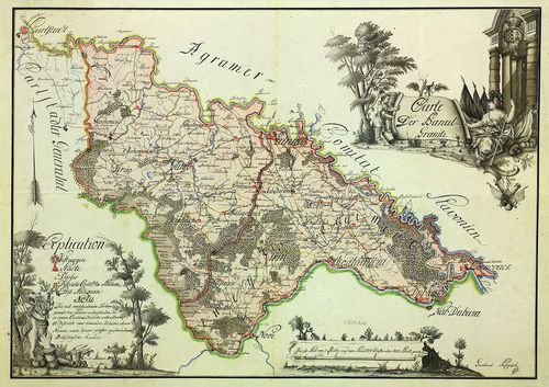
2966. Carte der Banal Granitz. [B IX a 1295]
Institute and Museum of Military History •
B IX a
•
B IX Ausztria–Magyarország
•
B I–XV. Európa
| Title | Carte der Banal Granitz. |
| Main title | A Báni Határőrvidék térképe. |
2967. Carte der Banal Granitz. [B IX a 1296]
Institute and Museum of Military History •
B IX a
•
B IX Ausztria–Magyarország
•
B I–XV. Európa
| Title | Carte der Banal Granitz. |
| Main title | A Báni Határőrvidék térképe. |
2968. Charte von der Militair-Banal Gräntz. [B IX a 1297]
Institute and Museum of Military History •
B IX a
•
B IX Ausztria–Magyarország
•
B I–XV. Európa
| Title | Charte von der Militair-Banal Gräntz. |
| Main title | A Báni Határőrvidék térképe. |
2969. Plan von dem Carlstädter Generalate und einem Theile des Pro... [B IX a 1298]
Institute and Museum of Military History •
B IX a
•
B IX Ausztria–Magyarország
•
B I–XV. Európa
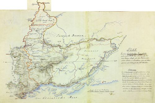
| Title | Plan von dem Carlstädter Generalate und einem Theile des Provinciale bis zum Culpa-Flusse als der Gränze zwischen Crain u. Croatien. |
| Main title | A Károlyvárosi Határőrvidék ée környékének térképe a Kulpa folyóig, mint Krajna és Horvátország határáig. |
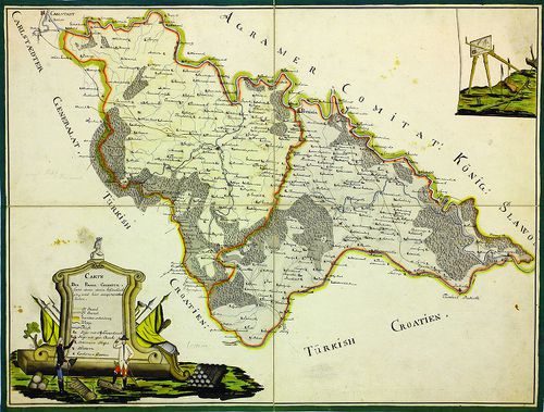
2970. Generalatus Warasdinensis. [B IX a 1299]
Institute and Museum of Military History •
B IX a
•
B IX Ausztria–Magyarország
•
B I–XV. Európa
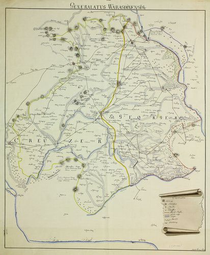
| Title | Generalatus Warasdinensis. |
| Main title | A Varasdi Határőrvidék térképe. |
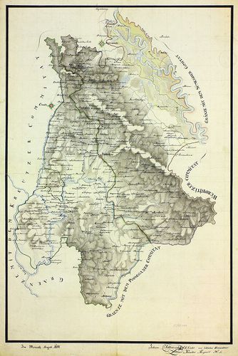
2971. Warasdiner Generalat. [B IX a 1300]
Institute and Museum of Military History •
B IX a
•
B IX Ausztria–Magyarország
•
B I–XV. Európa

| Title | Warasdiner Generalat. |
| Main title | A Varasdi Határőrvidék térképe. |
2972. [A Varasdi Határőrvidék térképe.] [B IX a 1301]
Institute and Museum of Military History •
B IX a
•
B IX Ausztria–Magyarország
•
B I–XV. Európa
| Title | [A Varasdi Határőrvidék térképe.] |
2973. Mappa …Carlstaeter Generalats. [B IX a 1302]
Institute and Museum of Military History •
B IX a
•
B IX Ausztria–Magyarország
•
B I–XV. Európa
| Title | Mappa …Carlstaeter Generalats. |
| Main title | A Károlyvárosi Határőrvidék térképe. |
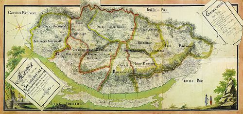
2974. Plan von den löbl Szluiner und Oguliner Grenz Regiment. [B IX a 1303]
Institute and Museum of Military History •
B IX a
•
B IX Ausztria–Magyarország
•
B I–XV. Európa
| Title | Plan von den löbl Szluiner und Oguliner Grenz Regiment. |
| Main title | A Szluin-i és Ogulin-i Határőrezredek térképe. |
2975. Übersichts-Carte des Liccaner Grenz Regiments. [B IX a 1304]
Institute and Museum of Military History •
B IX a
•
B IX Ausztria–Magyarország
•
B I–XV. Európa
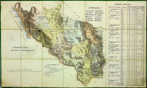
| Title | Übersichts-Carte des Liccaner Grenz Regiments. |
| Main title | A Likka-i Határőrezred áttekintő térképe. |
2976. Karte von Liccaner Grenz-Regiments. [B IX a 1305]
Institute and Museum of Military History •
B IX a
•
B IX Ausztria–Magyarország
•
B I–XV. Európa
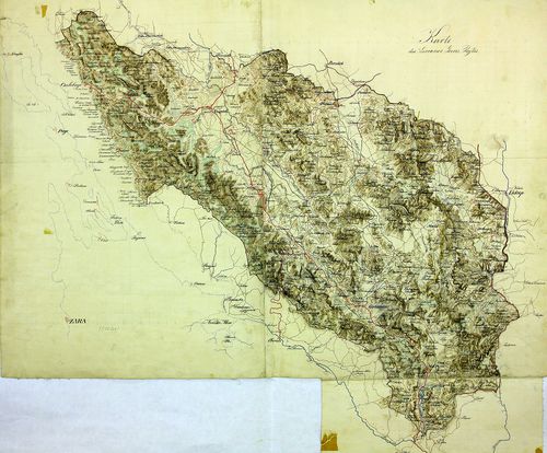
| Title | Karte von Liccaner Grenz-Regiments. |
| Main title | A Likka-i Határőrezred térképe. |
2977. Charte des Ottochaner Regiments. [B IX a 1306]
Institute and Museum of Military History •
B IX a
•
B IX Ausztria–Magyarország
•
B I–XV. Európa
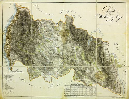
| Title | Charte des Ottochaner Regiments. |
| Main title | Az Otocsáni Határőrezred térképe. |
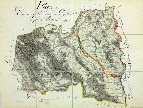
2978. Carte des Carlstaedter Oguliner Grenz-Regiment… [B IX a 1307]
Institute and Museum of Military History •
B IX a
•
B IX Ausztria–Magyarország
•
B I–XV. Európa
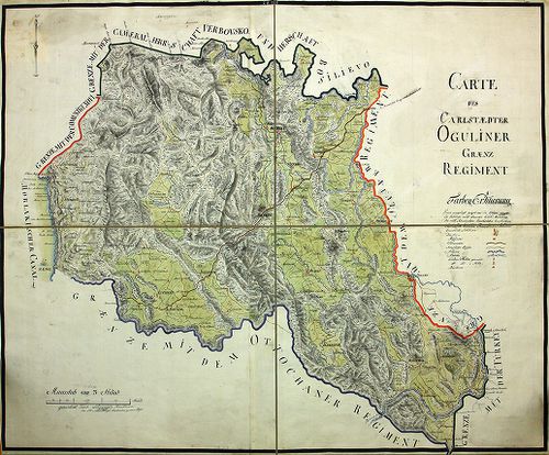
| Title | Carte des Carlstaedter Oguliner Grenz-Regiment… |
| Main title | Az Otocsáni Határőrezred térképe. |
2979. Charte des Varasdiner Kreuzer Grenz Infanterie Regiments No.... [B IX a 1308]
Institute and Museum of Military History •
B IX a
•
B IX Ausztria–Magyarország
•
B I–XV. Európa
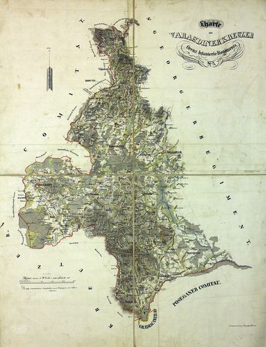
| Title | Charte des Varasdiner Kreuzer Grenz Infanterie Regiments No. 5. |
| Main title | A Varasdi 5. határőr gyalogezred térképe. |
2980. Warasdiner-Kreutzer Grenz Regiments No. [B IX a 1309]
Institute and Museum of Military History •
B IX a
•
B IX Ausztria–Magyarország
•
B I–XV. Európa
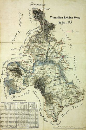
| Title | Warasdiner-Kreutzer Grenz Regiments No. |
| Main title | A Varasdi 5. határőr gyalogezred térképe. |