3001. Plan des in Herzogthum Syrmien liegenden Peterwardeiner -Inf... [B IX a 1330]
Institute and Museum of Military History •
B IX a
•
B IX Ausztria–Magyarország
•
B I–XV. Európa
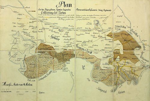
| Title | Plan des in Herzogthum Syrmien liegenden Peterwardeiner -Infanterie- Grenz -Regiments. |
| Main title | A szerémségi Péterváradi határ-gyalogezred térképe. |
3002. Plan des Slavonischen Peterwardeiner Gränz Regiments. [B IX a 1331]
Institute and Museum of Military History •
B IX a
•
B IX Ausztria–Magyarország
•
B I–XV. Európa
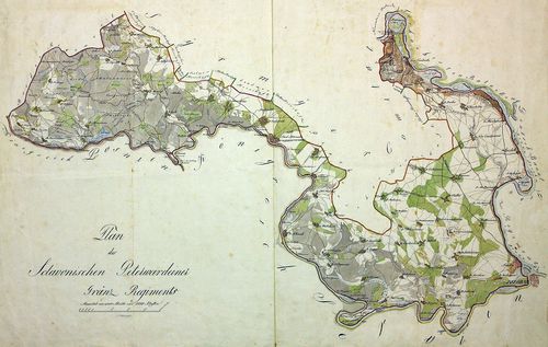
| Title | Plan des Slavonischen Peterwardeiner Gränz Regiments. |
| Main title | A szlavóniai Péterváradi határezred térképe. |
3003. Carte des Kais. König. Peterwardeiner Grenz-Regiments. [B IX a 1332]
Institute and Museum of Military History •
B IX a
•
B IX Ausztria–Magyarország
•
B I–XV. Európa
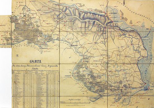
| Title | Carte des Kais. König. Peterwardeiner Grenz-Regiments. |
| Main title | A császári-királyi Péterváradi határezred térképe. |
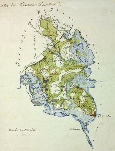
3004. Plan aller Gründe des k. k. Tschaikisten Bataillons-Cantons-... [B IX a 1333]
Institute and Museum of Military History •
B IX a
•
B IX Ausztria–Magyarország
•
B I–XV. Európa
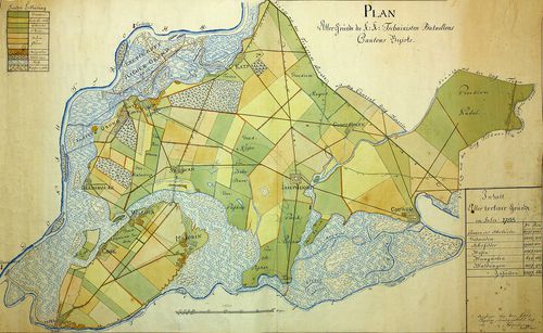
| Title | Plan aller Gründe des k. k. Tschaikisten Bataillons-Cantons-Bezirk. |
| Main title | A császári-királyi Csajkások térképe. |
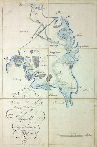
3005. Plan des Tschaikisten Bataillons. [B IX a 1334]
Institute and Museum of Military History •
B IX a
•
B IX Ausztria–Magyarország
•
B I–XV. Európa
| Title | Plan des Tschaikisten Bataillons. |
| Main title | A Csajkás ezred térképe. |
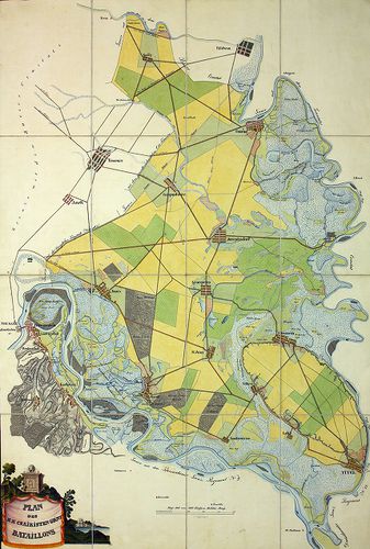
3006. Plan des löblichen kaiserlichen königlichen Tschaikisten Gre... [B IX a 1335]
Institute and Museum of Military History •
B IX a
•
B IX Ausztria–Magyarország
•
B I–XV. Európa
| Title | Plan des löblichen kaiserlichen königlichen Tschaikisten Grenz-Bataillons. |
| Main title | A Csajkás határezred térképe. |
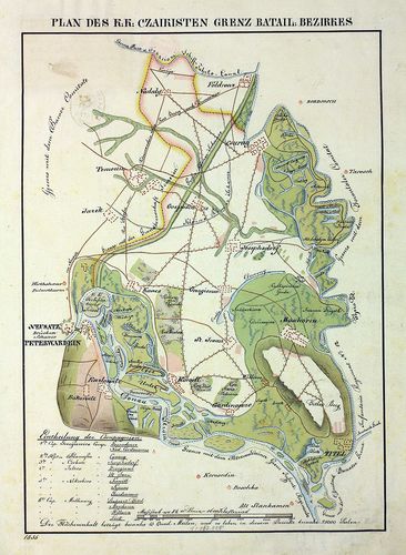
3007. Plan des k. k. Czaikisten Grenz-Bataillons. [B IX a 1336]
Institute and Museum of Military History •
B IX a
•
B IX Ausztria–Magyarország
•
B I–XV. Európa
| Title | Plan des k. k. Czaikisten Grenz-Bataillons. |
| Main title | A Csajkás határezred térképe. |
3008. Plan vom Syrmier Comitat. [B IX a 1337]
Institute and Museum of Military History •
B IX a
•
B IX Ausztria–Magyarország
•
B I–XV. Európa
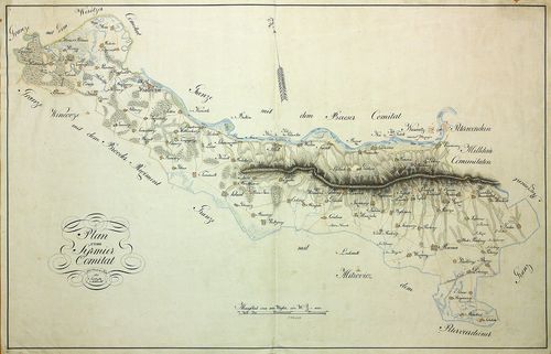
| Title | Plan vom Syrmier Comitat. |
| Main title | A Szerémség térképe. |
3009. Plan des k. k. Czaikisten Grenz-Bataill. Bezirks. [B IX a 1338]
Institute and Museum of Military History •
B IX a
•
B IX Ausztria–Magyarország
•
B I–XV. Európa
| Title | Plan des k. k. Czaikisten Grenz-Bataill. Bezirks. |
| Main title | A Csajkás határezred térképe. |
3010. Aufnahme von der Marmorosch in Ober Ungarn. [B IX a 1340]
Institute and Museum of Military History •
B IX a
•
B IX Ausztria–Magyarország
•
B I–XV. Európa
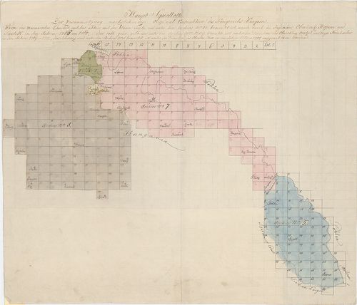
| Title | Aufnahme von der Marmorosch in Ober Ungarn. |
| Main title | Máramaros I. katonai felmérése (részfelmérés). |
3011. Eine newe Land Karte von Wien biss nach Constantinopel und a... [B IX a 1341]
Institute and Museum of Military History •
B IX a
•
B IX Ausztria–Magyarország
•
B I–XV. Európa
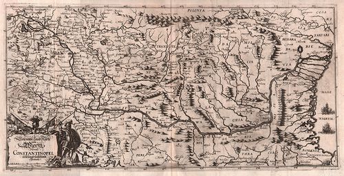
| Title | Eine newe Land Karte von Wien biss nach Constantinopel und angräntzenden Ländern. |
| Main title | Magyarország és a környező területek (Bécs-Konstantinápoly között) térképe. |
3012. Die königliche niederhung. 7 freye Bergstädt, Kremnitz, Sche... [B IX a 1342]
Institute and Museum of Military History •
B IX a
•
B IX Ausztria–Magyarország
•
B I–XV. Európa
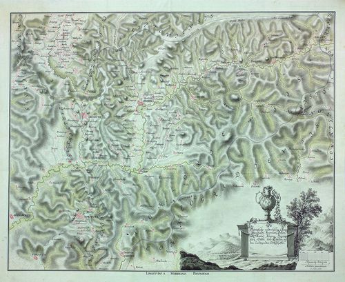
| Title | Die königliche niederhung. 7 freye Bergstädt, Kremnitz, Schemnitz, Neusol Pugans (Bakabánya). Königsberg, Dulln und Libeten (Libetbánya) mit den umliegenden Ortschaften. |
| Main title | A hét szabad királyi bányaváros térképe. |
3013. Abaúj megye átnézeti térképe. [B IX a 1401]
Institute and Museum of Military History •
B IX a 1401–2599 Magyarország megyetérképek
•
B IX Ausztria–Magyarország
•
B I–XV. Európa
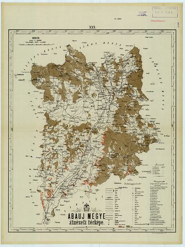
| Title | Abaúj megye átnézeti térképe. |
3014. A. Abaujvár-megye. (Abaujvarer comitat.) B. Torna-megye. (To... [B IX a 1402]
Institute and Museum of Military History •
B IX a 1401–2599 Magyarország megyetérképek
•
B IX Ausztria–Magyarország
•
B I–XV. Európa
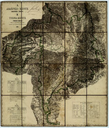
| Title | A. Abaujvár-megye. (Abaujvarer comitat.) B. Torna-megye. (Tornaer Comitat.) |
3015. Comitat Abaúj-Torna. Abaúj-Torna vármegye. [B IX a 1403]
Institute and Museum of Military History •
B IX a 1401–2599 Magyarország megyetérképek
•
B IX Ausztria–Magyarország
•
B I–XV. Európa
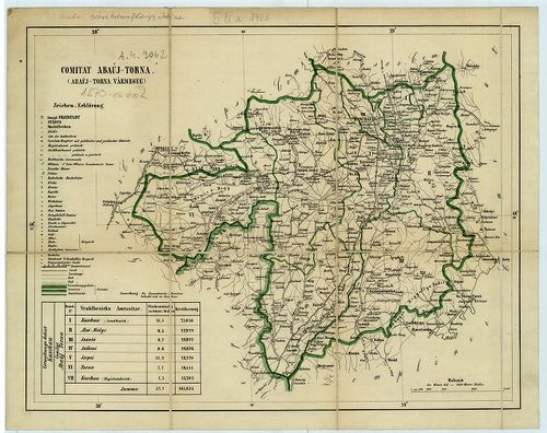
| Title | Comitat Abaúj-Torna. Abaúj-Torna vármegye. |
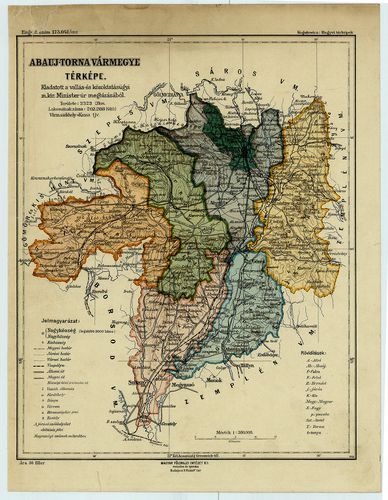
3016. Abaúj-Torna megye térképe. [B IX a 1404]
Institute and Museum of Military History •
B IX a 1401–2599 Magyarország megyetérképek
•
B IX Ausztria–Magyarország
•
B I–XV. Európa
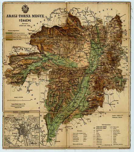
| Title | Abaúj-Torna megye térképe. |
| Main title | Mt. Kassa (Košice) és környéke. |
| Subject | „Magyarország megyéinek kézi atlasza” 27. sz. lapja. |
3017. Abaúj-Torna vármegye térképe. [B IX a 1406]
Institute and Museum of Military History •
B IX a 1401–2599 Magyarország megyetérképek
•
B IX Ausztria–Magyarország
•
B I–XV. Európa
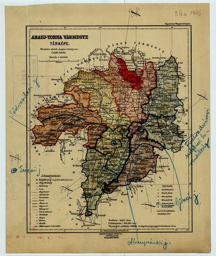
| Title | Abaúj-Torna vármegye térképe. |
| Main title | Kogutowicz: „Megyei térképek” c. mű lapja, átdolgozta Czakó I. |
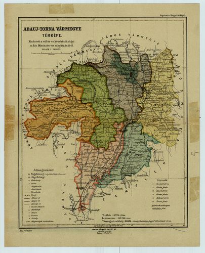
3018. Abaúj-Torna vármegye térképe. [B IX a 1407]
Institute and Museum of Military History •
B IX a 1401–2599 Magyarország megyetérképek
•
B IX Ausztria–Magyarország
•
B I–XV. Európa
| Title | Abaúj-Torna vármegye térképe. |
| Main title | Kogutowicz: „Megyei Térképek” c. mű lapja. |
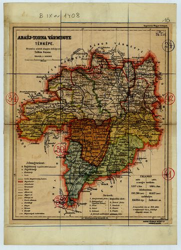
3019. Abaúj-Torna vármegye térképe. [B IX a 1408/1]
Institute and Museum of Military History •
B IX a 1401–2599 Magyarország megyetérképek
•
B IX Ausztria–Magyarország
•
B I–XV. Európa
| Title | Abaúj-Torna vármegye térképe. |
| Main title | Kogutowicz: „Megyei térképek” c. mű lapja. |
3020. Abaúj-Torna vármegye térképe. [B IX a 1408/2]
Institute and Museum of Military History •
B IX a 1401–2599 Magyarország megyetérképek
•
B IX Ausztria–Magyarország
•
B I–XV. Európa
| Title | Abaúj-Torna vármegye térképe. |
| Main title | Kogutowicz: „Megyei térképek”c. mű lapja. |