1521. Mansfeldiae Comitatus Descriptio. [B IV a 1056]
Institute and Museum of Military History •
B IV a
•
B IV Német birodalom
•
B I–XV. Európa
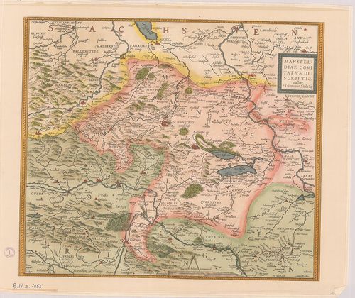
| Title | Mansfeldiae Comitatus Descriptio. |
| Main title | Mansfelt tartomány (Németo.) térképe a XVI. sz.-ból. |
1522. Berlin. [B IV a 1058]
Institute and Museum of Military History •
B IV a
•
B IV Német birodalom
•
B I–XV. Európa
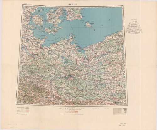
| Title | Berlin. |
1523. Neu Hand- und Wandkarte des Deutschlen Reich und der nachbar... [B IV a 1059]
Institute and Museum of Military History •
B IV a
•
B IV Német birodalom
•
B I–XV. Európa
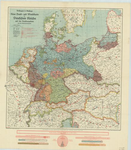
| Title | Neu Hand- und Wandkarte des Deutschlen Reich und der nachbargebirte … |
| Main title | A Német Birodalom és környezete a békeszerződések után 1919 júniusában. A határok tervezete. |
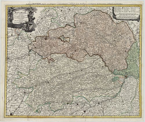
1524. Bavariae… [B IV a 1063]
Institute and Museum of Military History •
B IV a
•
B IV Német birodalom
•
B I–XV. Európa
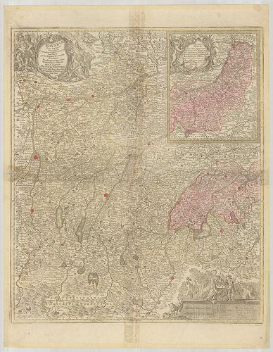
| Title | Bavariae… |
| Main title | Bajorország térképe. |
1525. Bavariae Pars Inferior tam in sua Regimina Generalia quam in... [B IV a 1066]
Institute and Museum of Military History •
B IV a
•
B IV Német birodalom
•
B I–XV. Európa
| Title | Bavariae Pars Inferior tam in sua Regimina Generalia quam in eorundem Praefecturas Particulares… |
| Main title | Bajorország térképe (Straubing és Landhut, német kormányzóságok) a 18. században. |
1526. Deutschland Geländebildkarte. [B IV b 12]
Institute and Museum of Military History •
B IV b
•
B IV Német birodalom
•
B I–XV. Európa
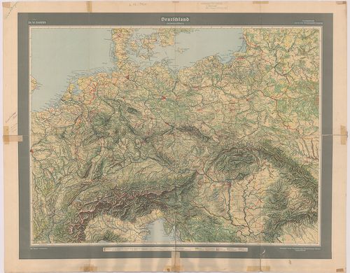
| Title | Deutschland Geländebildkarte. |
| Main title | Németország és a környező államok áttekintő térképe 1944. VI. 29-i határokkal. |
1527. Höhen-Karte des Königreichs Sachsen und des anstossenden The... [B IV b 17]
Institute and Museum of Military History •
B IV b
•
B IV Német birodalom
•
B I–XV. Európa
| Title | Höhen-Karte des Königreichs Sachsen und des anstossenden Theiles von Böhmen. |
| Main title | 3 mt.: 1. Das rechte Elb-Ufer (Az Elba-jobbpartjának hegységei.) 2. Übersichtscharte vom Königreiche Sachsen. (A Szász Királyság áttekintő térképe.) 3. Nebencharte für das Gebiet der Neisse. (Melléktérkép a Neisse vidékről.)A Szász Királyság hegyvidékének orográfiai térképe az 1883 körül. |
1528. Karte vom Erzgebirge. [B IV b 18]
Institute and Museum of Military History •
B IV b
•
B IV Német birodalom
•
B I–XV. Európa
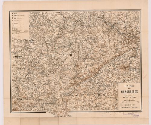
| Title | Karte vom Erzgebirge. |
| Main title | A Szász Érchegység térképe. |
1529. Harz-Gebirge. [B IV b 19]
Institute and Museum of Military History •
B IV b
•
B IV Német birodalom
•
B I–XV. Európa
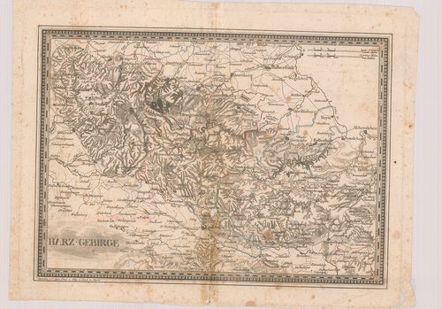
| Title | Harz-Gebirge. |
| Main title | A Harz-hegység térképe. |
1530. Théâtre des Opérations Entre le Danube et l’Isar en Avril 18... [B IV b 23]
Institute and Museum of Military History •
B IV b
•
B IV Német birodalom
•
B I–XV. Európa
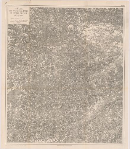
| Title | Théâtre des Opérations Entre le Danube et l’Isar en Avril 1809. |
| Main title | A Duna és Isar közötti terület katonai térképe a francia–bajor háború alatt 1807-ben. |
1531. Grenz u. Örter-Karte von Deutschland. [B IV b 25/1]
Institute and Museum of Military History •
B IV b
•
B IV Német birodalom
•
B I–XV. Európa
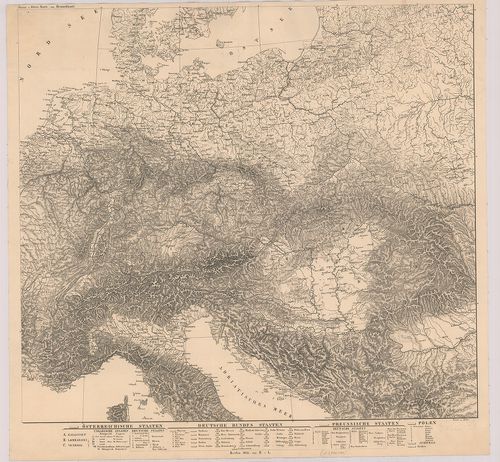
| Title | Grenz u. Örter-Karte von Deutschland. |
| Main title | Németország hegyvízrajzi térképe 1826-ban. |
1532. Germania Vetus. [B IV b 26]
Institute and Museum of Military History •
B IV b
•
B IV Német birodalom
•
B I–XV. Európa
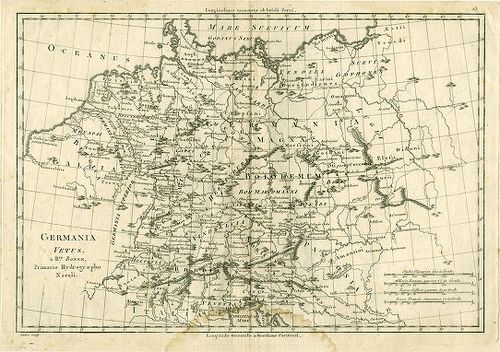
| Title | Germania Vetus. |
| Main title | Németország hegyvízrajzi térképe. |
1533. Gebirgs Skizze von Deutschland. [B IV b 29]
Institute and Museum of Military History •
B IV b
•
B IV Német birodalom
•
B I–XV. Európa
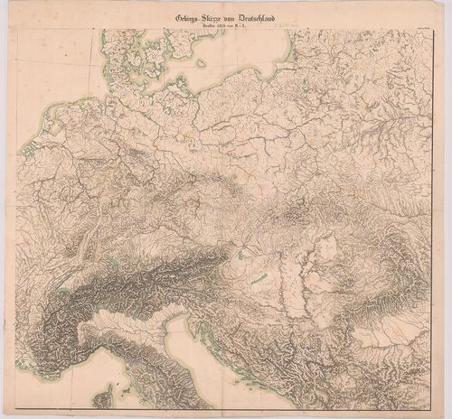
| Title | Gebirgs Skizze von Deutschland. |
| Main title | Németország és a környező országok hegyvízrajz vázlattérképe 1826-ban. |
1534. Mappa Geographica Ad Historiam Nigrae Silvae Martini Gerbert... [B IV b 41]
Institute and Museum of Military History •
B IV b
•
B IV Német birodalom
•
B I–XV. Európa
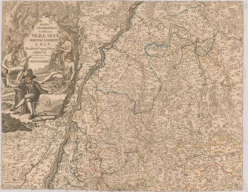
| Title | Mappa Geographica Ad Historiam Nigrae Silvae Martini Gerberti S. R. I. P. Monasterii et Congreg. S. Blasii. Abbatis. |
| Main title | Schwarzwald (Fekete-erdő), Württemberg–Baden tartomány földrajzi térképe 1788-ban. |
1535. Gewässer und Höhenkarte des Königreiches Württemberg. [B IV b 44]
Institute and Museum of Military History •
B IV b
•
B IV Német birodalom
•
B I–XV. Európa
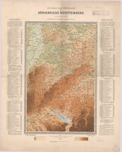
| Title | Gewässer und Höhenkarte des Königreiches Württemberg. |
| Main title | A Württemberg-i Királyság hegyvízrajzi térképe 1893-ban. |
1536. Hydrographia Germaniae qua Geographiae Naturalis… [B IV b 45]
Institute and Museum of Military History •
B IV b
•
B IV Német birodalom
•
B I–XV. Európa
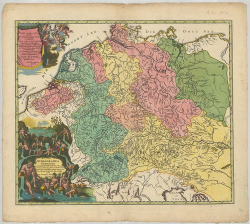
| Title | Hydrographia Germaniae qua Geographiae Naturalis… |
| Main title | Németország vízrajzi térképe. |
1537. Strom Atlas von Baiern, Donau Strom, Inn, Isar, Lech, Loisac... [B IV b 52]
Institute and Museum of Military History •
B IV b
•
B IV Német birodalom
•
B I–XV. Európa
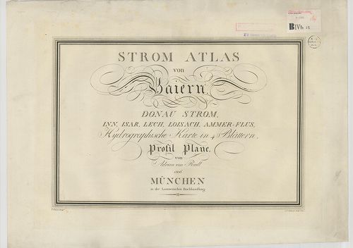
| Title | Strom Atlas von Baiern, Donau Strom, Inn, Isar, Lech, Loisach, Ammer-Flus, Hydrographische-Karte in 4 Blättern. |
| Main title | Bajorország vízrajzi térképe 1806-ban. |
1538. [Danubius Flus.] [B IV b 58]
Institute and Museum of Military History •
B IV b
•
B IV Német birodalom
•
B I–XV. Európa
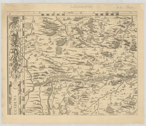
| Title | [Danubius Flus.] |
| Main title | A Duna térképe Dunawörth-től Ingolstadtig. |
1539. Karte des Donaustroms von seinem Ursprung bis zum Ausfluss i... [B IV b 60/4]
Institute and Museum of Military History •
B IV b
•
B IV Német birodalom
•
B I–XV. Európa
| Title | Karte des Donaustroms von seinem Ursprung bis zum Ausfluss ins Schwarze Meer… |
| Main title | A Duna térképe a forrásvidéktől a Fekete-tengerig 1788-ban. |
1540. Geographischer Grundriss von dem Neuen Elster und Canal-Flos... [B IV b 78/1]
Institute and Museum of Military History •
B IV b
•
B IV Német birodalom
•
B I–XV. Európa
| Title | Geographischer Grundriss von dem Neuen Elster und Canal-Flosswesen. |
| Main title | Az Elster új hajózható csatorna térképvázlata 1741–1748-ban. |