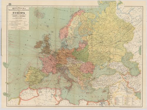
21. Maps of Europe and Germany. Including railroad, steamship, a... [B I c 64]
Institute and Museum of Military History •
B I c
•
B I Európa
•
B I–XV. Európa
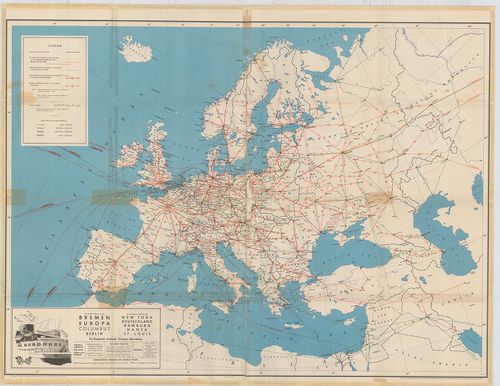
| Title | Maps of Europe and Germany. Including railroad, steamship, auto and air routes. |
| Main title | hátl.: Map of Germany. |
| Subject | Európa közlekedési térképe 1936-ban. |
22. Die Schnellzugslinien Europas. European Express Train Servic... [B I c 65]
Institute and Museum of Military History •
B I c
•
B I Európa
•
B I–XV. Európa
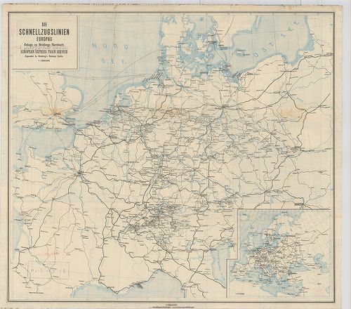
| Title | Die Schnellzugslinien Europas. European Express Train Service. |
| Main title | Mt.: Europa. Anlage zu Hobbings Kursbuch. |
| Subject | Nyugat- és Közép-Európa gyorsvonati vonalai a XX. század elején. |
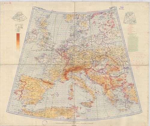
23. Nivellements de précision. Lignes existant en Europa (Russie... [B I c 66]
Institute and Museum of Military History •
B I c
•
B I Európa
•
B I–XV. Európa
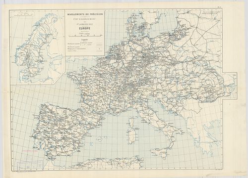
| Title | Nivellements de précision. Lignes existant en Europa (Russie exceptée) et en Afrique… |
| Main title | Európa úthálózati térképe 1903-ban. |
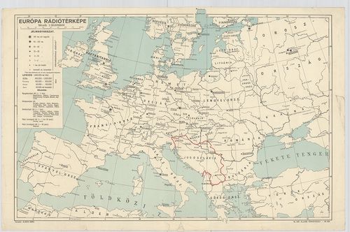
24. Európa rádió adóállomásai [B I c 67]
Institute and Museum of Military History •
B I c
•
B I Európa
•
B I–XV. Európa
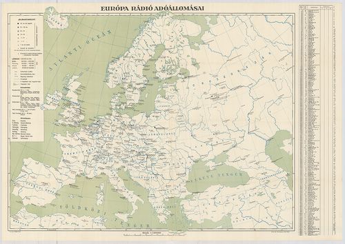
| Title | Európa rádió adóállomásai |
25. Neueste Reise-Hand-Und Kontorkarte von Europa mit den angren... [B I c 70]
Institute and Museum of Military History •
B I c
•
B I Európa
•
B I–XV. Európa
| Title | Neueste Reise-Hand-Und Kontorkarte von Europa mit den angrenzenden Teilen von Asien und Afrika. |
| Main title | Európa és Ázsia, Afrika határos részeinek úthálózati térképe. |
26. Karte von Europa und Westasien. [B I c 78]
Institute and Museum of Military History •
B I c
•
B I Európa
•
B I–XV. Európa
| Title | Karte von Europa und Westasien. |
| Main title | Európa térképe 1940-ben. |
27. Magyar Királyi Lég-ügyi Hivatal Időjelző Központ. [B I c 79]
Institute and Museum of Military History •
B I c
•
B I Európa
•
B I–XV. Európa
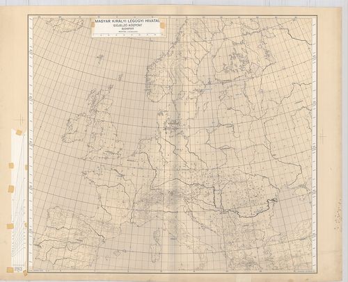
| Title | Magyar Királyi Lég-ügyi Hivatal Időjelző Központ. |
28. Schaubild von Europa mit bildlicher Darstellung der hauptsäc... [B I c 80]
Institute and Museum of Military History •
B I c
•
B I Európa
•
B I–XV. Európa
| Title | Schaubild von Europa mit bildlicher Darstellung der hauptsächlichsten Wirtschaftsgüter, Bodenschätze, Industriezentren. |
| Main title | Európa térképe gazdasági adatokkal 1940 körül. |
29. Angling in troubled Waters. – Der Fischfang im Trüben – La P... [B I c 85]
Institute and Museum of Military History •
B I c
•
B I Európa
•
B I–XV. Európa
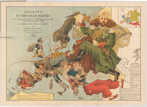
| Title | Angling in troubled Waters. – Der Fischfang im Trüben – La Peche en eau trouble – La Pesca nelle acque turbes. A Serio-Comic Map of Europe. |
| Main title | Mt.: Key Map of Europe. (Európa térképe.) |
| Subject | „Halászat a zavarosban" - tréfás rajz Európáról. 1899. |
30. G. Freytags Völkerkarte von Europa. [B I c 88]
Institute and Museum of Military History •
B I c
•
B I Európa
•
B I–XV. Európa
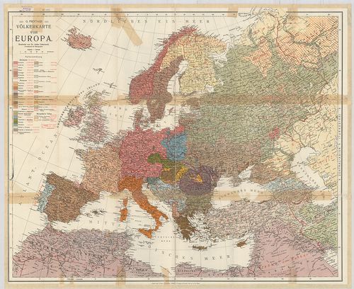
| Title | G. Freytags Völkerkarte von Europa. |
| Main title | Európa néprajzi térképe. |
31. Länder- und Völkerkarte Europas. [B I c 89]
Institute and Museum of Military History •
B I c
•
B I Európa
•
B I–XV. Európa
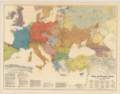
| Title | Länder- und Völkerkarte Europas. |
| Main title | Európa ország és néprajzi térképe. |
32. Nova karta Evrope. Po ryszkom lisztu „Novoe Zveno”. [B I c 90]
Institute and Museum of Military History •
B I c
•
B I Európa
•
B I–XV. Európa
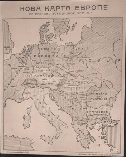
| Title | Nova karta Evrope. Po ryszkom lisztu „Novoe Zveno”. |
| Main title | Európa tervezett határrendezése az első világháború után. |
33. Europa etnografica. [B I c 94]
Institute and Museum of Military History •
B I c
•
B I Európa
•
B I–XV. Európa

| Title | Europa etnografica. |
| Main title | Európa néprajzi térképe 1940-ben. |
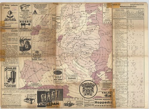
34. Európa rádiótérképe. [B I c 100]
Institute and Museum of Military History •
B I c
•
B I Európa
•
B I–XV. Európa
| Title | Európa rádiótérképe. |
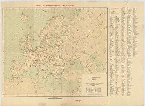
35. Mapa radjokomunikacyjna Europy. [B I c 101]
Institute and Museum of Military History •
B I c
•
B I Európa
•
B I–XV. Európa
| Title | Mapa radjokomunikacyjna Europy. |
| Main title | Európa rádióállomásainak térképe 1936. |
36. [Európa rádióállomásai.] [B I c 102/a]
Institute and Museum of Military History •
B I c
•
B I Európa
•
B I–XV. Európa
| Title | [Európa rádióállomásai.] |
37. [A világ rádióállomásai] [B I c 102/b]
Institute and Museum of Military History •
B I c
•
B I Európa
•
B I–XV. Európa

| Title | [A világ rádióállomásai] |
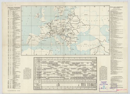
38. Európa rádióadó-állomásainak hullámhossz, kilowatt- és távol... [B I c 103]
Institute and Museum of Military History •
B I c
•
B I Európa
•
B I–XV. Európa
| Title | Európa rádióadó-állomásainak hullámhossz, kilowatt- és távolsági térképe. |
39. Übersichtskarte der Breiten- und Azimutbestimmungen. Carte d... [B I c 120]
Institute and Museum of Military History •
B I c
•
B I Európa
•
B I–XV. Európa
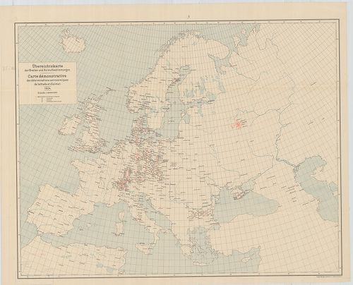
| Title | Übersichtskarte der Breiten- und Azimutbestimmungen. Carte demonstrative des déterminations astronomiques de latitude et d’azimut. 1904. |
| Main title | Európa térképe a földr. szélesség és azimut meghatározásokkal 1904-ben. |
40. Übersichtskarte der telegraphischen Längenbestimmungen. Cart... [B I c 121]
Institute and Museum of Military History •
B I c
•
B I Európa
•
B I–XV. Európa
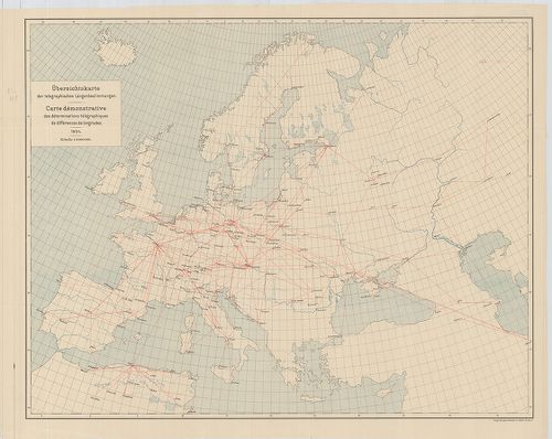
| Title | Übersichtskarte der telegraphischen Längenbestimmungen. Carte démonstrative des déterminations télégraphiques dex différences de longitudes. 1904. |
| Main title | Európa távíró vonalai 1904-ben. |