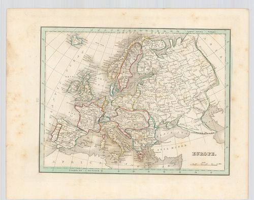
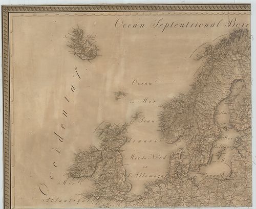
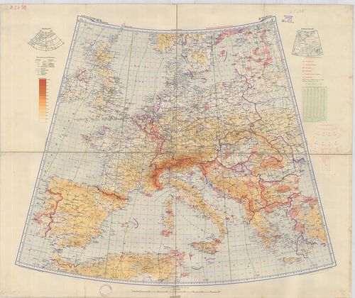
101. Carte générale de l'Europe. [B I a 201]
Institute and Museum of Military History •
B I a
•
B I Európa
•
B I–XV. Európa
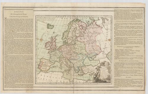
| Title | Carte générale de l'Europe. |
| Main title | Európa általános térképe. |
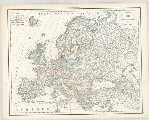
102. L'Europe. [B I a 202]
Institute and Museum of Military History •
B I a
•
B I Európa
•
B I–XV. Európa
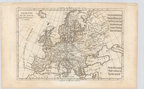
| Title | L'Europe. |
| Main title | Európa térképe. |
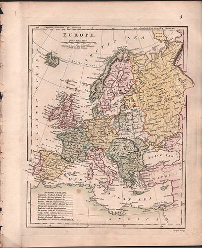
103. Carte d'Europe 1829. [B I a 203]
Institute and Museum of Military History •
B I a
•
B I Európa
•
B I–XV. Európa
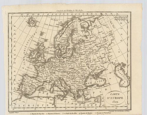
| Title | Carte d'Europe 1829. |
| Main title | Európa térképe. |
104. Europe. [B I a 204]
Institute and Museum of Military History •
B I a
•
B I Európa
•
B I–XV. Európa
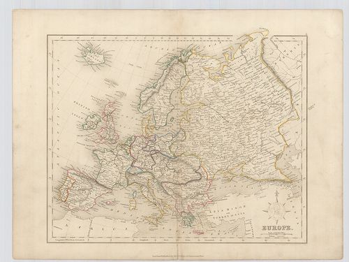
| Title | Europe. |
| Main title | Európa térképe. |
105. Europe. [B I a 205]
Institute and Museum of Military History •
B I a
•
B I Európa
•
B I–XV. Európa
| Title | Europe. |
| Main title | Európa térképe. |
106. Europe. [B I a 206]
Institute and Museum of Military History •
B I a
•
B I Európa
•
B I–XV. Európa
| Title | Europe. |
| Main title | Európa térképe. |
107. Europe. [B I a 208]
Institute and Museum of Military History •
B I a
•
B I Európa
•
B I–XV. Európa
| Title | Europe. |
| Main title | Európa térképe. |
108. An Accurate Map of Europe, compiled from the best Authotieri... [B I a 209]
Institute and Museum of Military History •
B I a
•
B I Európa
•
B I–XV. Európa
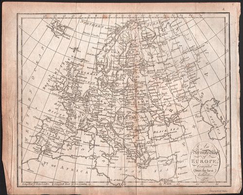
| Title | An Accurate Map of Europe, compiled from the best Authotieries. |
| Main title | Európa térképe. |
109. Carte Générale Orographique et Hydrographique de L’Europe. [B I b 3]
Institute and Museum of Military History •
B I b
•
B I Európa
•
B I–XV. Európa
| Title | Carte Générale Orographique et Hydrographique de L’Europe. |
| Main title | Európa hegy-vízrajzi térképe 1816-ban. |
110. Europa nach seinen oro-hydrographischen Verhältnissen. [B I b 5]
Institute and Museum of Military History •
B I b
•
B I Európa
•
B I–XV. Európa
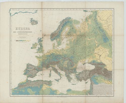
| Title | Europa nach seinen oro-hydrographischen Verhältnissen. |
| Main title | Európa orográfiai és hydrográfiai viszonyai 1870 körül. |
111. Europa. [B I b 6]
Institute and Museum of Military History •
B I b
•
B I Európa
•
B I–XV. Európa
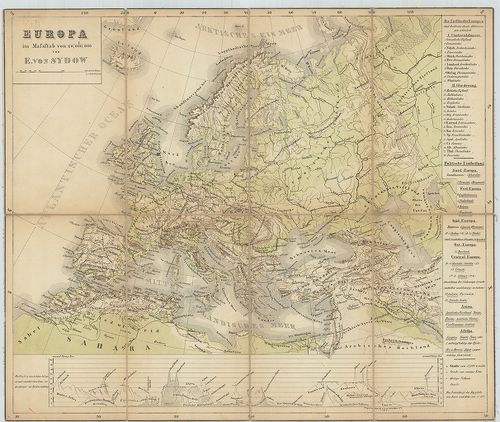
| Title | Europa. |
| Main title | Európa hegyrajzi térképe 1860 körül. |
112. Esquisse orographique de L’Europe. [B I b 7]
Institute and Museum of Military History •
B I b
•
B I Európa
•
B I–XV. Európa
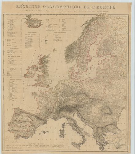
| Title | Esquisse orographique de L’Europe. |
| Main title | Mt.: (Krim félsziget és környéke.) |
| Subject | Európa orográfiai térképe 1830 körül. |
113. Carta di Cabottaggio del Mare Adriatico. [B I b 24]
Institute and Museum of Military History •
B I b
•
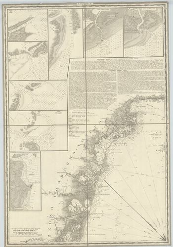
B I Európa
•
B I–XV. Európa
| Title | Carta di Cabottaggio del Mare Adriatico. |
| Main title | I. [Monfalcone] II. [Venedig (Venezia)] III. [Triest)] IV. [Rimini] V. [Carlopago (Karlobag)] VI. [Ancona.] VII. [Zara (Zadar] VIII. [Grottamare (Grottammaro)] IX. [Spalatro (Split)] X: [Termoli] XI. [Sabioncello (Peljesac fsz.)] XII. [Manfredonia] XIII. [Cattaro (Kotor)] XIV. [Trani] XV. [Antivari (Bar)] XVI. ]Brindisi] XVII. [Aulona] XVIII. [Otranto] XIX. [Annotazioni generali sul Mare Adriatico.] XX. [Corfu (Kérkira)] + 72 db mt. Kikötők és folyótorkolatok. |
| Subject | Az Adriai-tenger és a partvidéke hajózási térképe 1820 körül. |
114. Idrografia Generale del Mare Adriatico… [B I b 25]
Institute and Museum of Military History •
B I b
•
B I Európa
•
B I–XV. Európa
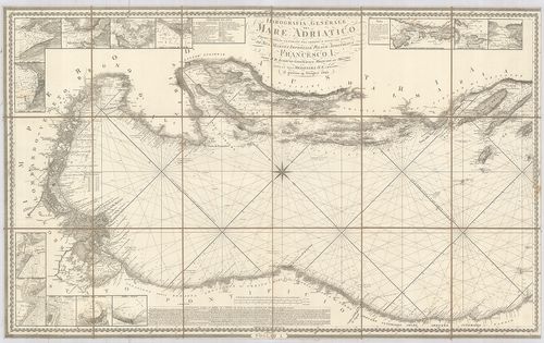
| Title | Idrografia Generale del Mare Adriatico… |
| Main title | 2 mt.: az Adriai kikötőkről. |
| Subject | Az Adriai-tenger általános hidrogáfiai térképe. |
115. [A Tirrén-Adriai és az Égei tenger mélységmérési térképe.] [B I b 50]
Institute and Museum of Military History •
B I b
•
B I Európa
•
B I–XV. Európa
| Title | [A Tirrén-Adriai és az Égei tenger mélységmérési térképe.] |
116. Karte des Baltischen Meeres und der, dassalbe begrenzenden L... [B I b 58]
Institute and Museum of Military History •
B I b
•
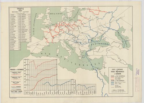
B I Európa
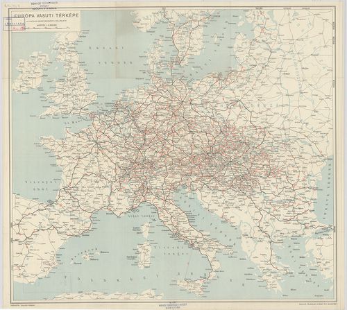
•
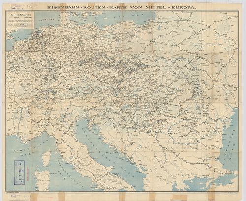
B I–XV. Európa
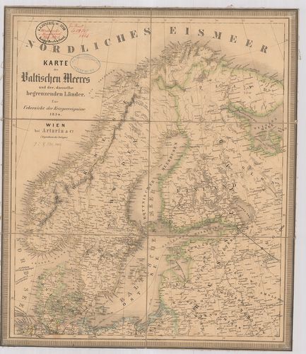
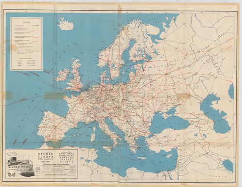
| Title | Karte des Baltischen Meeres und der, dassalbe begrenzenden Länder. Zur Uebersicht der Kriegsereignisse 1854. |
| Main title | A Balti-tenger és a vele határos országok térképe 1854-ben. |
117. [A Keleti (Balti)-tenger térképe.] [B I b 59]
Institute and Museum of Military History •
B I b
•
B I Európa
•
B I–XV. Európa
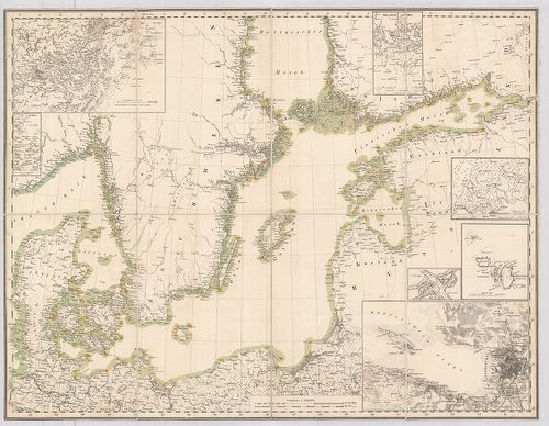
| Title | [A Keleti (Balti)-tenger térképe.] |
| Main title | 7 mt.: 1. Stockholm 2. Kieli-öböl, 3. Helsing Fors (Helsinki) 4. Reval (Tallinn) 5. Christiansö (Christiansř) 6. S[ankt] Petersburg (Leningrád) 7. [Düna (Dvina) folyó torkolata]. |
118. Európa hegy- és vízrajzi térképe. [B I b 80]
Institute and Museum of Military History •
B I b
•
B I Európa
•
B I–XV. Európa
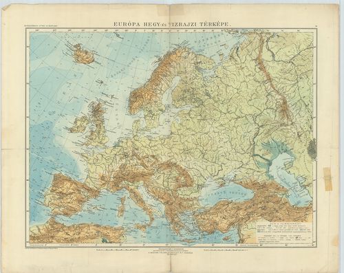
| Title | Európa hegy- és vízrajzi térképe. |
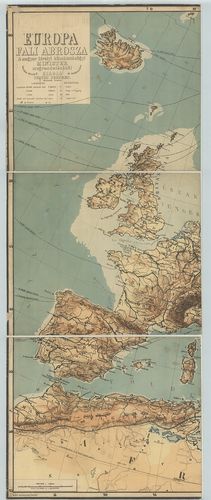
119. Európa fali abrosza. [B I b 90]
Institute and Museum of Military History •
B I b
•
B I Európa
•
B I–XV. Európa
| Title | Európa fali abrosza. |
| Main title | Mt.: Európa politikai felosztása. |
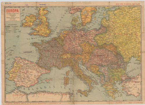
120. Európa hegy- és vízrajzi térképe. [B I b 95]
Institute and Museum of Military History •
B I b
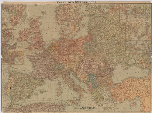
•
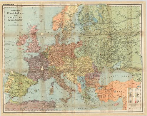
B I Európa
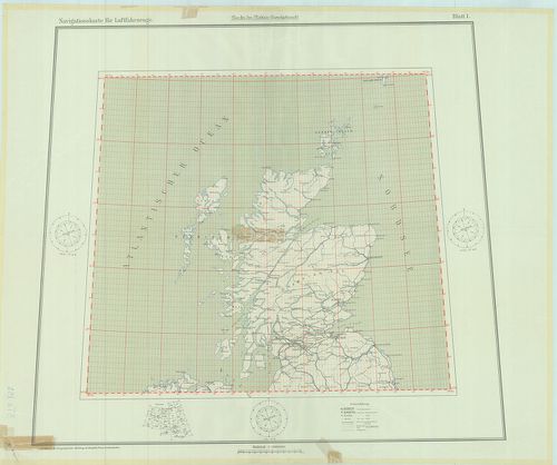
•
B I–XV. Európa
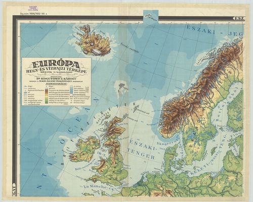
| Title | Európa hegy- és vízrajzi térképe. |
121. Die Mittlere Steinzeit (etwa 12 000–3000 v[or] d[em] Kr.) [B I b 100]
Institute and Museum of Military History •
B I b
•
B I Európa
•
B I–XV. Európa
| Title | Die Mittlere Steinzeit (etwa 12 000–3000 v[or] d[em] Kr.) |
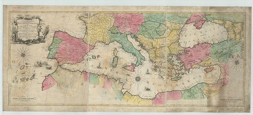
| Main title | 3 mt.: 1. Südschwedischer Eishalt. (A dél-svéd eljegesedés). 2. Yoldia Zeit (Yoldia időszak) 3. Ancylus Zeit. (Ancylus-időszak). Karten zur Vorgeschichte. |
| Subject | A középső kőkor Európában (i. e. 12 000–3000). |
122. Eiszeitalter. Die ältere Steinzeit. (etwa 400 000–12 000 v[o... [B I b 101]
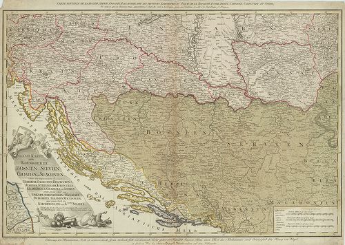
Institute and Museum of Military History •
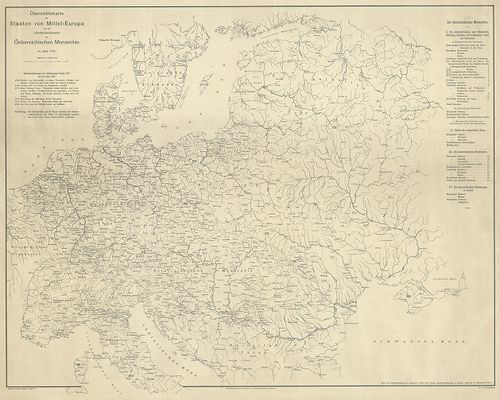
B I b
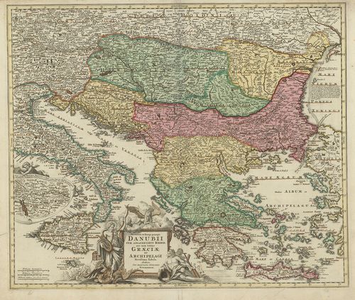
•
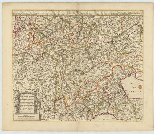
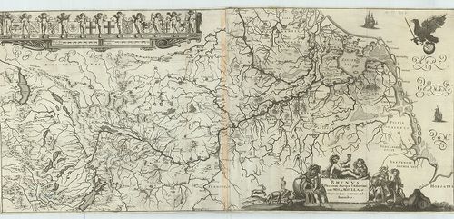
B I Európa
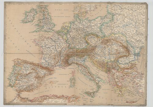
•
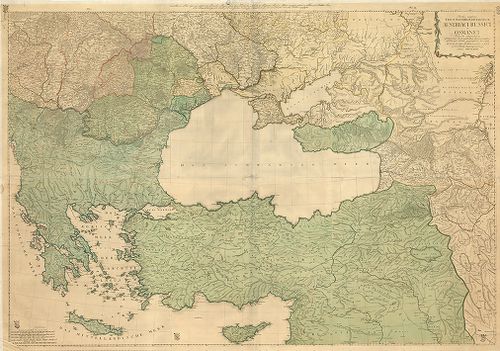
B I–XV. Európa
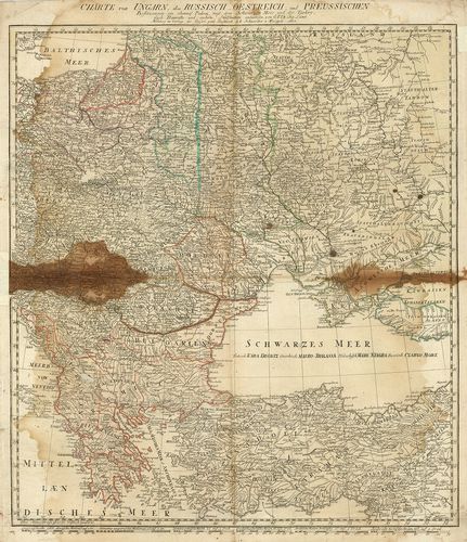
| Title | Eiszeitalter. Die ältere Steinzeit. (etwa 400 000–12 000 v[or] d[em] Kr.) |
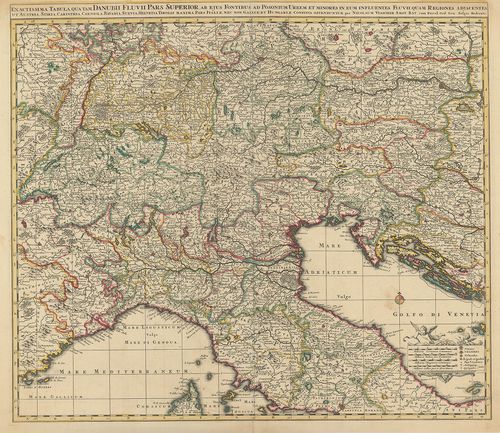
| Main title | Az őskor Európában (i. e. 400 000–12 000). |
123. Evropa. Fizicseszkaj karta. [B I b 103]
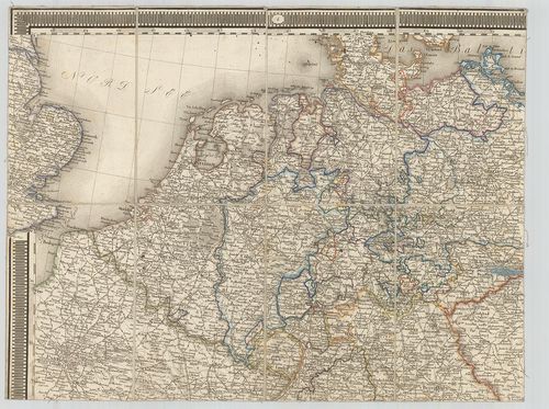
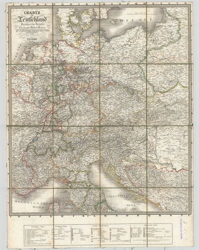
Institute and Museum of Military History •
B I b
•
B I Európa
•
B I–XV. Európa
| Title | Evropa. Fizicseszkaj karta. |
| Main title | Európa hegyvízrajzi térképe 1949-ben. |
124. General karte über alla in Europa vorkommenden Eisenbahnen… ... [B I c 1]
Institute and Museum of Military History •
B I c
•
B I Európa
•
B I–XV. Európa
| Title | General karte über alla in Europa vorkommenden Eisenbahnen… Haupt-u. Poststrassen, Canälen u. Dampfschiffahrten… |
| Main title | Európa közlekedési térképe. |
125. Eisenbahn- und Dampfschiffrouten-Karte von Europa [B I c 3]
Institute and Museum of Military History •
B I c
•
B I Európa
•
B I–XV. Európa
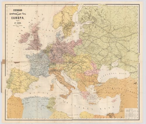
| Title | Eisenbahn- und Dampfschiffrouten-Karte von Europa |
| Main title | Európa közlekedési térképe 1881-ben. |
126. Carte itinéraire de l’Europe. [B I c 7]
Institute and Museum of Military History •
B I c
•
B I Európa
•
B I–XV. Európa
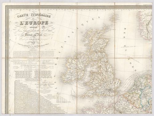
| Title | Carte itinéraire de l’Europe. |
| Main title | Európa közlekedési térképe 1842. |
127. Neueste Allgemeine Postkarte durch alle Europaeische Staaten... [B I c 8/a]
Institute and Museum of Military History •
B I c
•
B I Európa
•
B I–XV. Európa
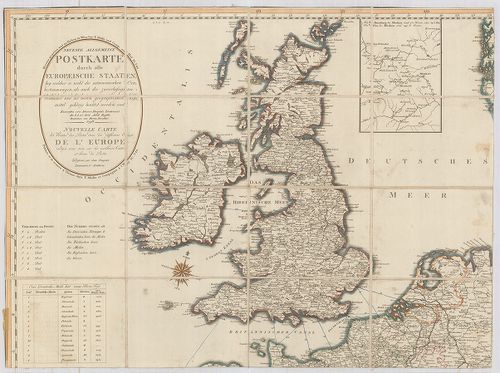
| Title | Neueste Allgemeine Postkarte durch alle Europaeische Staaten… Nouvelle Carte des Routes des Postes dans les différens États de l’Europe… Véste: Hieron. Benedicti. |
| Main title | Mt.: [Moszkva környéke] |
| Subject | Európa postaúthálózatának térképe 1798-ban. |
128. Vereinigte Eisenbahn-Routen- und Lademass-Karte von Mittel-E... [B I c 9]
Institute and Museum of Military History •
B I c
•
B I Európa
•
B I–XV. Európa
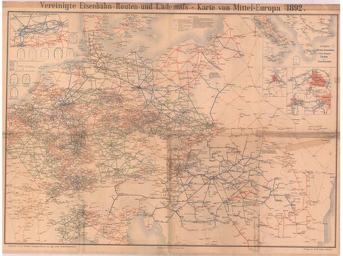
| Title | Vereinigte Eisenbahn-Routen- und Lademass-Karte von Mittel-Europa. |
| Main title | 6 mt.: 1. Eisenbahnen im Ruhr kohlen Gebiet 2. Eisenbahnen in Mittel-u. Unteritalien, Serbien, Bulgarien, Türkei und Griechenland 3. Wien, 4. Berlin, 5. Budapest, 6. Frankfurt. |
| Subject | Közép-Európa közlekedési térképe 1892-ben. |
129. Telegraphen-Karte von Europa… [B I c 12]
Institute and Museum of Military History •
B I c
•
B I Európa
•
B I–XV. Európa
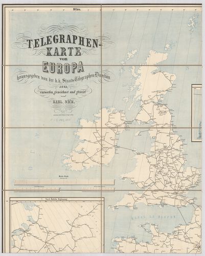
| Title | Telegraphen-Karte von Europa… |
| Main title | 2 mt.: 1. Nord-östliche Ergänzung 2. Nördliche Ergänzung. |
| Subject | Európa távíró térképe 1864-ben. |
130. Karte des Europaeischen Telegraphen-Netzes. [B I c 12/1]
Institute and Museum of Military History •
B I c
•
B I Európa
•
B I–XV. Európa
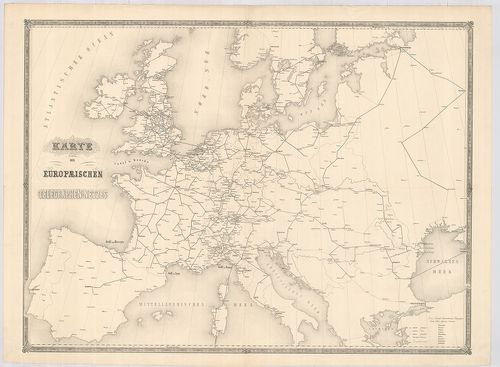
| Title | Karte des Europaeischen Telegraphen-Netzes. |
| Main title | Európa távíróhálózatának térképe. |
131. Germanorum [et] Slavorum per medium aevum Orbis Christianus.... [B I c 14]
Institute and Museum of Military History •
B I c
•
B I Európa
•
B I–XV. Európa
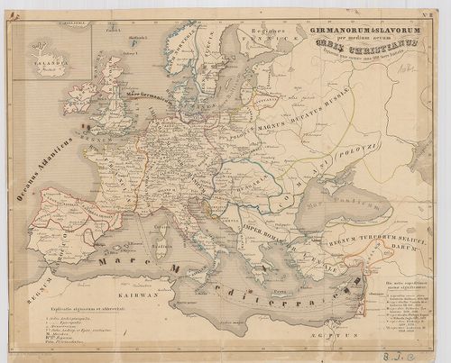
| Title | Germanorum [et] Slavorum per medium aevum Orbis Christianus. Regnorum quae exeunte anno 1100 fuere limitatio. |
| Main title | Európa történelmi térképe i. u. 1100-ban. |
132. Hauptverkehrslinien von Europa. [B I c 15]
Institute and Museum of Military History •
B I c
•
B I Európa
•
B I–XV. Európa
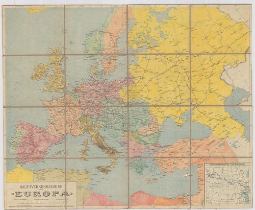
| Title | Hauptverkehrslinien von Europa. |
| Main title | 1 mt.: Eisenbahnkarte von Sibiren. (Szibériai vasútvonalak).Európa fő vasutainak térképe. |
133. Dislokationskarte der Heere Europas. [B I c 19]
Institute and Museum of Military History •
B I c
•
B I Európa
•
B I–XV. Európa
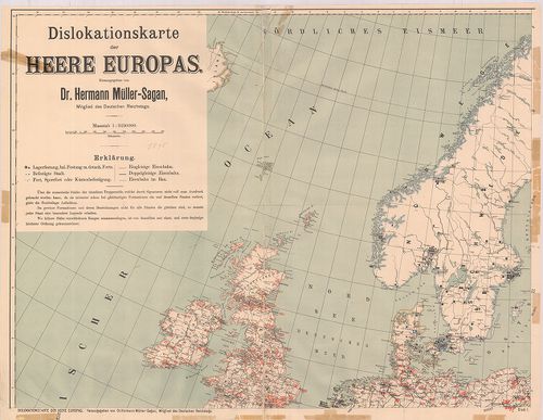
| Title | Dislokationskarte der Heere Europas. |
| Main title | Európai hadseregek elhelyezési térképe 1895-ben. |
134. Neue Carte von Europa welche die merkwürdigsten Produckte un... [B I c 21]
Institute and Museum of Military History •
B I c
•
B I Európa
•
B I–XV. Európa
| Title | Neue Carte von Europa welche die merkwürdigsten Produckte und vornehmsten Handelsplätze nebst dem Flächen-Inhalt aller Europäischen Länder. |
| Main title | Európa kereskedelmi térképe 1782-ben. |
135. Európa Nagy Lajos korában 1370–1380. [B I c 25]
Institute and Museum of Military History •
B I c
•
B I Európa
•
B I–XV. Európa
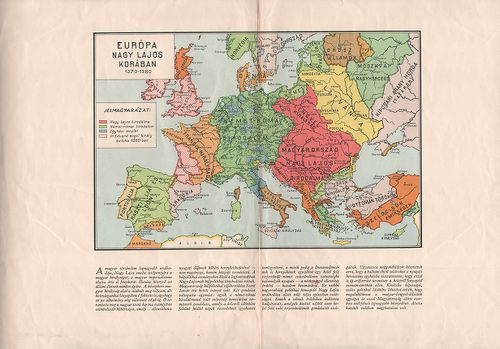
| Title | Európa Nagy Lajos korában 1370–1380. |
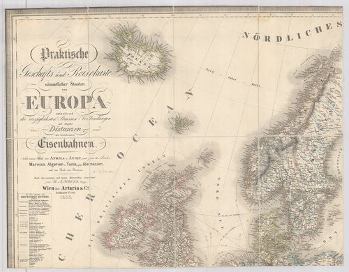
136. Praktische Geschäfts und Reisekarte sämmtlicher Staaten von ... [B I c 30]
Institute and Museum of Military History •
B I c
•
B I Európa
•
B I–XV. Európa
| Title | Praktische Geschäfts und Reisekarte sämmtlicher Staaten von Europa… Nebst einem Theile von Afrika u. Asien… |
| Main title | Európa és részben Afrika és Ázsia kereskedelmi utazási térképe 1862-ben. |
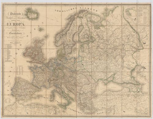
137. Praktische Geschäts und Reisekarte. sämmtlicher Staaten von ... [B I c 32]
Institute and Museum of Military History •
B I c
•
B I Európa
•
B I–XV. Európa
| Title | Praktische Geschäts und Reisekarte. sämmtlicher Staaten von Europa… Nebst einem Theile von Afrika u. Asien. |
| Main title | Európa és részben Afrika, Ázsia kereskedelmi, utazási térképe 1855-ben. |
138. Europa Politische Übersicht zu Beginn des 18. Jahrhunderts. [B I c 32/1]
Institute and Museum of Military History •
B I c
•
B I Európa
•
B I–XV. Európa
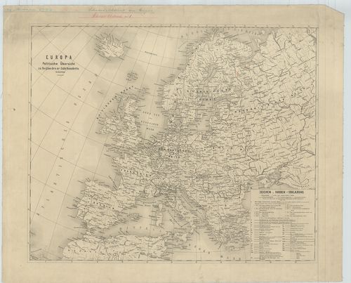
| Title | Europa Politische Übersicht zu Beginn des 18. Jahrhunderts. |
| Main title | Európa politikai térképe a 18. században. |
139. Praktische Geschäfts und Reisekarte. sämmtlicher Staaten von... [B I c 32/2]
Institute and Museum of Military History •
B I c
•
B I Európa
•
B I–XV. Európa
| Title | Praktische Geschäfts und Reisekarte. sämmtlicher Staaten von Europa… Nebst einem Theile von Afrika u. Asien. Véste: Dominik Bitter. |
| Main title | Európa és részben Afrika, Ázsia kereskedelmi utazási térképe 1859-ben. |
140. Európa népei és nyelvei. [B I c 35]
Institute and Museum of Military History •
B I c
•
B I Európa
•
B I–XV. Európa
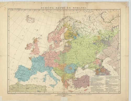
| Title | Európa népei és nyelvei. |
141. Carte itinéraire des voies navigables de l’Europe. [B I c 60]
Institute and Museum of Military History •
B I c
•
B I Európa
•
B I–XV. Európa
| Title | Carte itinéraire des voies navigables de l’Europe. |
| Main title | Európa légi útjainak térképe 1928. |
142. Európa vasúti térképe. [B I c 61]
Institute and Museum of Military History •
B I c
•
B I Európa
•
B I–XV. Európa
| Title | Európa vasúti térképe. |
143. Hauptverkehrslinien von Europa. [B I c 62]
Institute and Museum of Military History •
B I c
•
B I Európa
•
B I–XV. Európa
| Title | Hauptverkehrslinien von Europa. |
| Main title | 2 mt. 1. Eisenbahnlinien im nördlichen Böhmen. (Észak-Csehország vasútvonalai.) 2. Eisenbahnkarte von Sibirien. (Szibériai vasút, SzU.) 19 Lage der Bahnhöfe. (19 vasútforg. várostérképe.) Hátlapon: Eisenbahn-Routen-Karte von Mitteleuropa. (Közép-Európa vasút és úttérképe.) |
| Subject | Európa közlekedési térképe 1904-ben. |
144. Maps of Europe and Germany. Including railroad, steamship, a... [B I c 64]
Institute and Museum of Military History •
B I c
•
B I Európa
•
B I–XV. Európa
| Title | Maps of Europe and Germany. Including railroad, steamship, auto and air routes. |
| Main title | hátl.: Map of Germany. |
| Subject | Európa közlekedési térképe 1936-ban. |
145. Die Schnellzugslinien Europas. European Express Train Servic... [B I c 65]
Institute and Museum of Military History •
B I c
•
B I Európa
•
B I–XV. Európa
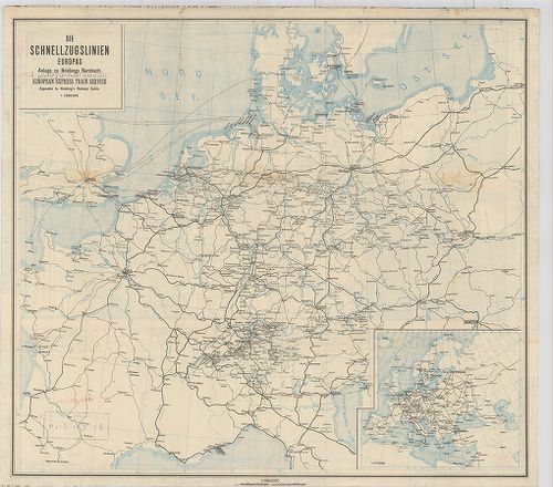
| Title | Die Schnellzugslinien Europas. European Express Train Service. |
| Main title | Mt.: Europa. Anlage zu Hobbings Kursbuch. |
| Subject | Nyugat- és Közép-Európa gyorsvonati vonalai a XX. század elején. |
146. Nivellements de précision. Lignes existant en Europa (Russie... [B I c 66]
Institute and Museum of Military History •
B I c
•
B I Európa
•
B I–XV. Európa
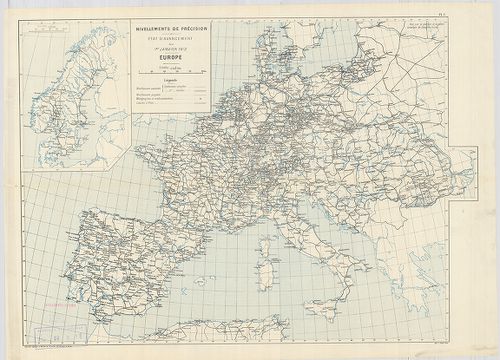
| Title | Nivellements de précision. Lignes existant en Europa (Russie exceptée) et en Afrique… |
| Main title | Európa úthálózati térképe 1903-ban. |
147. Európa rádió adóállomásai [B I c 67]
Institute and Museum of Military History •
B I c
•
B I Európa
•
B I–XV. Európa
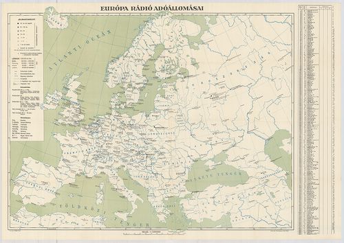
| Title | Európa rádió adóállomásai |
148. Neueste Reise-Hand-Und Kontorkarte von Europa mit den angren... [B I c 70]
Institute and Museum of Military History •
B I c
•
B I Európa
•
B I–XV. Európa
| Title | Neueste Reise-Hand-Und Kontorkarte von Europa mit den angrenzenden Teilen von Asien und Afrika. |
| Main title | Európa és Ázsia, Afrika határos részeinek úthálózati térképe. |
149. Karte von Europa und Westasien. [B I c 78]
Institute and Museum of Military History •
B I c
•
B I Európa
•
B I–XV. Európa
| Title | Karte von Europa und Westasien. |
| Main title | Európa térképe 1940-ben. |
150. Magyar Királyi Lég-ügyi Hivatal Időjelző Központ. [B I c 79]
Institute and Museum of Military History •
B I c
•
B I Európa
•
B I–XV. Európa
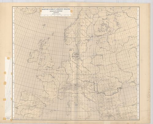
| Title | Magyar Királyi Lég-ügyi Hivatal Időjelző Központ. |
151. Schaubild von Europa mit bildlicher Darstellung der hauptsäc... [B I c 80]
Institute and Museum of Military History •
B I c
•
B I Európa
•
B I–XV. Európa
| Title | Schaubild von Europa mit bildlicher Darstellung der hauptsächlichsten Wirtschaftsgüter, Bodenschätze, Industriezentren. |
| Main title | Európa térképe gazdasági adatokkal 1940 körül. |
152. Angling in troubled Waters. – Der Fischfang im Trüben – La P... [B I c 85]
Institute and Museum of Military History •
B I c
•
B I Európa
•
B I–XV. Európa
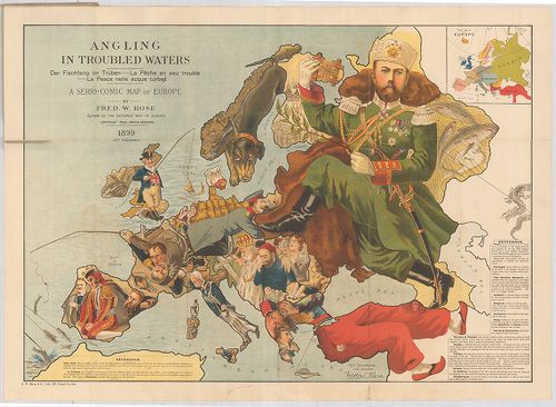
| Title | Angling in troubled Waters. – Der Fischfang im Trüben – La Peche en eau trouble – La Pesca nelle acque turbes. A Serio-Comic Map of Europe. |
| Main title | Mt.: Key Map of Europe. (Európa térképe.) |
| Subject | „Halászat a zavarosban" - tréfás rajz Európáról. 1899. |
153. G. Freytags Völkerkarte von Europa. [B I c 88]
Institute and Museum of Military History •
B I c
•
B I Európa
•
B I–XV. Európa
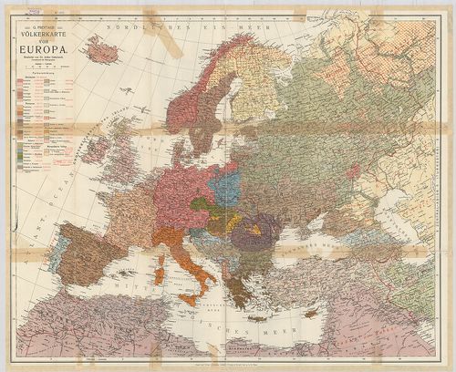
| Title | G. Freytags Völkerkarte von Europa. |
| Main title | Európa néprajzi térképe. |
154. Länder- und Völkerkarte Europas. [B I c 89]
Institute and Museum of Military History •
B I c
•
B I Európa
•
B I–XV. Európa
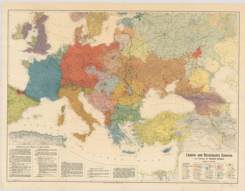
| Title | Länder- und Völkerkarte Europas. |
| Main title | Európa ország és néprajzi térképe. |
155. Nova karta Evrope. Po ryszkom lisztu „Novoe Zveno”. [B I c 90]
Institute and Museum of Military History •
B I c
•
B I Európa
•
B I–XV. Európa
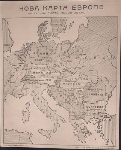
| Title | Nova karta Evrope. Po ryszkom lisztu „Novoe Zveno”. |
| Main title | Európa tervezett határrendezése az első világháború után. |
156. Europa etnografica. [B I c 94]
Institute and Museum of Military History •
B I c
•
B I Európa
•
B I–XV. Európa

| Title | Europa etnografica. |
| Main title | Európa néprajzi térképe 1940-ben. |
157. Európa rádiótérképe. [B I c 100]
Institute and Museum of Military History •
B I c
•
B I Európa
•
B I–XV. Európa
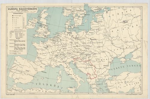
| Title | Európa rádiótérképe. |
158. Mapa radjokomunikacyjna Europy. [B I c 101]
Institute and Museum of Military History •
B I c
•
B I Európa
•
B I–XV. Európa
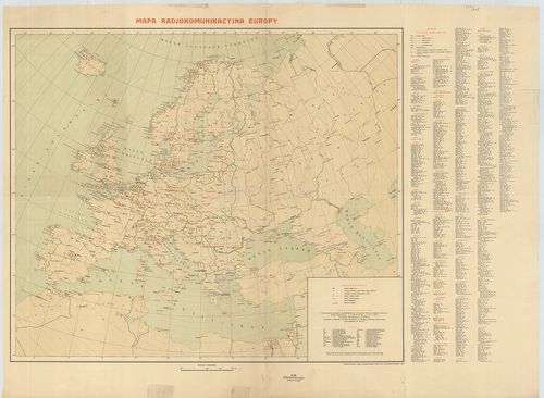
| Title | Mapa radjokomunikacyjna Europy. |
| Main title | Európa rádióállomásainak térképe 1936. |
159. [Európa rádióállomásai.] [B I c 102/a]
Institute and Museum of Military History •
B I c
•
B I Európa
•
B I–XV. Európa
| Title | [Európa rádióállomásai.] |
160. [A világ rádióállomásai] [B I c 102/b]
Institute and Museum of Military History •
B I c
•
B I Európa
•
B I–XV. Európa

| Title | [A világ rádióállomásai] |
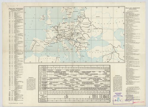
161. Európa rádióadó-állomásainak hullámhossz, kilowatt- és távol... [B I c 103]
Institute and Museum of Military History •
B I c
•
B I Európa
•
B I–XV. Európa
| Title | Európa rádióadó-állomásainak hullámhossz, kilowatt- és távolsági térképe. |
162. Übersichtskarte der Breiten- und Azimutbestimmungen. Carte d... [B I c 120]
Institute and Museum of Military History •
B I c
•
B I Európa
•
B I–XV. Európa
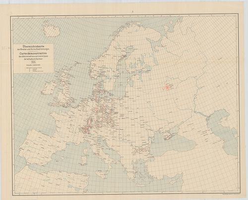
| Title | Übersichtskarte der Breiten- und Azimutbestimmungen. Carte demonstrative des déterminations astronomiques de latitude et d’azimut. 1904. |
| Main title | Európa térképe a földr. szélesség és azimut meghatározásokkal 1904-ben. |
163. Übersichtskarte der telegraphischen Längenbestimmungen. Cart... [B I c 121]
Institute and Museum of Military History •
B I c
•
B I Európa
•
B I–XV. Európa
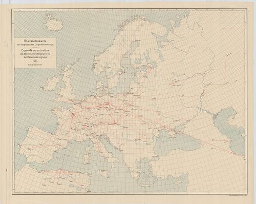
| Title | Übersichtskarte der telegraphischen Längenbestimmungen. Carte démonstrative des déterminations télégraphiques dex différences de longitudes. 1904. |
| Main title | Európa távíró vonalai 1904-ben. |
164. Übersichtskarte der Bestimmungen der Schwerkraft. Carte demo... [B I c 122]
Institute and Museum of Military History •
B I c
•
B I Európa
•
B I–XV. Európa
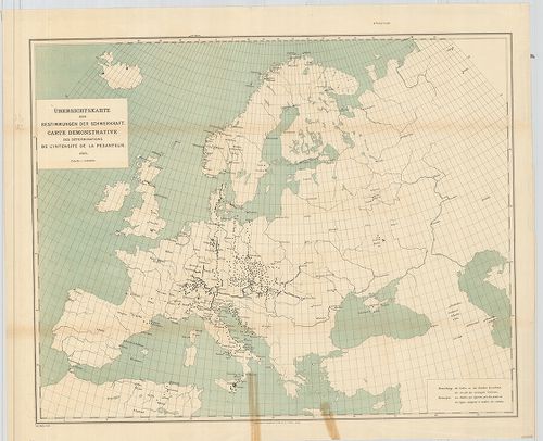
| Title | Übersichtskarte der Bestimmungen der Schwerkraft. Carte demonstrative des déterminations de lintensité de la pesanteur. |
| Main title | Európa térképe a meghatározott nehézségi erővel 1900-ban. |
165. Übersichtskarte für den Stand der Trigonometrischen Arbeiten... [B I c 123]
Institute and Museum of Military History •
B I c
•
B I Európa
•
B I–XV. Európa
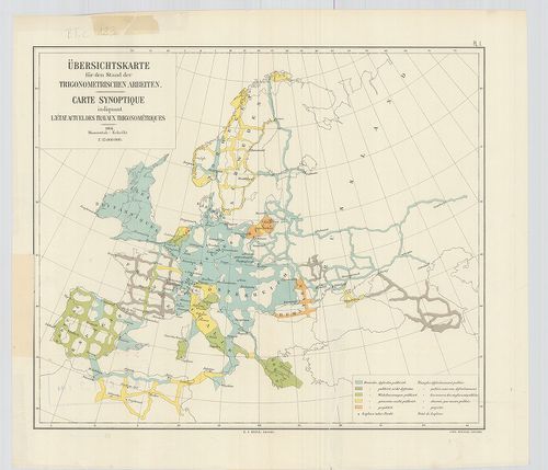
| Title | Übersichtskarte für den Stand der Trigonometrischen Arbeiten. Carte synoptique indiquant l’état actuel des travaux trigonométriques. |
| Main title | Európa térképe a háromszögelési munkák állásáról 1904-ben. |
166. [Európa állatföldrajzi térképe.] [B I c 133]
Institute and Museum of Military History •
B I c
•
B I Európa
•
B I–XV. Európa
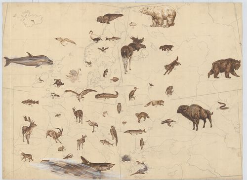
| Title | [Európa állatföldrajzi térképe.] |
167. Politisch-Geographische Grundlagen Europas-Flemming Friedens... [B I c 142]
Institute and Museum of Military History •
B I c
•
B I Európa
•
B I–XV. Európa
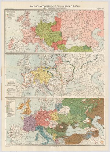
| Title | Politisch-Geographische Grundlagen Europas-Flemming Friedenskarten |
| Main title | 3 térk. 1. Európa háborús térkép 2. Európa történelmi térkép 3. Európa népességi térkép. |
| Subject | Európa politikai-földrajzi térképe 1917-ben. |
168. Európai háború kis térképe. [B I c 143]
Institute and Museum of Military History •
B I c
•
B I Európa
•
B I–XV. Európa
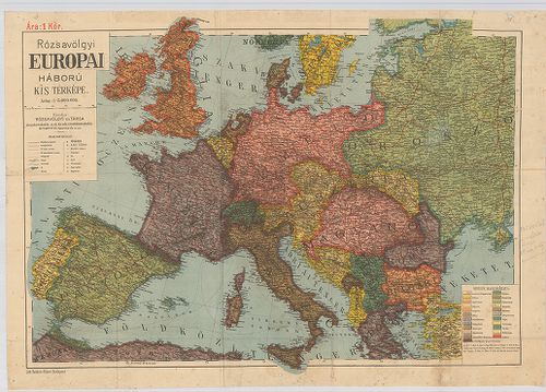
| Title | Európai háború kis térképe. |
169. Flemmings Übersichtskarte für den europäischen Kriegsschaupa... [B I c 144]
Institute and Museum of Military History •
B I c
•
B I Európa
•
B I–XV. Európa
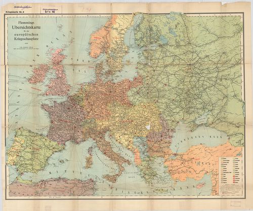
| Title | Flemmings Übersichtskarte für den europäischen Kriegsschaupaltz. |
| Main title | Az európai hadszíntér áttekintő térképe az első világháborúban. |
170. Ravensteins Karte des Deutschen Sperrgebietes für den uneing... [B I c 145]
Institute and Museum of Military History •
B I c
•
B I Európa
•
B I–XV. Európa
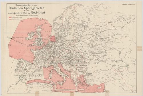
| Title | Ravensteins Karte des Deutschen Sperrgebietes für den uneingeschkränkten „U” Boot-Krieg. Ravensteins Kriegskarte. |
| Main title | Európa térképe. Tengeralattjáró háború a németek által korlátlanul lezárt Európa NY-i és D-i területein. |
171. Europa világháború térképe. [B I c 146]
Institute and Museum of Military History •
B I c
•
B I Európa
•
B I–XV. Európa
| Title | Europa világháború térképe. |
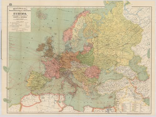
172. Mittelbach’s Billige Kriegskarte von Europa mit den angrenze... [B I c 147]
Institute and Museum of Military History •
B I c
•
B I Európa
•
B I–XV. Európa
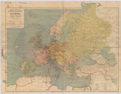
| Title | Mittelbach’s Billige Kriegskarte von Europa mit den angrenzenden Teilen von Asien und Afrika. |
| Main title | Európa háború tárképe Ázsia és Afrika határterületeivel. |
173. Staaten und Verkehrskarte von Europa. [B I c 148]
Institute and Museum of Military History •
B I c
•
B I Európa
•
B I–XV. Európa
| Title | Staaten und Verkehrskarte von Europa. |
| Main title | Az európai államok közlekedési térképe. |
174. Osnovni projekt buduce Evrope prema politickom stanju i naci... [B I c 149]
Institute and Museum of Military History •
B I c
•
B I Európa
•
B I–XV. Európa
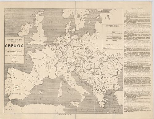
| Title | Osnovni projekt buduce Evrope prema politickom stanju i nacionalnoj teznji. |
| Main title | Tervezet Európa jövőjéről, politikai helyzet és nemzetiségi megosztás. |
175. Karte des Weltkrieges. Europäischer Kriegsschauplatz. [B I c 150]
Institute and Museum of Military History •
B I c
•
B I Európa
•
B I–XV. Európa
| Title | Karte des Weltkrieges. Europäischer Kriegsschauplatz. |
| Main title | 9 mt.: 1.) Die Deutschen Kolonien in Afrika, and ihre Umwelt. (Német gyarmatok Afrikában.) |
| Subject | 2.) Paris mit seinen Festungswerken. (Páris és erődítései.) |
176. Flemmongs Übersichtskarte für den europäischen Kriegsschaupl... [B I c 151]
Institute and Museum of Military History •
B I c
•
B I Európa
•
B I–XV. Európa
| Title | Flemmongs Übersichtskarte für den europäischen Kriegsschauplatz. No. 9. |
| Main title | Az európai hadszíntér átnézeti térképe. |
177. Navigationskarte für Luftfahrzenge. [B I c 152]
Institute and Museum of Military History •
B I c
•
B I Európa
•
B I–XV. Európa
| Title | Navigationskarte für Luftfahrzenge. |
| Main title | Fokhálózatos navigációs térkép légi járművek számára Európa fölött Angliától a Közel-Keletig terjedő térségben. |
178. Humorist. Darstellung der Wappen unserer Feinde 1914. [B I c 153]
Institute and Museum of Military History •
B I c
•
B I Európa
•
B I–XV. Európa

| Title | Humorist. Darstellung der Wappen unserer Feinde 1914. |
| Main title | Az ellenséges hatalmak arcképcímereinek karikatúra-vázlatai. |
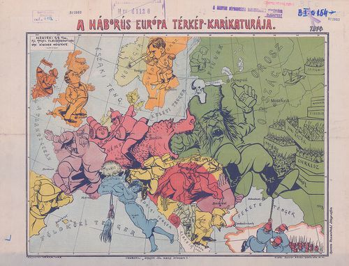
179. A háborús európa térkép-karikatúrája. [B I c 154]
Institute and Museum of Military History •
B I c
•
B I Európa
•
B I–XV. Európa
| Title | A háborús európa térkép-karikatúrája. |
180. Szimbolicseszkaja karta Evropi. [B I c 155]
Institute and Museum of Military History •
B I c
•
B I Európa
•
B I–XV. Európa
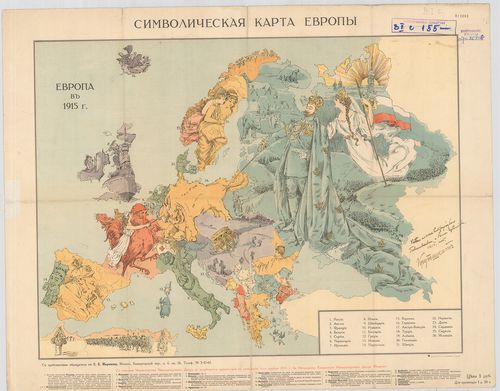
| Title | Szimbolicseszkaja karta Evropi. |
| Main title | Jelképes karikatúra-térképe a háborús Európáról. |
181. A Humorous Diplomatic Atlas of Europe and Asia. [B I c 156]
Institute and Museum of Military History •
B I c
•
B I Európa
•
B I–XV. Európa
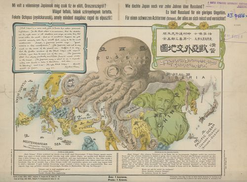
| Title | A Humorous Diplomatic Atlas of Europe and Asia. |
| Main title | Politikai karikatúra térkép Európáról és Ázsiáról. |
182. Von grossem Sammelwert’. – „Hark! Hark! The dogs do bark.” [B I c 157]
Institute and Museum of Military History •
B I c
•
B I Európa
•
B I–XV. Európa
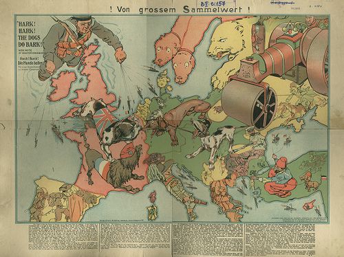
| Title | Von grossem Sammelwert’. – „Hark! Hark! The dogs do bark.” |
| Main title | Európai gúnytérkép. |
183. Az Európai fokmérésnél alapul szolgáló Astronomiai és Geodet... [B I c 160]
Institute and Museum of Military History •
B I c
•
B I Európa
•
B I–XV. Európa
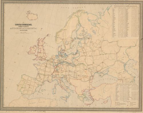
| Title | Az Európai fokmérésnél alapul szolgáló Astronomiai és Geodetai munkálatok. |
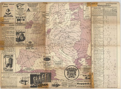
184. Radis – Carte D’Europe. [B I c 171]
Institute and Museum of Military History •
B I c
•
B I Európa
•
B I–XV. Európa
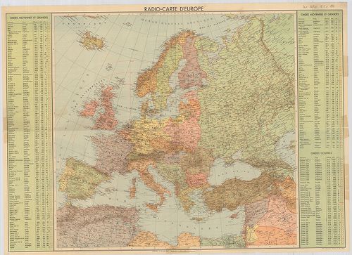
| Title | Radis – Carte D’Europe. |
| Main title | Európa rádió-adóállomásainak hullámhossz, Kilowatt – és távolsági térképe. A Berni rádióadó hatósugarának feltüntetésével. Hátl.: Az Európán kívüli földrészek főbb rádióadóinak hullámhossza, és teljesítménye. Különböző rádiók reklámai (francia nyelven). |
185. Az uráli nyelvcsalád földrajzi elhelyezkedése. [B I c 175]
Institute and Museum of Military History •
B I c
•
B I Európa
•
B I–XV. Európa
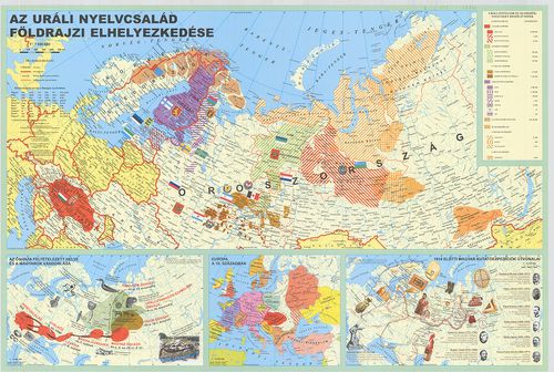
| Title | Az uráli nyelvcsalád földrajzi elhelyezkedése. |
| Main title | 3 melléktérkép: 1. Az őshaza feltételezett helye és a magyarok vándorlása |
| Subject | 2. Európa a 10. században |
186. Humoristische Karte von Europa im Jahre 1914. [B I c 181]
Institute and Museum of Military History •
B I c
•
B I Európa
•
B I–XV. Európa
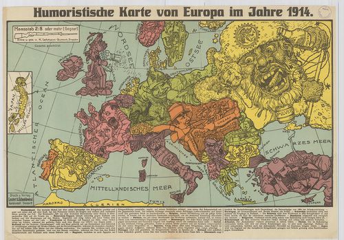
| Title | Humoristische Karte von Europa im Jahre 1914. |
| Main title | Európa karikatúra-térképe 1914-ben. |
187. Übersichtskarte der Habsburgischen Länder zur Zeit des Todes... [B II a 1/1]
Institute and Museum of Military History •
B II a
•
B II Európa, nagyobb részek és országcsoportok
•
B I–XV. Európa
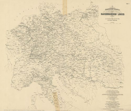
| Title | Übersichtskarte der Habsburgischen Länder zur Zeit des Todes Carl VI. 1740 mit, innerer Eintheilung. |
188. Carte geographique representant la Mer Mediterranée… avec la... [B II a 1/2]
Institute and Museum of Military History •
B II a
•
B II Európa, nagyobb részek és országcsoportok
•
B I–XV. Európa
| Title | Carte geographique representant la Mer Mediterranée… avec la Mer Noire ou Pont Euxine et une Part die de la Province Georgie en Asia. |
| Main title | A Földközi-tenger, Fekete-tenger országai és Kis-Ázsia 1770-ben. |
189. [Nyugat-, Közép- és Dél-Európa.] [B II a 2]
Institute and Museum of Military History •
B II a
•
B II Európa, nagyobb részek és országcsoportok
•
B I–XV. Európa
| Title | [Nyugat-, Közép- és Dél-Európa.] |
190. Carta Noua accurata del Passagio et strada dalli Paesi Bassi... [B II a 3]
Institute and Museum of Military History •
B II a
•
B II Európa, nagyobb részek és országcsoportok
•
B I–XV. Európa
| Title | Carta Noua accurata del Passagio et strada dalli Paesi Bassi per via de Allemagna per Italia et per via di Paesi suizeri a Geneua, Lione et Roma…Április 1671. |
| Main title | A Németalföld, Németország D-i, Olaszország É-i részének általános térképe 1671-ben. |
191. Neueste Karte der Koenigreiche Bosnien Servien Croatien und ... [B II a 4]
Institute and Museum of Military History •
B II a
•
B II Európa, nagyobb részek és országcsoportok
•
B I–XV. Európa
| Title | Neueste Karte der Koenigreiche Bosnien Servien Croatien und Slavonien. Samt den angraezenden Provinzen… einem grosen Theil von Ungarn, Siebenbürgen, Walachei, Bulgarien, Albanien, Macedonien…Carte nouvelle de la Bosnie, Servie, Croatie, Esclavonie avel les provinces Limitrophes du Banat, de la Dalmatie, Istria Friaul Carniole, Carinthie, et Stirie… |
| Main title | Bosznia, Szerbia, Horvátország, Szlavónia és a határos területek - Magyarország, Erdély, Havasalföld, Bulgária, Albánia, Macedónia térképe 1788-ban. |
192. Übersichtskarte der Staaten von Mittel-Európa und des Länder... [B II a 5]
Institute and Museum of Military History •
B II a
•
B II Európa, nagyobb részek és országcsoportok
•
B I–XV. Európa
| Title | Übersichtskarte der Staaten von Mittel-Európa und des Länderbestandes der Österreichischen Monarchia im Jahre 1790. |
| Main title | Közép-Európa és az Osztrák Monarchia térképe 1763–1790-es években. |
193. Fluviorum in Europa principis Danubii cum adiaceniibus Regni... [B II a 5/4]
Institute and Museum of Military History •
B II a
•
B II Európa, nagyobb részek és országcsoportok
•
B I–XV. Európa
| Title | Fluviorum in Europa principis Danubii cum adiaceniibus Regnis, nec non totius Graeciae et Archipelagi. |
| Main title | Mt.: Cum integrum Danubii Tractum… (A Duna eredete.) |
| Subject | A Duna menti országok, Görögország és szigetei térképe. |
194. Rhenvs, Fluviorum Europae Celeberrimus, cum Mosa, Mosella, e... [B II a 6]
Institute and Museum of Military History •
B II a
•
B II Európa, nagyobb részek és országcsoportok
•
B I–XV. Európa
| Title | Rhenvs, Fluviorum Europae Celeberrimus, cum Mosa, Mosella, et reliquis, in illum se exonerantibus fluminibus. |
| Main title | A Rajna vidéke eredettől a torkolatig. |
195. [Közép-Európa térképe.] [B II a 7]
Institute and Museum of Military History •
B II a
•
B II Európa, nagyobb részek és országcsoportok
•
B I–XV. Európa
| Title | [Közép-Európa térképe.] |
196. Partes confines Trium Magnorum Imperiorum Austriaci Russici ... [B II a 9]
Institute and Museum of Military History •
B II a
•
B II Európa, nagyobb részek és országcsoportok
•
B I–XV. Európa
| Title | Partes confines Trium Magnorum Imperiorum Austriaci Russici et Osmanici… |
| Main title | Fekete-tenger országai: az t nagyhatalom területének általános térképe 1785-ben. |
197. Charte von Ungarn, den Russisch-Oestreich und Preussischen. ... [B II a 10]
Institute and Museum of Military History •
B II a
•
B II Európa, nagyobb részek és országcsoportok
•
B I–XV. Európa
| Title | Charte von Ungarn, den Russisch-Oestreich und Preussischen. Besitzungen im ehemal Polen, ingl dem Schwarzen Meer und der Türkey… |
| Main title | Közép- és Kelet-Európa a Fekete-tengerrel és Törökországgal 1803-ban. |
198. Exactissima Tabula, qua tam Danubii Fluvii Pars Superior, ab... [B II a 11]
Institute and Museum of Military History •
B II a
•
B II Európa, nagyobb részek és országcsoportok
•
B I–XV. Európa
| Title | Exactissima Tabula, qua tam Danubii Fluvii Pars Superior, ab ejus Fontibus ad Posonium Urben… Austria, Stiria, Carinthia, Carniola, Bavaria, Suevia, Helvetia, Tirolis… Italiae… Hungariae… |
| Main title | A Duna eredetétől Pozsonyig és a területtel határos országok térképe. |
199. Neueste General – und Post-Karte von ganz Deutschland un Ita... [B II a 12/1]
Institute and Museum of Military History •
B II a
•
B II Európa, nagyobb részek és országcsoportok
•
B I–XV. Európa
| Title | Neueste General – und Post-Karte von ganz Deutschland un Italien mit Inbegriff aller Provinzen der Oesterreichischen Monarchie… – Carte novissima della Germania e dell’Italia… Monarchia Austriaca. |
| Main title | Közép-Európa: Németország, Olaszország, Osztrák Monarchia általános térképe postahálózattal 1921-ben. |
200. Charte von Teutschland Preussen der Schweiz Nord- Und Mittel... [B II a 13]
Institute and Museum of Military History •
B II a
•
B II Európa, nagyobb részek és országcsoportok
•
B I–XV. Európa
| Title | Charte von Teutschland Preussen der Schweiz Nord- Und Mittel-Italien… |
| Main title | Közép-Európa: Németország, Poroszország, Svájc, Olaszország északi és középső részének általános térképe 1833-ban. |