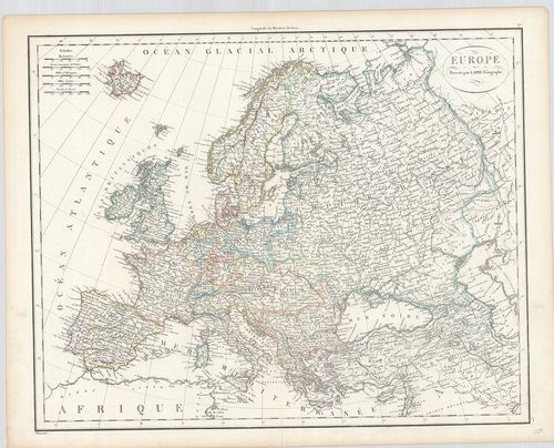
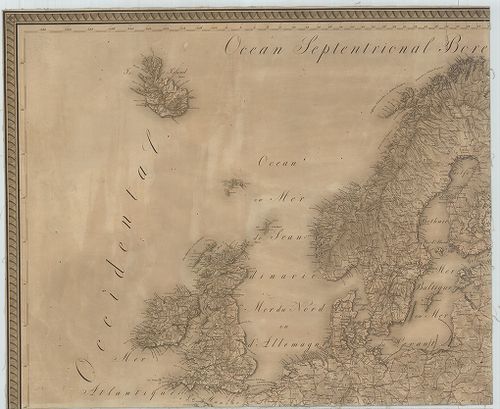
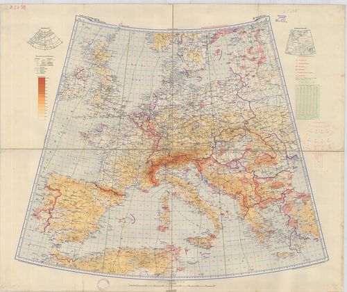
101. Carte générale de l'Europe. [B I a 201]
Institute and Museum of Military History •
B I a
•
B I Európa
•
B I–XV. Európa
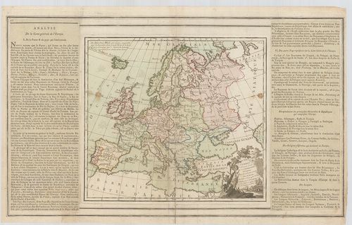
| Title | Carte générale de l'Europe. |
| Main title | Európa általános térképe. |
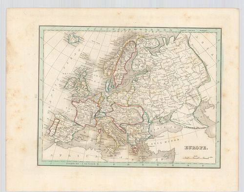
102. L'Europe. [B I a 202]
Institute and Museum of Military History •
B I a
•
B I Európa
•
B I–XV. Európa
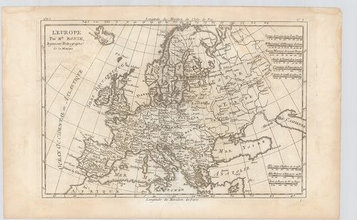
| Title | L'Europe. |
| Main title | Európa térképe. |
103. Carte d'Europe 1829. [B I a 203]
Institute and Museum of Military History •
B I a
•
B I Európa
•
B I–XV. Európa
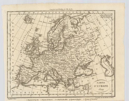
| Title | Carte d'Europe 1829. |
| Main title | Európa térképe. |
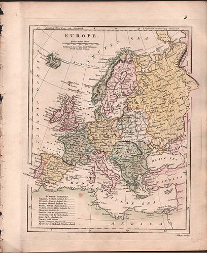
104. Europe. [B I a 204]
Institute and Museum of Military History •
B I a
•
B I Európa
•
B I–XV. Európa
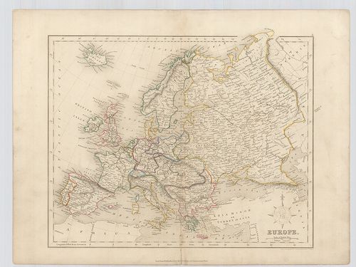
| Title | Europe. |
| Main title | Európa térképe. |
105. Europe. [B I a 205]
Institute and Museum of Military History •
B I a
•
B I Európa
•
B I–XV. Európa
| Title | Europe. |
| Main title | Európa térképe. |
106. Europe. [B I a 206]
Institute and Museum of Military History •
B I a
•
B I Európa
•
B I–XV. Európa
| Title | Europe. |
| Main title | Európa térképe. |
107. Europe. [B I a 208]
Institute and Museum of Military History •
B I a
•
B I Európa
•
B I–XV. Európa
| Title | Europe. |
| Main title | Európa térképe. |
108. An Accurate Map of Europe, compiled from the best Authotieri... [B I a 209]
Institute and Museum of Military History •
B I a
•
B I Európa
•
B I–XV. Európa
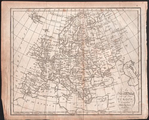
| Title | An Accurate Map of Europe, compiled from the best Authotieries. |
| Main title | Európa térképe. |
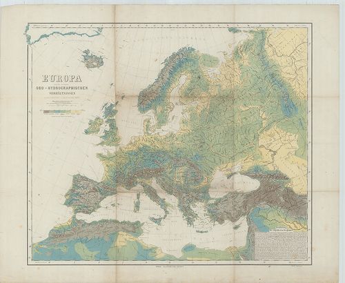
109. Carte Générale Orographique et Hydrographique de L’Europe. [B I b 3]
Institute and Museum of Military History •
B I b
•
B I Európa
•
B I–XV. Európa
| Title | Carte Générale Orographique et Hydrographique de L’Europe. |
| Main title | Európa hegy-vízrajzi térképe 1816-ban. |
110. Europa nach seinen oro-hydrographischen Verhältnissen. [B I b 5]
Institute and Museum of Military History •
B I b
•
B I Európa
•
B I–XV. Európa
| Title | Europa nach seinen oro-hydrographischen Verhältnissen. |
| Main title | Európa orográfiai és hydrográfiai viszonyai 1870 körül. |
111. Europa. [B I b 6]
Institute and Museum of Military History •
B I b
•
B I Európa
•
B I–XV. Európa
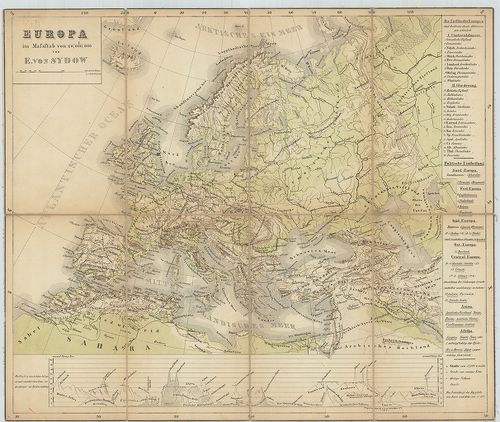
| Title | Europa. |
| Main title | Európa hegyrajzi térképe 1860 körül. |
112. Esquisse orographique de L’Europe. [B I b 7]
Institute and Museum of Military History •
B I b
•
B I Európa
•
B I–XV. Európa
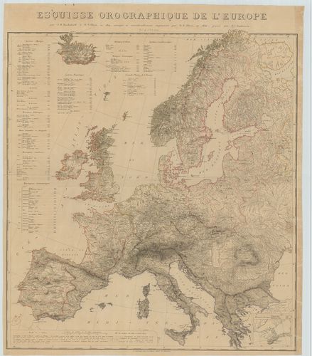
| Title | Esquisse orographique de L’Europe. |
| Main title | Mt.: (Krim félsziget és környéke.) |
| Subject | Európa orográfiai térképe 1830 körül. |
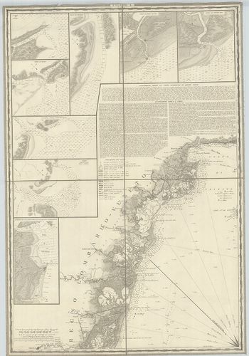
113. Carta di Cabottaggio del Mare Adriatico. [B I b 24]
Institute and Museum of Military History •
B I b
•
B I Európa
•
B I–XV. Európa
| Title | Carta di Cabottaggio del Mare Adriatico. |
| Main title | I. [Monfalcone] II. [Venedig (Venezia)] III. [Triest)] IV. [Rimini] V. [Carlopago (Karlobag)] VI. [Ancona.] VII. [Zara (Zadar] VIII. [Grottamare (Grottammaro)] IX. [Spalatro (Split)] X: [Termoli] XI. [Sabioncello (Peljesac fsz.)] XII. [Manfredonia] XIII. [Cattaro (Kotor)] XIV. [Trani] XV. [Antivari (Bar)] XVI. ]Brindisi] XVII. [Aulona] XVIII. [Otranto] XIX. [Annotazioni generali sul Mare Adriatico.] XX. [Corfu (Kérkira)] + 72 db mt. Kikötők és folyótorkolatok. |
| Subject | Az Adriai-tenger és a partvidéke hajózási térképe 1820 körül. |
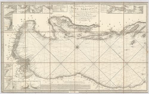
114. Idrografia Generale del Mare Adriatico… [B I b 25]
Institute and Museum of Military History •
B I b
•
B I Európa
•
B I–XV. Európa
| Title | Idrografia Generale del Mare Adriatico… |
| Main title | 2 mt.: az Adriai kikötőkről. |
| Subject | Az Adriai-tenger általános hidrogáfiai térképe. |
115. [A Tirrén-Adriai és az Égei tenger mélységmérési térképe.] [B I b 50]
Institute and Museum of Military History •
B I b
•
B I Európa
•
B I–XV. Európa
| Title | [A Tirrén-Adriai és az Égei tenger mélységmérési térképe.] |
116. Karte des Baltischen Meeres und der, dassalbe begrenzenden L... [B I b 58]
Institute and Museum of Military History •
B I b
•
B I Európa
•
B I–XV. Európa
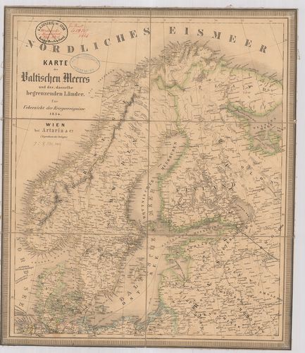
| Title | Karte des Baltischen Meeres und der, dassalbe begrenzenden Länder. Zur Uebersicht der Kriegsereignisse 1854. |
| Main title | A Balti-tenger és a vele határos országok térképe 1854-ben. |
117. [A Keleti (Balti)-tenger térképe.] [B I b 59]
Institute and Museum of Military History •
B I b
•
B I Európa
•
B I–XV. Európa
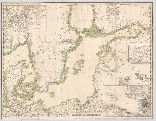
| Title | [A Keleti (Balti)-tenger térképe.] |
| Main title | 7 mt.: 1. Stockholm 2. Kieli-öböl, 3. Helsing Fors (Helsinki) 4. Reval (Tallinn) 5. Christiansö (Christiansř) 6. S[ankt] Petersburg (Leningrád) 7. [Düna (Dvina) folyó torkolata]. |
118. Európa hegy- és vízrajzi térképe. [B I b 80]
Institute and Museum of Military History •
B I b
•
B I Európa
•
B I–XV. Európa
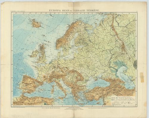
| Title | Európa hegy- és vízrajzi térképe. |
119. Európa fali abrosza. [B I b 90]
Institute and Museum of Military History •
B I b
•
B I Európa
•
B I–XV. Európa
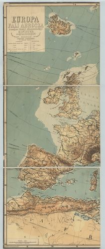
| Title | Európa fali abrosza. |
| Main title | Mt.: Európa politikai felosztása. |
120. Európa hegy- és vízrajzi térképe. [B I b 95]
Institute and Museum of Military History •
B I b
•
B I Európa
•
B I–XV. Európa
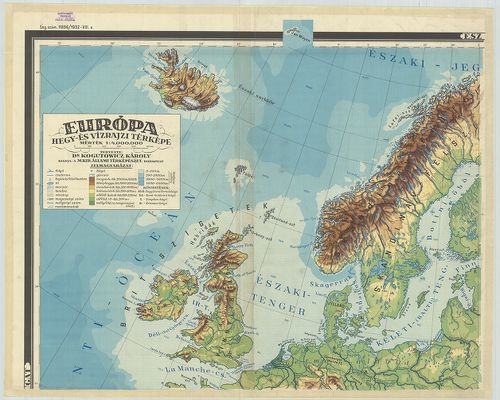
| Title | Európa hegy- és vízrajzi térképe. |
121. Die Mittlere Steinzeit (etwa 12 000–3000 v[or] d[em] Kr.) [B I b 100]
Institute and Museum of Military History •
B I b
•
B I Európa
•
B I–XV. Európa
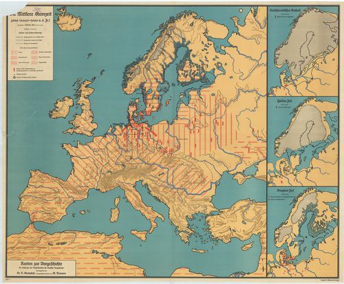
| Title | Die Mittlere Steinzeit (etwa 12 000–3000 v[or] d[em] Kr.) |
| Main title | 3 mt.: 1. Südschwedischer Eishalt. (A dél-svéd eljegesedés). 2. Yoldia Zeit (Yoldia időszak) 3. Ancylus Zeit. (Ancylus-időszak). Karten zur Vorgeschichte. |
| Subject | A középső kőkor Európában (i. e. 12 000–3000). |
122. Eiszeitalter. Die ältere Steinzeit. (etwa 400 000–12 000 v[o... [B I b 101]
Institute and Museum of Military History •
B I b
•
B I Európa
•
B I–XV. Európa
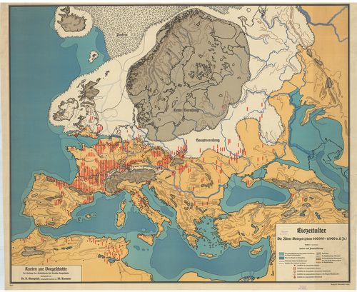
| Title | Eiszeitalter. Die ältere Steinzeit. (etwa 400 000–12 000 v[or] d[em] Kr.) |
| Main title | Az őskor Európában (i. e. 400 000–12 000). |
123. Evropa. Fizicseszkaj karta. [B I b 103]
Institute and Museum of Military History •
B I b
•
B I Európa
•
B I–XV. Európa
| Title | Evropa. Fizicseszkaj karta. |
| Main title | Európa hegyvízrajzi térképe 1949-ben. |
124. General karte über alla in Europa vorkommenden Eisenbahnen… ... [B I c 1]
Institute and Museum of Military History •
B I c
•
B I Európa
•
B I–XV. Európa
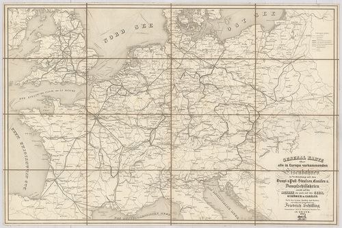
| Title | General karte über alla in Europa vorkommenden Eisenbahnen… Haupt-u. Poststrassen, Canälen u. Dampfschiffahrten… |
| Main title | Európa közlekedési térképe. |
125. Eisenbahn- und Dampfschiffrouten-Karte von Europa [B I c 3]
Institute and Museum of Military History •
B I c
•
B I Európa
•
B I–XV. Európa
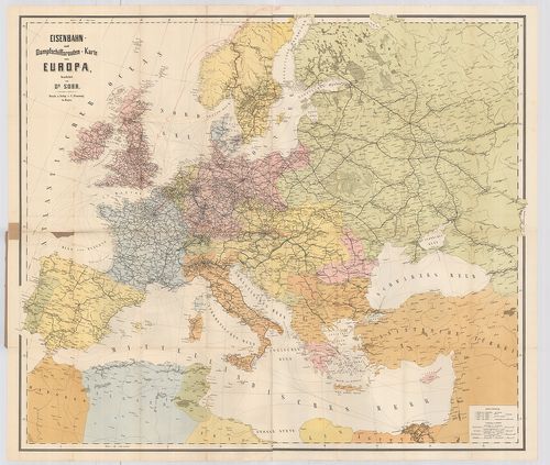
| Title | Eisenbahn- und Dampfschiffrouten-Karte von Europa |
| Main title | Európa közlekedési térképe 1881-ben. |
126. Carte itinéraire de l’Europe. [B I c 7]
Institute and Museum of Military History •
B I c
•
B I Európa
•
B I–XV. Európa
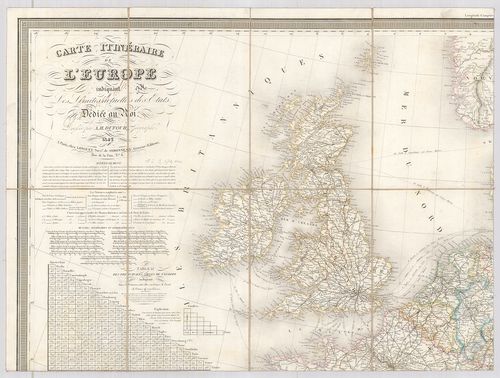
| Title | Carte itinéraire de l’Europe. |
| Main title | Európa közlekedési térképe 1842. |
127. Neueste Allgemeine Postkarte durch alle Europaeische Staaten... [B I c 8/a]
Institute and Museum of Military History •
B I c
•
B I Európa
•
B I–XV. Európa
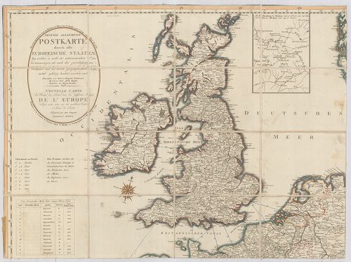
| Title | Neueste Allgemeine Postkarte durch alle Europaeische Staaten… Nouvelle Carte des Routes des Postes dans les différens États de l’Europe… Véste: Hieron. Benedicti. |
| Main title | Mt.: [Moszkva környéke] |
| Subject | Európa postaúthálózatának térképe 1798-ban. |
128. Vereinigte Eisenbahn-Routen- und Lademass-Karte von Mittel-E... [B I c 9]
Institute and Museum of Military History •
B I c
•
B I Európa
•
B I–XV. Európa
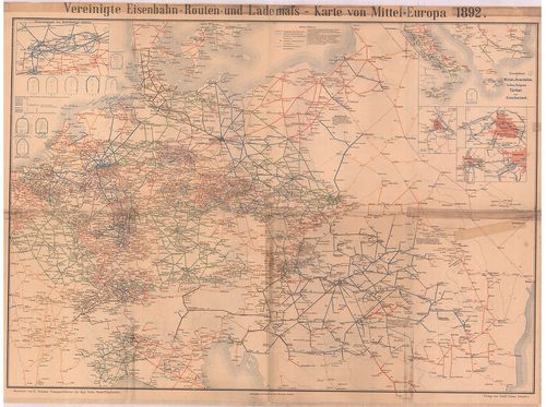
| Title | Vereinigte Eisenbahn-Routen- und Lademass-Karte von Mittel-Europa. |
| Main title | 6 mt.: 1. Eisenbahnen im Ruhr kohlen Gebiet 2. Eisenbahnen in Mittel-u. Unteritalien, Serbien, Bulgarien, Türkei und Griechenland 3. Wien, 4. Berlin, 5. Budapest, 6. Frankfurt. |
| Subject | Közép-Európa közlekedési térképe 1892-ben. |
129. Telegraphen-Karte von Europa… [B I c 12]
Institute and Museum of Military History •
B I c
•
B I Európa
•
B I–XV. Európa
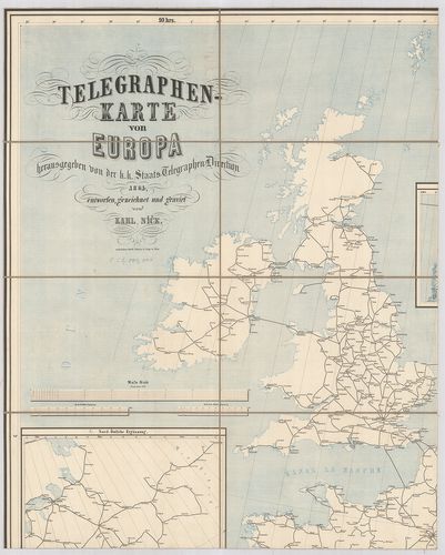
| Title | Telegraphen-Karte von Europa… |
| Main title | 2 mt.: 1. Nord-östliche Ergänzung 2. Nördliche Ergänzung. |
| Subject | Európa távíró térképe 1864-ben. |
130. Karte des Europaeischen Telegraphen-Netzes. [B I c 12/1]
Institute and Museum of Military History •
B I c
•
B I Európa
•
B I–XV. Európa
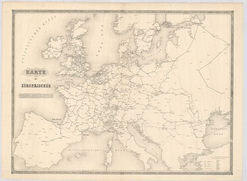
| Title | Karte des Europaeischen Telegraphen-Netzes. |
| Main title | Európa távíróhálózatának térképe. |
131. Germanorum [et] Slavorum per medium aevum Orbis Christianus.... [B I c 14]
Institute and Museum of Military History •
B I c
•
B I Európa
•
B I–XV. Európa
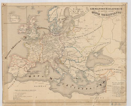
| Title | Germanorum [et] Slavorum per medium aevum Orbis Christianus. Regnorum quae exeunte anno 1100 fuere limitatio. |
| Main title | Európa történelmi térképe i. u. 1100-ban. |
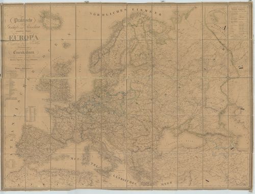
132. Hauptverkehrslinien von Europa. [B I c 15]
Institute and Museum of Military History •
B I c
•
B I Európa
•
B I–XV. Európa
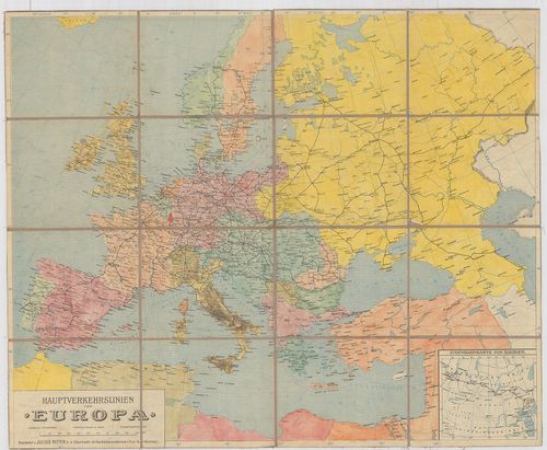
| Title | Hauptverkehrslinien von Europa. |
| Main title | 1 mt.: Eisenbahnkarte von Sibiren. (Szibériai vasútvonalak).Európa fő vasutainak térképe. |
133. Dislokationskarte der Heere Europas. [B I c 19]
Institute and Museum of Military History •
B I c
•
B I Európa
•
B I–XV. Európa
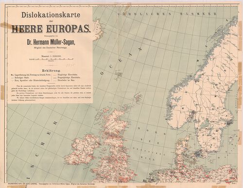
| Title | Dislokationskarte der Heere Europas. |
| Main title | Európai hadseregek elhelyezési térképe 1895-ben. |
134. Neue Carte von Europa welche die merkwürdigsten Produckte un... [B I c 21]
Institute and Museum of Military History •
B I c
•
B I Európa
•
B I–XV. Európa
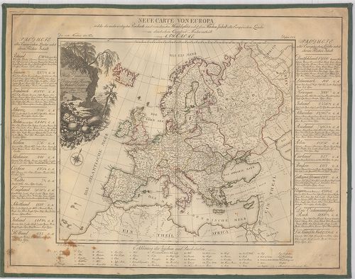
| Title | Neue Carte von Europa welche die merkwürdigsten Produckte und vornehmsten Handelsplätze nebst dem Flächen-Inhalt aller Europäischen Länder. |
| Main title | Európa kereskedelmi térképe 1782-ben. |
135. Európa Nagy Lajos korában 1370–1380. [B I c 25]
Institute and Museum of Military History •
B I c
•
B I Európa
•
B I–XV. Európa
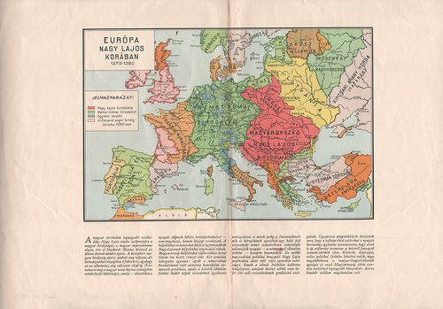
| Title | Európa Nagy Lajos korában 1370–1380. |
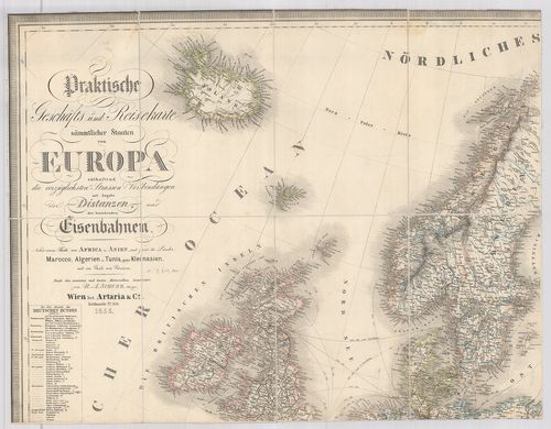
136. Praktische Geschäfts und Reisekarte sämmtlicher Staaten von ... [B I c 30]
Institute and Museum of Military History •
B I c
•
B I Európa
•
B I–XV. Európa
| Title | Praktische Geschäfts und Reisekarte sämmtlicher Staaten von Europa… Nebst einem Theile von Afrika u. Asien… |
| Main title | Európa és részben Afrika és Ázsia kereskedelmi utazási térképe 1862-ben. |
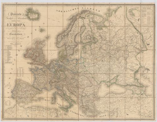
137. Praktische Geschäts und Reisekarte. sämmtlicher Staaten von ... [B I c 32]
Institute and Museum of Military History •
B I c
•
B I Európa
•
B I–XV. Európa
| Title | Praktische Geschäts und Reisekarte. sämmtlicher Staaten von Europa… Nebst einem Theile von Afrika u. Asien. |
| Main title | Európa és részben Afrika, Ázsia kereskedelmi, utazási térképe 1855-ben. |
138. Europa Politische Übersicht zu Beginn des 18. Jahrhunderts. [B I c 32/1]
Institute and Museum of Military History •
B I c
•
B I Európa
•
B I–XV. Európa
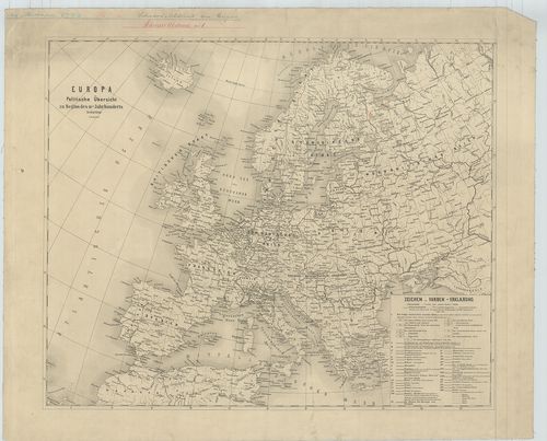
| Title | Europa Politische Übersicht zu Beginn des 18. Jahrhunderts. |
| Main title | Európa politikai térképe a 18. században. |
139. Praktische Geschäfts und Reisekarte. sämmtlicher Staaten von... [B I c 32/2]
Institute and Museum of Military History •
B I c
•
B I Európa
•
B I–XV. Európa
| Title | Praktische Geschäfts und Reisekarte. sämmtlicher Staaten von Europa… Nebst einem Theile von Afrika u. Asien. Véste: Dominik Bitter. |
| Main title | Európa és részben Afrika, Ázsia kereskedelmi utazási térképe 1859-ben. |
140. Európa népei és nyelvei. [B I c 35]
Institute and Museum of Military History •
B I c
•
B I Európa
•
B I–XV. Európa
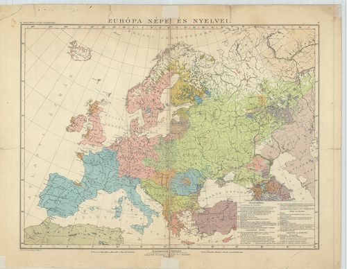
| Title | Európa népei és nyelvei. |
141. Carte itinéraire des voies navigables de l’Europe. [B I c 60]
Institute and Museum of Military History •
B I c
•
B I Európa
•
B I–XV. Európa
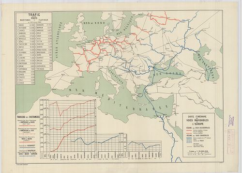
| Title | Carte itinéraire des voies navigables de l’Europe. |
| Main title | Európa légi útjainak térképe 1928. |
142. Európa vasúti térképe. [B I c 61]
Institute and Museum of Military History •
B I c
•
B I Európa
•
B I–XV. Európa
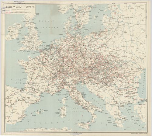
| Title | Európa vasúti térképe. |
143. Hauptverkehrslinien von Europa. [B I c 62]
Institute and Museum of Military History •
B I c
•
B I Európa
•
B I–XV. Európa
| Title | Hauptverkehrslinien von Europa. |
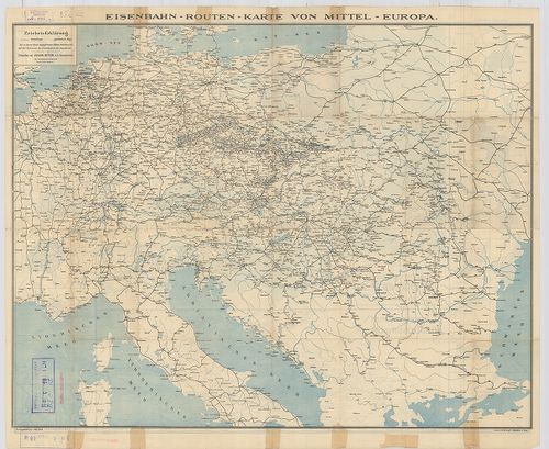
| Main title | 2 mt. 1. Eisenbahnlinien im nördlichen Böhmen. (Észak-Csehország vasútvonalai.) 2. Eisenbahnkarte von Sibirien. (Szibériai vasút, SzU.) 19 Lage der Bahnhöfe. (19 vasútforg. várostérképe.) Hátlapon: Eisenbahn-Routen-Karte von Mitteleuropa. (Közép-Európa vasút és úttérképe.) |
| Subject | Európa közlekedési térképe 1904-ben. |
144. Maps of Europe and Germany. Including railroad, steamship, a... [B I c 64]
Institute and Museum of Military History •
B I c
•
B I Európa
•
B I–XV. Európa
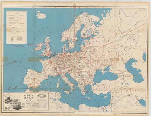
| Title | Maps of Europe and Germany. Including railroad, steamship, auto and air routes. |
| Main title | hátl.: Map of Germany. |
| Subject | Európa közlekedési térképe 1936-ban. |
145. Die Schnellzugslinien Europas. European Express Train Servic... [B I c 65]
Institute and Museum of Military History •
B I c
•
B I Európa
•
B I–XV. Európa
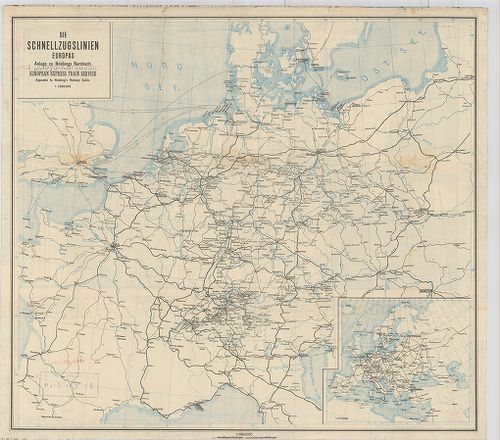
| Title | Die Schnellzugslinien Europas. European Express Train Service. |
| Main title | Mt.: Europa. Anlage zu Hobbings Kursbuch. |
| Subject | Nyugat- és Közép-Európa gyorsvonati vonalai a XX. század elején. |
146. Nivellements de précision. Lignes existant en Europa (Russie... [B I c 66]
Institute and Museum of Military History •
B I c
•
B I Európa
•
B I–XV. Európa
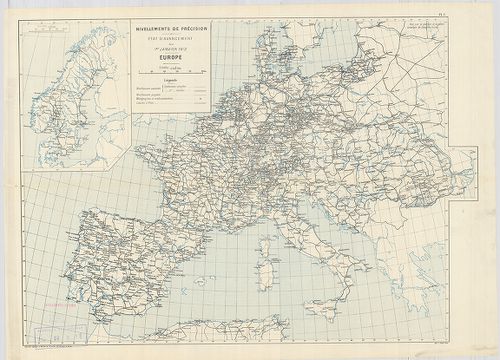
| Title | Nivellements de précision. Lignes existant en Europa (Russie exceptée) et en Afrique… |
| Main title | Európa úthálózati térképe 1903-ban. |
147. Európa rádió adóállomásai [B I c 67]
Institute and Museum of Military History •
B I c
•
B I Európa
•
B I–XV. Európa
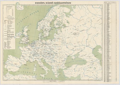
| Title | Európa rádió adóállomásai |
148. Neueste Reise-Hand-Und Kontorkarte von Europa mit den angren... [B I c 70]
Institute and Museum of Military History •
B I c
•
B I Európa
•
B I–XV. Európa
| Title | Neueste Reise-Hand-Und Kontorkarte von Europa mit den angrenzenden Teilen von Asien und Afrika. |
| Main title | Európa és Ázsia, Afrika határos részeinek úthálózati térképe. |
149. Karte von Europa und Westasien. [B I c 78]
Institute and Museum of Military History •
B I c
•
B I Európa
•
B I–XV. Európa
| Title | Karte von Europa und Westasien. |
| Main title | Európa térképe 1940-ben. |
150. Magyar Királyi Lég-ügyi Hivatal Időjelző Központ. [B I c 79]
Institute and Museum of Military History •
B I c
•
B I Európa
•
B I–XV. Európa
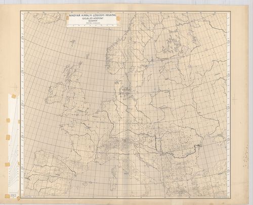
| Title | Magyar Királyi Lég-ügyi Hivatal Időjelző Központ. |