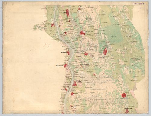
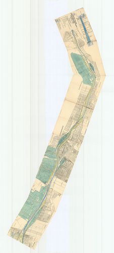
3821. A Duna és mellékfolyóinak ártere Alsó-Magyarországban. – Ter... [B IX b 110]
Institute and Museum of Military History •
B IX b
•
B IX Ausztria–Magyarország
•
B I–XV. Európa
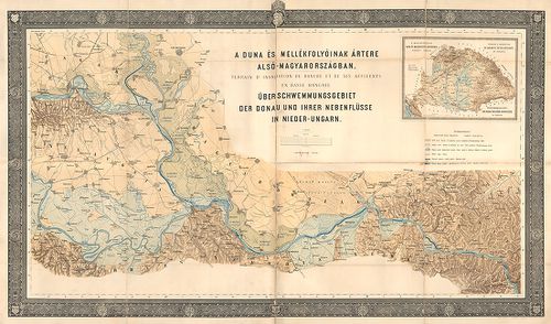
| Title | A Duna és mellékfolyóinak ártere Alsó-Magyarországban. – Terrain d’inondation du Danube et de ses affluents en basse Hongrie. – Ueber-schwemmungsgebiet der Donau und ihrer nebenflüsse in Nieder-Ungarn. |
| Main title | Mt. A magyarországi Duna és mellékfolyói árterének átnézeti térképe. – Terrain d’inondation du Danube et de ses affluents en Hongrie. – Überschwemmungsgebiet der Donau und deren nebenflüsse in Ungarn. |
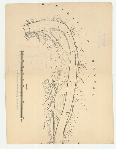
3822. [A Duna Bécs és Giorgio közti szakaszának térképe.] [B IX b 112]
Institute and Museum of Military History •
B IX b
•
B IX Ausztria–Magyarország
•
B I–XV. Európa
| Title | [A Duna Bécs és Giorgio közti szakaszának térképe.] |
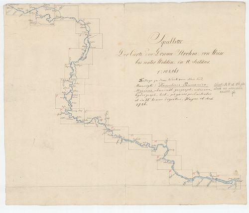
3823. Plan von dem Laufe des Donau Stroms von Ofen bis Baja. [B IX b 115]
Institute and Museum of Military History •
B IX b
•
B IX Ausztria–Magyarország
•
B I–XV. Európa
| Title | Plan von dem Laufe des Donau Stroms von Ofen bis Baja. |
| Main title | A Duna Buda és Baja között 1740 körül. |
3824. A’ Ferencz csatorna Pestig hosszabbításának eszméje. [B IX b 115/2]
Institute and Museum of Military History •
B IX b
•
B IX Ausztria–Magyarország
•
B I–XV. Európa

| Title | A’ Ferencz csatorna Pestig hosszabbításának eszméje. |
3825. Die Donau vom Ursprung bis Ulm. Der schiffbare Donau-Strom v... [B IX b 116]
Institute and Museum of Military History •
B IX b
•
B IX Ausztria–Magyarország
•
B I–XV. Európa

| Title | Die Donau vom Ursprung bis Ulm. Der schiffbare Donau-Strom von Ulm bis Pressburg. |
| Main title | A Duna eredetétől Ulmig, valamint a hajózható szakasz Ulmtól Pozsonyig. |
3826. Carte du cours du Danube depuis Ulm jusqua son embouchure da... [B IX b 118]
Institute and Museum of Military History •
B IX b
•
B IX Ausztria–Magyarország
•
B I–XV. Európa
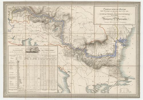
| Title | Carte du cours du Danube depuis Ulm jusqua son embouchure dans la Mer noire ou guide de voyage a Constantinople… |
| Main title | A Duna Ulmtól a Fekete-tengerig 1839 körül a folyómenti települések feltüntetésével. |
3827. Panorama der Donau von Linz bis Wien. [B IX b 120]
Institute and Museum of Military History •
B IX b
•
B IX Ausztria–Magyarország
•
B I–XV. Európa
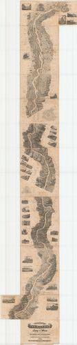
| Title | Panorama der Donau von Linz bis Wien. |
| Main title | A Duna madártávlati képe Linz és Bécs között 1839-ben. |
3828. Panorama der Donau von Regensburg bis Linz in Vogelperspecti... [B IX b 121]
Institute and Museum of Military History •
B IX b
•
B IX Ausztria–Magyarország
•
B I–XV. Európa
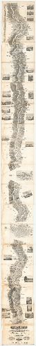
| Title | Panorama der Donau von Regensburg bis Linz in Vogelperspective. |
| Main title | A Duna madártávlati képe Regensburg és Linz között 1840-ben. |
3829. Panorama der Donau von Wien bis Pesth. [B IX b 122]
Institute and Museum of Military History •
B IX b
•
B IX Ausztria–Magyarország
•
B I–XV. Európa
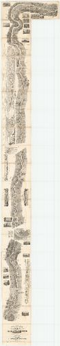
| Title | Panorama der Donau von Wien bis Pesth. |
| Main title | A Duna madártávlati képe Bécs és Pest között 1842-ben. |
3830. A Duna Ulmtól a torkolatig. – Die Donau von Ulm bis zur Münd... [B IX b 122/1]
Institute and Museum of Military History •
B IX b
•
B IX Ausztria–Magyarország
•
B I–XV. Európa
| Title | A Duna Ulmtól a torkolatig. – Die Donau von Ulm bis zur Mündung átnézeti térképe |
3831. Topographisch hydrometrischen Donau Strom Karte von Petronel... [B IX b 122/2]
Institute and Museum of Military History •
B IX b
•
B IX Ausztria–Magyarország
•
B I–XV. Európa
| Title | Topographisch hydrometrischen Donau Strom Karte von Petronell… |
| Main title | A Duna topográfiai térképe Petronelltől (Alsó-Ausztria) Csernetzig (Vaskapu-szoros). |
3832. [Topographisch hydrometrischen Donau Strom Karte von Petrone... [B IX b 122/3]
Institute and Museum of Military History •
B IX b
•
B IX Ausztria–Magyarország
•
B I–XV. Európa
| Title | [Topographisch hydrometrischen Donau Strom Karte von Petronell… |
| Main title | A Duna topográfiai térképe 1890 körül. |
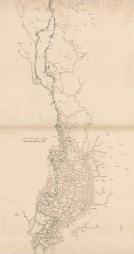
3833. [A Duna térképe Lindentől-Kaltenbachig.] [B IX b 122/12]
Institute and Museum of Military History •
B IX b
•
B IX Ausztria–Magyarország
•
B I–XV. Európa
| Title | [A Duna térképe Lindentől-Kaltenbachig.] |
3834. Preliminaire Donau Karte. [B IX b 123]
Institute and Museum of Military History •
B IX b
•
B IX Ausztria–Magyarország
•
B I–XV. Európa
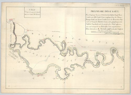
| Title | Preliminaire Donau Karte. |
| Main title | A Duna térképe Bajától Péterváradig 1788 szeptemberben. |
3835. A Soroksári Dunaág helyszínrajza a Tassi zsiliptől a Gubacsi... [B IX b 124]
Institute and Museum of Military History •
B IX b
•
B IX Ausztria–Magyarország
•
B I–XV. Európa
| Title | A Soroksári Dunaág helyszínrajza a Tassi zsiliptől a Gubacsi hídig. |
3836. [A Kazán-szoros és környékének szintvonalas kéziratos térkép... [B IX b 125]
Institute and Museum of Military History •
B IX b
•
B IX Ausztria–Magyarország
•
B I–XV. Európa
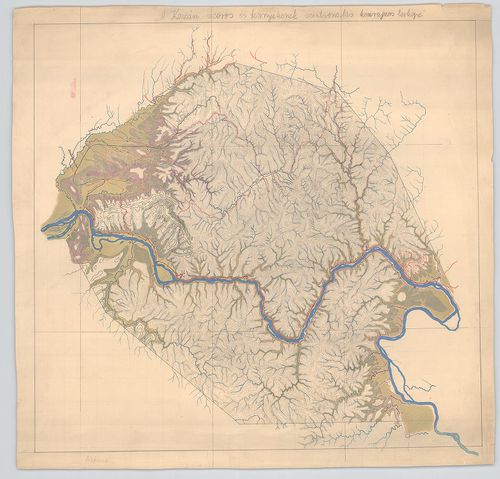
| Title | [A Kazán-szoros és környékének szintvonalas kéziratos térképe. |
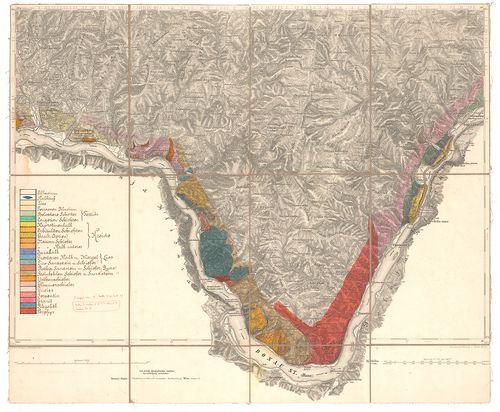
3837. Berzaszka und Ó-Ogradina. [B IX b 125/1]
Institute and Museum of Military History •
B IX b
•
B IX Ausztria–Magyarország
•
B I–XV. Európa
| Title | Berzaszka und Ó-Ogradina. |
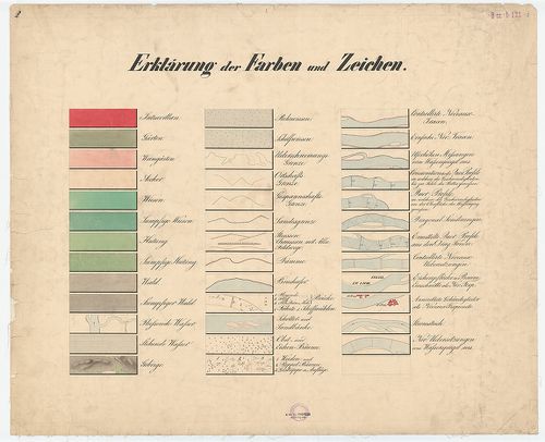
| Main title | Az Al-Duna partvidékének 1:75 000 ma. alaptérképére (6168 sz.) rajzolt geológiai térképe Berzaszka (Berzasca) és Ó-Ogradina (Ogradena-Veche) között. |
3838. [Vaskapu] 1879-ik évi bizottság. A Dunán Moldova és Turn[u]-... [B IX b 125/2]
Institute and Museum of Military History •
B IX b
•
B IX Ausztria–Magyarország
•
B I–XV. Európa
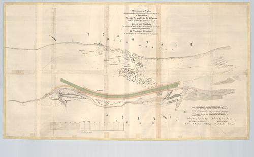
| Title | [Vaskapu] 1879-ik évi bizottság. A Dunán Moldova és Turn[u]-Severin között levő hajózási akadályok kijavítása. A Vaskapu Orsovánál. A Vaskapu és a tervezett csatorna helyszínrajza. – Commission de 1879. Amélioration des cataractes du Danube entre Moldova et Turn[u]-Severin. Panoge des portes de fer et du canal projeté. |
3839. A Duna folyam Ó-Moldova (Moldova-Veche) – Turn[u]-Szeverini ... [B IX b 125/3]
Institute and Museum of Military History •
B IX b
•
B IX Ausztria–Magyarország
•
B I–XV. Európa

| Title | A Duna folyam Ó-Moldova (Moldova-Veche) – Turn[u]-Szeverini (Turnu Severin) zuhatagos szakaszának átnézeti térképe. – Map of the cataracts of the lower Danube between Moldova and Turn[u]-Severin. |
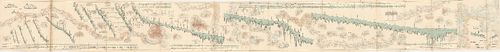
3840. Plan général des cataractes du Bas-Danube. D’aprés la 4-e ed... [B IX b 125/6]
Institute and Museum of Military History •
B IX b
•
B IX Ausztria–Magyarország
•
B I–XV. Európa
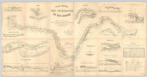
| Title | Plan général des cataractes du Bas-Danube. D’aprés la 4-e edition du plan. Dressé en 1896 par la direction royale hongroise des travaux de regularisation. |
| Main title | Az Al-Duna hajózási térképe 1896-ban. |